
A similar upper level system and surface dynamics as the October 21st, 2019 Southern Plains Severe Weather Event with the EF3 Tornado hitting Dallas will enter the region on Friday evening and spread eastward into NE TX to AR/LA and part of Mississippi overnight into Saturday morning. Grab the details by reading on …
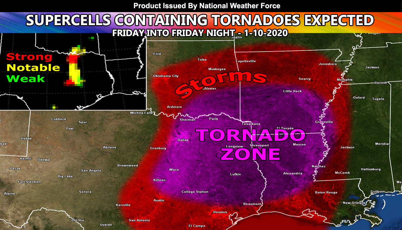
The storm system will enter the plains on Friday morning and storms popping through the Oklahoma areas will be likely then, racing fast off to the east-northeast. The main severe weather area with tornadoes exists from the Eastern Oklahoma zones, south through The Dallas Metroplex, and further south along the I-35 corridor and east into parts of Louisiana, Mississippi, and Arkansas. The magenta color on the map is where the most tornado dynamics will be with this event.
Preliminary estimations of the in-house tornado forecast model here indicates that the Dallas-Fort Worth zones will see an EF2 or 3 capable tornado and it will be close, if not in the metro area so stay alert. The system does resemble the October 21st, 2019 system where it was confirmed an EF-3 tornado hit Dallas, an EF-1 hit Rowlett and an EF-0 struck Wills Point. An EF3 tornado has estimated wind speeds between 136 and 165 mph.
Southern Plains Weather Force division will issue Tornado Watches with the National Weather Force with the FINAL run of the tornado forecast model expected on Friday afternoon and this allow for the Tornado Watches to be issued well in advance of supercell development so make sure you like the page below for those details …
NOTE: This is the SCWF Website but it is being used for national updates until a suitable national website can be developed for you.
Reading for another state? Find your region I serve here – https://www.facebook.com/nwfweather/photos/a.643550279121473/1544547759021716