
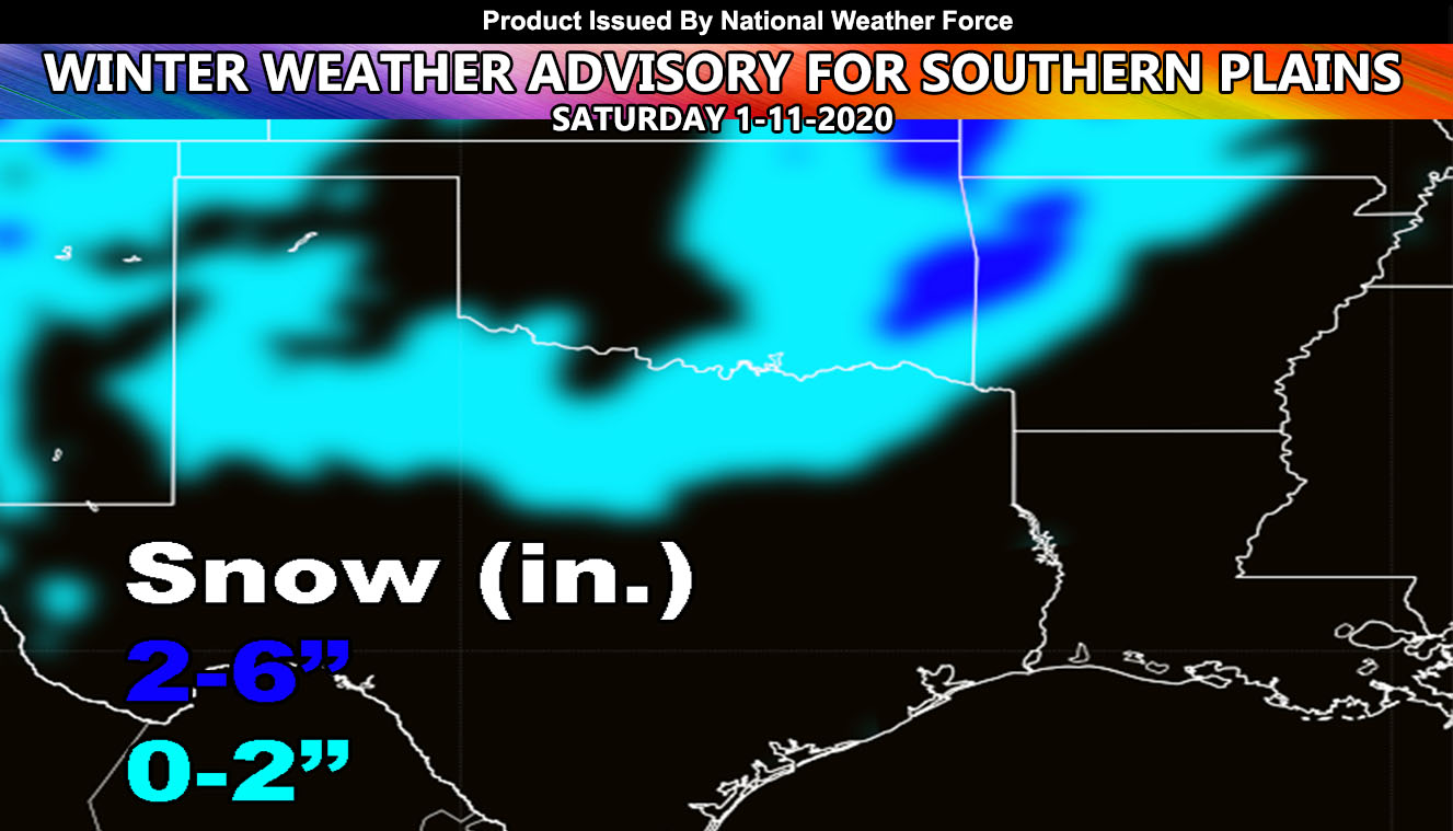
A number of warnings hit the Southern Plains this evening and it will be on-going through AR/LA tonight straight into early Saturday morning. Check out the in-office tornado track radar that shows actual tornado tracks before surveys are carried out. A round of snow is expected for parts of Oklahoma, Northern Texas and even Arkansas so read on for details.
The backside of the system will draw in cold air through the Northern Half of Texas, with DFW possibly right on the edge for a dusting-1″ of snowfall. The highest concentration of snowfall in the Southern Plains will be Eastern OK into W/NW AR. Snow is already falling back in the TX Panhandle. This is expected for your Saturday … Drive carefully.
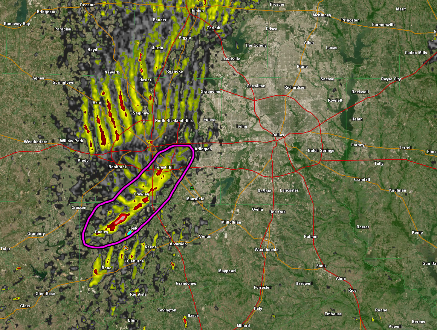
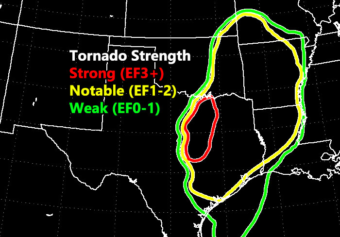
Tornado track radar does not lie. A strong tornado signature was indicated south of Fort Worth with indications of a tornado moving from Godley to Crowley, and ending at Forest Hill. The tornado signature was the strongest in the entire event so wind reports would likely turn into a confirmed tornado with the next day or two as assessments go check the damage. If you were in those area you probably have damage somewhere on that path. The image of that is below. Note the rib structure shape on tornado track radar west of Fort Worth. That is a straightline wind indication. However circled in magenta the indication is a tire track look in the direction the storm was moving. This is your tornado path.
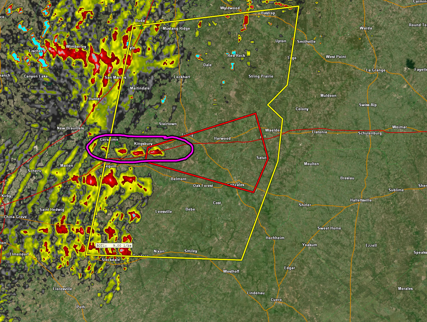
The line extended to San Antonio. NOAA did not issue a Tornado Watch down there, however my in-house tornado model did issue the computer generated watch all the way down there and the signature shows straightline winds surrounding (circled) a due east moving embedded tornado ahead in the line itself, which likely was a tornado.
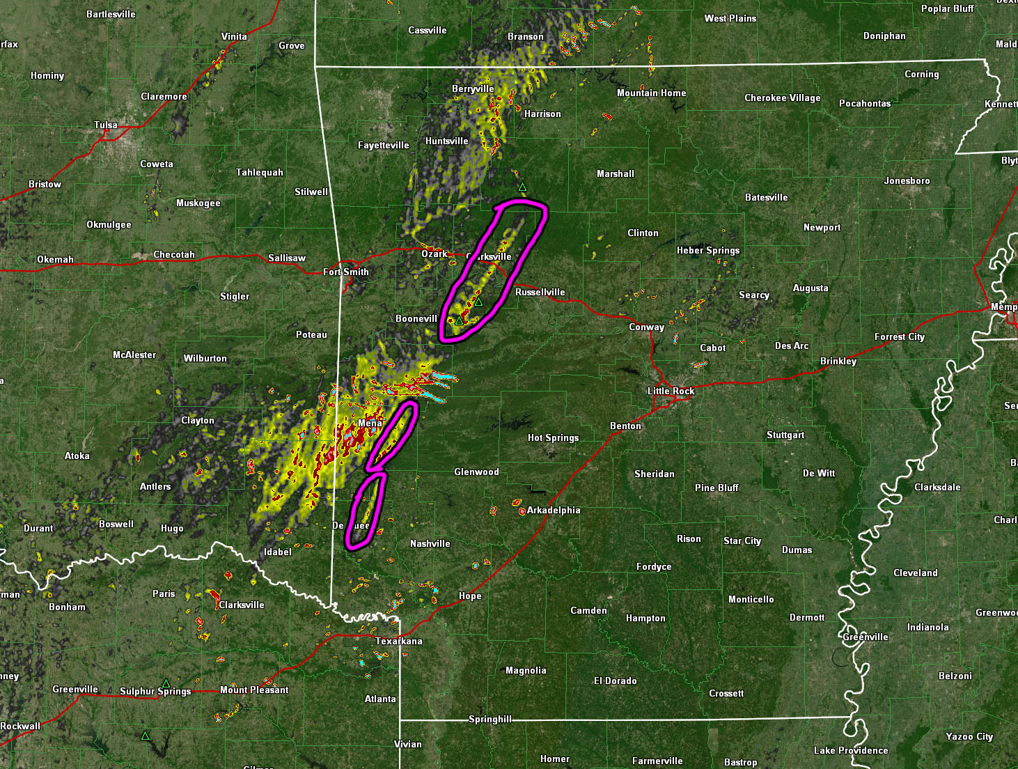
Finally we move into Western Arkansas and you can see three distinct tornado tracks. A number did hit Arkansas as well and by the time this is over, it would be a small-scale tornado outbreak in the Southern Plains by reports.
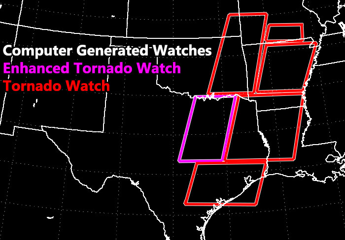
And these were the computer generated tornado watches, giving ample lead-time ahead of what you locally will watch on a tornado watch issuance.
NOTE: This is the SCWF Website but it is being used for national updates until a suitable national website can be developed for you.
Reading for another state? Find your region I serve here – https://www.facebook.com/nwfweather/photos/a.643550279121473/1544547759021716