
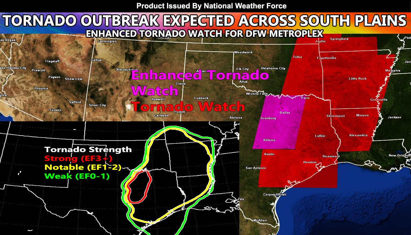
The in-office tornado model has completed for this event starting 3pm and going through sunrise on Saturday morning. The model is pinpointing the Dallas-Fort Worth area for Enhanced Strong Tornado (EF3+) tornado dynamics much like it did during the October 21, 2019 event with a line of storms moving through OK/AR/LA as well so read on for details.
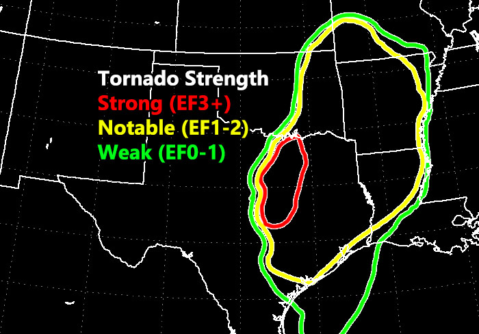
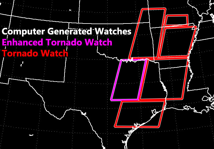
National Weather Force has issued an Enhanced Tornado Watch for stronger tornado dynamics in a corridor from the OK/TX border north of DFW and stretching across the metroplex, which is ground zero on the model, and then southward along I-35 to just north of Austin. Storms this later afternoon and evening will be in a favorable instability/shear environment for tornadoes. Given the non-direction mid-upper level shear, we will see storm exhaust, meaning tornadoes will sustain for a bit of time across the watch area. This box was issued similar to the October 21, 2019 tornado outbreak across the region that produced an EF3 tornado in Dallas
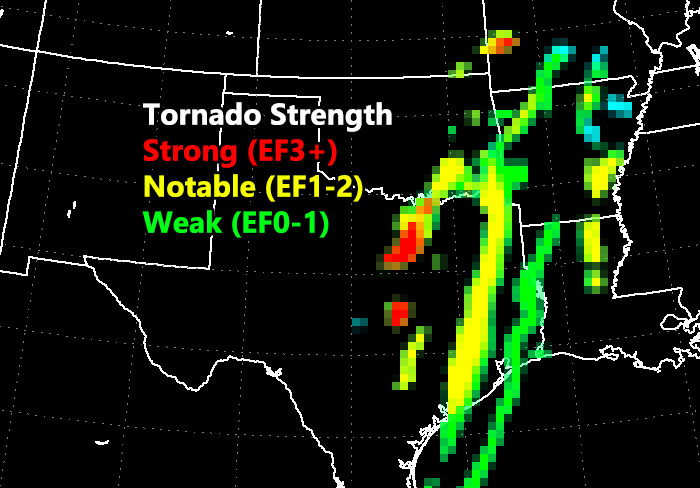
Further computer generated tornado watches extend from Eastern Oklahoma into Southern Missouri and across all of Arkansas and from South-Central Louisiana north through the state and east to Southeast/East Texas, which includes Houston and Austin. These are for EF1-2 type tornado dynamics, which is the yellow outline in the model projection. The weaker projection with the storms moving out of the DFW metroplex is because we do lose some storm exhaust as the upper trough from the west catches up.
The very best area for the strongest dynamics is in the Enhanced Tornado Watch issued by the in-office computer here.
Model images below
NOTE: This is the SCWF Website but it is being used for national updates until a suitable national website can be developed for you.
Reading for another state? Find your region I serve here – https://www.facebook.com/nwfweather/photos/a.643550279121473/1544547759021716