
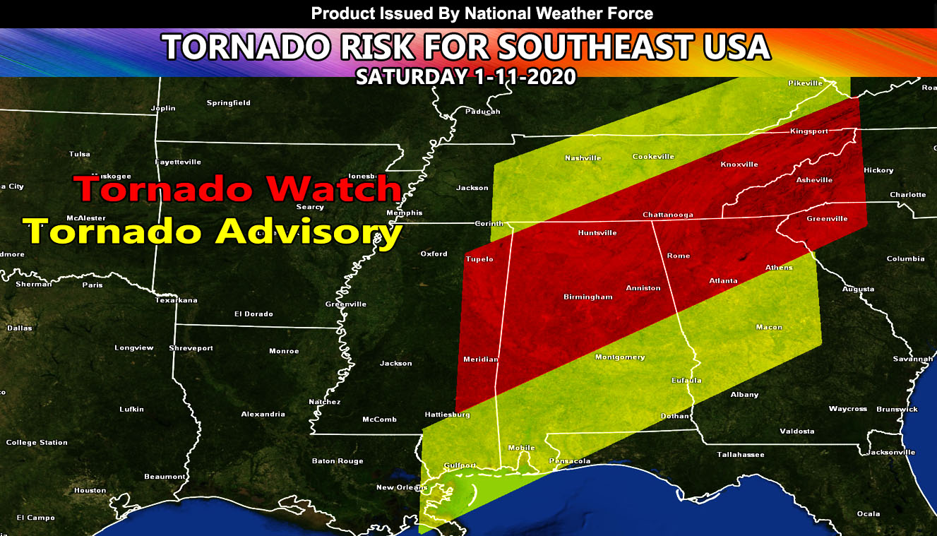
The same system that started over the Southern Plains yesterday is moving through Mississippi this morning and will exit eastward from there over the day and into some of tonight. The in-office tornado forecast model has finished running and computer generated tornado watches have been issued for the entire event so read on for details.
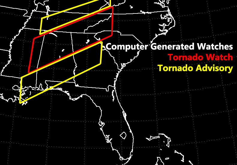
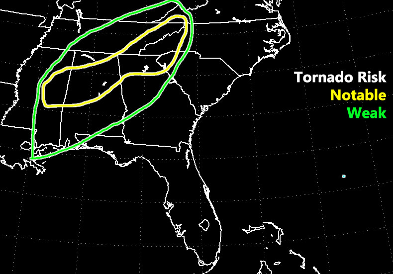
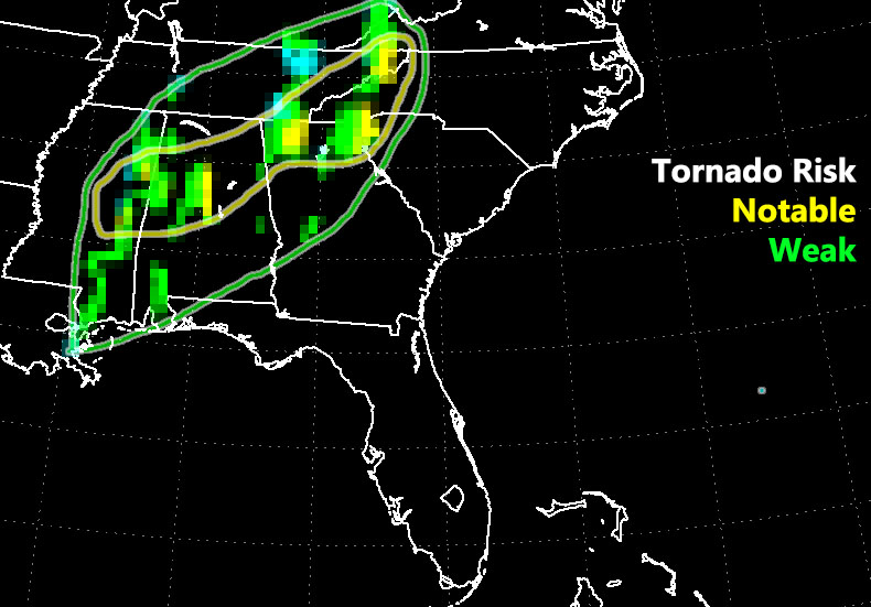
Short and sweet to the point, this is just going to show you the computer generated tornado watches and advisories this project is capable of. A Tornado Watch from this computer means that conditions are there for notable tornado development. A Tornado Advisory means that conditions are there for weak tornado development. The strongest will be from Eastern MS in a corridor through Alabama, North Georgia, Eastern TN, NW SC, and Western NC. The work is below.
NOTE: This is the SCWF Website but it is being used for national updates until a suitable national website can be developed for you.
Reading for another state? Find your region I serve here – https://www.facebook.com/nwfweather/photos/a.643550279121473/1544547759021716