
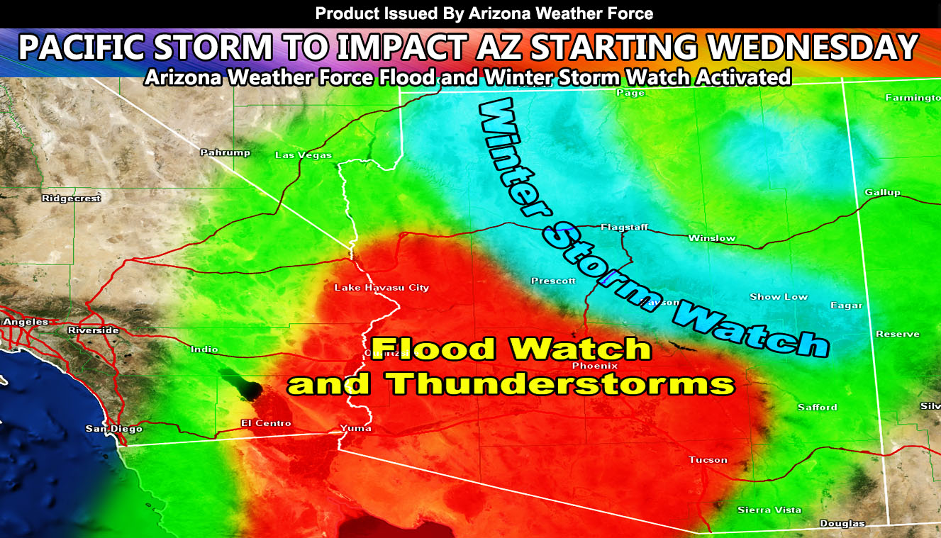
Arizona Weather Force has issued a Flood Watch and Winter Storm Watch that covers most of the state. The alerts officially went out earlier today and will cover the zones starting Wednesday. Tuesday will have the final forecast article but for details of these alerts, read on for more …
Two alerts went out over the Arizona Weather Force micro-climate e-mail alert system today. The alerts are as followed; Issued zones – Low Terrain of Arizona … Globe … – Flood Watch – Click here for link – A pacific system will approach the region on Wednesday. This will start off activity in Western Arizona and spread through the day across the rest of the state. Given the magnitude of the deepening upper system along with the cold core overhead, thunderstorms are expected to break-out in the Flood Watch area. At the time, I’ll take the thunderstorm dynamics all the way to the CO River Valley and adjust from there if warranted. The final product will be out the evening before the storms are expected so you’ll get the final stuff issued here at Arizona Weather Force on Tuesday evening. Tucson, you are not in this watch at the moment due to the lack of heavy rainfall spanning many hours at a time, but you are on the southeast end of my thunderstorm risk. A Flood Watch is issued at AZWF when dynamics give the risk of heavy rainfall in a short period of time, which can lead to flooding. Flood Advisory criteria would be met …
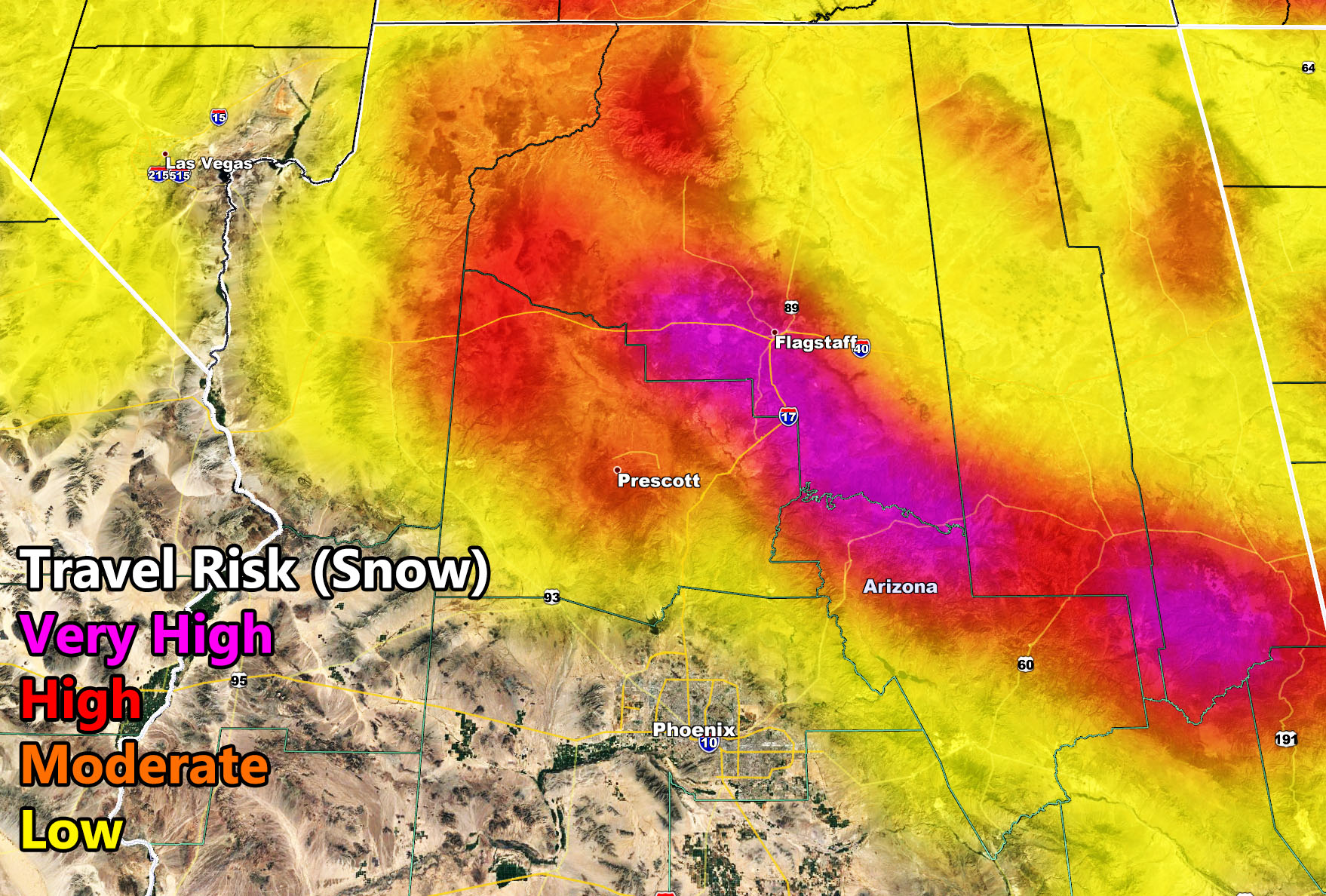
The Winter Storm Watch is for the mountain areas, which includes the Grand Canyon zones. Click here for link – A cold system will reach the area by mid- week. The snow levels with it in the beginning on Wednesday will be around 5,300 to 5,700 FT with a drop to 5,000 FT or around there by Thursday. A winter storm watch means that conditions are favorable for heavy snowfall to fall with lowering drops in visibility. It does not tell you how many inches of snow you will get … yet. That is with the final alert. The Arizona Weather Force travel risk model for snow is below, and anything in the high category is considered a Winter Storm Watch to Warning criteria. Official final alerts will be issued early week before the storm gets there. Because of the colder core nature of the system, thunderstorms will likely accompany it in spots, making for thundersnow …
As you know, just as Southern California Weather Force has a service for members with micro-climate alerts, Arizona Weather Force does as well and we do have some people already signed up getting those so it is seeming like it is helping. The service helps businesses and persons, especially with ranches. Click Here to read about it and even join.
NOTE: This is the SCWF Website but it is being used for national updates until ad placement is ready on the AZWF site.
Your Facebook Page to join for this update is linked here – https://www.facebook.com/ArizonaWeatherForce