
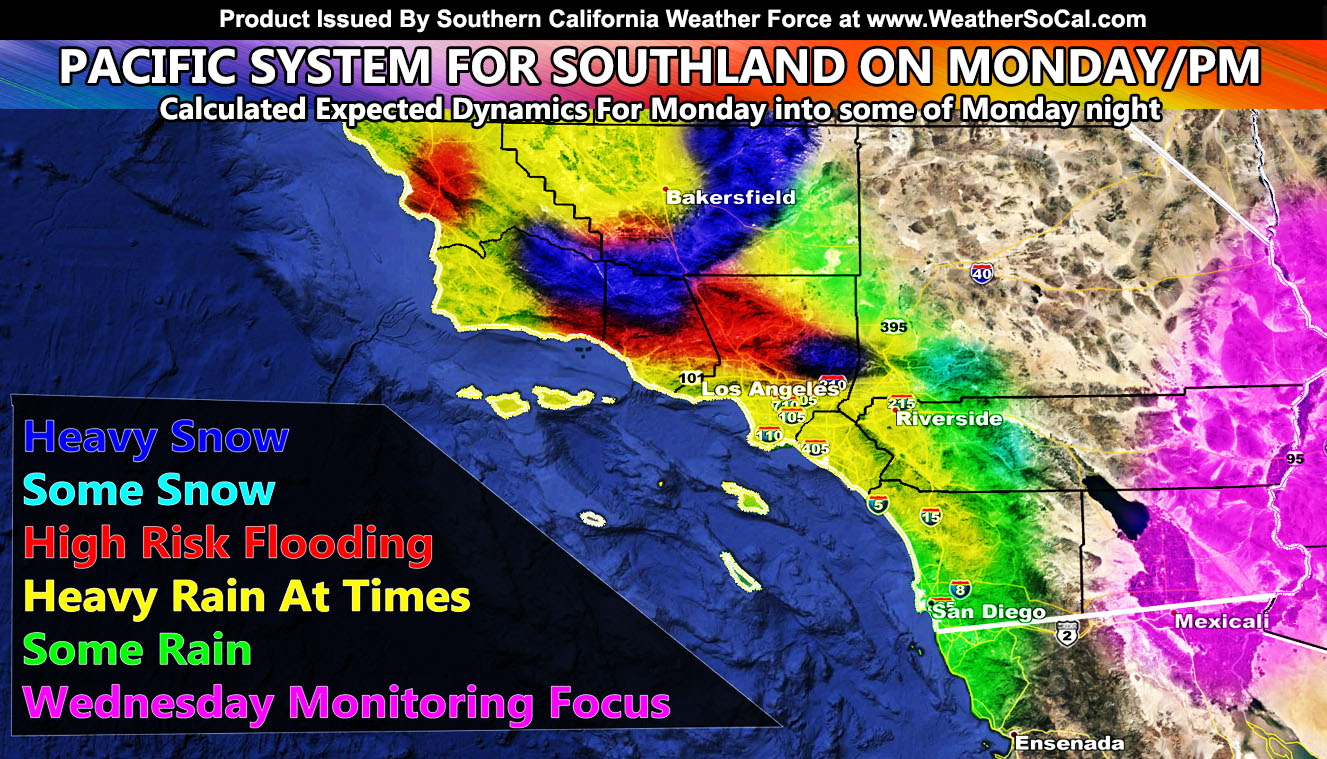
A pacific system ranging in the Category Two position that falls just short for an issued name will move through Southern California on Monday into Monday night, bringing snow to some, and rain to others, while others remain high and dry. A full suite of information is available so read on for details.
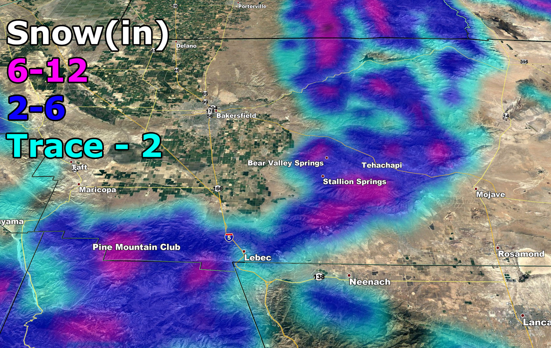
A Winter Weather Advisory went out this morning for this event for the Kern County Mountains, including the Gorman Pass. Click here to read it. It reads; A cold pacific storm will come into the area on Monday and Monday night, providing the Kern County Mountains with snowfall as the snow-level goes below the 4,000 FT Mark. 2-6″ looks likely for the Tehachapi zones, with maybe 6″ or so for BVS … and a 6-12″ mark for the Cuddy Valley areas, averaging around that 6″ mark. Use the snowfall map below for the forecast in your area … This will impact the Gorman Pass with 2-6″ of snow but likely the 2-3″ mark and it will be a possible closing/escort situation that starts somewhere around 4pm on Monday evening …
One thing to note is this does not cover the Los Angeles, San Bernardino, or Riverside County Mountains. The reason for this is because I will have ample time on Monday morning to issue anything there. The Los Angeles Mountains will need an advisory I am thinking, but this is a weakening front and it is possible that the lack of depth in the moisture levels above 5,000 FT will preclude the need for one in Big Bear or the Riverside Mountains, but will likely impact the Rim more with some snowfall. Expect your final alert and model to be issued via the micro-climate alert system on FB groups and the app/email alert system on Monday morning found by Clicking Here
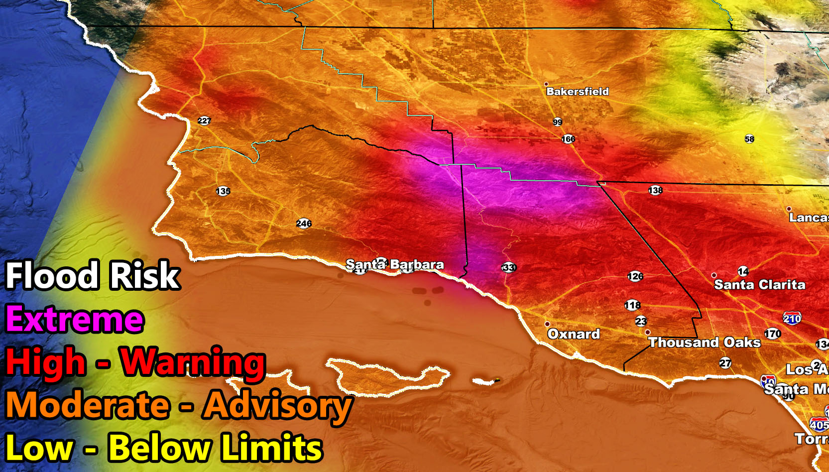
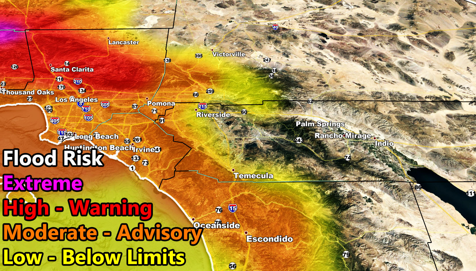
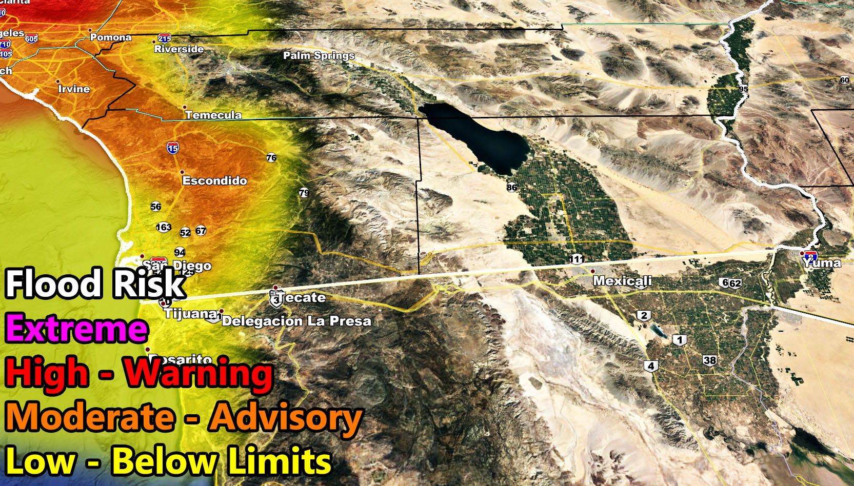
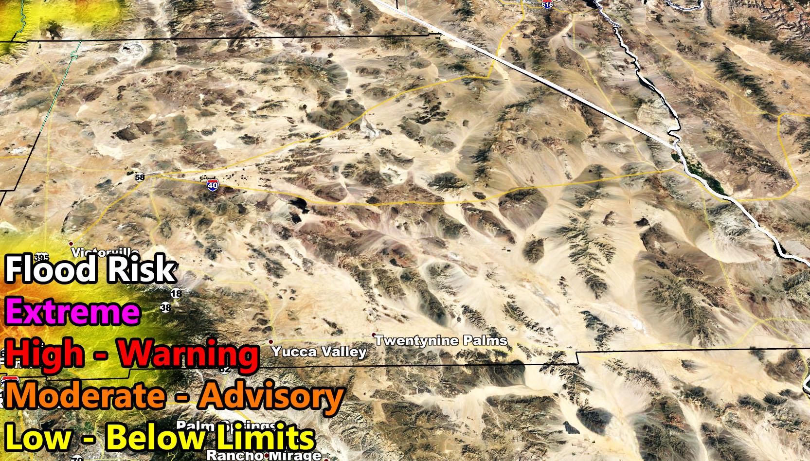
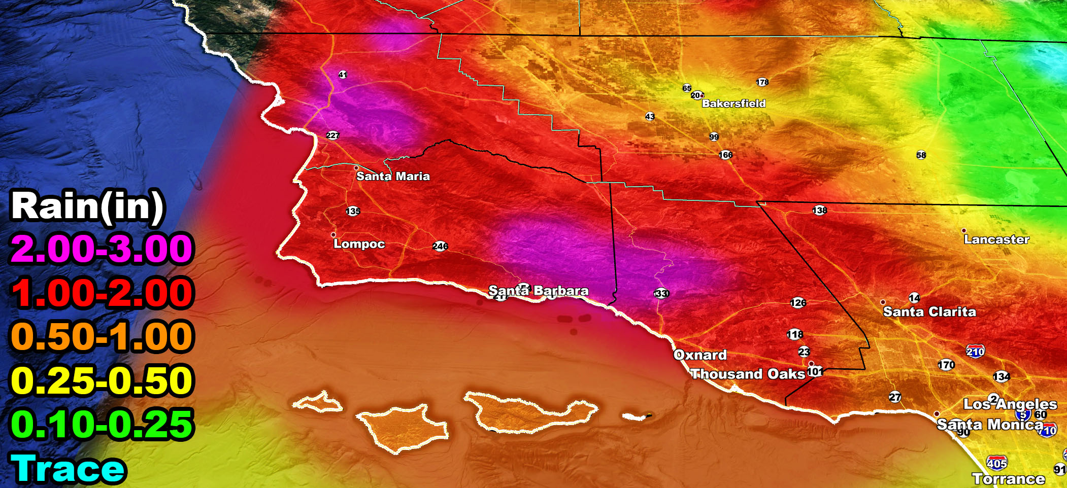
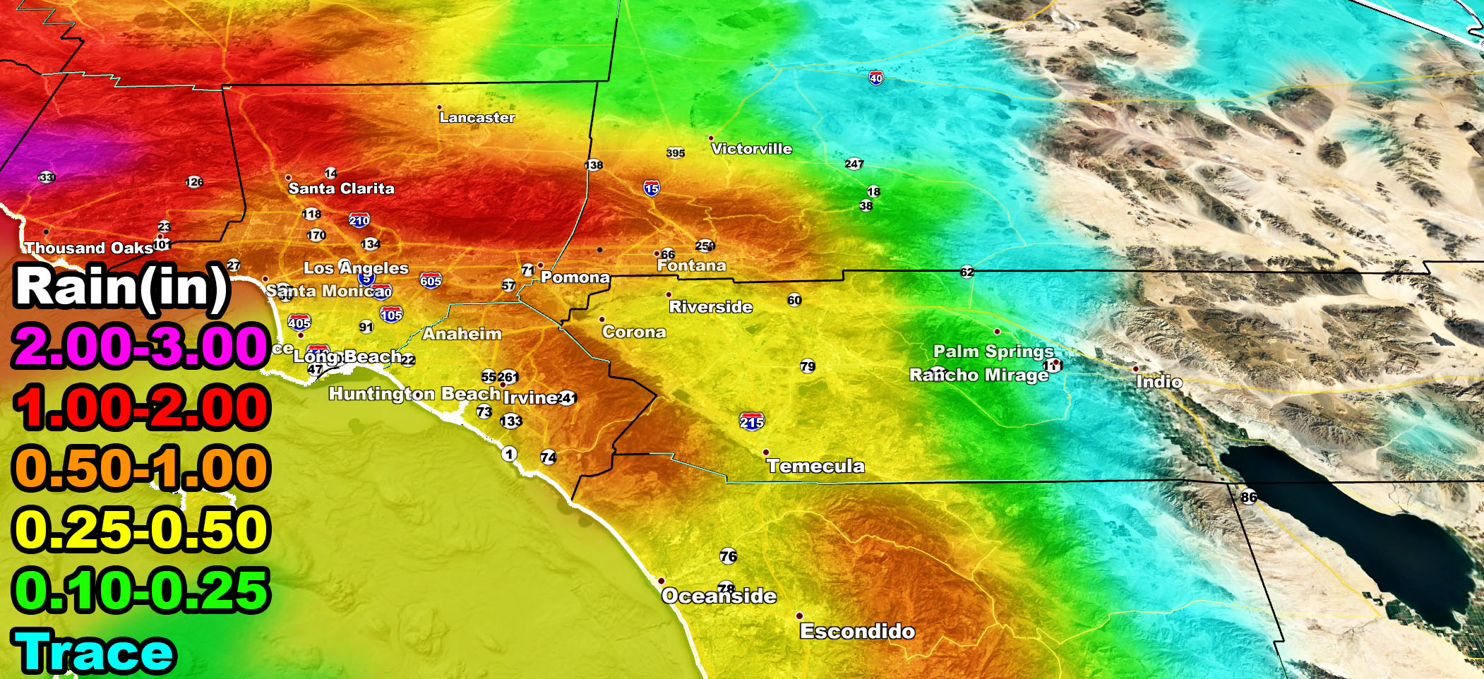
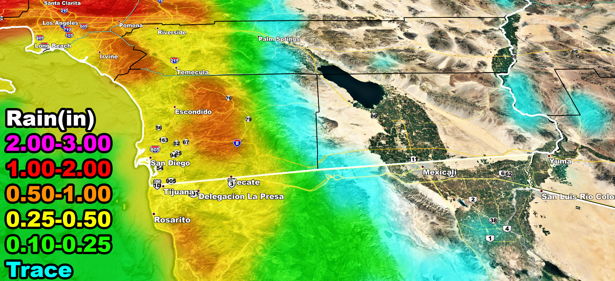
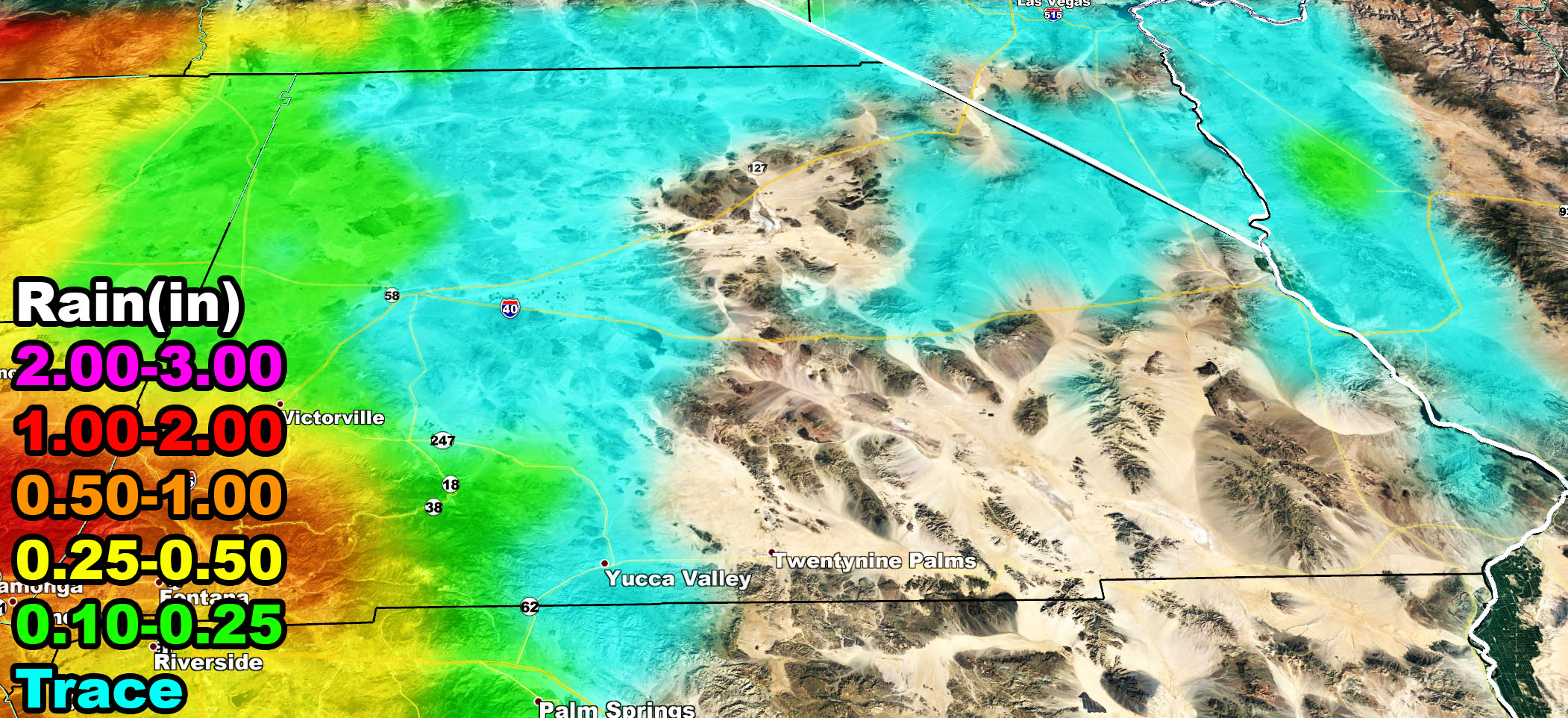
As for the areas with heavy rainfall. Use the flood risk model below along with the SCWF rain model for your forecast. The front is expected into Los Angeles proper by around 4pm.
SCWF Flood Risk Model Monday into Monday night
SCWF Rain Forecast Monday into Monday night
LOWER DESERTS – On Wednesday the system takes a turn and brings up moisture into Arizona. A lot of thunderstorms are expected in that state and Arizona Weather Force will take care of that … but the western edge of the dynamics may affect the Imperial County zones, north to the Desert Center/Havasu/Blythe forecast areas. It is very possible that you won’t see any rain with this system on Monday into Monday night, but you will have elevated chances on Wednesday. Those forecasts will be made over the micro-climate alert system so keep tuned to them …
At the same time on Wednesday, expecting a west flow to bring gusty winds to the metro areas with gusts 25-35 mph being possible …
Join Southern California Weather Force main Facebook Page for future updates!
MICRO-CLIMATE ALERT FACEBOOK GROUPS: Find yours today!
Click here to join
Reading for another state? Join my national page – https://www.facebook.com/nwfweather/
All articles and micro-climate alerts can be delivered to you via the app/email alert service subscription so Click Here To Check It Out And Join Today and NEVER miss a beat
MICRO-CLIMATE ALERT FACEBOOK GROUPS: Find yours today!
Click here to join
As always, stay tuned to official forecasts from Southern California Weather Force for updates …
For The Main Weather Facebook Page Click Here and Join.
End Article
FACEBOOK PAGES TO JOIN!
SOUTHERN CALIFORNIA WEATHER FORCE MAIN: Southern California Weather Force Office Main Page
BEHIND THE SCENES FORECASTS/UPDATE PAGE: Southern California Weather Force Meteorologist Page
FOR THE CALIFORNIA FAULT STRESS MODEL PAGE: For SCWF official updates to the California Fault Stress Model and more!
“PONDER THIS” SCIENCE ADVENTURE SHOW: A science adventure show developed here at Southern California Weather Force that is a fun ride!
INSTAGRAM AND TWITTER ACCOUNTS TO JOIN!
Instagram – https://www.instagram.com/socalweatherforce/
Twitter – https://twitter.com/SCweatherforce