

Issued Zones: ALL Desert locations and the top of the Cajon Pass …
Site: Southern California Weather Force has issued a Wind Advisory effective now for Wednesday into Thursday …
Date: 3/24/20 at 7:05am PT
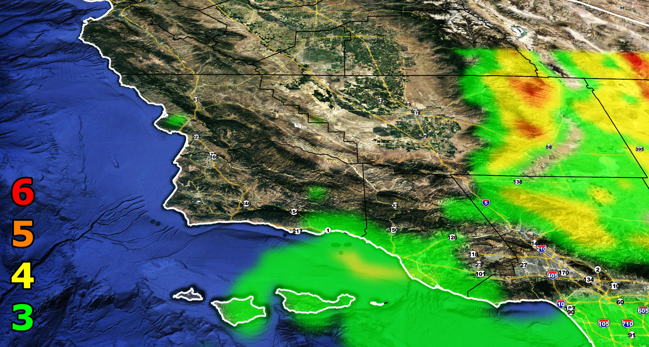
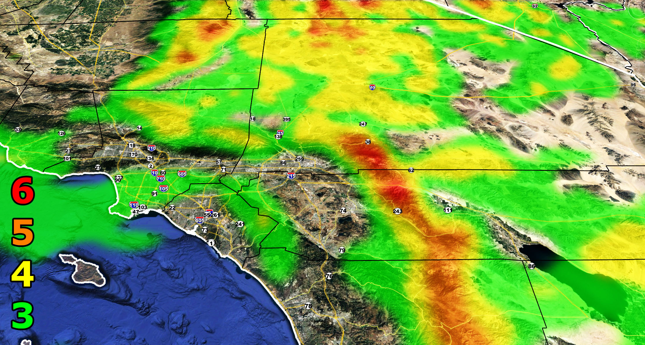
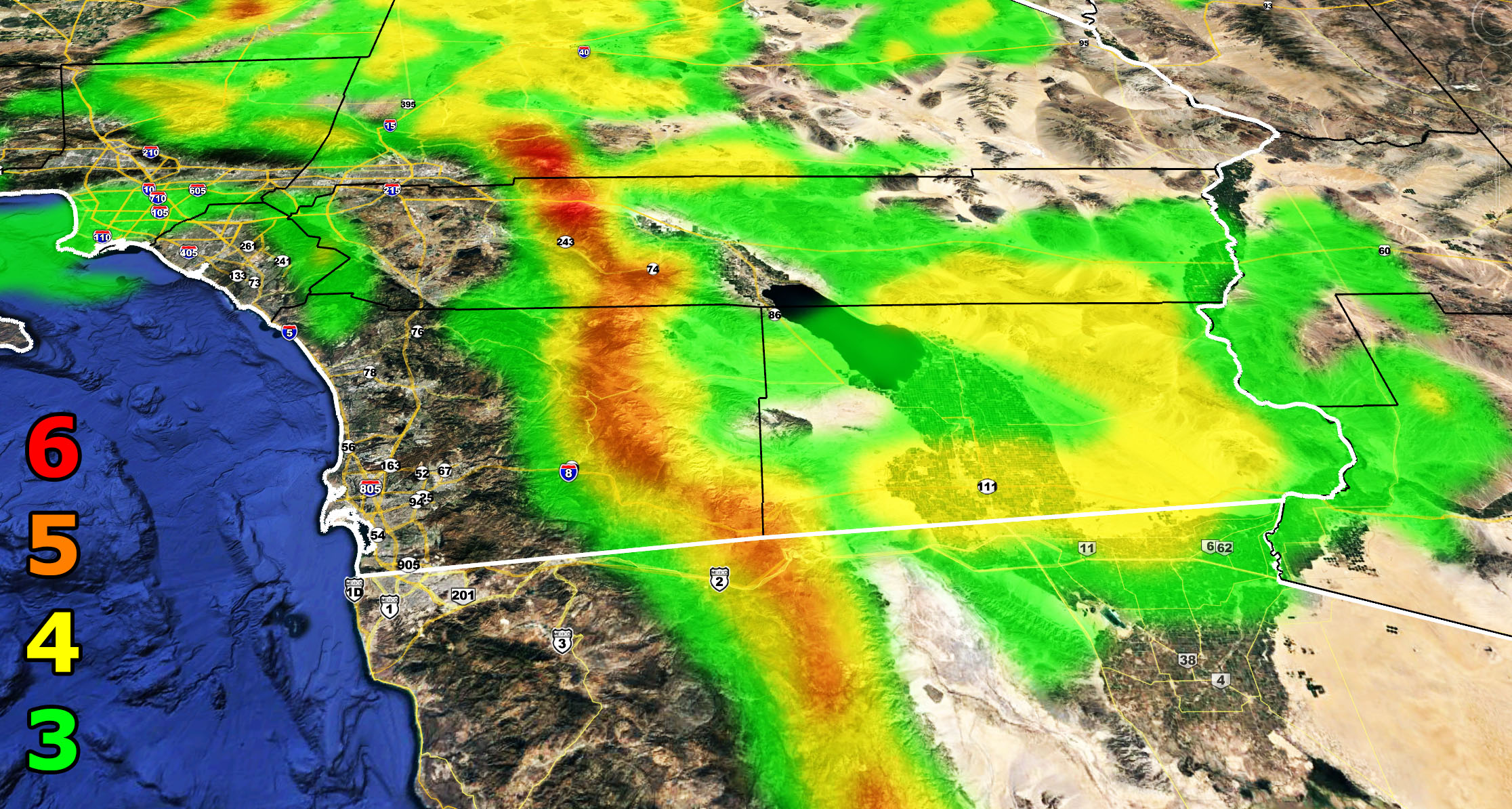
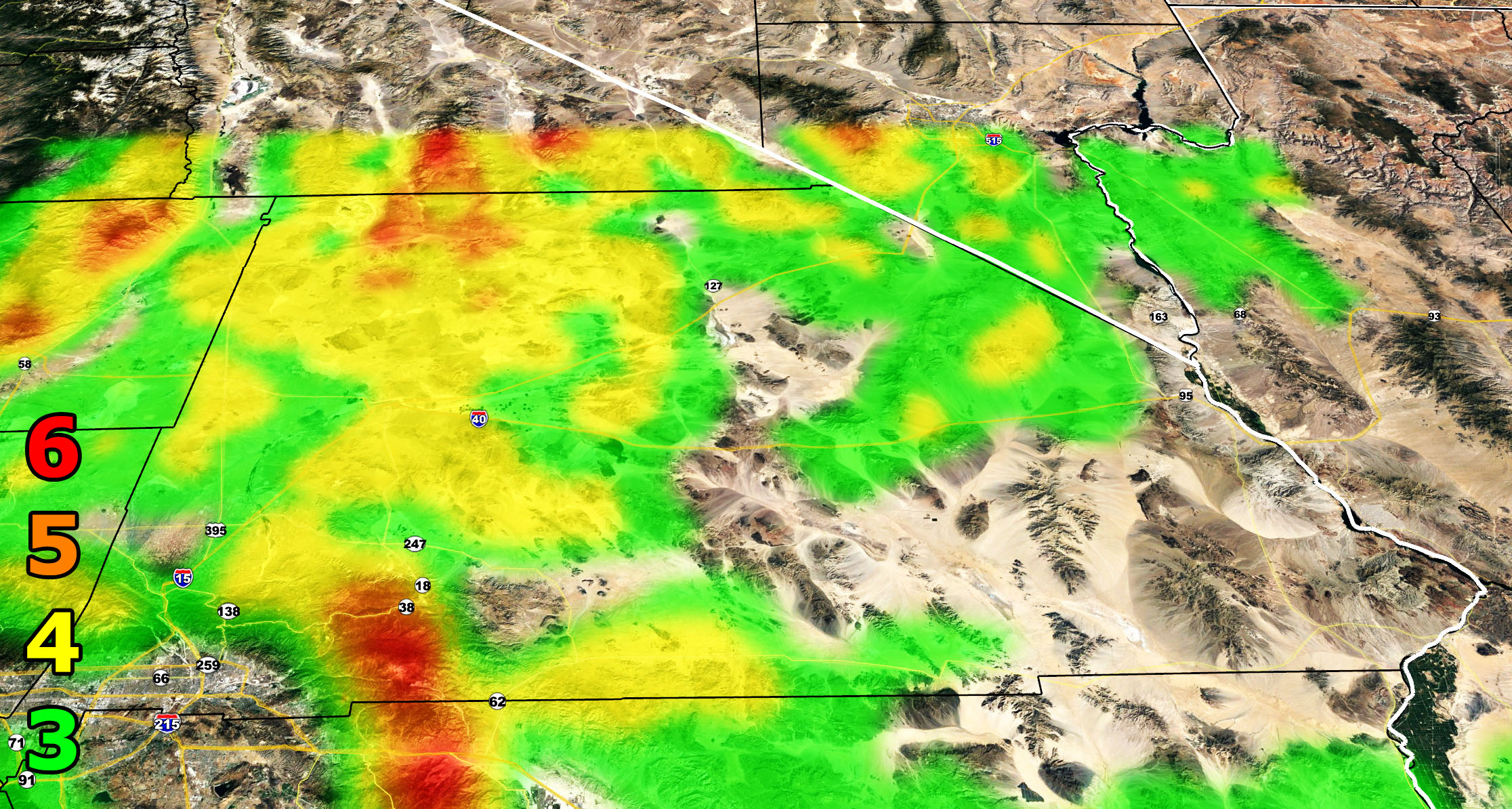
Forecast: A dry frontal zone from an inside slider will move through the region starting on Wednesday and lasting through Thursday. A thermal low will form east of Southern California, bringing in stronger west winds. Depending where you are, you’ll see either level 3, 4, or 5 winds and the SCWF wind intensity model images are included below.
6. SOME Trees are broken or uprooted, building damage is possible. – High Profile Vehicle Roll-Over Likely, Do NOT recommend Traveling in this zone
5. Slight damage occurs to buildings, shingles are blown off of roofs. HIGH WIND WARNING CRITERIA – High Profile Vehicle Roll-Over Possible if weight is not corrected.
4. Twigs and small branches are broken from trees, walking is difficult. BLOWING DUST CRITERIA if in an area known for blowing dust.
3. Large trees sway, becoming difficult to walk. POWER SHUTDOWN THRESHOLD during any high fire risk. WIND ADVISORY CRITERIA
How to get these alerts with a premium subscription? (100 percent delivery time)
Click Here For Options
Join A Micro-Climate Group On Facebook For These Alerts? (50 percent delivery time)
Click Here To Find Your Location Served By SCWF Today!
NOTE: If you read this from a SCWF micro-climate Facebook Group, keep in mind that forecast ARTICLES are NOT posted there unless it directly affects you. You will want to go to the MAIN SCWF Facebook Page and to go there you CLICK HERE.
10 mile rule: These alerts issued on this site means that within your zone and 10 miles from you will see the event forecast for. You may or may not see the event but it means you are in the zone or 10 miles from where someone will.
Forecaster: KM