
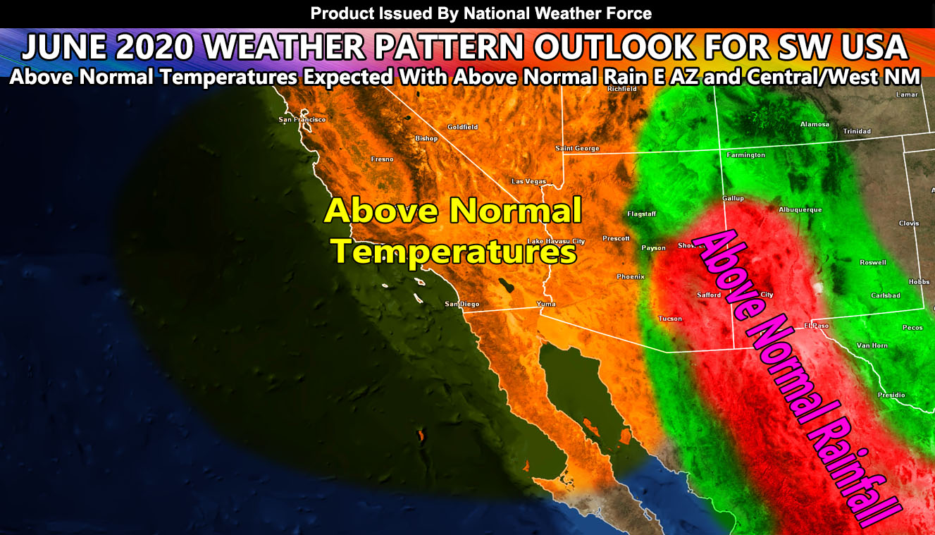
The June 2020 Pattern will be more of the same with above normal temperatures. This Summer 2020 will be one of the hottest Summers in the Southwestern United States as the upper jet stream (unlike last year) will be pushed far enough north to allow for ridging to take hold, with less chances of troughs developing west of California. The end result of this will be a ridge forming over the four corners on time.
Monsoon Season starts on June 15th and I think around then to end month is when we will start to see a good life developing for the four-corners ridge. As a result, the monsoonal moisture intrusions in most of the Southwestern United States will be at average, but the Eastern half of Arizona and Western half of New Mexico will see an above average monsoonal moisture flow for this month, with Tucson coming in hot with a lot of storm activity. This is because the future Tropical Storm or Hurricane Cristobal (Click Here For That Information) will deepen Western Gulf of Mexico moisture and the ridge will shove it into Mexico and eventually through Arizona and New Mexico. Simple pattern physics here!
There will be times where the easterly waves can rotate westward into Phoenix, Western Arizona, Las Vegas, and even Southern California, which will be watched. We are just getting started in what will be a very hot season ahead, opposite of last year. Global SO2 levels are down and this means we will see dangerous UV penetration as a result.
For Southern California Weather Force Facebook – Click Here
For Arizona Weather Force – Click Here
For National Weather Force – Click Here