
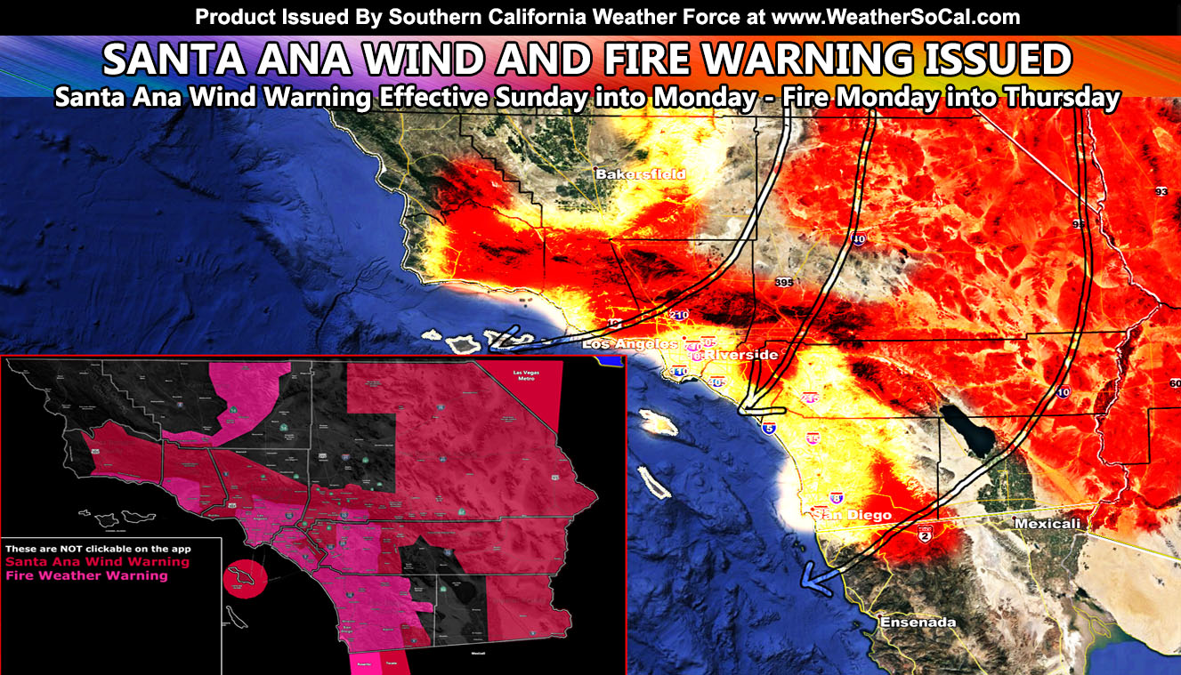
Southern California Weather Force has issued the official Santa Ana Wind Warning starting Sunday and going through Monday. This has also prompted the Fire Weather Warning as warm temperatures along with the dry air working in will promote fire conditions on the level of the August 2009 Station Fire conditions so read on for details.
If you have been following National Weather Force (Click here to the Facebook Post) then you will note that I predicted a rare snow level chance for parts of Central/Eastern Oregon into Idaho and that event will happen tonight into Sunday. That one rare event will cause another rare event in the butterfly effect. Because of the cold air in place up north, The Great Basin will cool-down to abnormal June levels and create thermal support. This thermal support will rush southward and into our mountain passes and jet out of the north and northeast in what is called a Santa Ana Wind. Take note that power may be shut-off once again or that the power can go out with downed power-poles in the yellow, orange, and red shaded zones below –
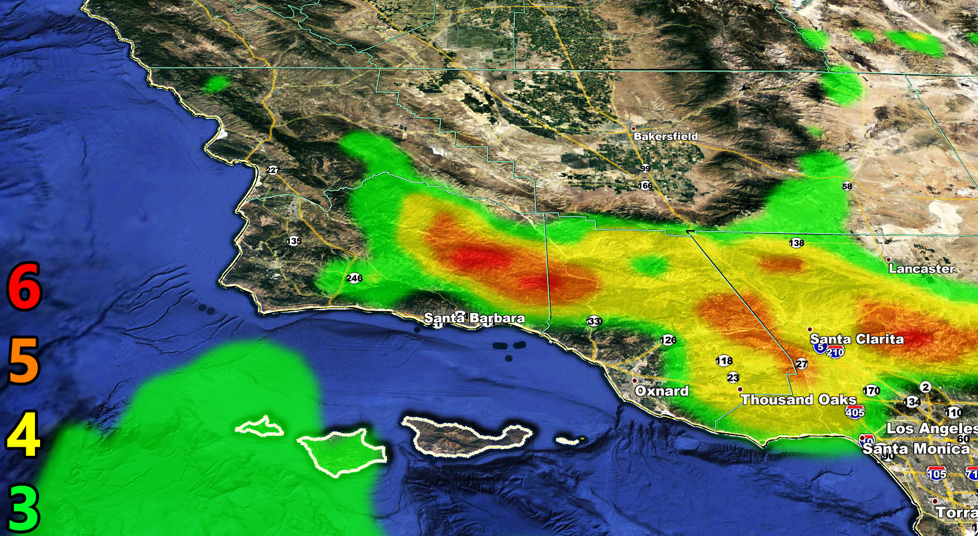
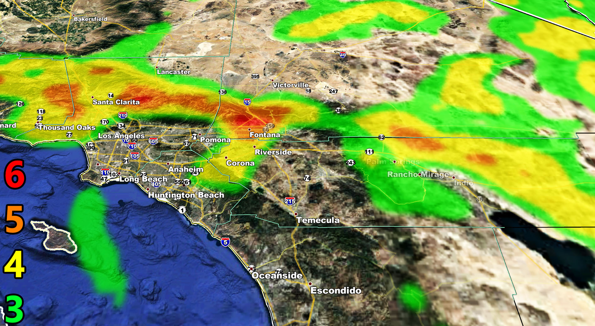
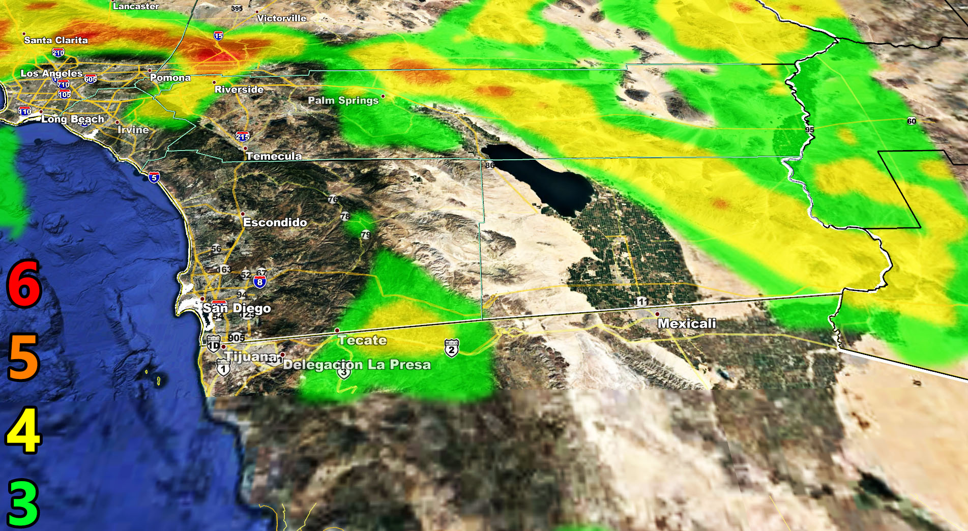
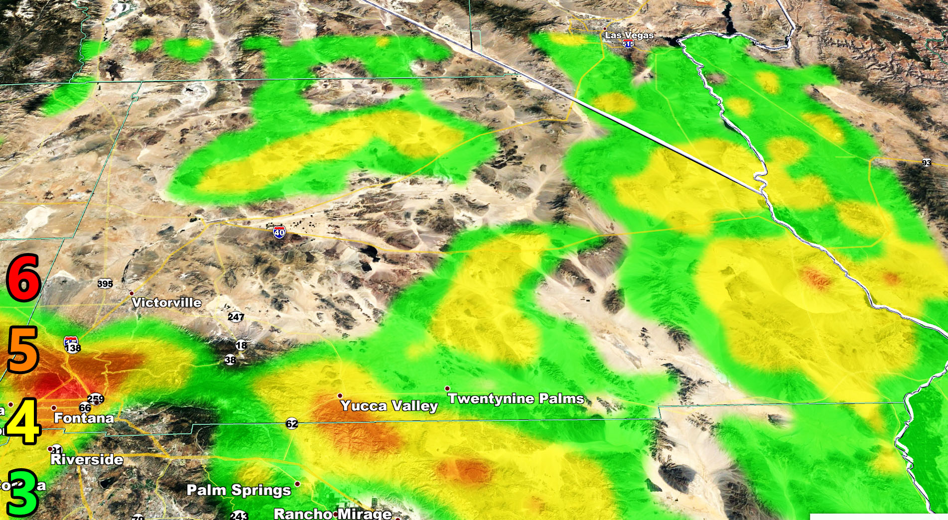
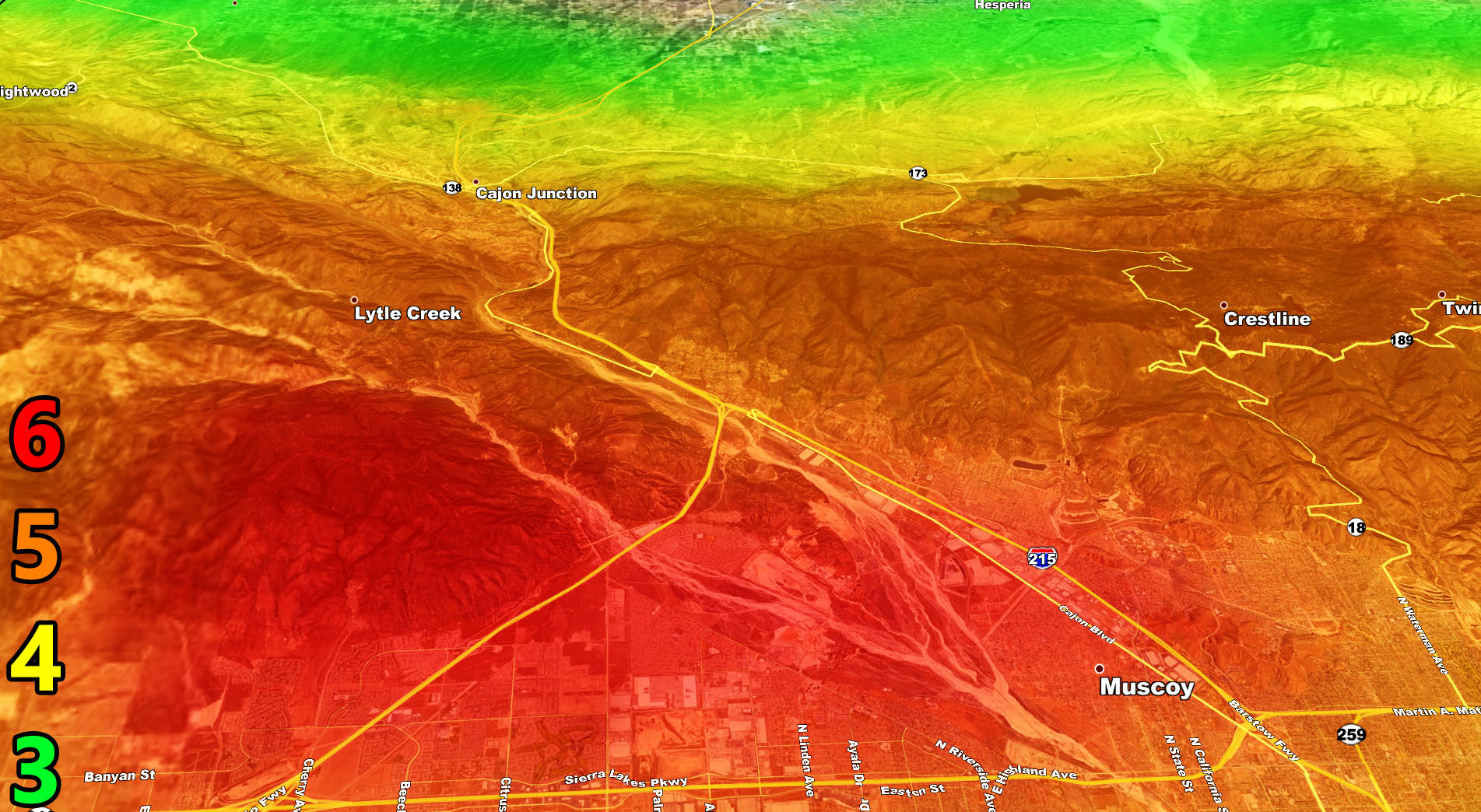
The Martin Wind Gust Intensity Model shows where the winds will be on Sunday night into Monday so use it below.
6. SOME Trees are broken or uprooted, building damage is possible. – High Profile Vehicle Roll-Over Likely, Do NOT recommend Traveling in this zone
5. Slight damage occurs to buildings, shingles are blown off of roofs. HIGH WIND WARNING CRITERIA – High Profile Vehicle Roll-Over Possible if weight is not corrected.
4. Twigs and small branches are broken from trees, walking is difficult. Anything 4 and above will have blowing dust if conditions are dry, which does reduce visibility and make driving difficult …
3. Large trees sway, becoming difficult to walk. POWER SHUTDOWN THRESHOLD during any high fire risk. WIND ADVISORY CRITERIA
As for all areas south and west of the Santa Barbara, Ventura, Los Angeles, Riverside, San Bernardino, Orange, and San Diego County Mountains in the metros to coast it will be a FIRE WEATHER WARNING due to warm/dry conditions …
Triple digit temperatures will hit Tuesday through Thursday, maintaining a fire weather hazard for the inland basin/valley areas …
As always, stay tuned to Southern California Weather Force for official forecasts and updates in weather across Southern California
Join Southern California Weather Force main Facebook Page for future updates!
MICRO-CLIMATE ALERT FACEBOOK GROUPS: Find yours today!
Click here to join
Reading for another state? Join my national page – https://www.facebook.com/nwfweather/
All articles and micro-climate alerts can be delivered to you via the email alert service subscription and we are on a FREE TRIAL ALL SUMMER so CLICK HERE to join
MICRO-CLIMATE ALERT FACEBOOK GROUPS: Find yours today!
Click here to join
As always, stay tuned to official forecasts from Southern California Weather Force for updates …
For The Main Weather Facebook Page Click Here and Join.
End Article
FACEBOOK PAGES TO JOIN!
SOUTHERN CALIFORNIA WEATHER FORCE MAIN: Southern California Weather Force Office Main Page
BEHIND THE SCENES FORECASTS/UPDATE PAGE: Southern California Weather Force Meteorologist Page
FOR THE CALIFORNIA FAULT STRESS MODEL PAGE: For SCWF official updates to the California Fault Stress Model and more!
“PONDER THIS” SCIENCE ADVENTURE SHOW: A science adventure show developed here at Southern California Weather Force that is a fun ride!
INSTAGRAM AND TWITTER ACCOUNTS TO JOIN!
Instagram – https://www.instagram.com/socalweatherforce/
Twitter – https://twitter.com/SCweatherforce