
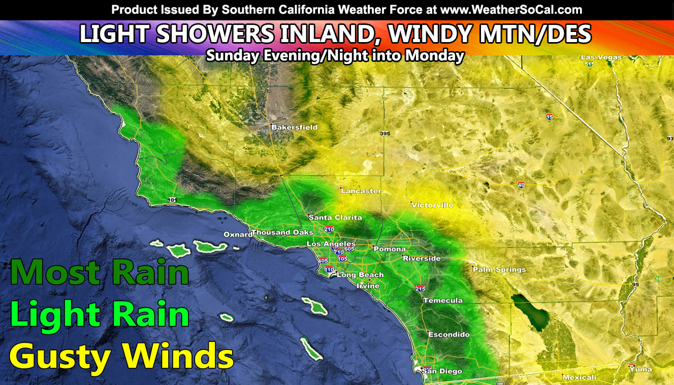
A trough of low pressure passing the region will bring a deeper onshore flow and thus a deeper low-level moisture field into the area later today (Sunday) and go into the night. Showers are expected to develop at times within this, the heaviest will be inland against the western and southern foothill zones. The map included in this article will show you by the key where these will most likely be.
In addition to the precipitation, I have issued a Fog Advisory for all mountain pass zones above 2,500 FT, which includes Gorman, Cajon, and even parts of the Ortega Highway in the Santa Ana Mountains through Monday morning …
The passing system will also bring gusty winds to the mountain and desert region where I have a hybrid high wind warning + wind advisory already issued via the micro-climate alert system days ago .. .so if you are on the FB groups or signed up as a trial member you would have received that via those channels. The ones left out of any gusty wind or rain is Bakersfield.
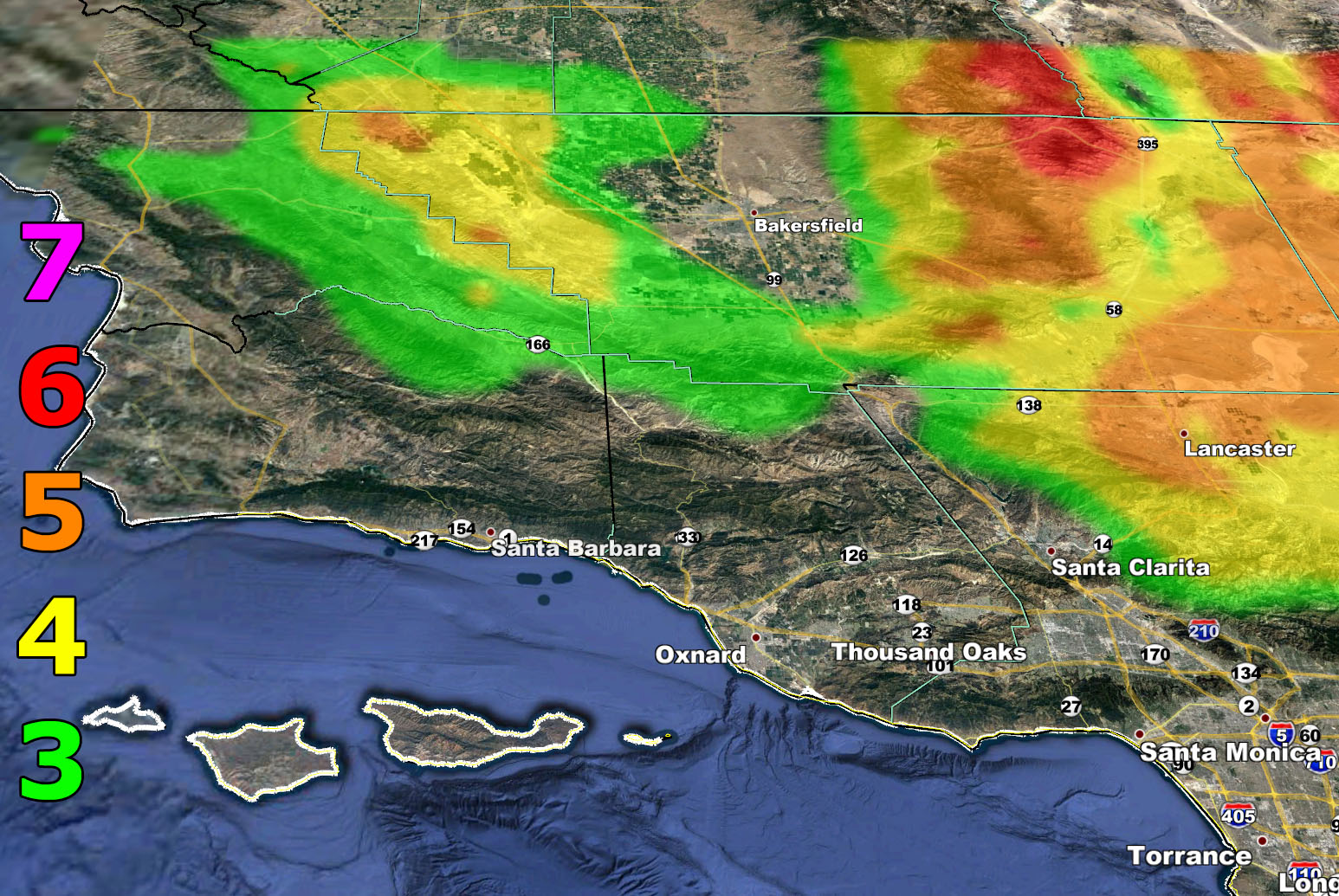
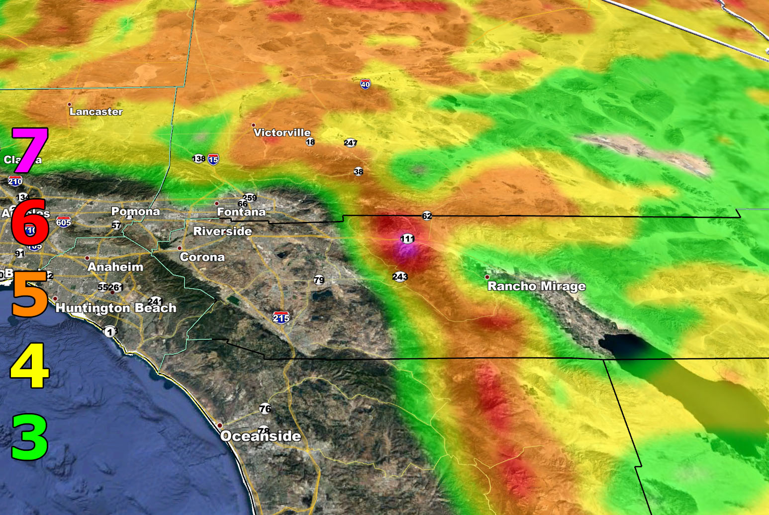
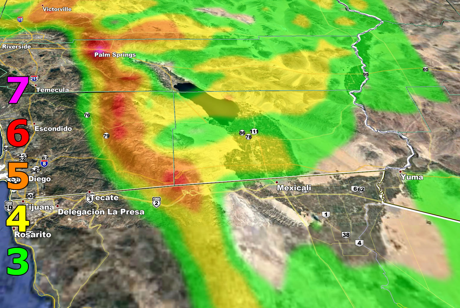
7. Trees are broken or uprooted, building damage is considerable. – High Profile Vehicle Roll-Over CERTAIN.
6. SOME Trees are broken or uprooted, building damage is possible. – High Profile Vehicle Roll-Over Likely, Do NOT recommend Traveling in this zone
5. Slight damage occurs to buildings, shingles are blown off of roofs. HIGH WIND WARNING CRITERIA – High Profile Vehicle Roll-Over Possible if weight is not corrected.
4. Twigs and small branches are broken from trees, walking is difficult. Anything 4 and above will have blowing dust if conditions are dry, which does reduce visibility and make driving difficult …
3. Large trees sway, becoming difficult to walk. POWER SHUTDOWN THRESHOLD during any high fire risk. WIND ADVISORY CRITERIA

We are seeing less activity in the Eastern Pacific Ocean in terms of hurricanes and this is why we have not seen an appreciable monsoon flow yet. It is still pretty early. July looks to have a good amount of storms for parts of Arizona, but the kicker is if they can move this far west. Generally without a hurricane south of here the chances of that are slim so we will be stuck with the heat after mid-July and I’ll continue to monitor the flow.
As always, stay tuned to Southern California Weather Force for official forecasts and updates in weather across Southern California
Join Southern California Weather Force main Facebook Page for future updates!
MICRO-CLIMATE ALERT FACEBOOK GROUPS: Find yours today!
Click here to join
Reading for another state? Join my national page – https://www.facebook.com/nwfweather/
All articles and micro-climate alerts can be delivered to you via the email alert service subscription and we are on a FREE TRIAL ALL SUMMER so CLICK HERE to join
MICRO-CLIMATE ALERT FACEBOOK GROUPS: Find yours today!
Click here to join
As always, stay tuned to official forecasts from Southern California Weather Force for updates …
For The Main Weather Facebook Page Click Here and Join.
End Article
FACEBOOK PAGES TO JOIN!
SOUTHERN CALIFORNIA WEATHER FORCE MAIN: Southern California Weather Force Office Main Page
BEHIND THE SCENES FORECASTS/UPDATE PAGE: Southern California Weather Force Meteorologist Page
FOR THE CALIFORNIA FAULT STRESS MODEL PAGE: For SCWF official updates to the California Fault Stress Model and more!
“PONDER THIS” SCIENCE ADVENTURE SHOW: A science adventure show developed here at Southern California Weather Force that is a fun ride!
INSTAGRAM AND TWITTER ACCOUNTS TO JOIN!
Instagram – https://www.instagram.com/socalweatherforce/
Twitter – https://twitter.com/SCweatherforce