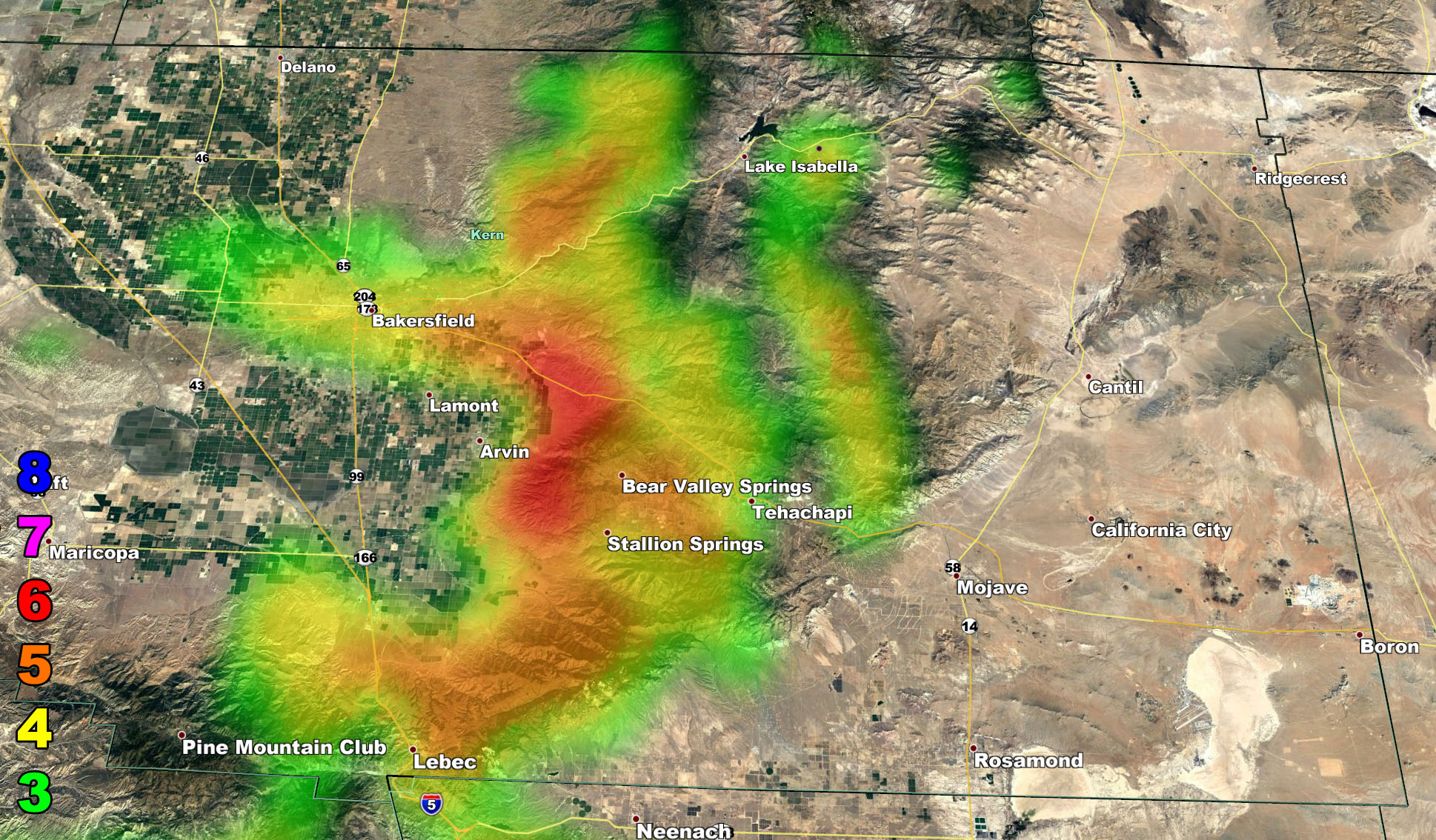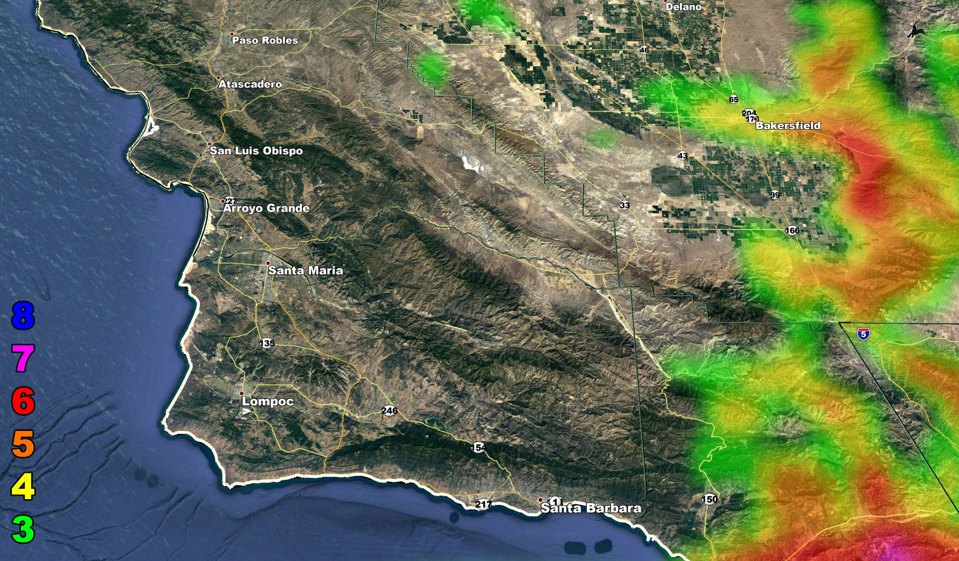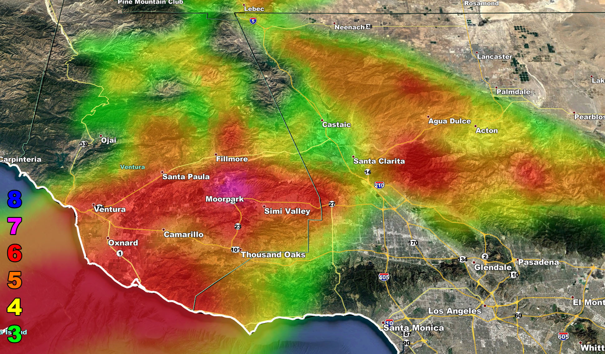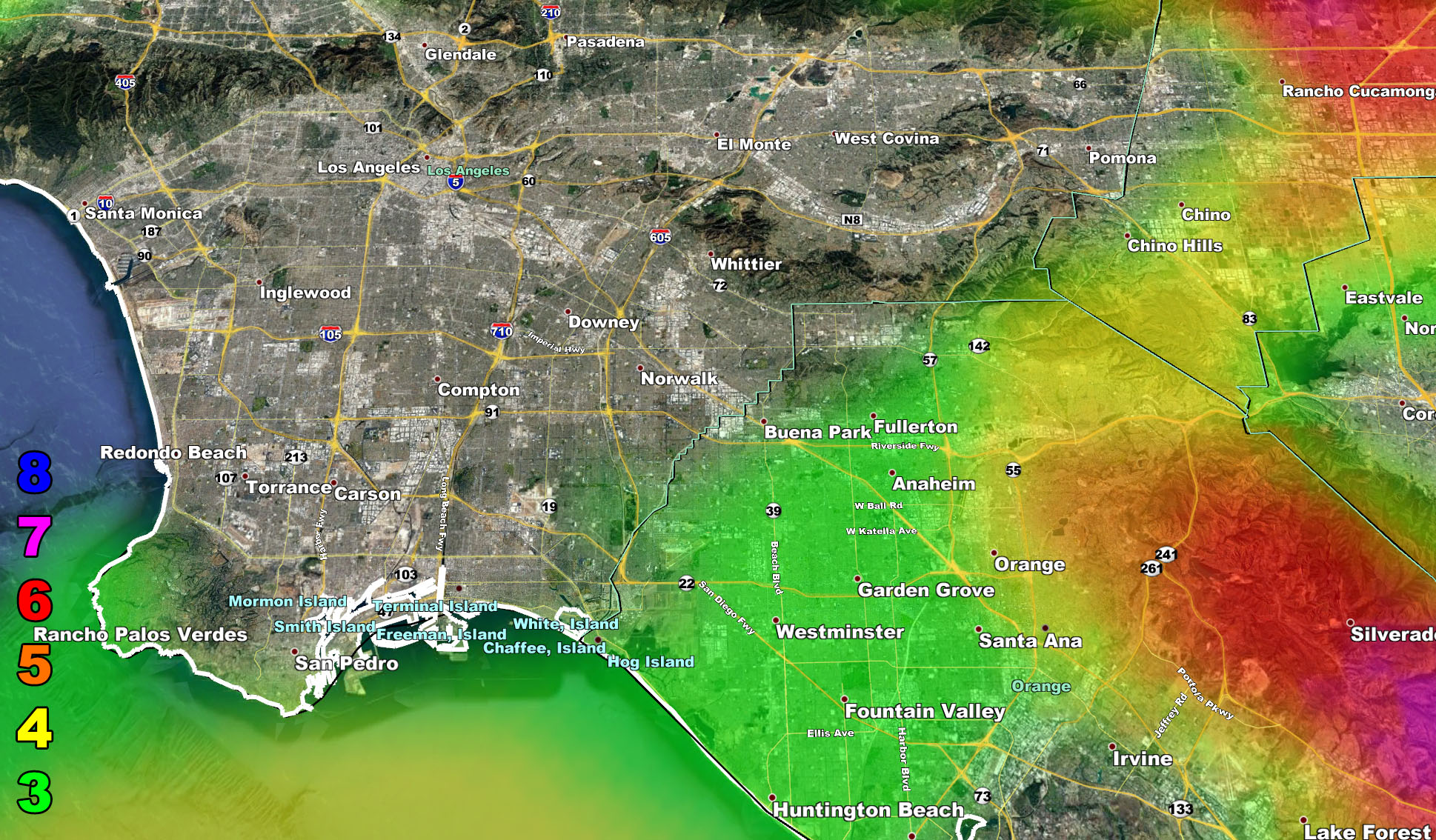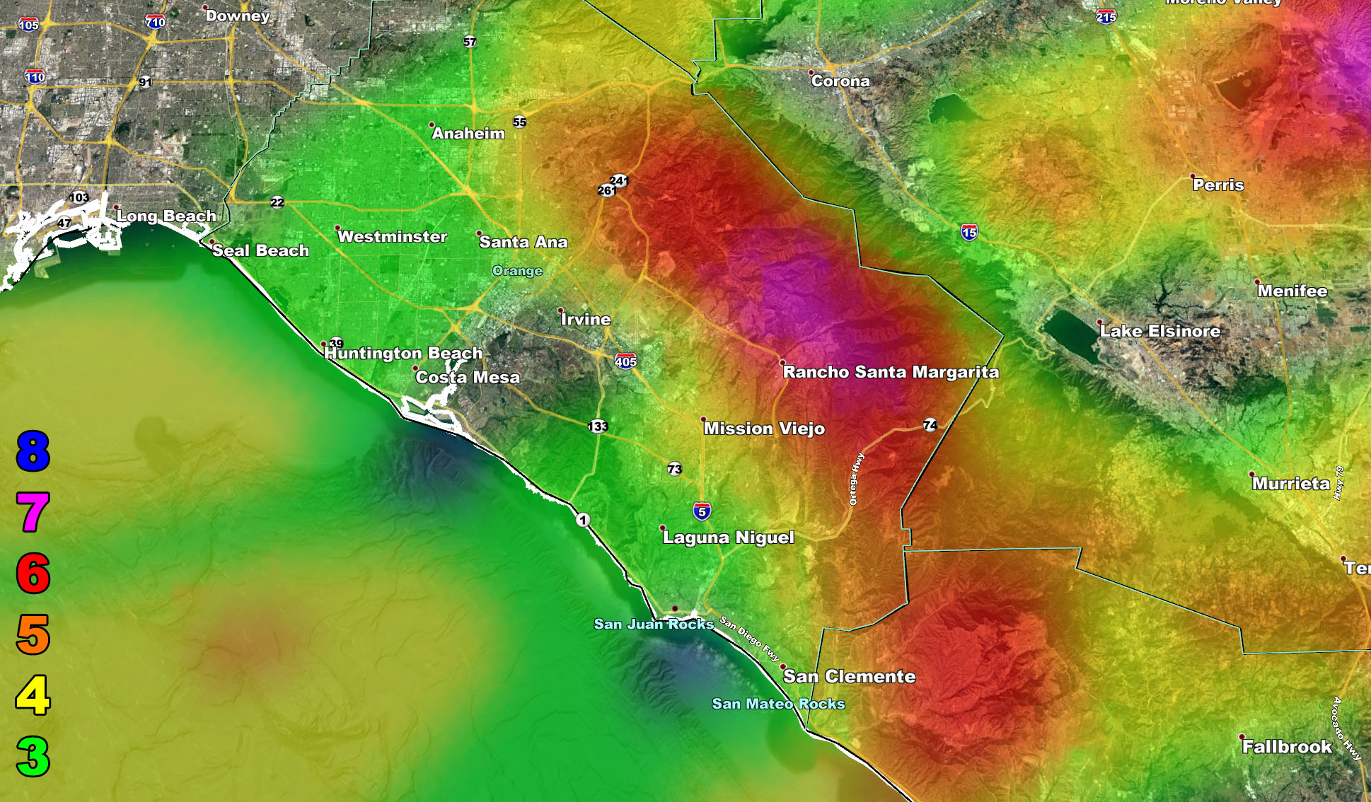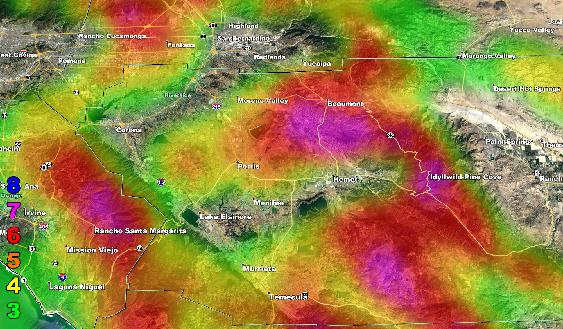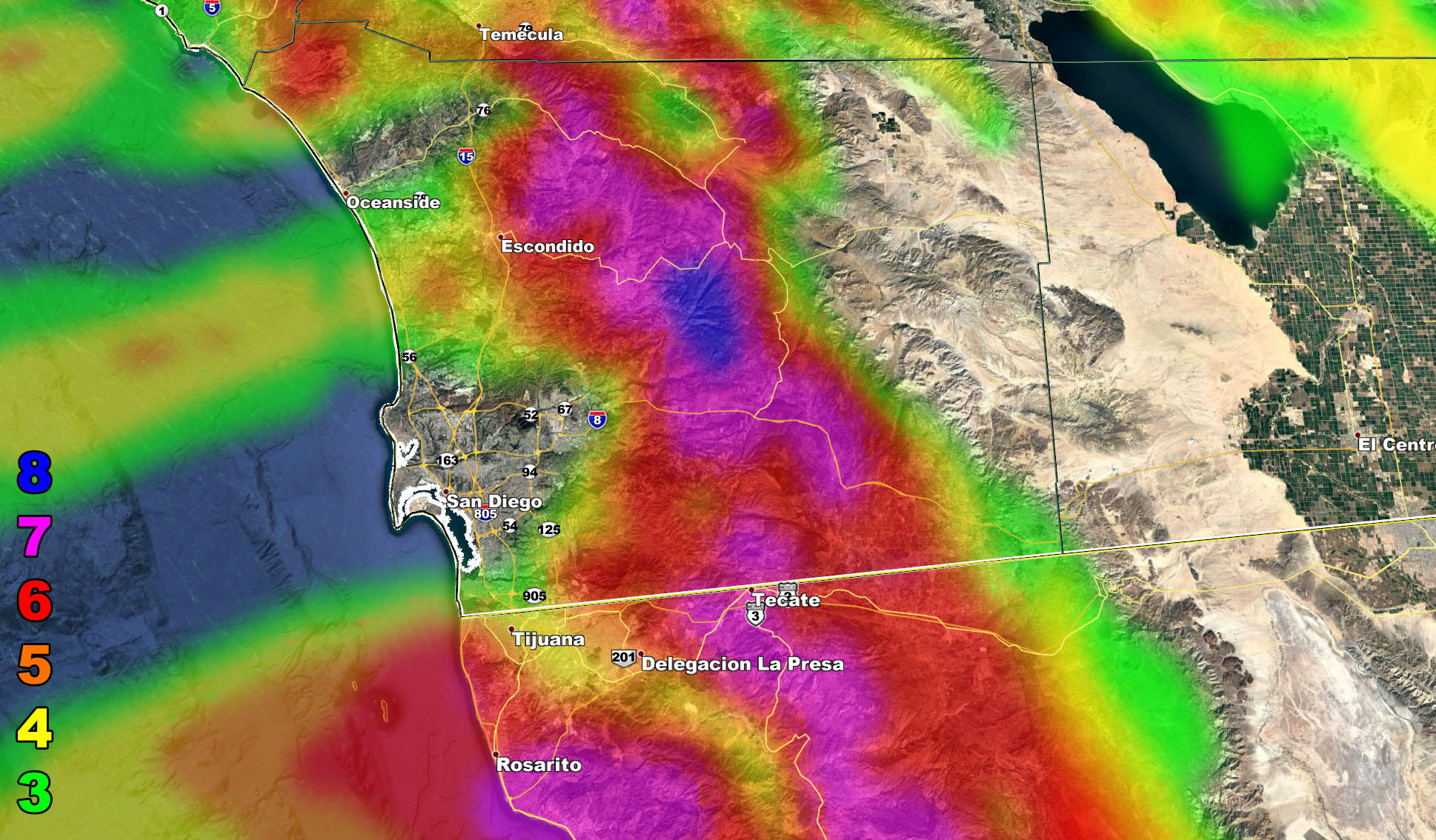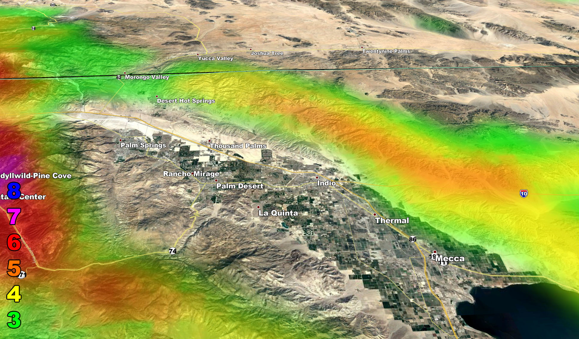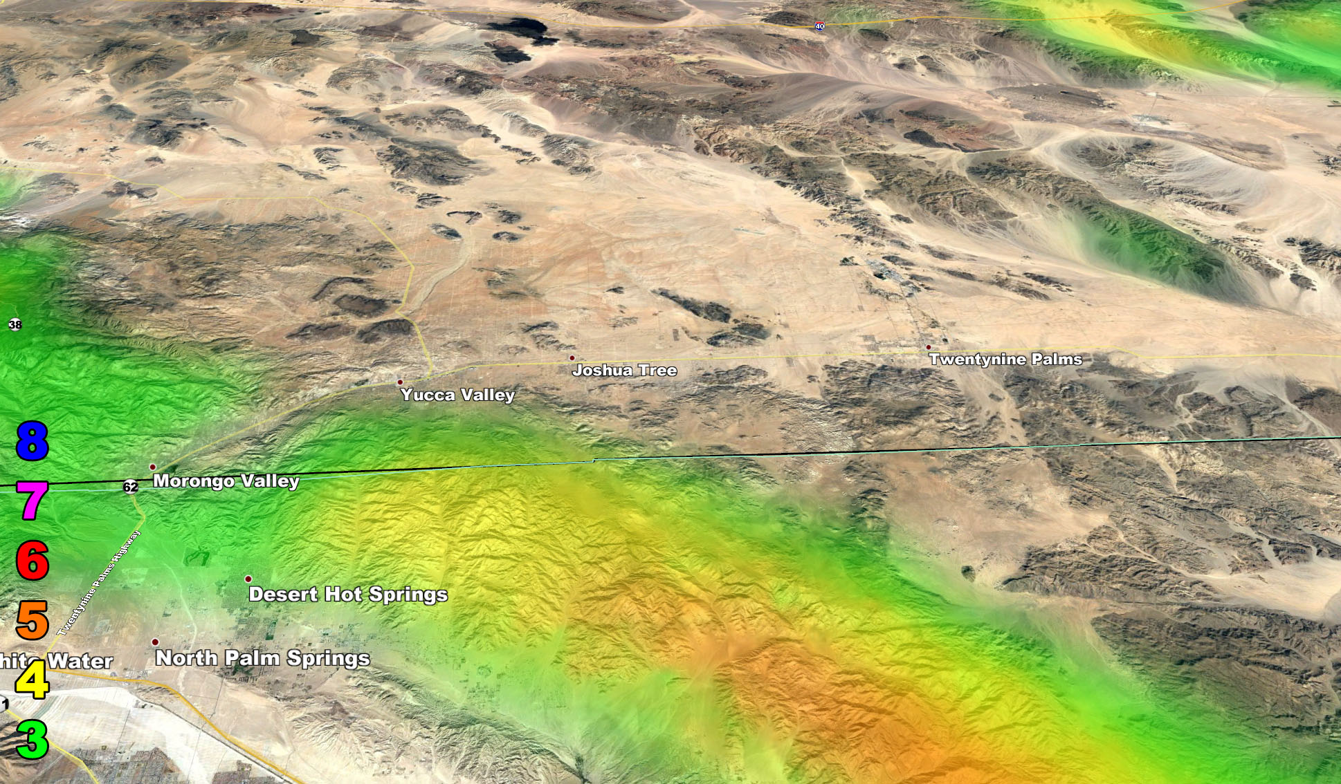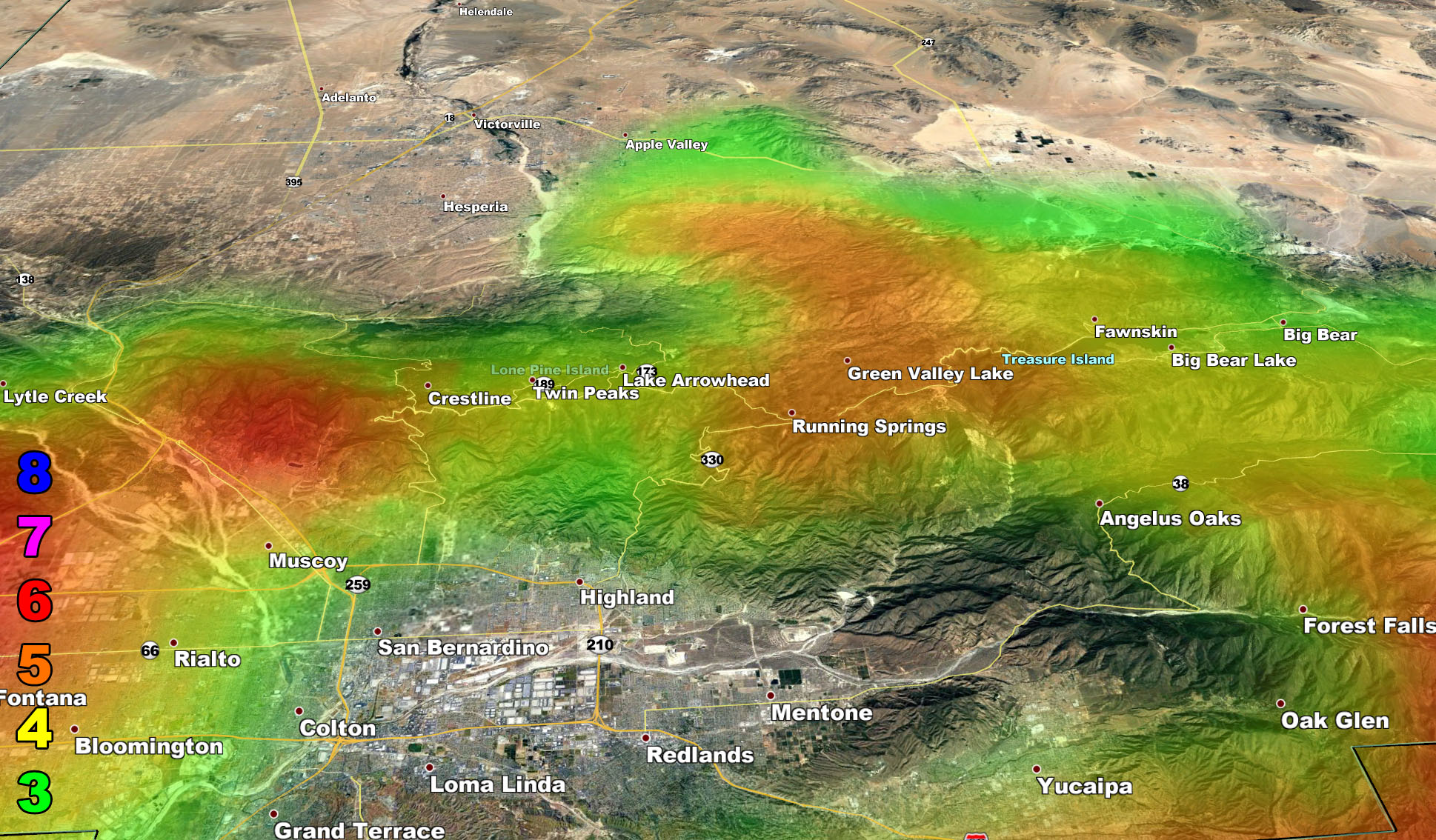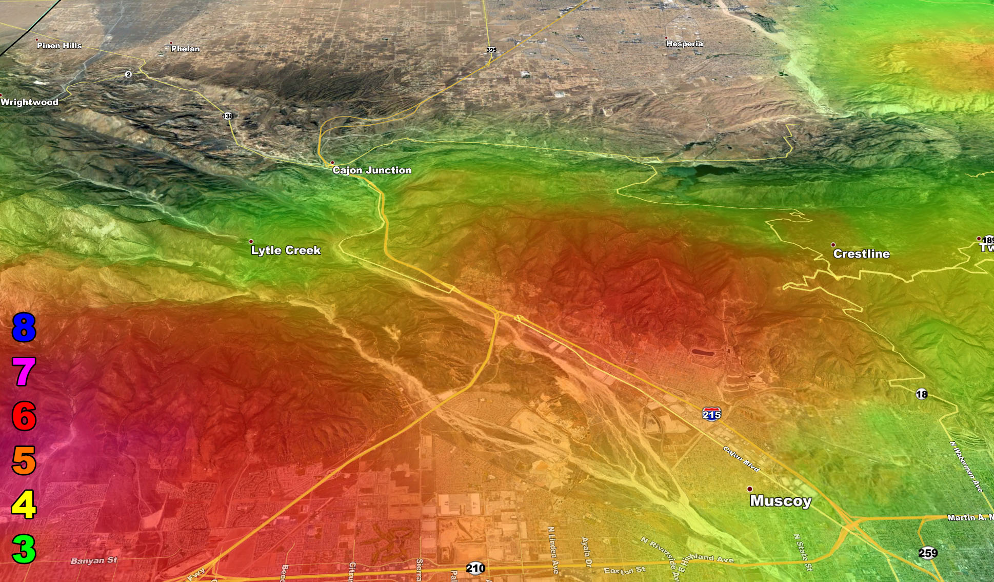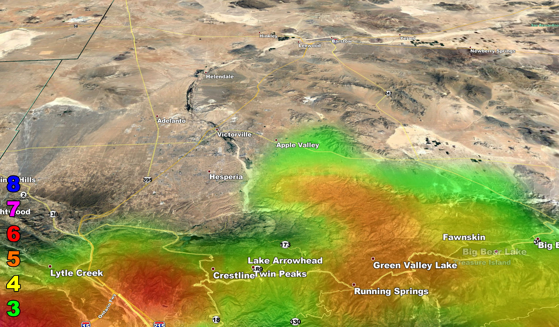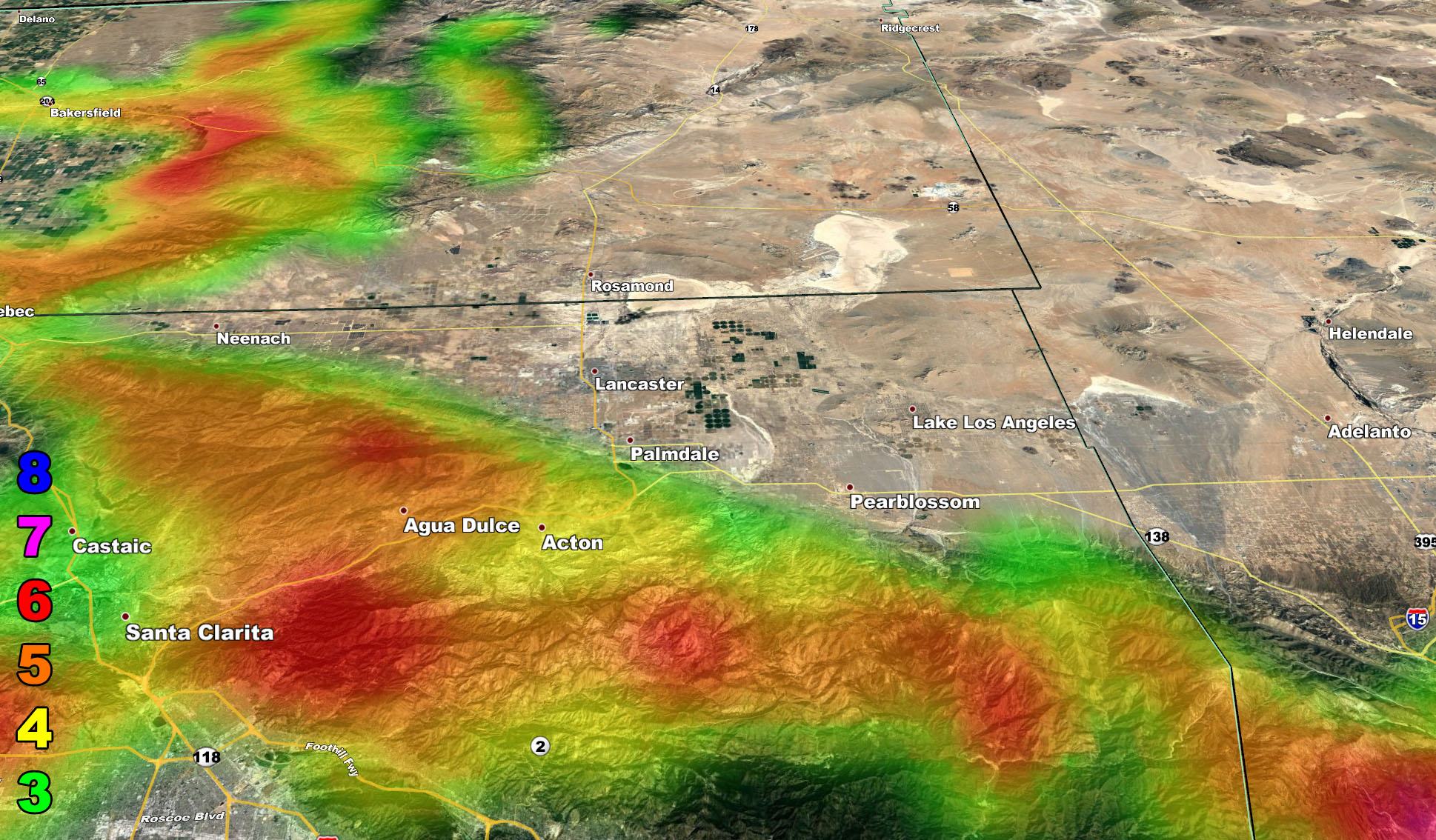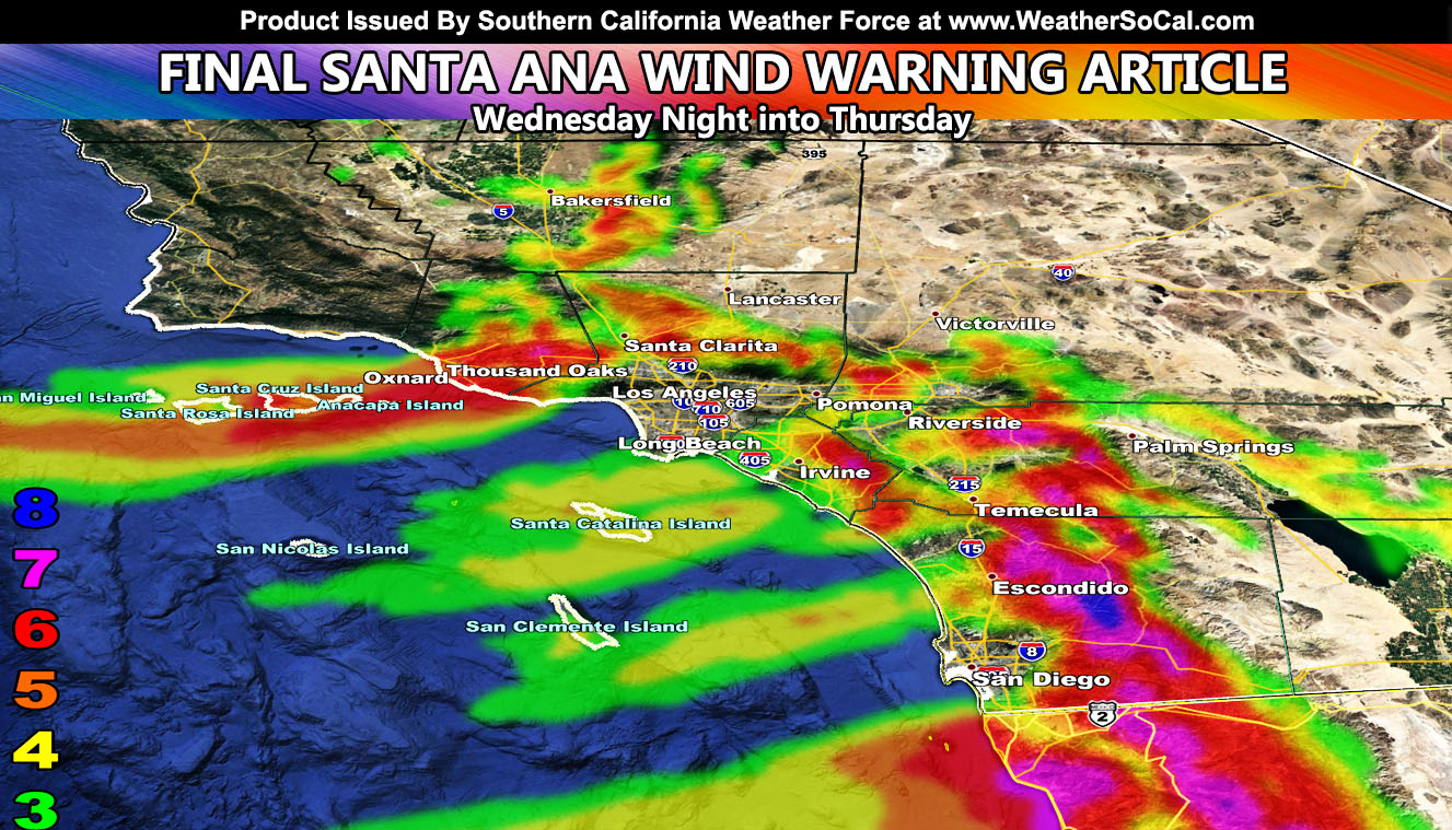
Wind speeds have increased on the final outlook with winds starting later this evening in the prone zones and peaking overnight into Thursday morning, dropping off by Thursday evening below advisory levels in all areas. This is a damaging level 8 event for the San Diego County Mountain/Foothill areas surrounding Ramona, the strongest east wind event since Fall 2003 and damage is certain so for your aerial zoom-in model, read on …
The Santa Ana Wind Watch issued on November 27th stated that this is an east wind event. The drainage wind event is when very cold air hits the Great Basin and Rocky Mountain areas, spilling westward off the higher terrain and through our mountain and mountain pass areas into the populated zones.
East wind events tend to favor Ontario International Airport having the risk of delays or redirects, so if you have plans to fly into this airport on Thursday morning or early afternoon, you could be redirected to Las Vegas or Phoenix Sky Harbor.
Today’s Motivational: What the mind of a person can conceive and believe, it can achieve.
THIS EVENT IS ONE OF THE MOST DANGEROUS PATTERNS FOR THE SAN DIEGO COUNTY MOUNTAINS AROUND RAMONA AND VALLEY CENTER, INCLUDING LEVEL 8 CONDITIONS AT SAN DIEGO COUNTY ESTATES … DAMAGE IS CERTAIN IN A LEVEL 7 OR 8
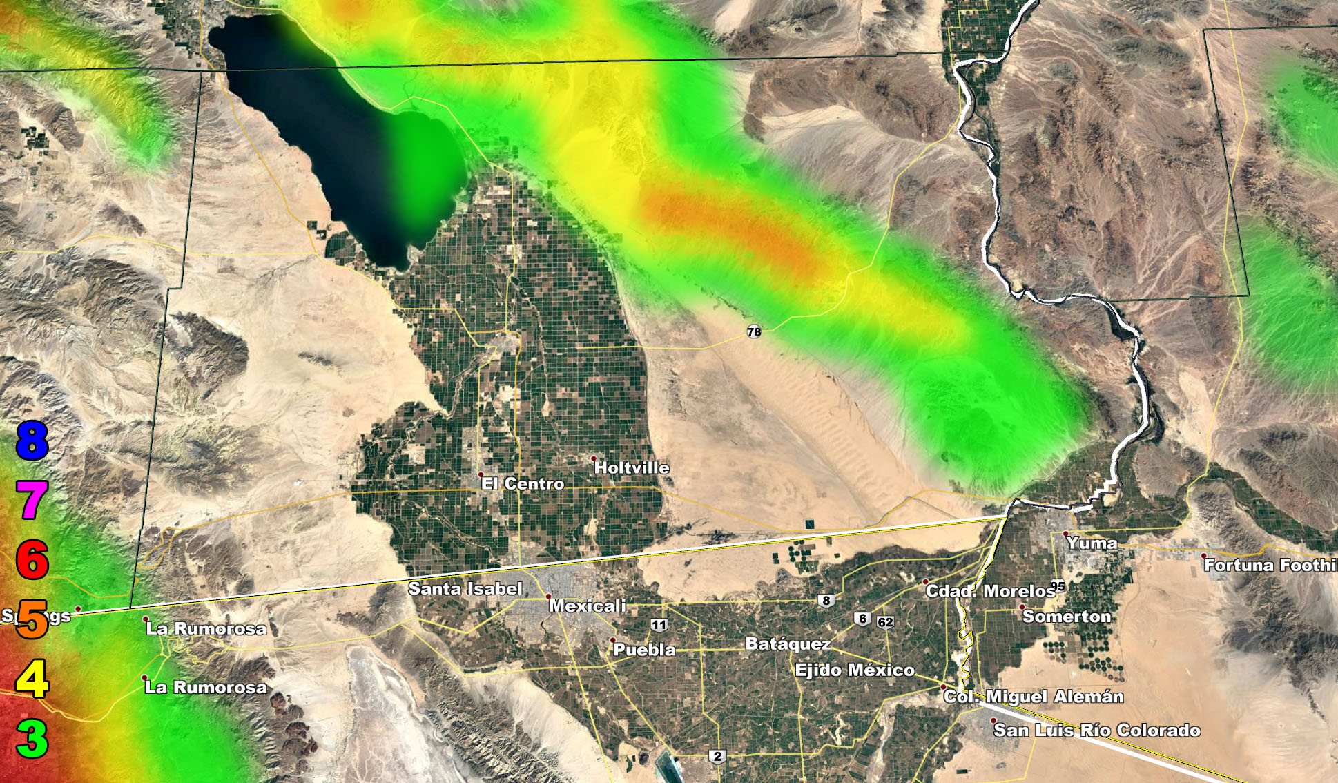
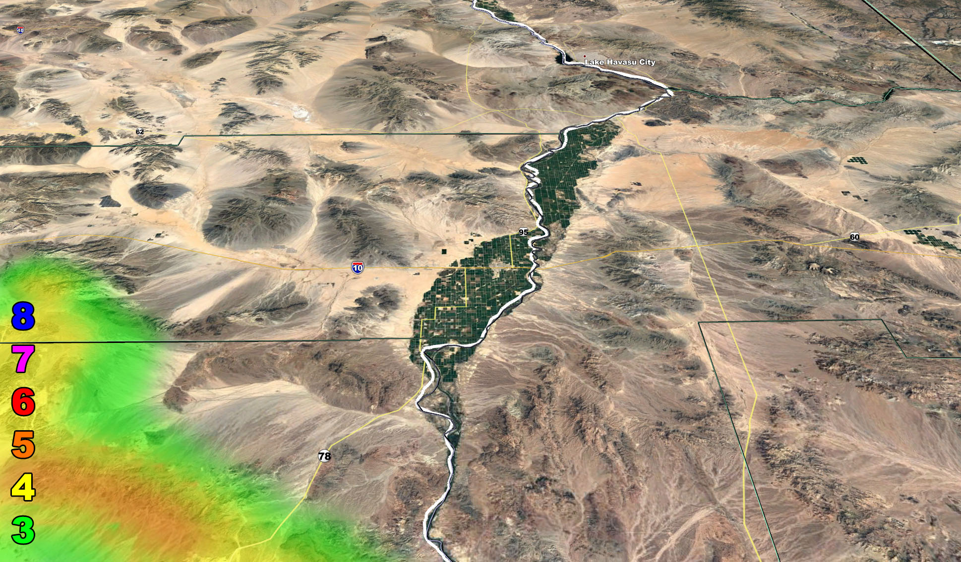
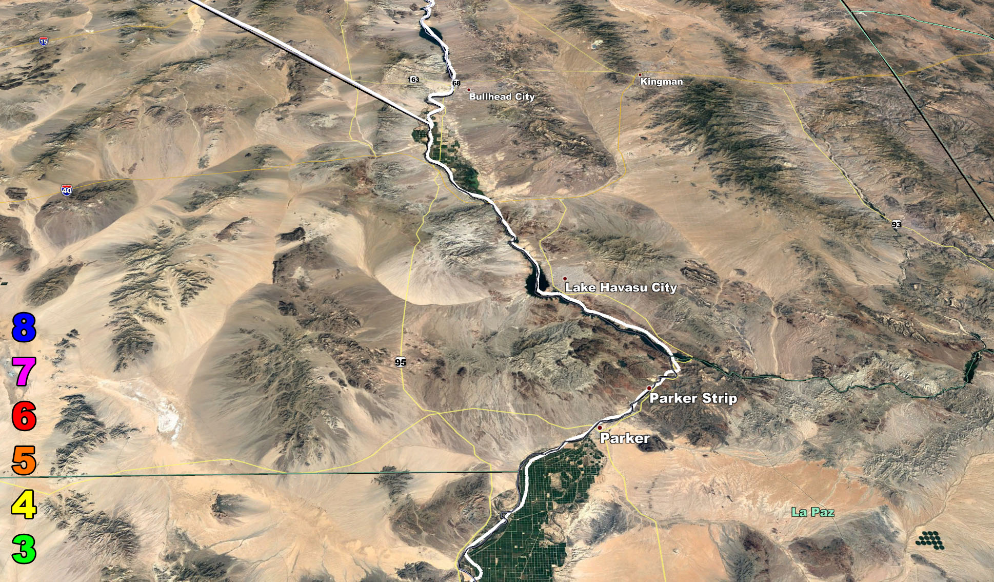
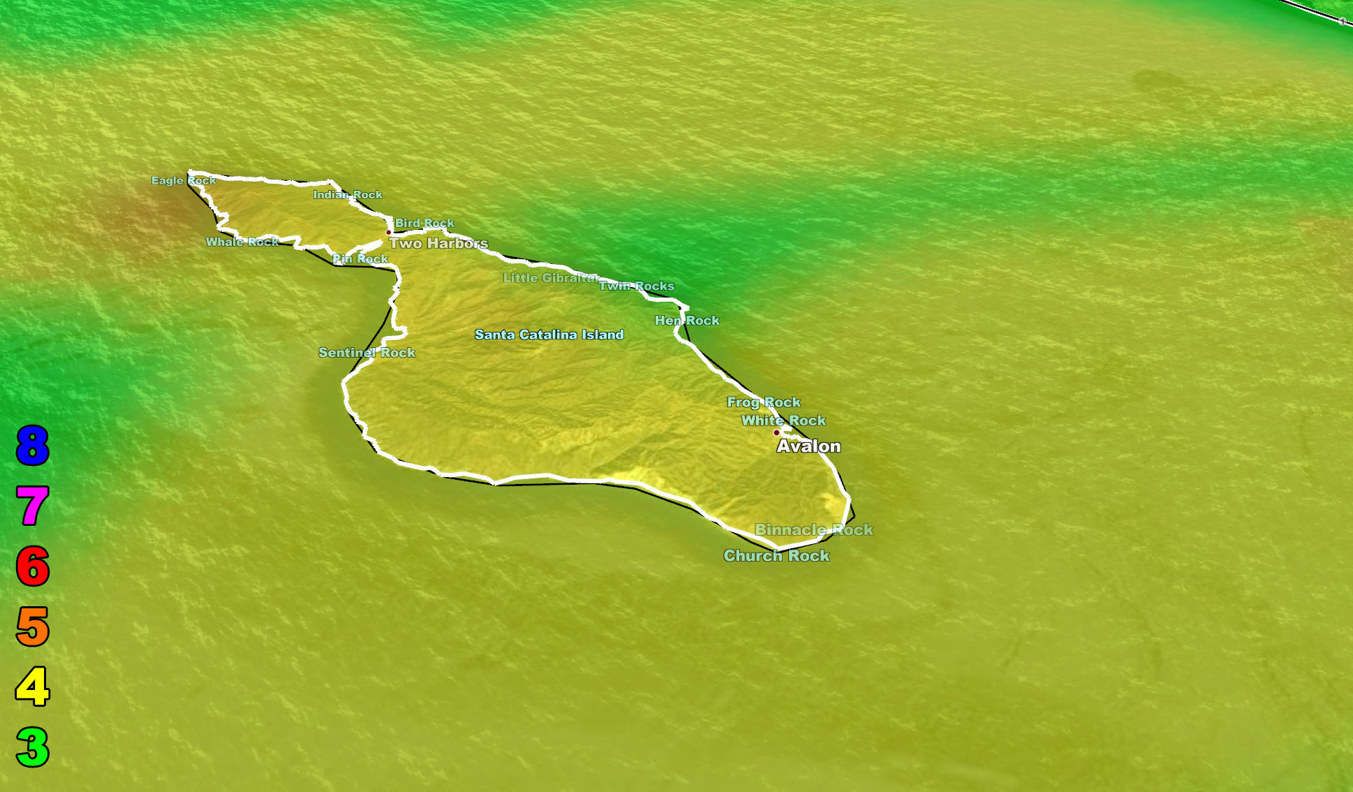
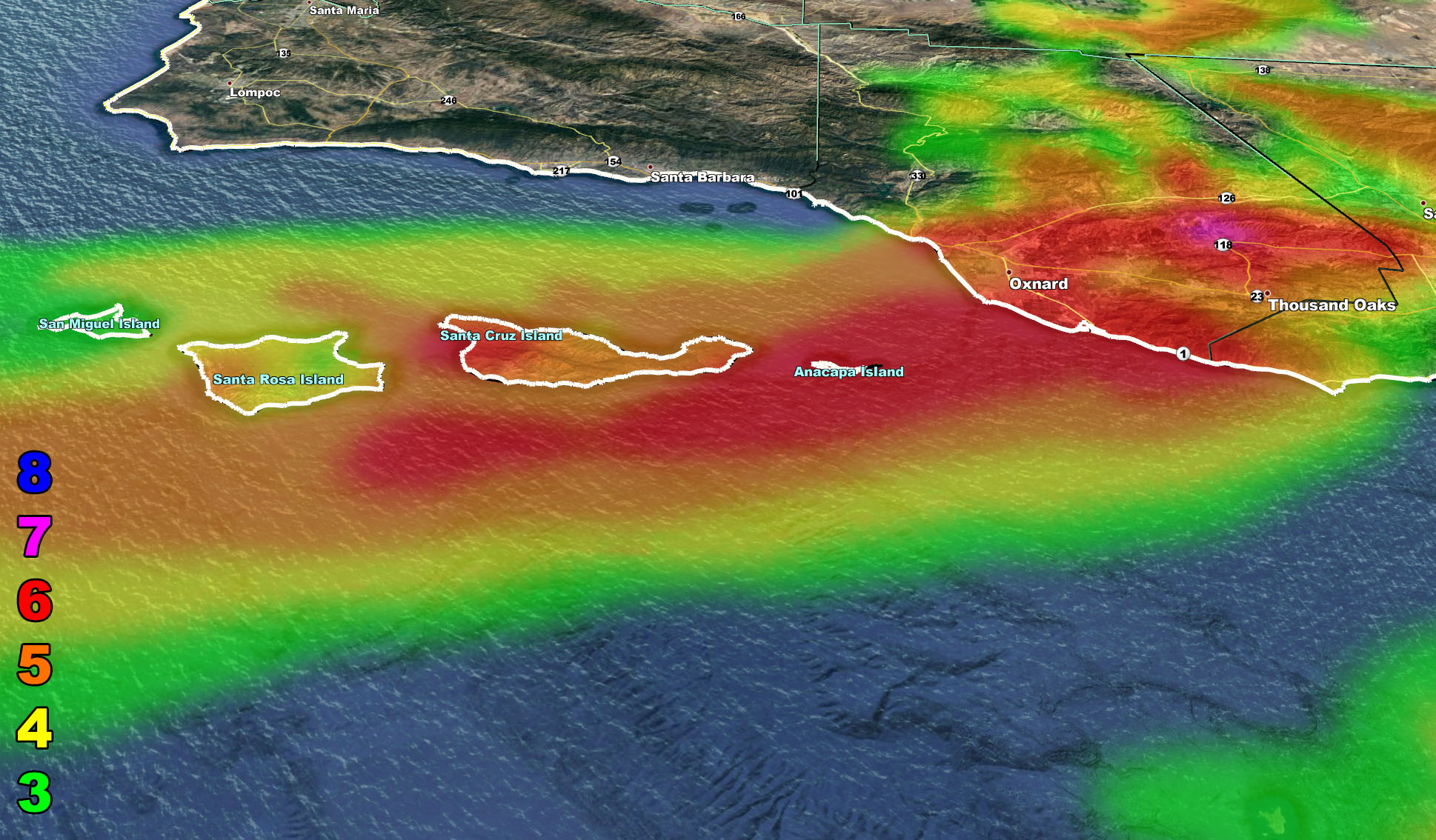
East wind events also favor the Banning Pass, Trabuco Canyon (Highway 74 as well), Camp Pendleton test and firing area, San Diego Mountain/Foothills, and Escondido, Tecate, Tijuana, Rosarito, Ensenada area, as well as Bakersfield and Ventura.
East wind events do not favor the San Gabriel Valley like north wind events do.
This is also the SCWF Fire Weather Warning from dry conditions along with these winds. Offshore winds will continue through the weekend, but not as strong as Thursday’s event.
Basically just use the SCWF high resolution model maps below for Thursday’s event – Images are clickable to be larger.
8. Extensive widespread damage.
7. Trees are broken or uprooted, building damage is considerable. – High Profile Vehicle Roll-Over CERTAIN.
6. SOME Trees are broken or uprooted, building damage is possible. – High Profile Vehicle Roll-Over Likely, Do NOT recommend Traveling in this zone
5. Slight damage occurs to buildings, shingles are blown off of roofs. HIGH WIND WARNING CRITERIA – High Profile Vehicle Roll-Over Possible if weight is not corrected.
4. Twigs and small branches are broken from trees, walking is difficult. Anything 4 and above will have blowing dust if conditions are dry, which does reduce visibility and make driving difficult …
3. Large trees sway, becoming difficult to walk. POWER SHUTDOWN THRESHOLD during any high fire risk. WIND ADVISORY CRITERIA