
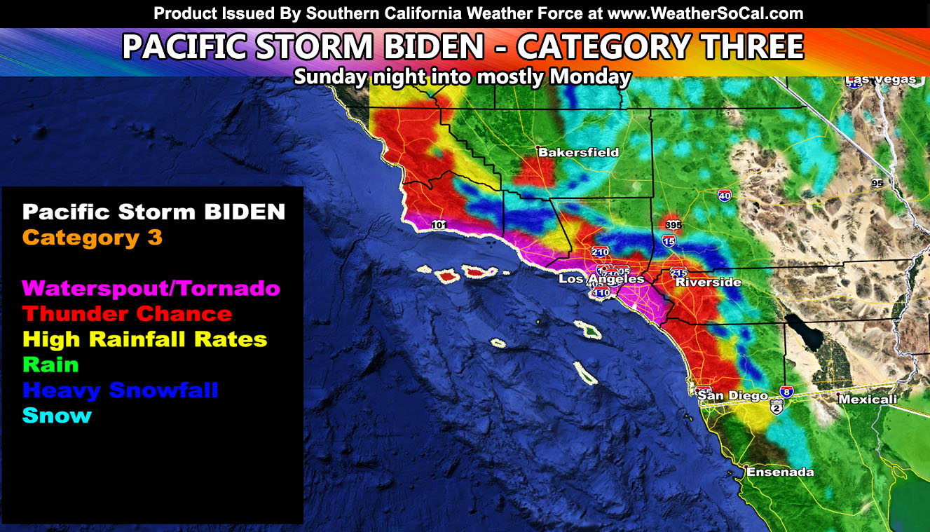
Pacific Storm BIDEN is now official, the next name on the 2020-2021 storm list. The storm is due into Southern California starting Sunday night, but most of the impacts will be through Monday. Mountain Passes like Cajon and the Gorman/Grapevine will be affected. The system will produce some areas of thunder and high rain/snowfall rates so read on for the first outlook of details…
Join Southern California Weather Force main Facebook Page for future updates!
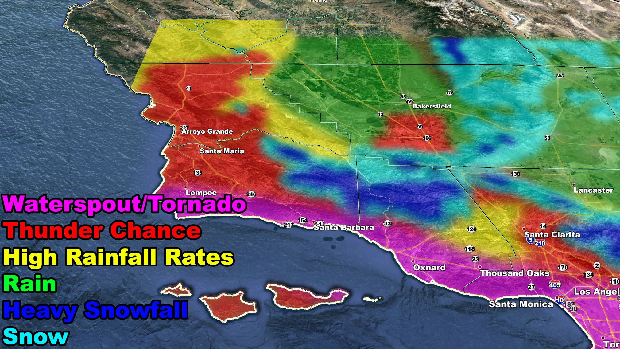
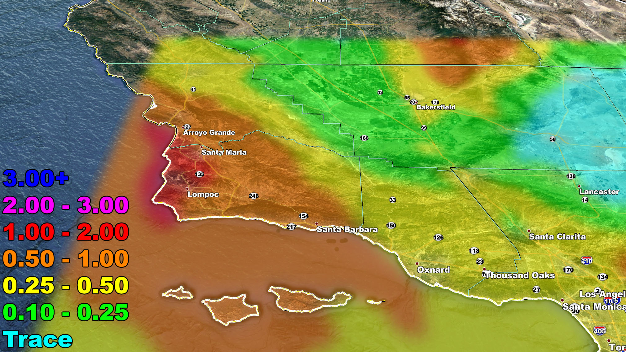
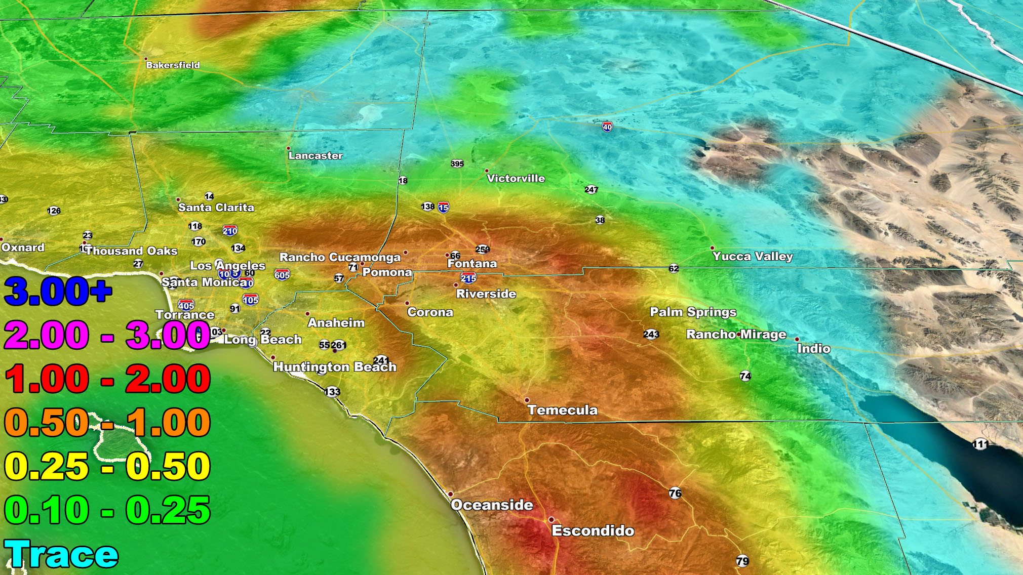
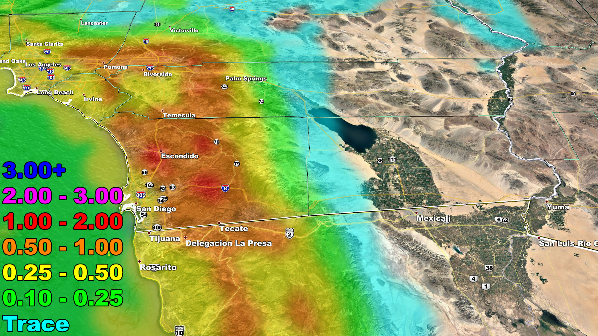
The system has a strong surface low with it so it will come in two parts. The first part will hit the Vandenberg/SLO areas on Sunday night. As that is happening, areas across Ventura, Los Angeles, Orange, Inland Empire, and some San Diego metro areas will notice an increase in pre-frontal zone showers. The front will zip through those areas on Monday morning, bringing a healthy dose of precipitation. The first frontal zone will have snow levels of 4000-4500 FT so by early morning through the Cajon Pass we should have some snowflakes out there, maybe even a dusting during the Monday morning commute… but it will not be a heavy snow outlook then. The next front will however cause some issues on the passes at 4,000 FT.
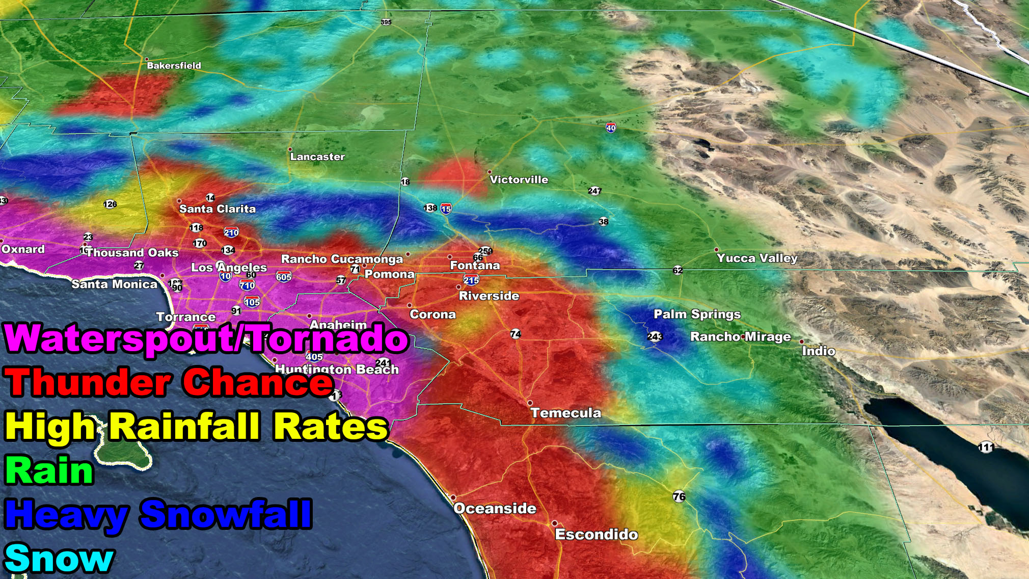
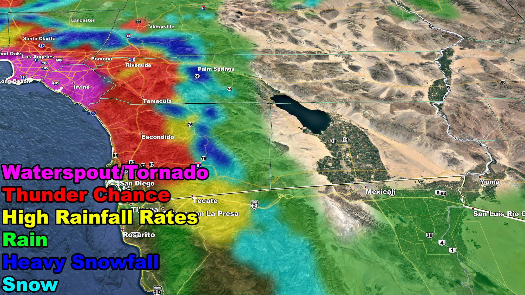
The next front will move through the region over the day on Monday, right behind the first weaker one. Rainfall rates are enough to warrant a flood risk of moderate / advisory for the metro areas of San Luis Obispo, Santa Barbara, Ventura, Los Angeles, Orange, The Inland Empire, and along I-15 in San Diego County’s valley corridor. Of course also in the foothills below 4,000 FT. The snow-level with this will be at 4,000 FT, which means under stronger convective bands, both the Gorman and Cajon Pass will have travel delays later on Monday. They could even be enough to have CHP escorts or even a shutdown in some cases.
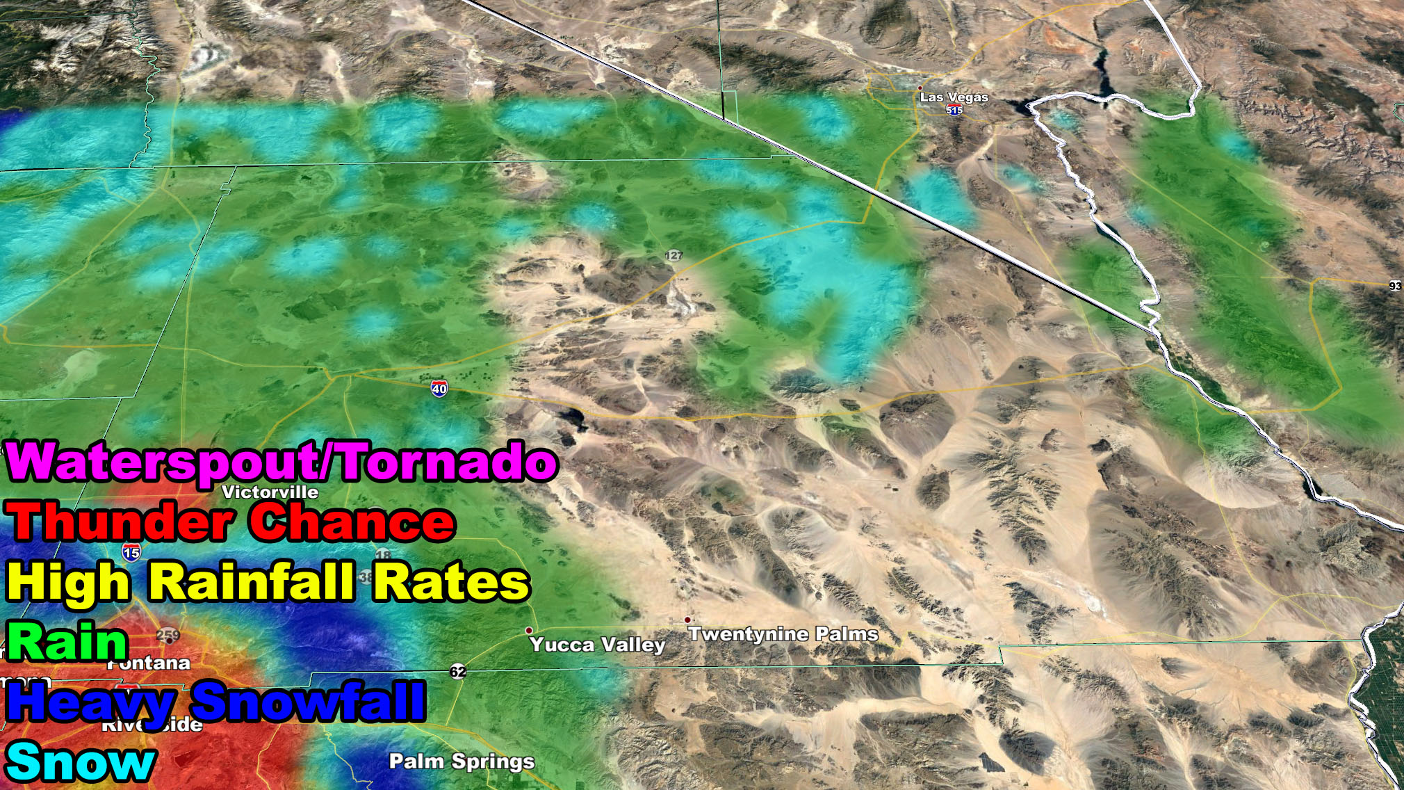
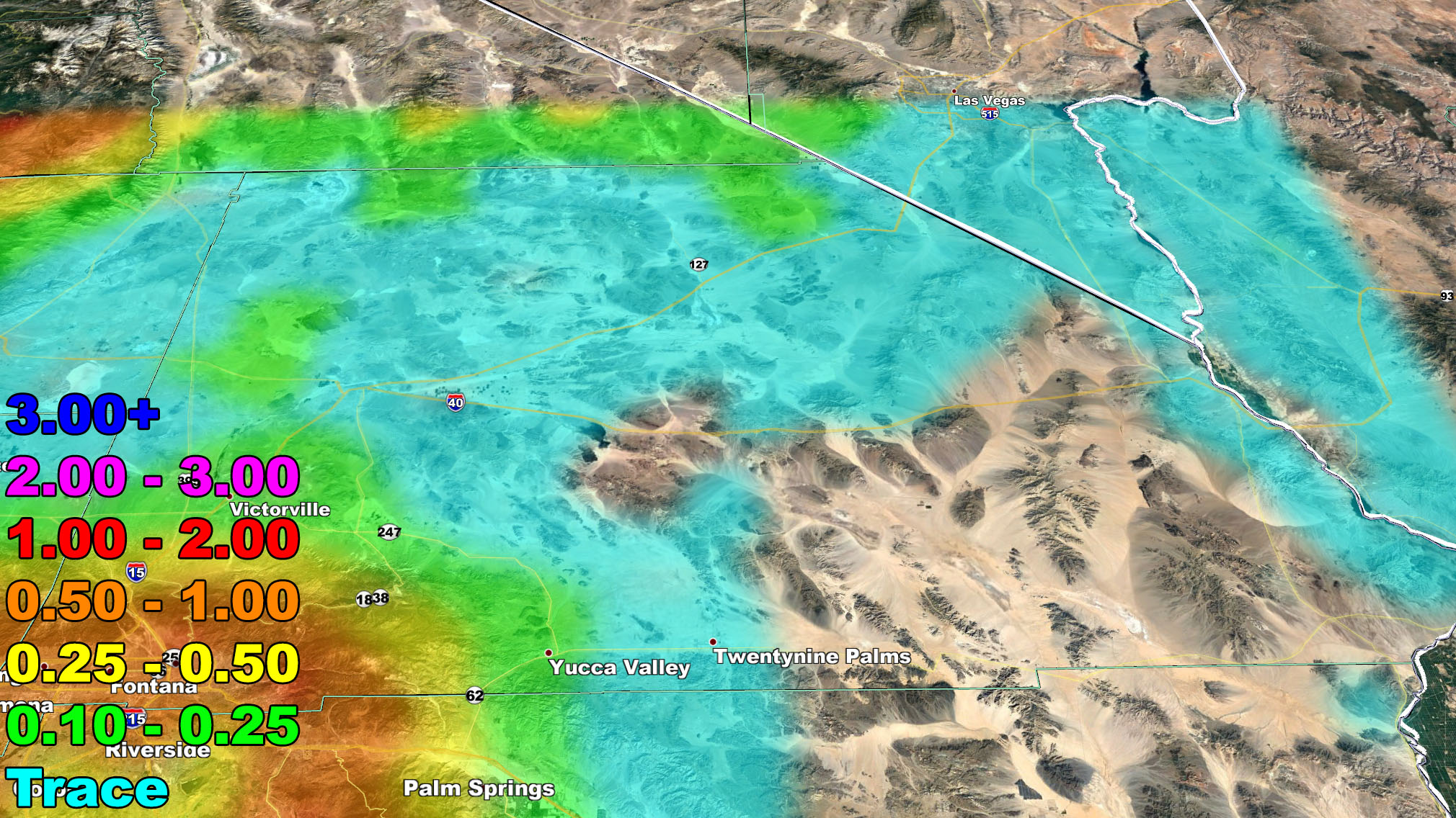
The second front is going to bring colder air aloft, along with the trough-axis. This will bring the chance the atmosphere does charge for the risk of thunderstorms, mainly in the areas south and west of the mountains. The image in this and the four-zone images below show what dynamics this system will have.
I have decided this only a category three because it will lack damaging frontal zone winds. Major Pacific Storm ASGARD in early November did have those winds and therefore reached category four status. At the center of Biden’s dynamics, it will have a chance of thunderstorms, breezy conditions, flood risk potential with high rainfall rates, and a chance of isolated waterspout/tornado activity. This all equals to a category three.
These images below will be the dynamics model image and the rainfall total forecast in four zoom-in zones. The final forecast will be issued later Sunday with final rain, snow, wind, and flood risk maps.
REMEMBER: FINAL ALERTS GO OUT FIRST ON THE MICRO-CLIMATE GROUPS SO FIND AND JOIN YOURS TODAY – Click here to join
As always, stay tuned to Southern California Weather Force for official forecasts and updates on weather across Southern California
Join Southern California Weather Force main Facebook Page for future updates!
MICRO-CLIMATE ALERT FACEBOOK GROUPS: Find yours today!
Click here to join
Reading for another state? Join my national page – https://www.facebook.com/nwfweather/
FACEBOOK PAGES TO JOIN!
SOUTHERN CALIFORNIA WEATHER FORCE MAIN: Southern California Weather Force Office Main Page
NEWS REPORT BANDIT: Tired of Politics and Celebrities and want funny, interesting, weird stories, including science like solar storm, earthquake, volcano, space stories updated 1-2 times a day?
FOR THE CALIFORNIA FAULT STRESS MODEL PAGE: For SCWF official updates to the California Fault Stress Model and more!
PROJECT DESTINI WORLDWIDE QUAKE PREDICTION – A system that shows worldwide plate stress due to numerous factors
INSTAGRAM, TWITTER, and NOW MEWE ACCOUNTS TO JOIN!
Instagram – https://www.instagram.com/socalweatherforce/
Twitter – https://twitter.com/SCweatherforce