
I’m back. Did you miss me? Remember I said on Friday I would be gone and to take Monday’s system as a ‘what if’ you didn’t have me around. I can see some were caught off guard in certain areas. I can also see the thunderstorm watch on Friday was a big success as well in all A, B, C, and D lettered zones. We have another chance at a Santa Ana Wind Event, which is rather late in the season for one. There is also a tornado outbreak coming for Mississippi and surrounding areas and my tornado model ran for tomorrow (Wednesday) so read on for details if you have family/friends there …
First I’ll talk about Friday. I left the region on Friday afternoon. When I left, Fallbrook was having their thunderstorms. Next came the Kern/LA Desert areas. Then came the main thunderstorm watch box across LA and the Inland Empire. The magenta shade in this article (click here) was dead-on correct for the strongest lightning zone that evening. Then came storms off the Ventura foothills into the basin and coastal areas. All of this was in A, B, C, and D lettered zones on Facebook. If you missed it, click here for that. This demonstrates the micro-climate capabilities of the Southern California Weather Force.
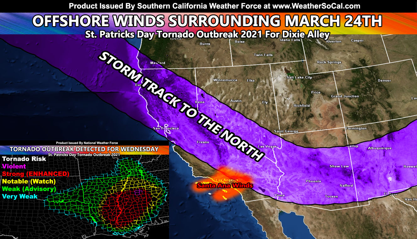
Second I’ll talk about the storm pattern. We are considered out of the Martin Storm Pattern now and we will see very little activity in the coming week or so. If you’re west of Los Angeles then you have a better chance at seeing anything over the next 10 day period. The main event will be around the 24th of this month where the pattern returns back to storms moving to the east of our area. This typically does produce Santa Ana Winds, some of those being on the strong side. So you kind of have your week alert that such is brewing. There are indications that April will return to a storm pattern at times. Although it is unlikely to even come close to a good season, it has proven that a ‘Super La Nina’ does act a La Nina for our region rainwise. It did not act La Nina for Texas one bit with all that snowfall. It truly was an interesting season in a scientific perspective and shows that no one has all the answers yet in long-range forecasting.
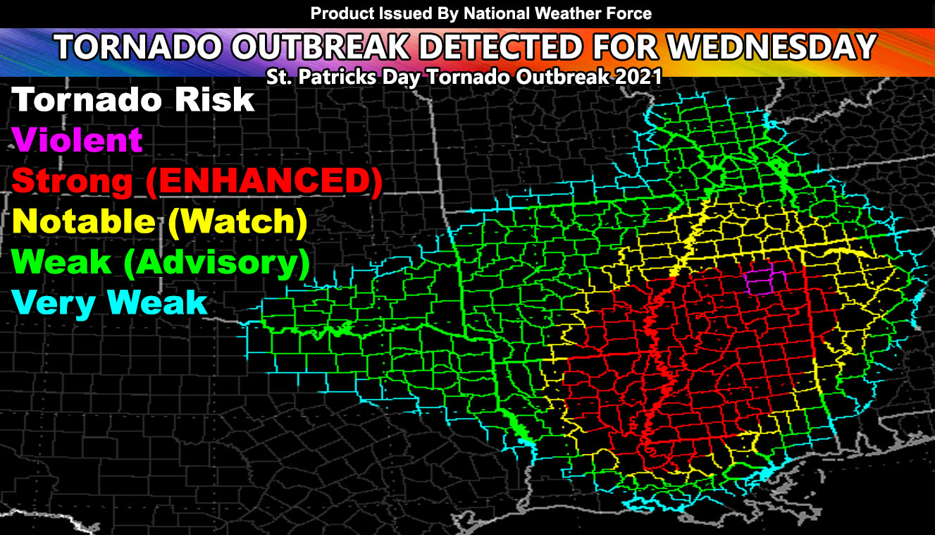
Last I’ll talk about the St. Patrick’s Day 2021 Tornado Outbreak that is about to hit. The outbreak will start with isolated activity along the TX/OK border overnight tonight and then spread into AR/LA/MS/TN/AL through the day and evening/night on Wednesday. My National Page on Facebook (Click here) has the post for you to share to your family and friends. The tornado model is a model that has been in the works since 2007 and is very close to completion for accurate risk assessments for tornado risk zones. A large red area would require a PDS Tornado Watch to be issued.
SCWF is on MeWe – https://mewe.com/p/southerncaliforniaweatherforce
MICRO-CLIMATE ALERTS DELIVERED BY EMAIL, FULL MEMBER SECTION WITH INTERACTION DURING EVENTS, ZOOM IN MODELS TO YOUR HOUSE/BUSINESS YOU CONTROL, AND MORE …
CLICK TO JOIN THIS WEBSITE AS A PREMIUM MEMBER
FACEBOOK PAGES TO JOIN!
SOUTHERN CALIFORNIA WEATHER FORCE MAIN: Southern California Weather Force Office Main Page
SOUTHERN CALIFORNIA WEATHER FORCE METEOROLOGIST: – Just my public figure page that isn’t as large so maybe you can reach me better at times.
INSTAGRAM, TWITTER, and NOW MEWE ACCOUNTS TO JOIN!
Instagram – https://www.instagram.com/socalweatherforce/
Twitter – https://twitter.com/SCweatherforce