
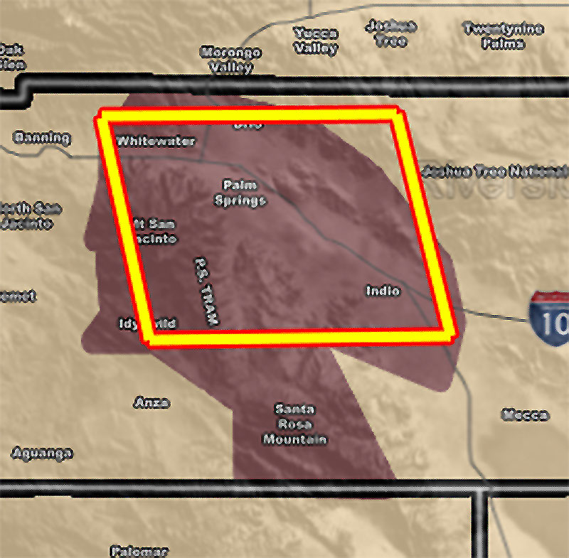
Issued Zones: Mt San Jacinto to Santa Rosa Mountain zones, including the Palm Springs Tram … Coachella Valley …
Site: Southern California Weather Force has issued a Thunderstorm Watch effective today from 11am till 6pm …
Date: 9/10/21 at 8:00 am PT
Forecast: The last of the moisture will bunch up against the Riverside County Mountains for the most concentrated activity in the region (Minus Las Vegas’ Severe Thunderstorm Watch). The flow will turn from south to north to southwest to northeast.
As this does so, instability developing over Mt. San Jacinto and the Palm Springs Aerial Tramway, to the Santa Rosa Mountain areas will pop off thunderstorms there. The flow being northeast, downrange would be the Coachella Valley. Frequent lightning and urban street flooding is likely with today’s storms along with 30-45 mph wind gusts. Thunderstorm outflow being from the southwest would mean a risk for high profile vehicles due to the crosswinds on Highway 111 and Interstate 10 through the watch area –
The storms will diminish with the setting of the Sun and this watch will expire then.
10 mile rule: These alerts issued on this site means that within your zone and 10 miles from you will see the event forecast for. You may or may not see the event but it means you are in the zone or 10 miles from where someone will.
Get these alerts via your own e-mail control panel for your zone, or the closest to you as a full supporting member of this service that saves lives and property – here – https://www.southerncaliforniaweatherforce.com/scwf-discount-member-sign-up-page
Join the Southern California Weather Force group for photos and pictures, and sometimes updates not posted on the main FB Page – here – https://www.facebook.com/groups/socalweatherforce/
See ALL Active articles and alerts for Arizona here – https://www.southerncaliforniaweatherforce.com
Southern California Weather Force is a custom weather alert service that began in September 1999 off and is regarded as the most accurate weather service in the region, offering custom alerts, maps, and models to help save life and property. The work done here is never 100% accurate, but it comes pretty close. Southern California Weather Force runs on zones, so if an event happens in a zone that is 10 miles from the border of your zone, the forecast is still valid to activate your zone’s alert system. A company quote to the public is that of “The Joker” and tells other agencies in weather this all the time… “This world deserves a better class of meteorologist… and I’m gonna give it to them”… out-forecasting even the National Weather Service with lead-time and precision, which makes this service a focus of ridicule and envy in the weather community due to having such accuracy. Alerts issued here are issued custom from this office and this office alone. You may not even hear it elsewhere, but if one is issued near or in your area, listen up because “if you do not wish to die in weather, follow, it’ll save your life one day.”