
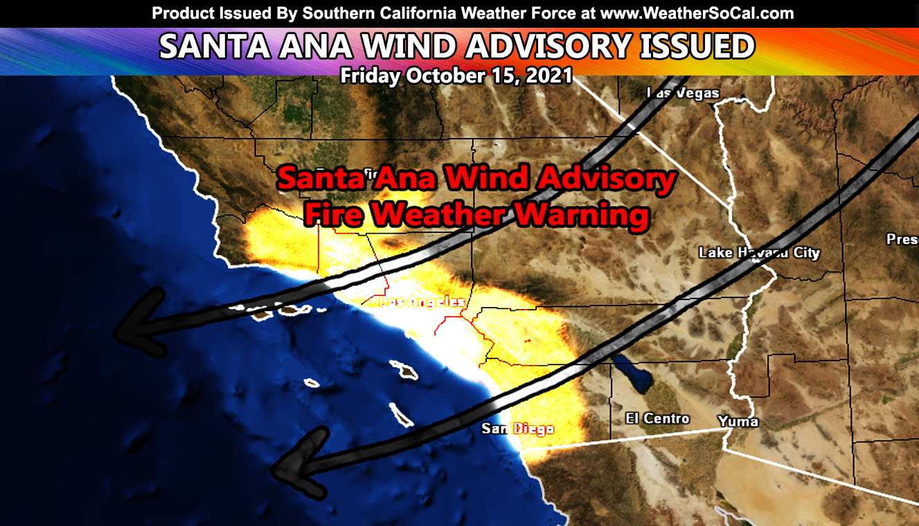
I’ve finally acquired my pages back from Facebook and started on a new personal account, which resets my jail time to zero. Everything must be weather from now on in order to just not have another bump in the road so I am back and I am going to be here to stay as long as possible. Those who were members on the main website are the ones that got must of the updates via email If you are a member and did not receive emails since signing up, contact the page, not the comment section. So here is the next event. Well for some, others it will be just a normal fall day so read on for details as Southern California Weather Force has issued a Santa Ana Wind Advisory, which includes a fire weather warning embedded for tomorrow (Friday 10-15-2021) …
Surface gradients will tighten with a system sliding by to the north. These will send gusty winds below passes and canyons once again. This is not a major event, most areas in known Santa Ana Wind areas seeing level 3 and 4 out of the 8 scale on the Martin Wind Gust Scale. The exception however will be the San Diego County Mountains. This is an easterly wind so I expect the highest there, Ramona and eastward along the mountain areas from north to south across the county with level 5 conditions. The four clickable maps below cover it.
As for the temperatures, I set my model to only show the warmer temperatures of 80s and 90s. Widespread 80s will return to the metros, some areas, including Disneyland/Knotts will see 90s so dress accordingly as these winds cause compressional warming. The models for those area below as well.
I control 10 counties in Southern California so there is a lot to say for various areas. The best I can do is let the images below speak for themselves. They are separated into rows of four. Four zones that I control. If you are in Southern California, you are in one of these. Each is identical so zone 1 is the same on all the rows and so on.
Row 1 – Wind Risk
Row 2 – Temp Value
NOTE: You also get e-mailed alerts/articles because if you do not want to miss my social media posts, and/or I issue a product not on my social media accounts, being a supporting website member is the way to go. You get your own control panel with hundreds of zones to choose from to receive my custom alerts from. Click here if you are interested in reading more.
Row 1 – Wind Risk
8. Extensive widespread damage.
7. Trees are broken or uprooted, building damage is considerable. – High Profile Vehicle Roll-Over CERTAIN.
6. SOME Trees are broken or uprooted, building damage is possible. – High Profile Vehicle Roll-Over Likely, Do NOT recommend Traveling in this zone
5. Slight damage occurs to buildings, shingles are blown off of roofs. HIGH WIND WARNING CRITERIA – High Profile Vehicle Roll-Over Possible if weight is not corrected.
4. Twigs and small branches are broken from trees, walking is difficult.
3. Large trees sway, becoming difficult to walk. POWER SHUTDOWN THRESHOLD WIND ADVISORY CRITERIA


Row 2 – Temp Value


LONG RANGE: Long range still suggests the pattern will change after around October 18th, but maybe a couple days after that. This pattern change kicks the ridge off and returns the storm pattern after the 21st or so. This will continue to be monitored, but we will not leave October without another storm or two crossing the region.