
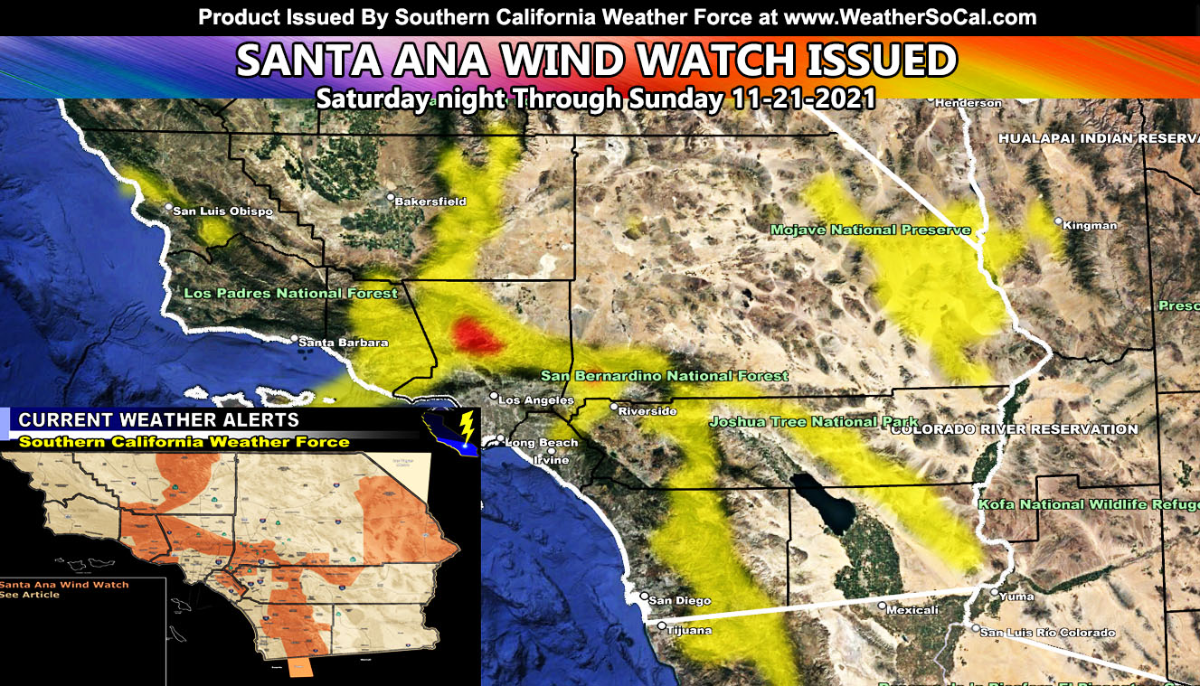
Southern California Weather Force has issued a Santa Ana Wind Watch for a moderate strength Santa Ana Wind Event expected to arrive later overnight on Saturday, but mainly on Sunday as this is also a Fire Weather Watch and if you are in a prone area, now is the time to get your plans together, clear the brush around the house, and even prepare for power outages so read on for details …
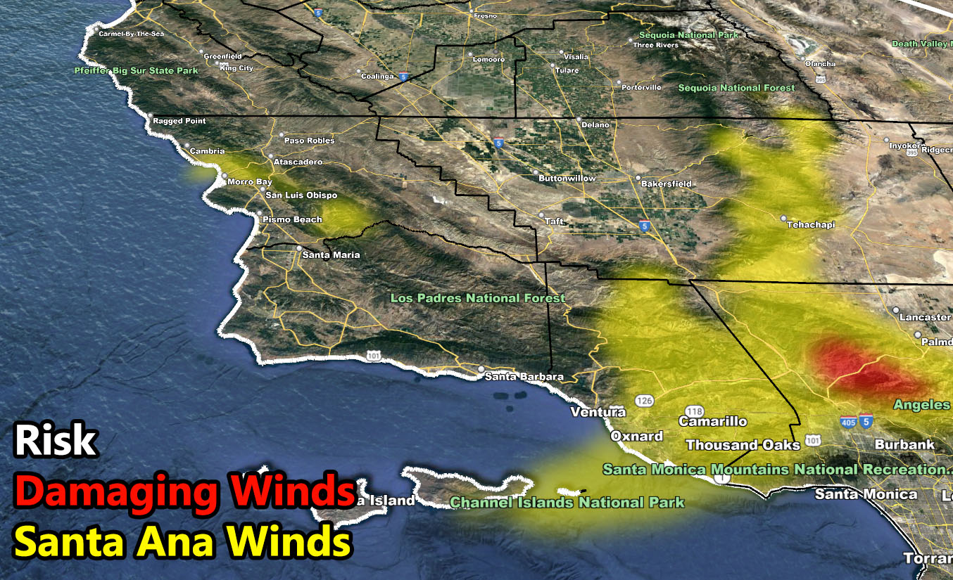
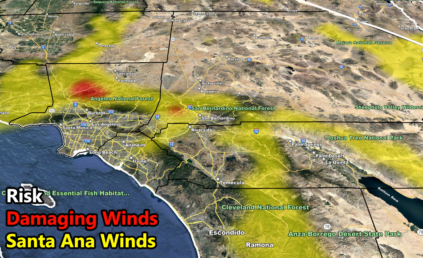
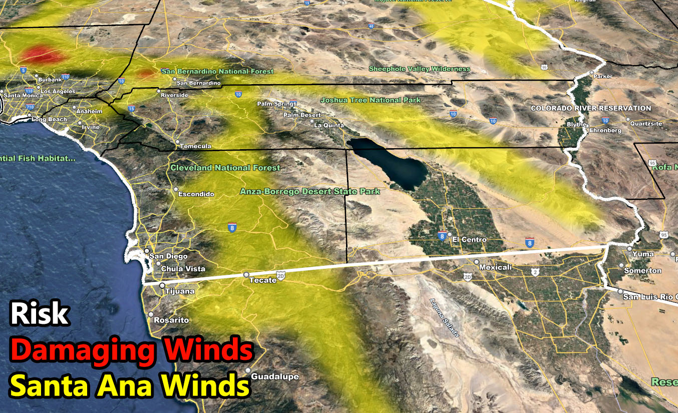
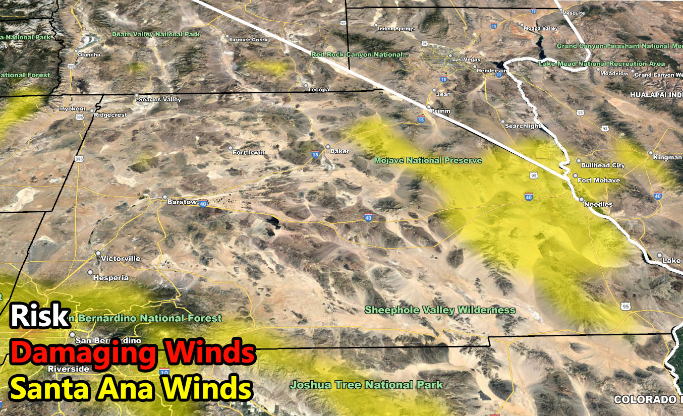
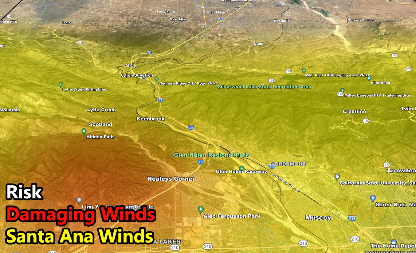
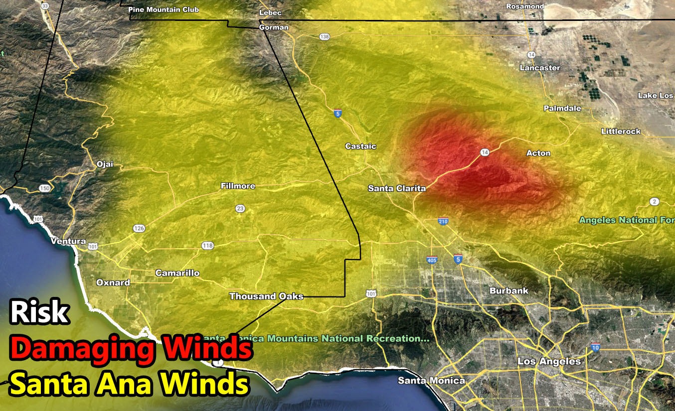
The SCWF Santa Ana Wind Watch is now officially in effect for below passes and canyons. SCWF Santa Ana Wind Risk Model paints where the winds will affect the most, including the ‘damaging wind’ color, which is evident in some areas. The strongest will be along Highway 14 from Agua Dulce to the Canyon Country areas. The next area will be below the Cajon Pass between Devore and the 210. Higher resolution wind intensity models will be available on Saturday to finalize the alert from a watch to and advisory or warning.
Given the area has been parched lately, expecting this to also have a high fire hazard with it, owning to this as well being an official SCWF Fire Weather Watch. If you are in the shaded areas, whether yellow or red, or in a fire risk prone zone nominal to the Santa Ana Winds, clear the brush around your home to minimize the hazard for fires to affect you directly. This also will be a power-shutdown for some areas, so have your power-shutdown precautions ready.
I control 10 counties in Southern California so there is a lot to say for various areas. The best I can do is let the images below speak for themselves. They are separated into 1 row of six. Four zones that I control. If you are in Southern California, you are in one of these. Each is identical so zone 1 is the same on all the rows and so on. Image 5 is Cajon Pass, and Image 6 is the SCV area. Here is the key to the rows below. They are extremely detailed and clickable.
NOTE: You also get e-mailed alerts/articles because if you do not want to miss my social media posts, and/or I issue a product not on my social media accounts, being a supporting website member is the way to go. You get your own control panel with hundreds of zones to choose from to receive my custom alerts from. Click here if you are interested in reading more.
FACEBOOK PAGES TO JOIN!
SOUTHERN CALIFORNIA WEATHER FORCE MAIN: Southern California Weather Force Office Main Page
SOUTHERN CALIFORNIA WEATHER FORCE METEOROLOGIST: – Just my public figure page that isn’t as large so maybe you can reach me better at times.
INSTAGRAM, TWITTER, TO JOIN!
Instagram – https://www.instagram.com/socalweatherforce/
Twitter – https://twitter.com/SCweatherforce