
As we start to lose the grip of the current arctic air-mass, we will enter a warmer air mass this next week, with temperatures in the 80s for the metros, well above average to end the month out and start the new one. This won’t last though as we are in a see-saw pattern yet again for a return of the arctic air-mass this next month so read on for details …
Join the Facebook Page for Further Updates If You Have Not Yet!
SOUTHERN CALIFORNIA WEATHER FORCE MAIN:
That was some storm we had for some, but Los Angeles only recorded a trace amount of rainfall with it. Don’t worry, that was expected as this last system was an inside slider. We’re going to need these to expand westward to get more precipitation west of where they have been mostly hitting. The last system was pegged fine and I did not feel the need to update the article from the preliminary. It seems even my preliminary was the correct call. Oh and if you are that person that said I was wrong and got banned from my page because of it, pay me $1000/month to forecast only for your house you yokel and it went exactly as I stated it would, being low-elevation in snow for the coldest system this season saw thus far…
Now, the coming week will have the return of the 80F+ temperatures to the metros areas under weak offshore flow. Nothing strong is expected in terms of the Santa Ana Winds, but the air-mass will be warm in the low-levels for the week.
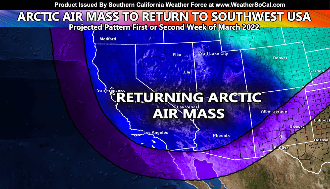
As we hit March, we remain above normal, but there are indications the Pacific jet stream will rage again as it moves into the spring. Meteorological Spring is what I go by in my profession. That is March 1st. It is not to be confused with astronomical. March 1st is when the jet stream starts becoming erratic for storms into the west coast, breaking the winter pattern it is stuck in. This is why we will see a number of changes in the weather pattern with swings up and down in both precipitation and temperatures. These translate to spark up tornado alley as well.
Sometime in the mid/end first week or second week of March we will see the warmer pattern break back up as the jet stream becomes erratic. This should easily end yet another system down the coast. Systems in March with the current pattern suggests these will again be of arctic variety so I expect more snow for the mountains and even lower elevations again in spots.
NASCAR February 27, 2022 In Fontana, California – I will be there as I stated on my Facebook Page, but the weather forecast will finalize at 75F with high clouds, thick at times, and a lot of airline contrails in the shots for your pictures. All and all a great day to be had …
How to get these alerts with a premium subscription via e-mail by micro-climate zone AND/OR Get the GPS models for all events on your device enabled? (100 percent delivery time)
Click Here To Join The Season Tier
Join The Main Southern California Weather Force Facebook Group (50 percent delivery time) – You can join the main SCWF page as well through that group.
Click Here To Join The Page Today
FACEBOOK PAGES TO JOIN!
SOUTHERN CALIFORNIA WEATHER FORCE MAIN: Southern California Weather Force Office Main Page
SOUTHERN CALIFORNIA WEATHER FORCE METEOROLOGIST: – Just my public figure page that isn’t as large so maybe you can reach me better at times.
INSTAGRAM, TWITTER, TO JOIN!
Instagram – https://www.instagram.com/socalweatherforce/
Twitter – https://twitter.com/SCweatherforce
Southern California Weather Force is a custom weather alert service that began in September 1999 off and is regarded as the most accurate weather service in the region, offering custom alerts, maps, and models to help save life and property. The work done here is never 100% accurate, but it comes pretty close. Southern California Weather Force runs on zones, so if an event happens in a zone that is 10 miles from the border of your zone, the forecast is still valid to activate your zone’s alert system. A company quote to the public is that of “The Joker” and tells other agencies in weather this all the time… “This world deserves a better class of meteorologist… and I’m gonna give it to them”… out-forecasting even the National Weather Service with lead-time and precision, which makes this service a focus of ridicule and envy in the weather community due to having such accuracy. Alerts issued here are issued custom from this office and this office alone. You may not even hear it elsewhere, but if one is issued near or in your area, listen up because “if you do not wish to die in weather, follow, it’ll save your life one day.”