

A cold inside slider system will move through Southern California this weekend, producing hit and miss showers for some, wind for others, and a dusting of snow up at Big Bear so read on for the details and see the SCWF models for it …
Not much to say about it … quite boring other than it will have gusty northwest winds for the Los Angeles Metro areas on Sunday …The highest precipitation will be the Kern County Mountains with the northwest to southeast flow along with those strong winds, including Tehachapi..
Use the models below for this system’s passage for your area …
Join the Facebook Page for Further Updates If You Have Not Yet!
SOUTHERN CALIFORNIA WEATHER FORCE MAIN:
LONG RANGE: We will have offshore winds by Tuesday with the next system into the state by around March 28th or so … strength unknown attm
I control 10 counties in Southern California so there is a lot to say for various areas. The best I can do is let the images below speak for themselves.
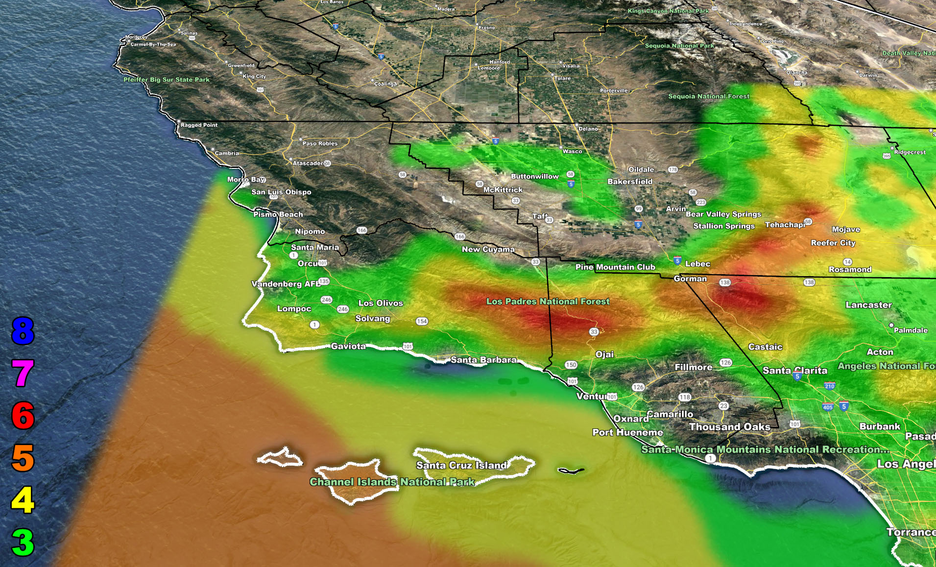
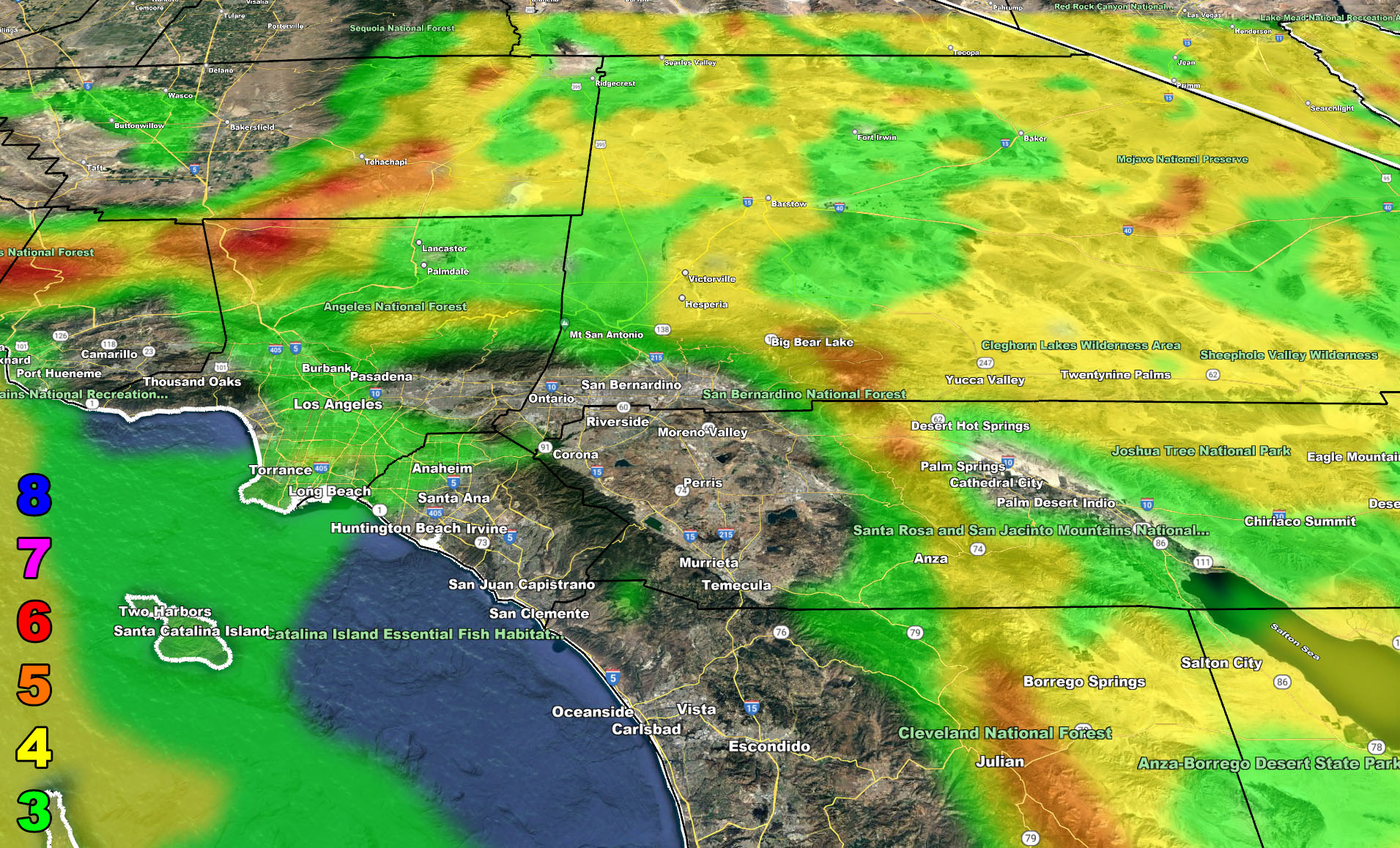
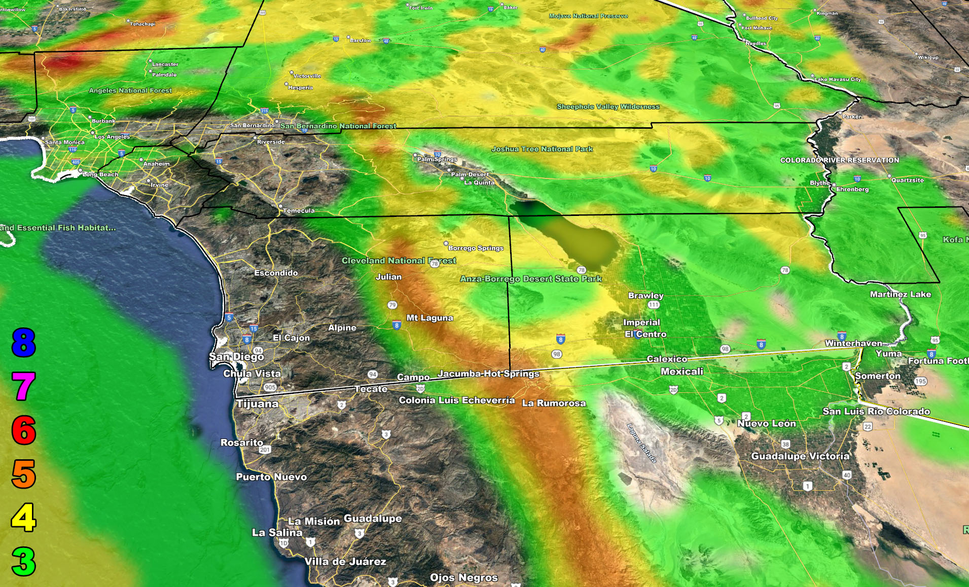
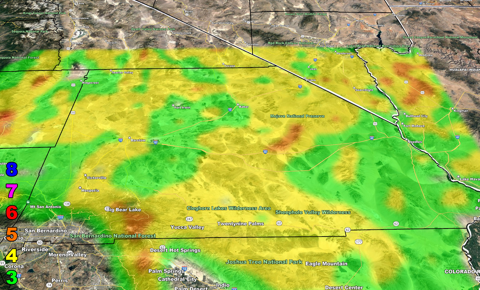
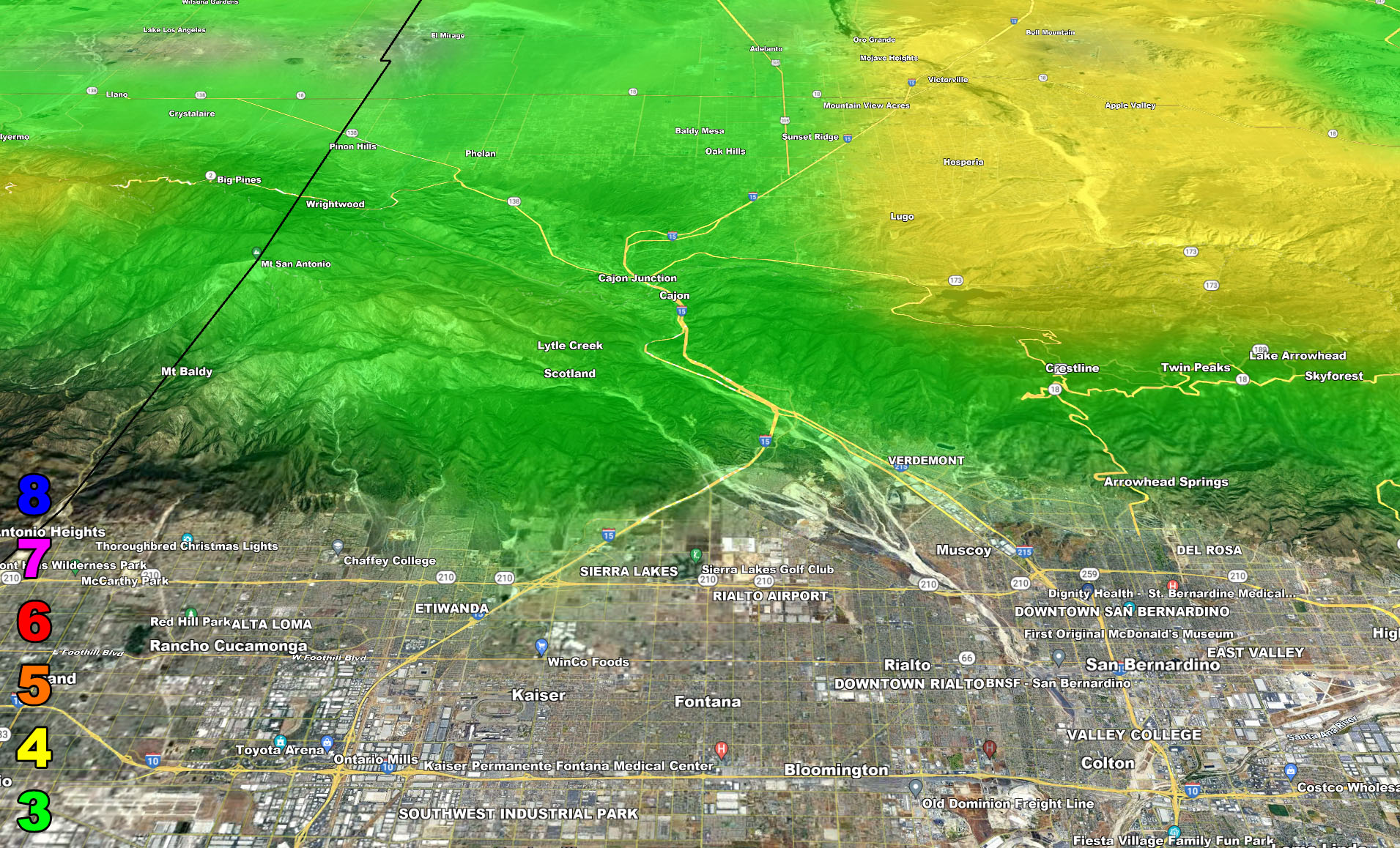
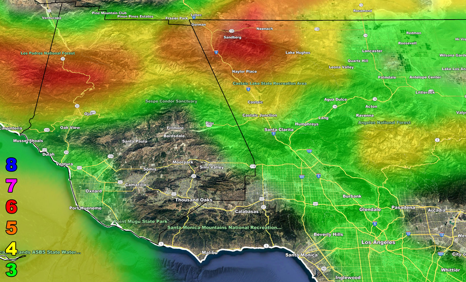
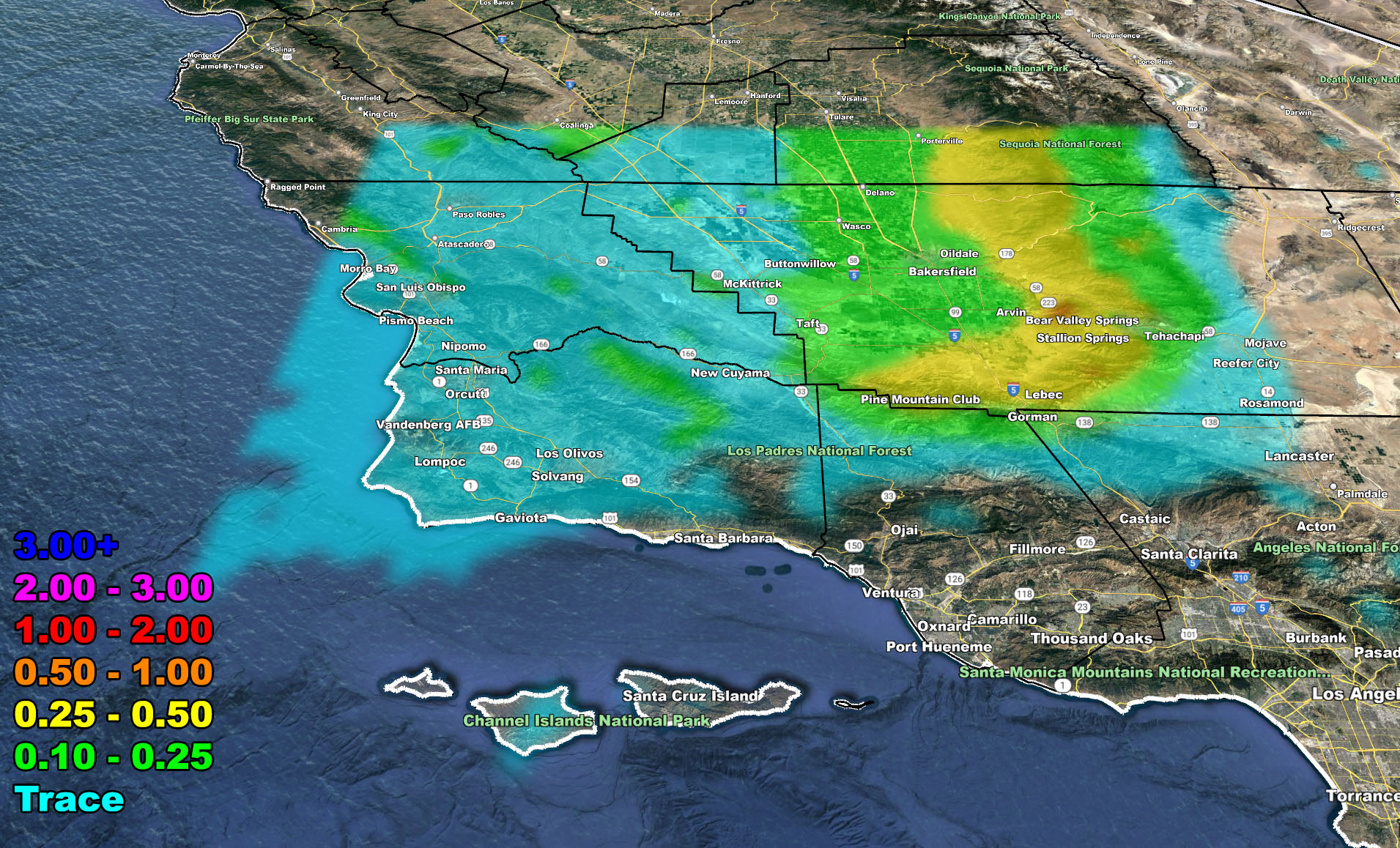
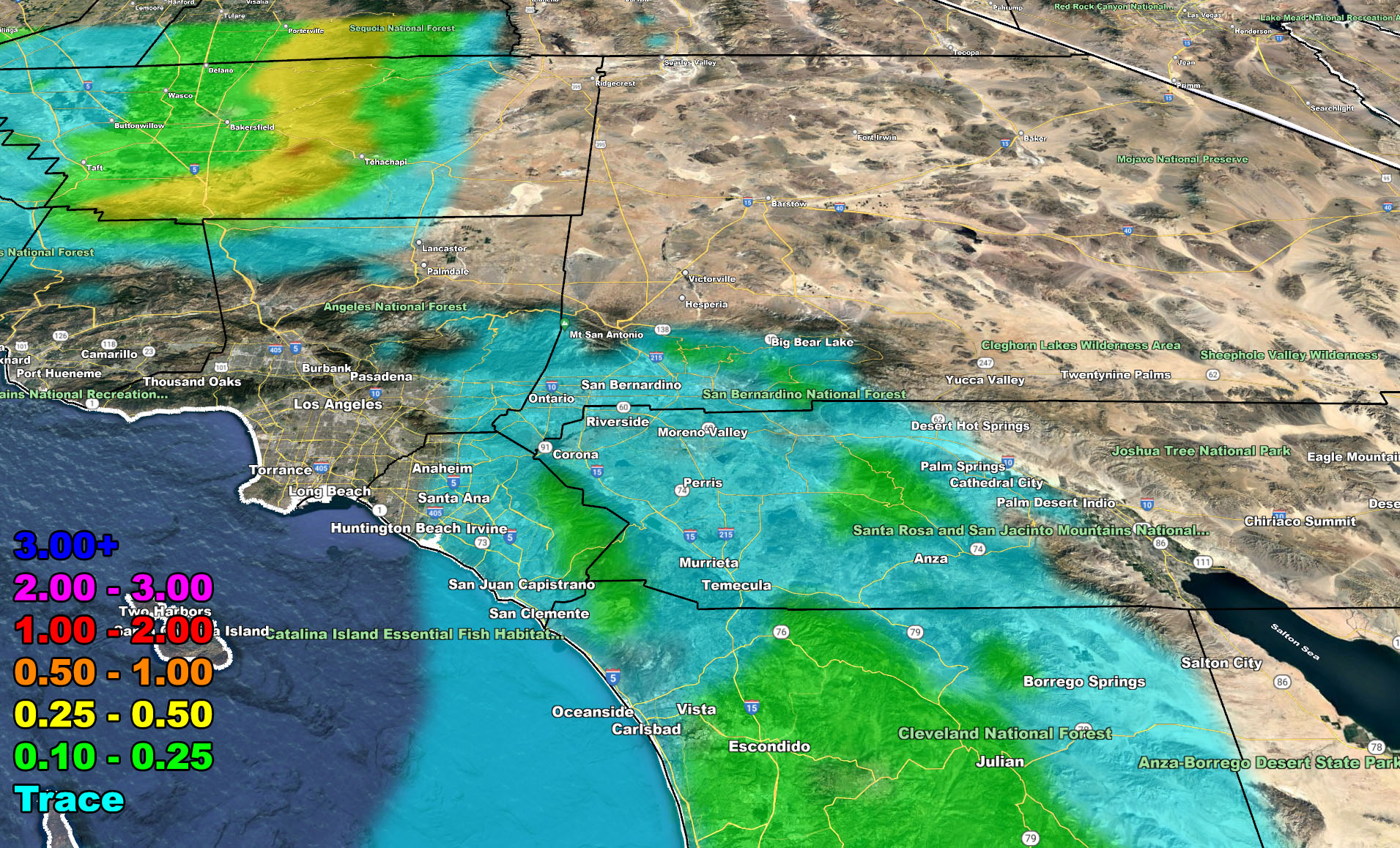
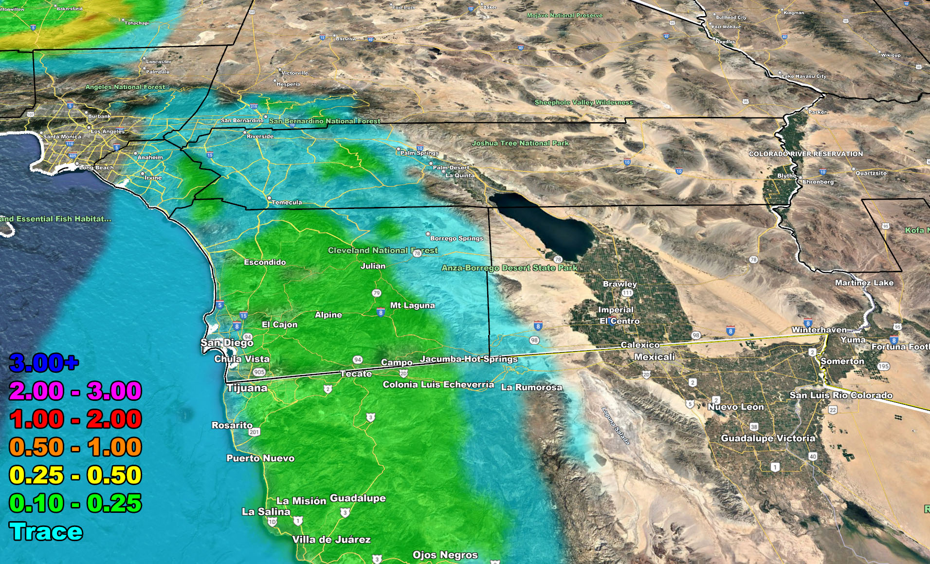
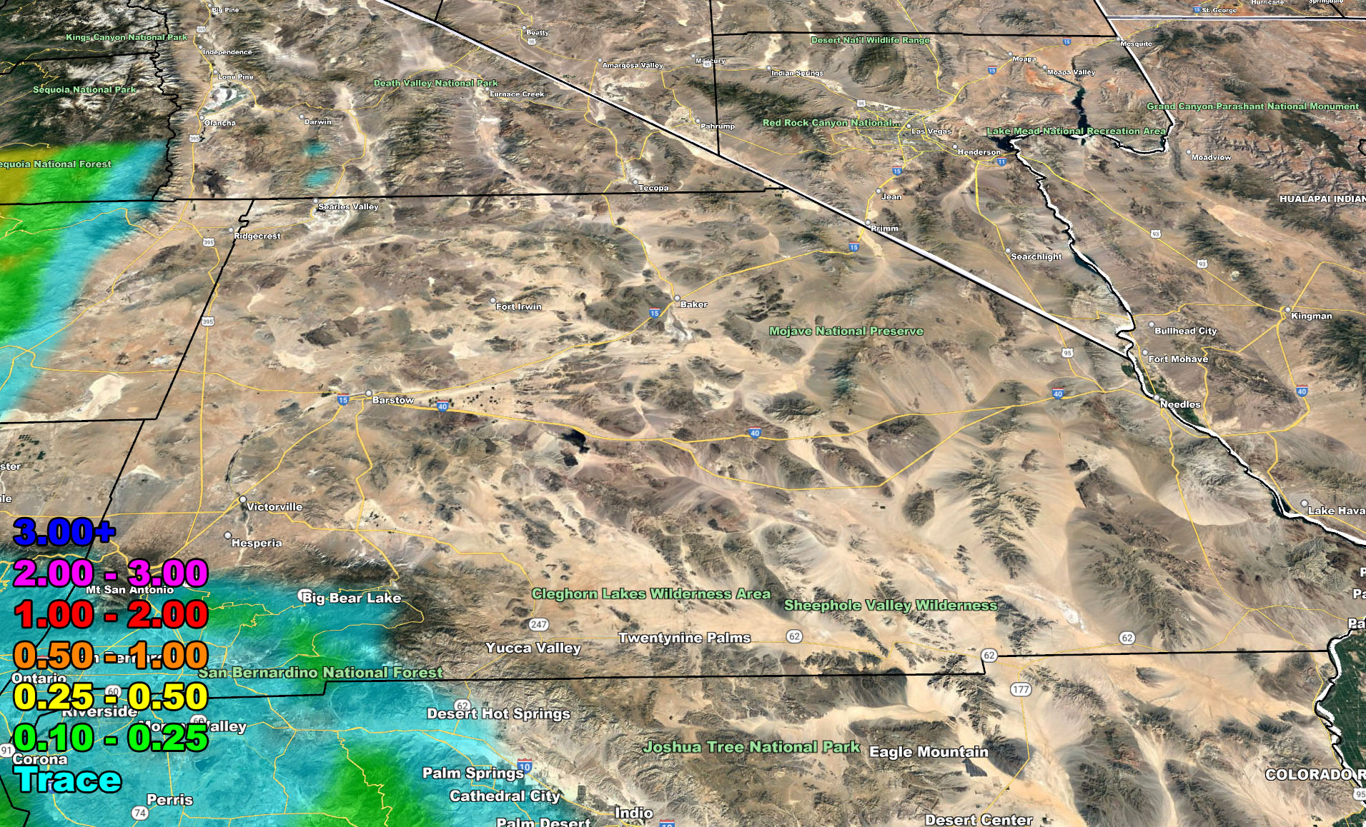
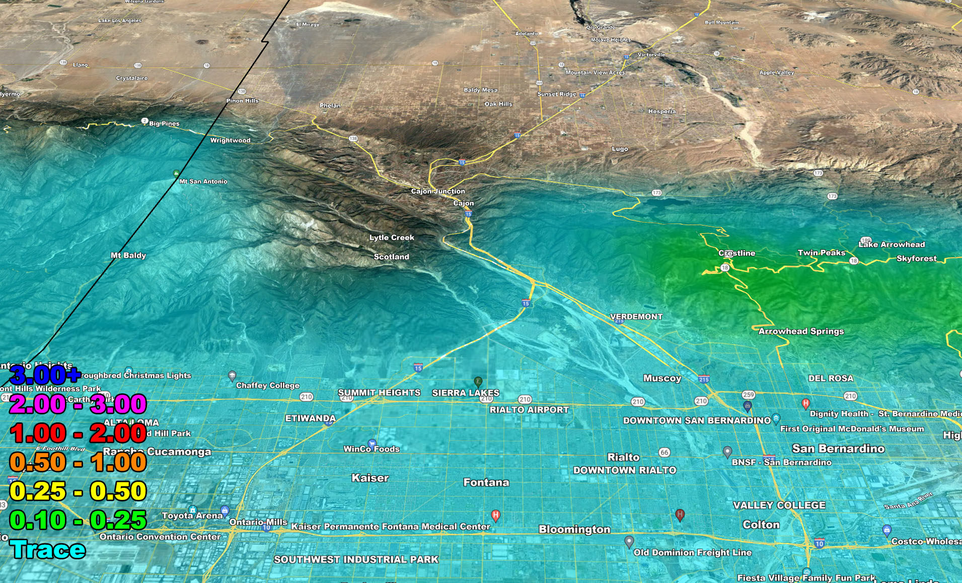
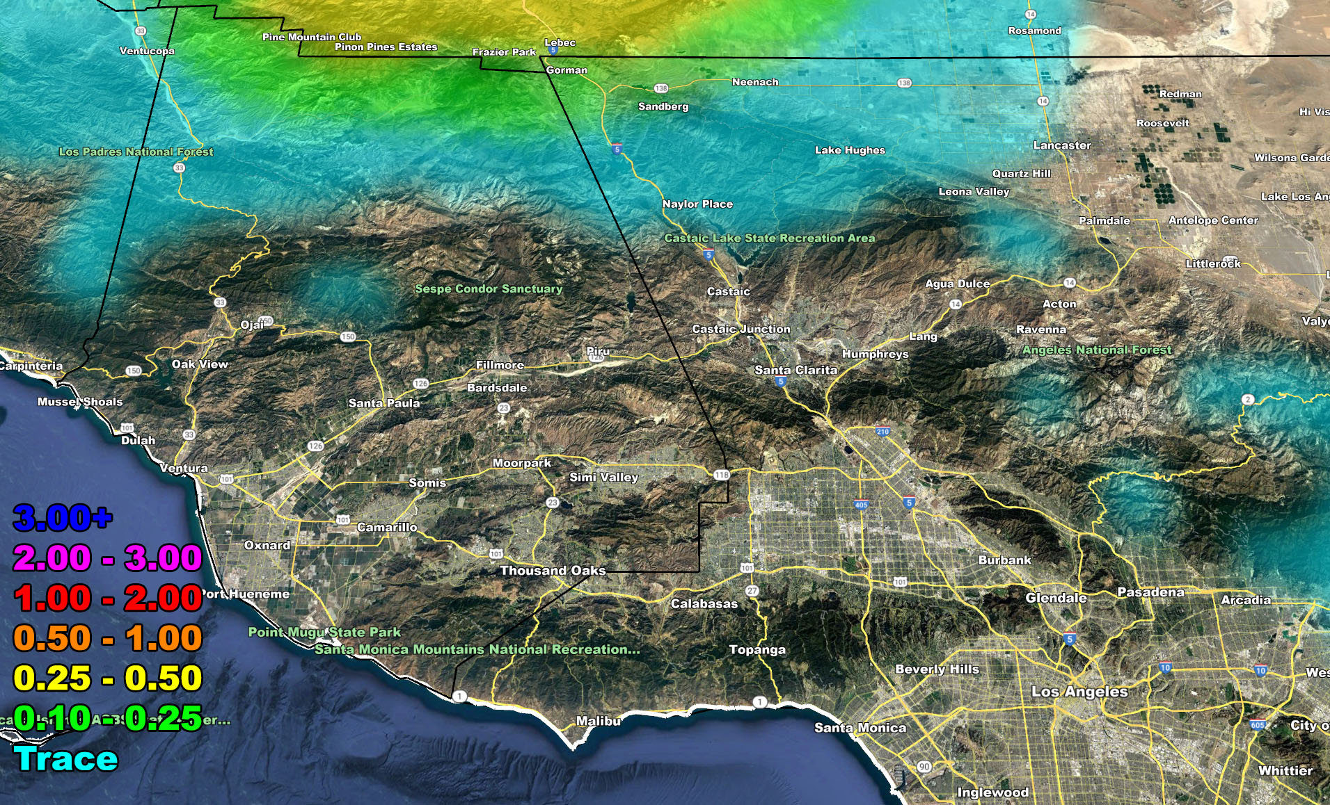
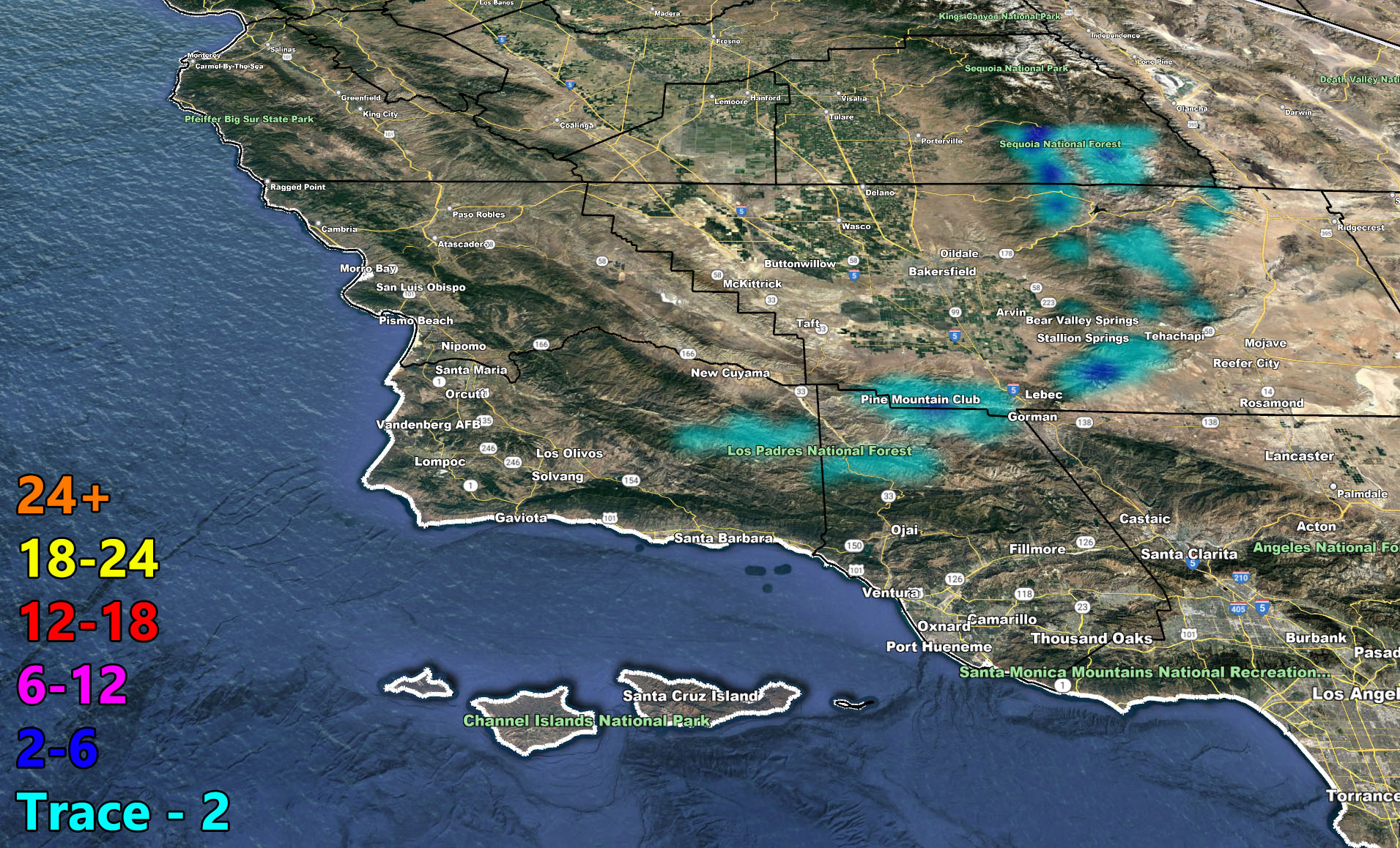
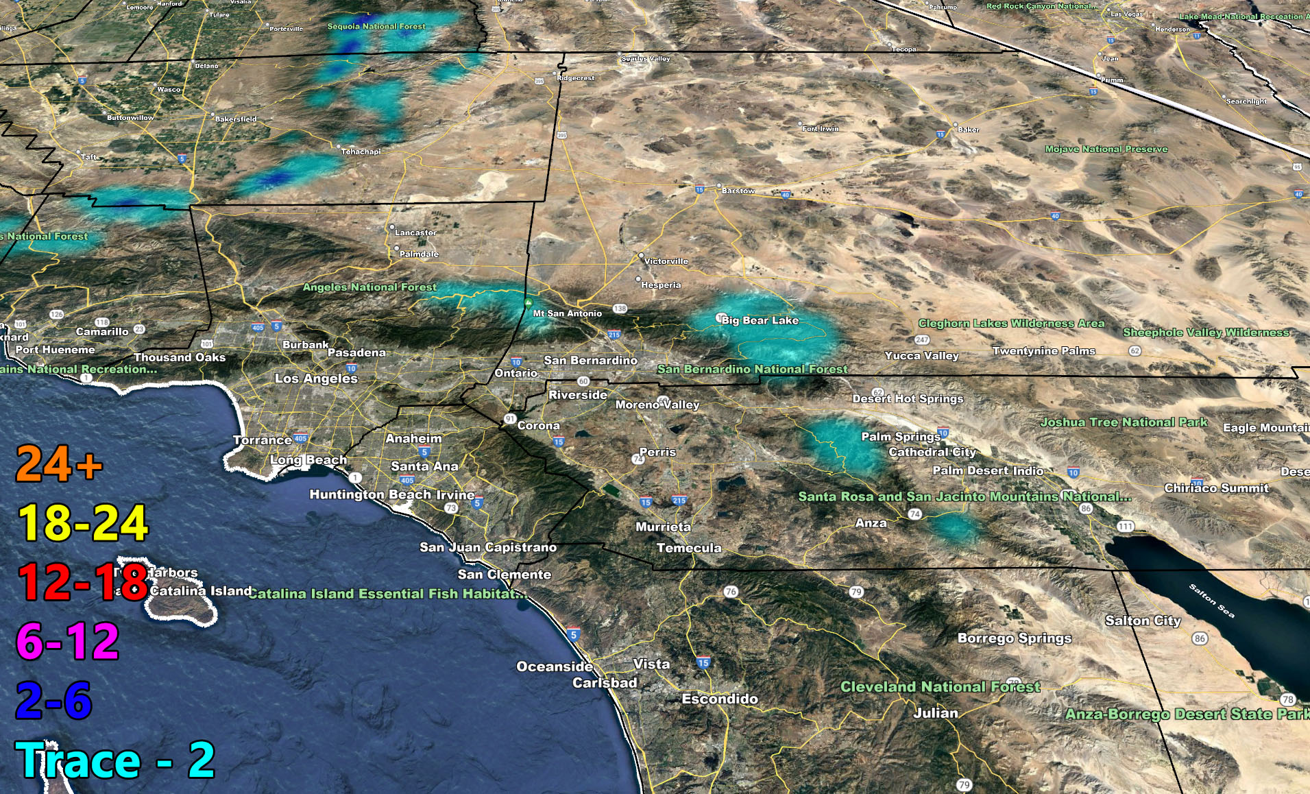
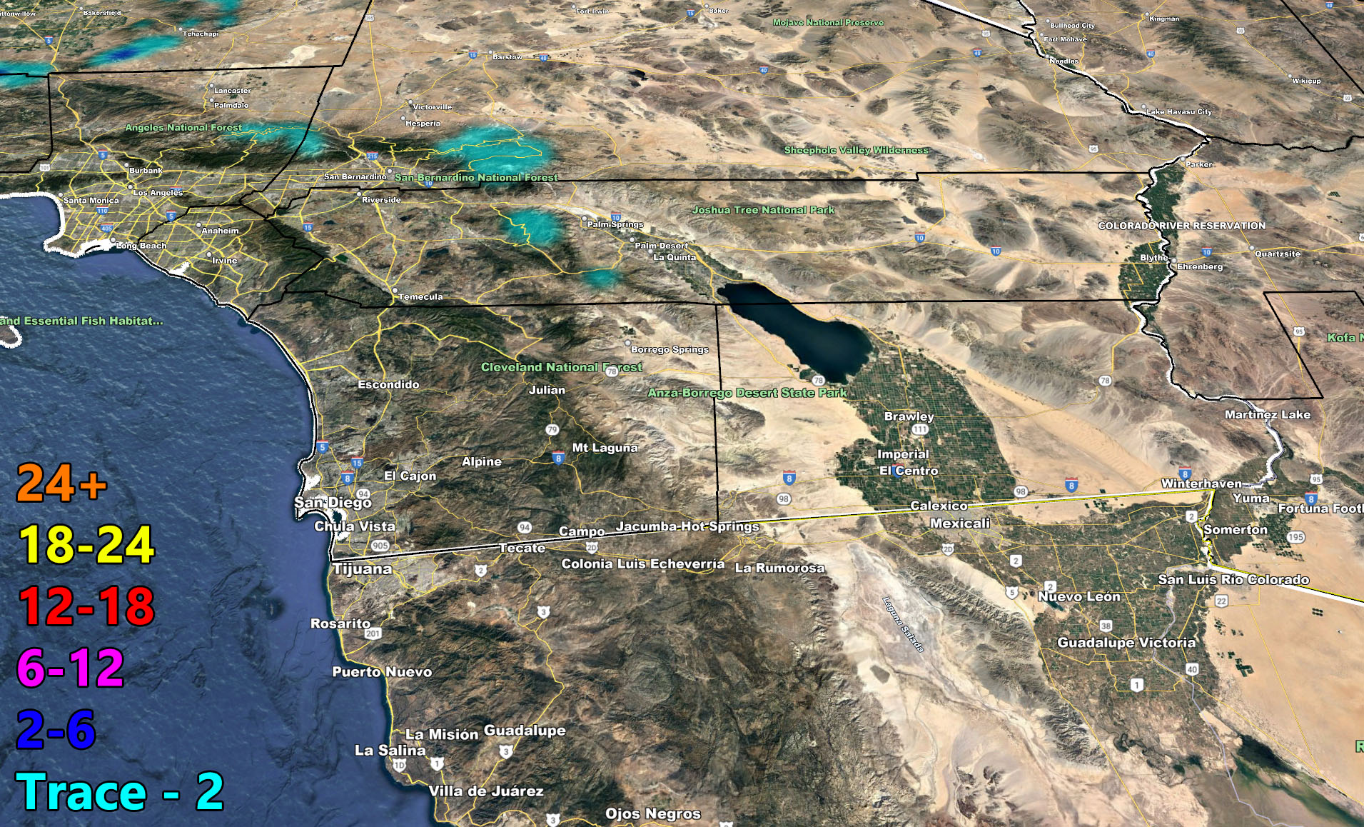
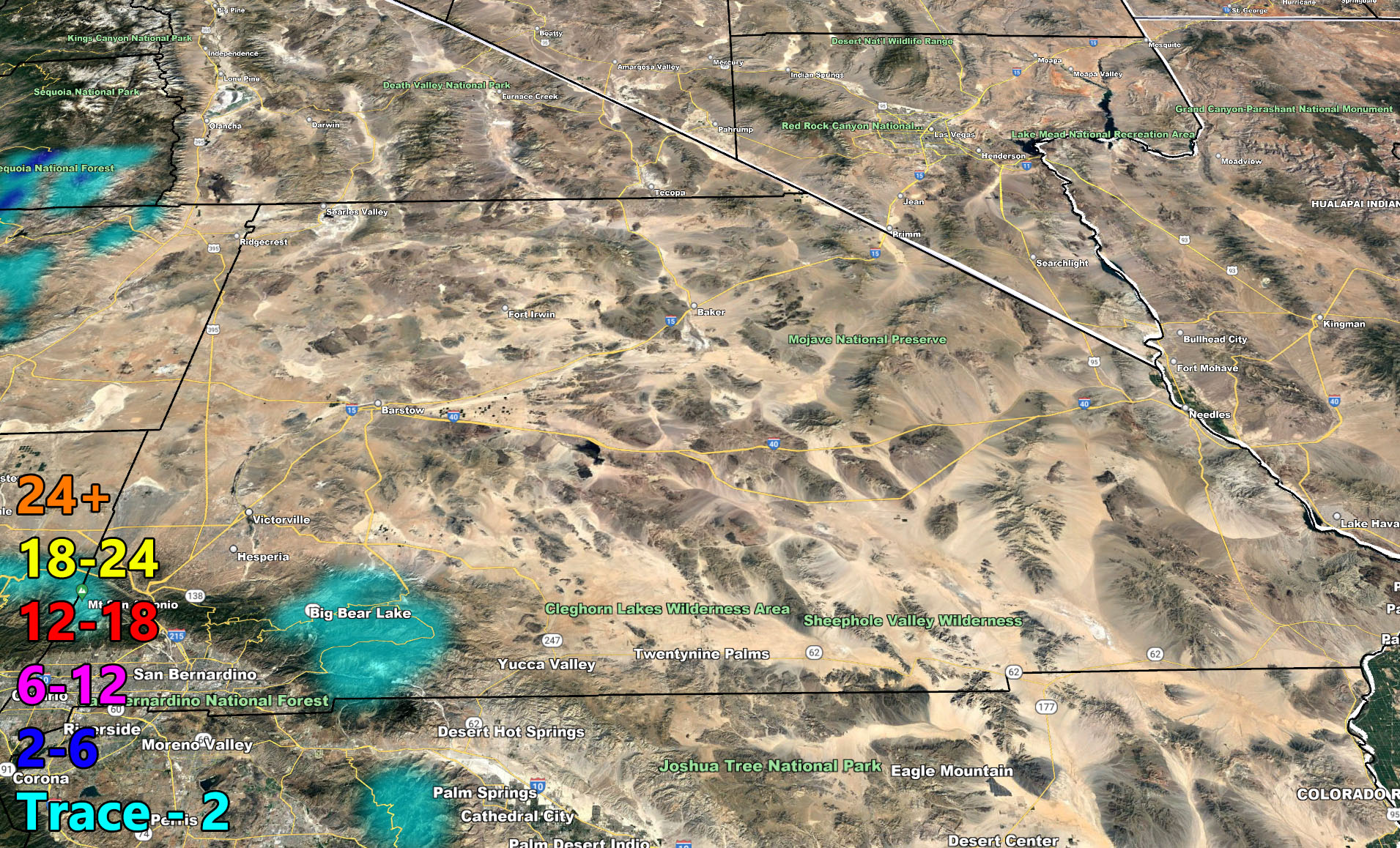
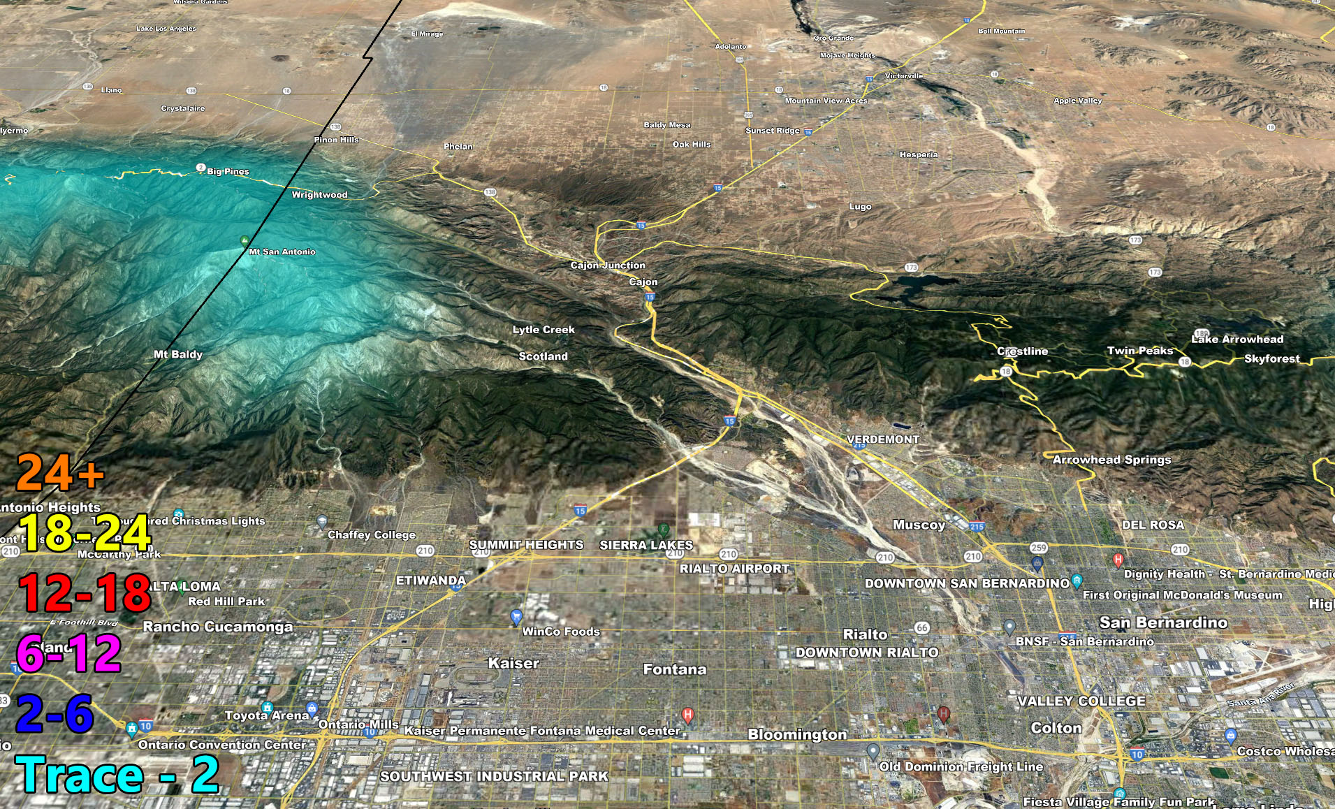
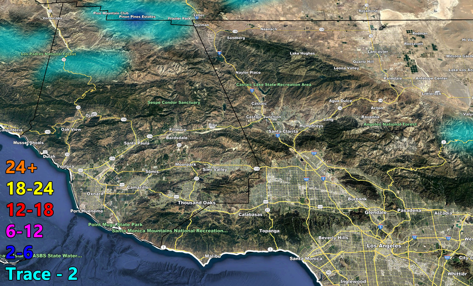
The maps below are of flood, rain, snow, snow-level, or wind intensity, whichever is available now. Each one is clickable. Map 1 is NW SoCal, Map 2 is SW SoCal, Map 3 is SE SoCal, Map 4 is NE SoCal, Map 5 is the Cajon Pass, and Map 6 is the SCV region, which includes Gorman at the top.
GET TO KNOW YOUR MAP BECAUSE THESE NEVER CHANGE LOCATIONS
Wind Gust Model – Valid Saturday through Sunday – PREMIUM MEMBERS CLICK HERE FOR YOUR GPS MODELS IN THE MEMBER SECTION
Martin Wind Gust Intensity Scale –
8. Extensive widespread damage.
7. Trees are broken or uprooted, building damage is considerable. – High Profile Vehicle Roll-Over CERTAIN.
6. SOME Trees are broken or uprooted, building damage is possible. – High Profile Vehicle Roll-Over Likely, Do NOT recommend Traveling in this zone. This zone also is the starting zone where trees and powerlines will fall and damage cars and even kill people near or in them!
5. Slight damage occurs to buildings, shingles are blown off of roofs. HIGH WIND WARNING CRITERIA – High Profile Vehicle Roll-Over Possible if weight is not corrected.
4. Twigs and small branches are broken from trees, walking is difficult.
3. Large trees sway, becoming difficult to walk. POWER SHUTDOWN THRESHOLD DURING FIRE WEATHER / WIND ADVISORY CRITERIA
Rain Model – Valid Saturday through Sunday – PREMIUM MEMBERS CLICK HERE FOR YOUR GPS MODELS IN THE MEMBER SECTION
Snow Model – Valid Saturday through Sunday – PREMIUM MEMBERS CLICK HERE FOR YOUR GPS MODELS IN THE MEMBER SECTION
How to get these alerts with a premium subscription via e-mail by micro-climate zone AND/OR Get the GPS models for all events on your device enabled? (100 percent delivery time)
Click Here To Join The Season Tier
Join The Main Southern California Weather Force Facebook Group (50 percent delivery time) – You can join the main SCWF page as well through that group.
Click Here To Join The Page Today
FACEBOOK PAGES TO JOIN!
SOUTHERN CALIFORNIA WEATHER FORCE MAIN: Southern California Weather Force Office Main Page
SOUTHERN CALIFORNIA WEATHER FORCE METEOROLOGIST: – Just my public figure page that isn’t as large so maybe you can reach me better at times.
INSTAGRAM, TWITTER, TO JOIN!
Instagram – https://www.instagram.com/socalweatherforce/
Twitter – https://twitter.com/SCweatherforce
Southern California Weather Force is a custom weather alert service that began in September 1999 off and is regarded as the most accurate weather service in the region, offering custom alerts, maps, and models to help save life and property. The work done here is never 100% accurate, but it comes pretty close. Southern California Weather Force runs on zones, so if an event happens in a zone that is 10 miles from the border of your zone, the forecast is still valid to activate your zone’s alert system. A company quote to the public is that of “The Joker” and tells other agencies in weather this all the time… “This world deserves a better class of meteorologist… and I’m gonna give it to them”… out-forecasting even the National Weather Service with lead-time and precision, which makes this service a focus of ridicule and envy in the weather community due to having such accuracy. Alerts issued here are issued custom from this office and this office alone. You may not even hear it elsewhere, but if one is issued near or in your area, listen up because “if you do not wish to die in weather, follow, it’ll save your life one day.”