
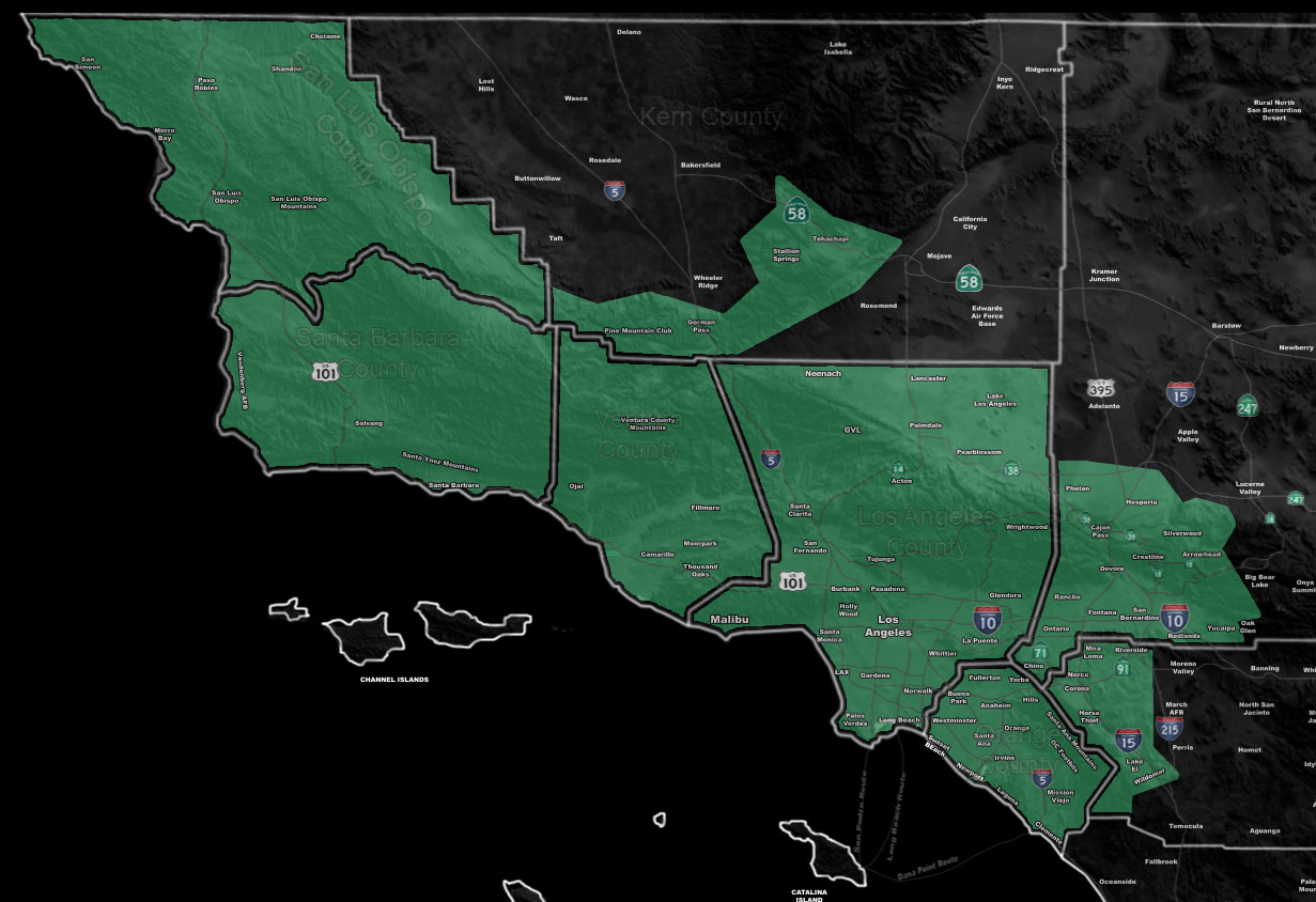
Issued Zones: San Luis Obispo, Ventura, Los Angeles, Orange County … The Northern and Western Inland Empire … San Bernardino to Tehachapi Mountains including Gorman and Cajon Pass … Southern Metro High Desert Hesperia/Phelan … Antelope Valley …
Site: Southern California Weather Force has issued a Flood Watch effective Monday March 28, 2022
Date Issued: 3/25/22 at 8:00am local
Forecast: A double whammy Pacific Front is expected to hit on Monday morning across the Flood Watch area. This should easily start very early Monday morning for the SLO/Santa Barbara/Ventura areas, moving along the morning across the Kern, Los Angeles, Orange, and Inland Empire forecast zones, including their surrounding mountains.
This system has a southeasterly flow into it. Southeast flows in the low-levels tend to favor the Santa Barbara/Ventura/Los Angeles County zones with Santa Barbara/Ventura County at the center of the highest flood risk, which will be given in the final forecast.
Rates within this will also be on the higher side where thunderstorms cross. Both the first and second fronts have the power to produce thunderstorms, including waterspouts to small tornadoes along and near the coast.
Flood Watches are issued here at Southern California Weather Force when conditions will be favorable for rain that is falling at rates that can produce flooding, with flash flooding in some of the recent burn areas and if you are in one of those areas … it tells you to get sandbags to protect your property and selves.
How to get these alerts with a premium subscription via e-mail by micro-climate zone AND/OR Get the GPS models for this event on your device enabled? (100 percent delivery time)
Click Here To Join The Season Tier
Join The Main Southern California Weather Force Facebook Group (50 percent delivery time) – You can join the main SCWF page as well through that group.
Click Here To Join The Page Today
10 mile rule: These alerts issued on this site means that within your zone and 10 miles from you will see the event forecast for. You may or may not see the event but it means you are in the zone or 10 miles from where someone will.
Southern California Weather Force is a custom weather alert service that began in September 1999 off and is regarded as the most accurate weather service in the region, offering custom alerts, maps, and models to help save life and property. The work done here is never 100% accurate, but it comes pretty close. Southern California Weather Force runs on zones, so if an event happens in a zone that is 10 miles from the border of your zone, the forecast is still valid to activate your zone’s alert system. A company quote to the public is that of “The Joker” and tells other agencies in weather this all the time… “This world deserves a better class of meteorologist… and I’m gonna give it to them”… out-forecasting even the National Weather Service with lead-time and precision, which makes this service a focus of ridicule and envy in the weather community due to having such accuracy. Alerts issued here are issued custom from this office and this office alone. You may not even hear it elsewhere, but if one is issued near or in your area, listen up because “if you do not wish to die in weather, follow, it’ll save your life one day.”