
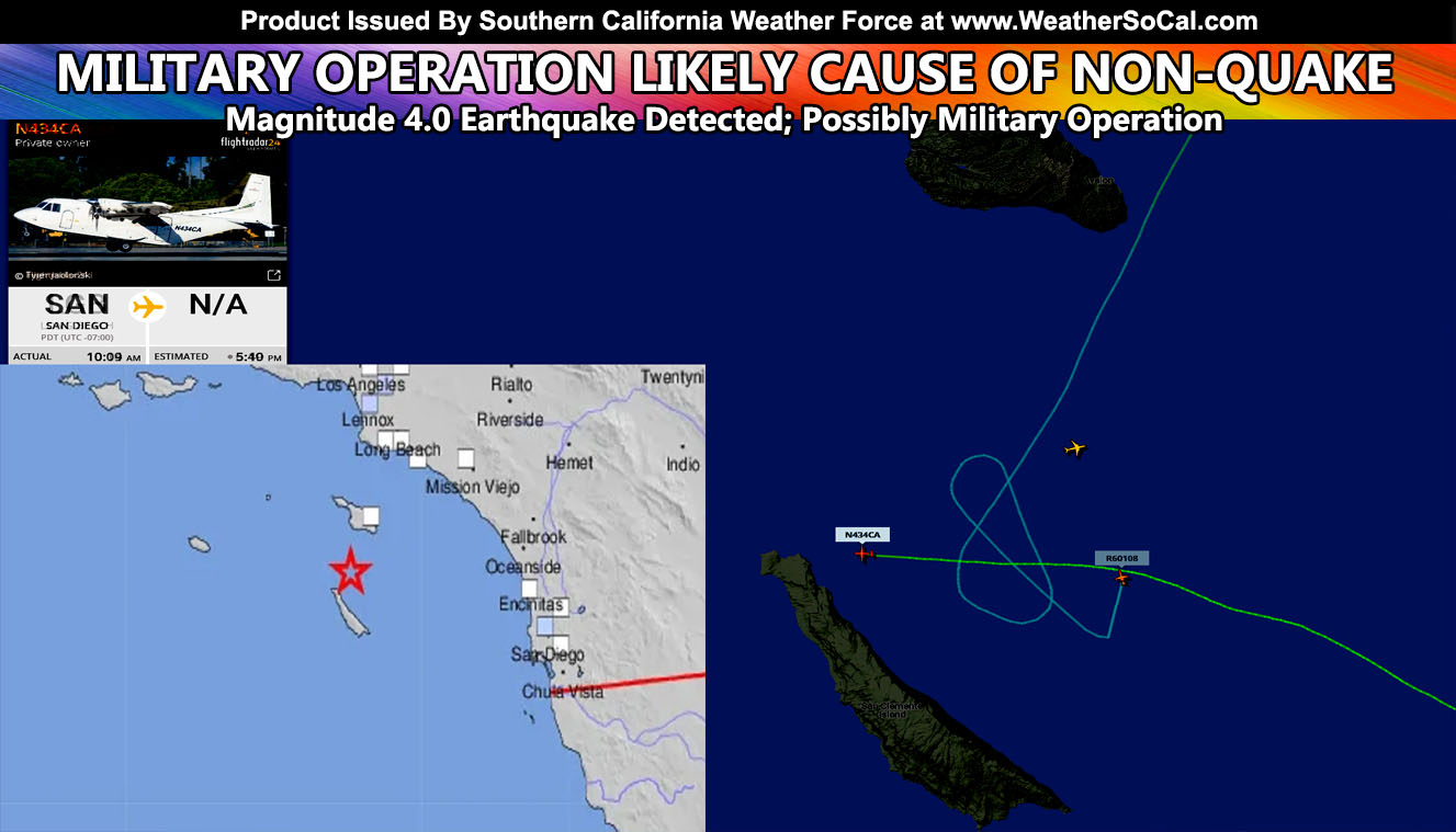
At 9:48am on Friday morning, April 15, 2022, the USGS detection network detected a magnitude 4.0 earthquake off the Southern California coast south of Catalina and east of San Clemente Island. They later concluded this was not a real earthquake and I have discovered this was indeed a military operation of some kind so read on for the details …
Join the Facebook Page for Further Updates If You Have Not Yet!
SOUTHERN CALIFORNIA WEATHER FORCE MAIN:
As you know I frequent in patterns and numbers. The pattern today got me a bunch of messages asking me what this really was. How can a magnitude 4.0 quake be detected and then be called a non-quake. Well your answer is simple. Find out what was out there. I opened the archives of a popular flight tracking software and went back to around 9am. And I’ll take you through what I see happened.
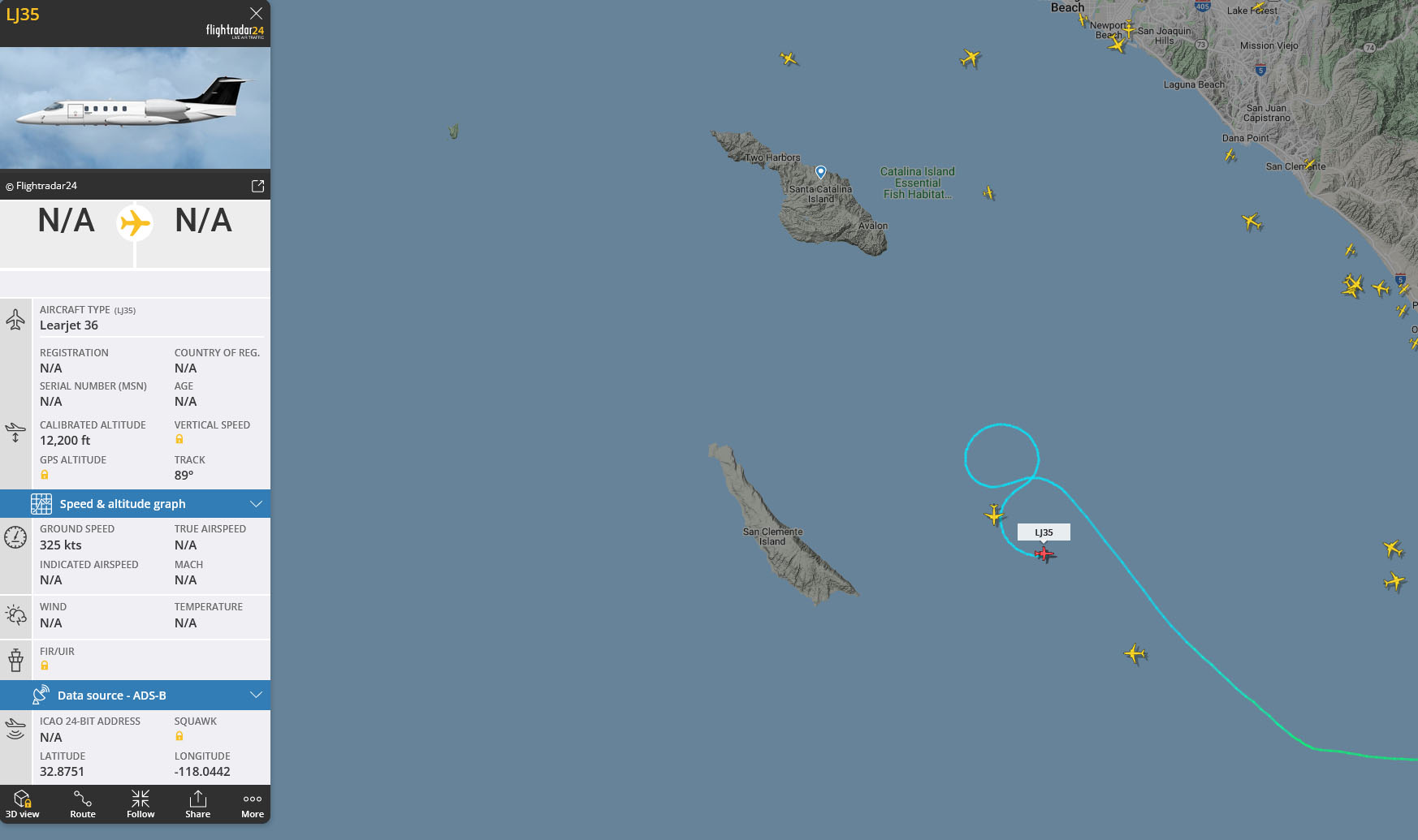
At 9:30am there were two aircraft in the exact area this non-quake was epic-entered. The one with the holding pattern look came before the cargo holder from San Diego. This was telling me that a ‘scout’ plane was dispatched to the location the military had chosen for some kind of drop. You can see further in the image (clickable) that the cargo plane is similar to that used for skydiving, where the back of the plane opens up. This passed over the drop-zone the other plane was circling and then landed at a runway on the north end of San Clemente Island. Then whatever it dropped had to have had some type of energy to be detected as a 4.0 quake. This was easily some type of bomb test in the middle of the ocean.

At 8:20am, a Boeing 727 took off from Ontario International Airport. It then circled the exact location of where the activity was to be and continued even after the time of ‘detonation’. A Boeing 727 aircraft is no longer a passenger plane so you can rule that one out. They were converted for other means, probably this was a command center of some kind, one we do not know anything about.
But, as the image below shows, such a plane did circle the area at the same time this all happened.
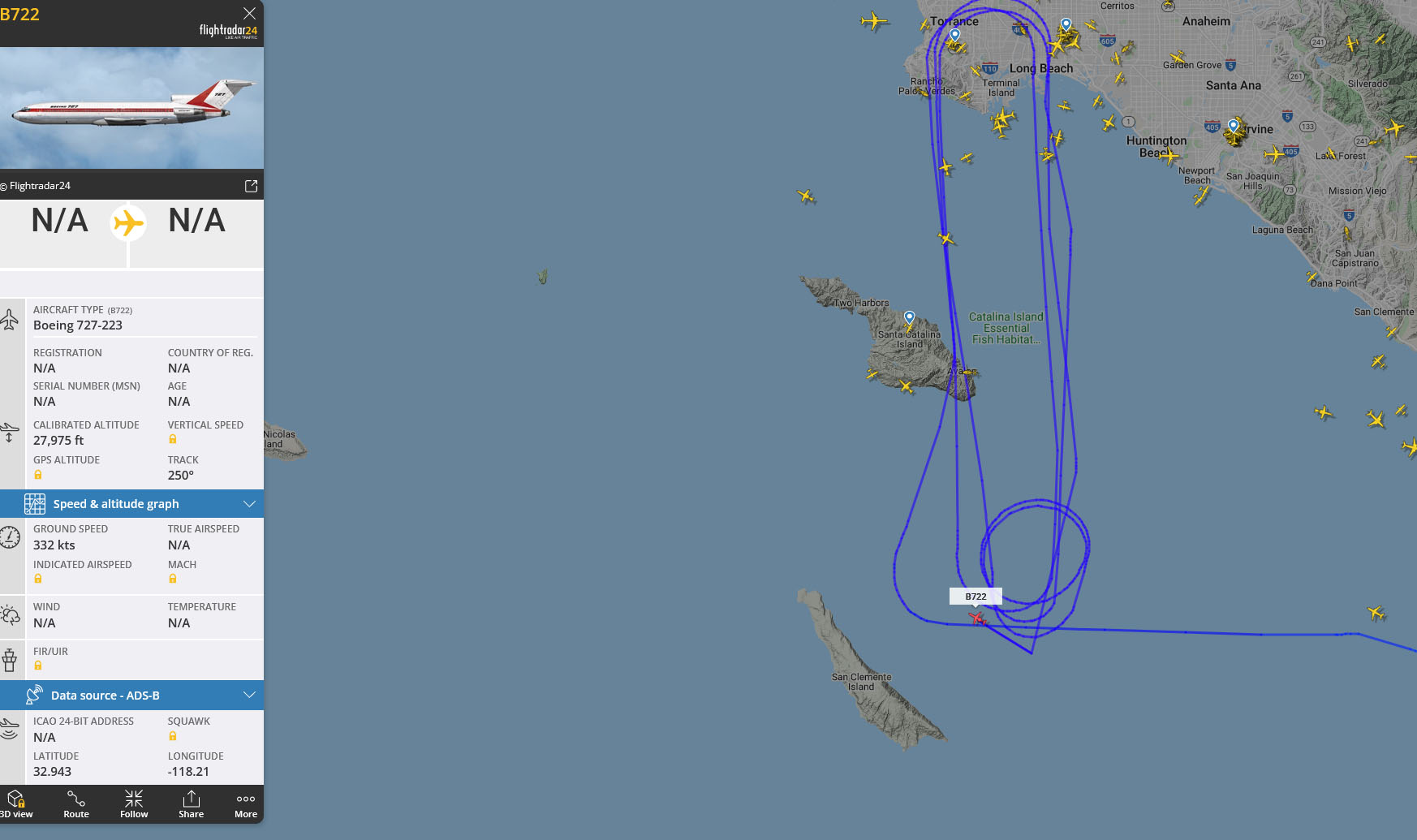
So in conclusion based off the evidence I see and the types of planes present at the time, A plane took off from Long Beach to circle the area of interest ahead of the cargo plane from San Diego that would make a drop into the water or even some sort of vessel in the area, whether above water or a under as submarine. Something detonated, and then a 727 from Ontario came in and circled the area for awhile, which was probably a command center within …
Even as I type this, the same jet that circled the area of epicenter is out there as of 5pm this evening and operations remain to be unknown what is going on at this time.
How to get these alerts with a premium subscription via e-mail by micro-climate zone AND/OR Get the GPS models for all events on your device enabled? (100 percent delivery time)
Click Here To Join The Season Tier
Join The Main Southern California Weather Force Facebook Group (50 percent delivery time) – You can join the main SCWF page as well through that group.
Click Here To Join The Page Today
FACEBOOK PAGES TO JOIN!
SOUTHERN CALIFORNIA WEATHER FORCE MAIN: Southern California Weather Force Office Main Page
SOUTHERN CALIFORNIA WEATHER FORCE METEOROLOGIST: – Just my public figure page that isn’t as large so maybe you can reach me better at times.
INSTAGRAM, TWITTER, TO JOIN!
Instagram – https://www.instagram.com/socalweatherforce/
Twitter – https://twitter.com/SCweatherforce
Southern California Weather Force is a custom weather alert service that began in September 1999 off and is regarded as the most accurate weather service in the region, offering custom alerts, maps, and models to help save life and property. The work done here is never 100% accurate, but it comes pretty close. Southern California Weather Force runs on zones, so if an event happens in a zone that is 10 miles from the border of your zone, the forecast is still valid to activate your zone’s alert system. A company quote to the public is that of “The Joker” and tells other agencies in weather this all the time… “This world deserves a better class of meteorologist… and I’m gonna give it to them”… out-forecasting even the National Weather Service with lead-time and precision, which makes this service a focus of ridicule and envy in the weather community due to having such accuracy. Alerts issued here are issued custom from this office and this office alone. You may not even hear it elsewhere, but if one is issued near or in your area, listen up because “if you do not wish to die in weather, follow, it’ll save your life one day.”