
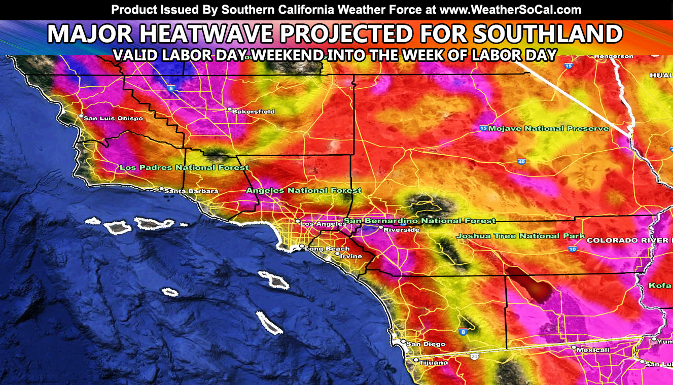
Southern California Weather Force has issued a Special Weather Statement ahead of a major ridge of high pressure developing by Labor Day Weekend, which will also put many activities at risk in what will be the strongest heatwave this year thus far so read on for details …
Join the Facebook Page for Further Updates If You Have Not Yet!
SOUTHERN CALIFORNIA WEATHER FORCE MAIN:
NOTE: Community tier for the email alerts has been discontinued at the end of August (this month) due to insufficient help within the community for the next season, so if you want these delivered to your e-mail and/or to continue to have that option, and also the many other alerts for your area that is a custom forecast for that you won’t see elsewhere, including the member section GPS models when events are in – Sign up here – https://www.southerncaliforniaweatherforce.com/southern-california-weather-force-membership/
This happens quite often. End August into early September usually is very hot and this is no exception. Many just moving into Southern California’s metro zones do in fact think that September and October are cool-down month. September is usually the hottest month in the metros due to many factors. This factor however will be the monsoon ridge re-developing for monsoon moisture to come out of due east.
This easterly flow will create a weak offshore flow pattern for both heat and humidity. Given the ridge of high pressure is pegging at 597dm, which is extremely high, I am expecting many inland areas between 108 and 116 degrees, temperatures that of what Phoenix, Arizona has during June and some of July. This will be the strongest heatwave of the season thus far. In reality, however, this happens after September 1st, and September 1st in meteorology is considered the start of Meteorological Fall, this it is the Fall Season weatherwise.
This easterly wave will also shove monsoon moisture way west into the area. I will be monitoring this moisture and also if showers/thunderstorms will accompany the flow so continue to stay tuned to Southern California Weather Force for further updates.
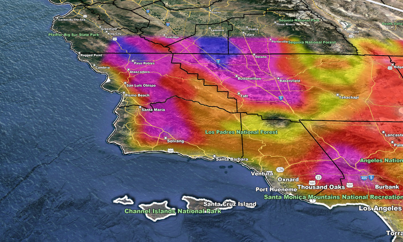
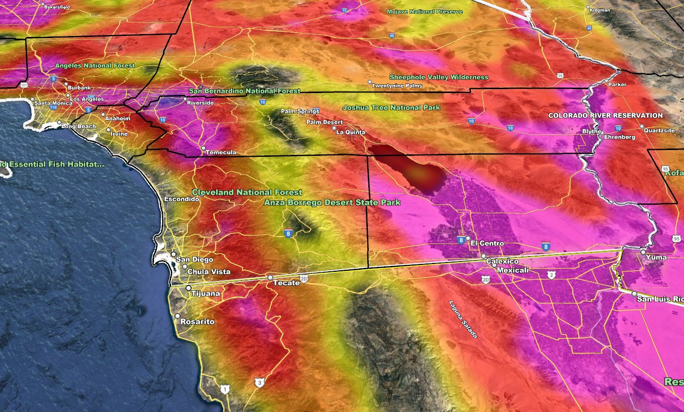
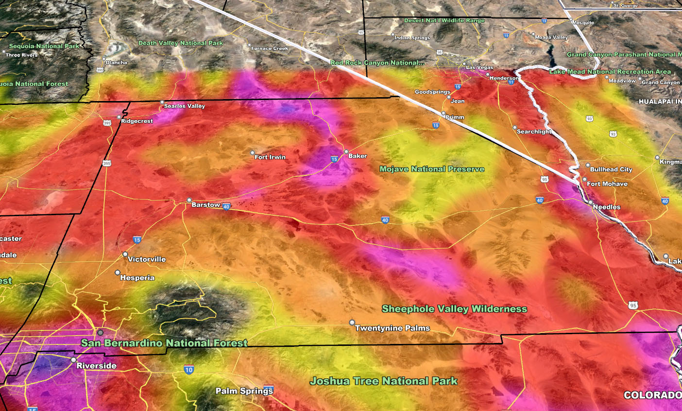
The images below are of the SCWF Heat Model, and the key are the numbers as well.
Members: Click Here to enter the member section to see this via the GPS feature.
1. Very little discomfort, however, long periods of exposure could bring heat exhaustion.
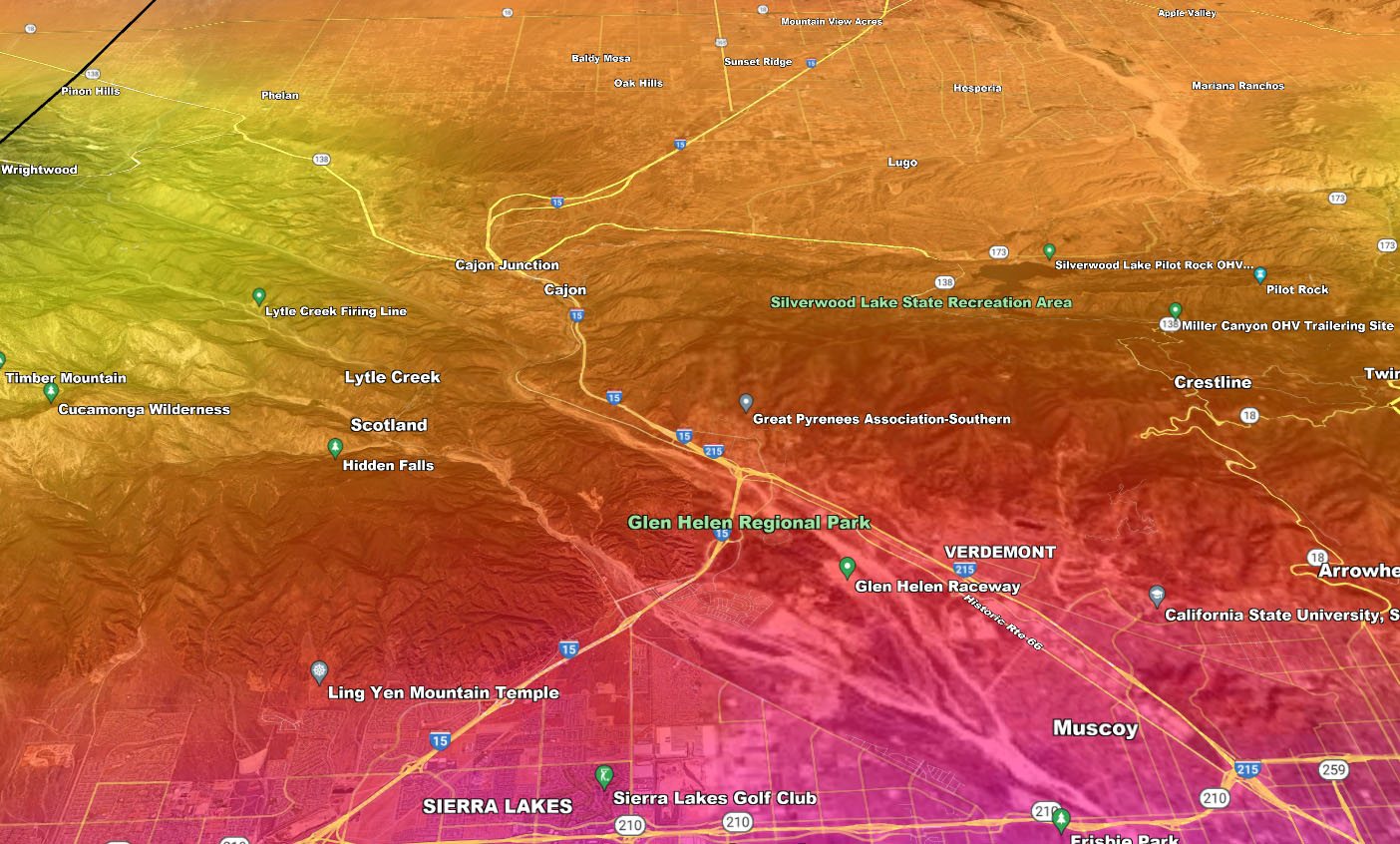
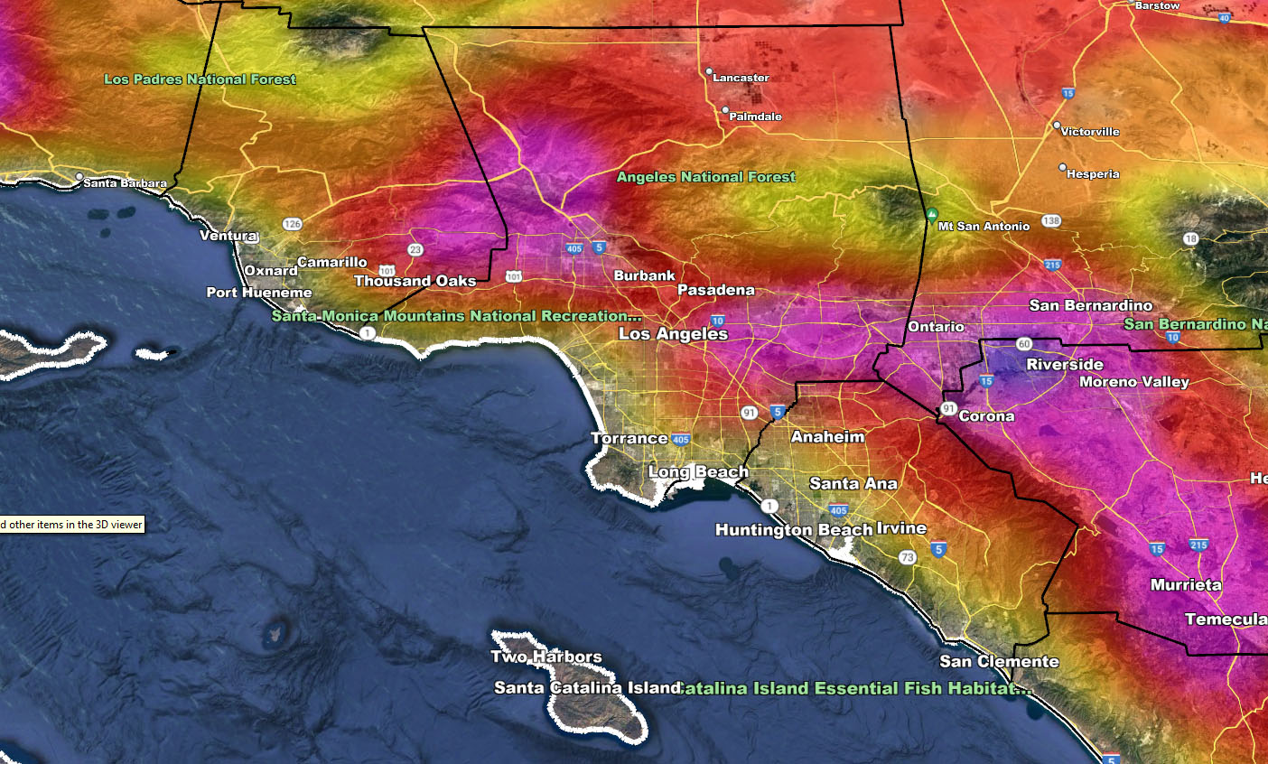
The maps below are of flood, rain, snow, snow-level, or wind intensity, whichever is available now. Each one is clickable. Map 1 is NW SoCal, Map 2 is SW SoCal, Map 3 is SE SoCal, Map 4 is NE SoCal, Map 5 is the Cajon Pass, and Map 6 is the metro areas of VT/LA/OC/IE …
GET TO KNOW YOUR MAP BECAUSE THESE NEVER CHANGE LOCATIONS – IMAGES ARE CLICKABLE

Southern California Weather Force Twitter – CLICK HERE