
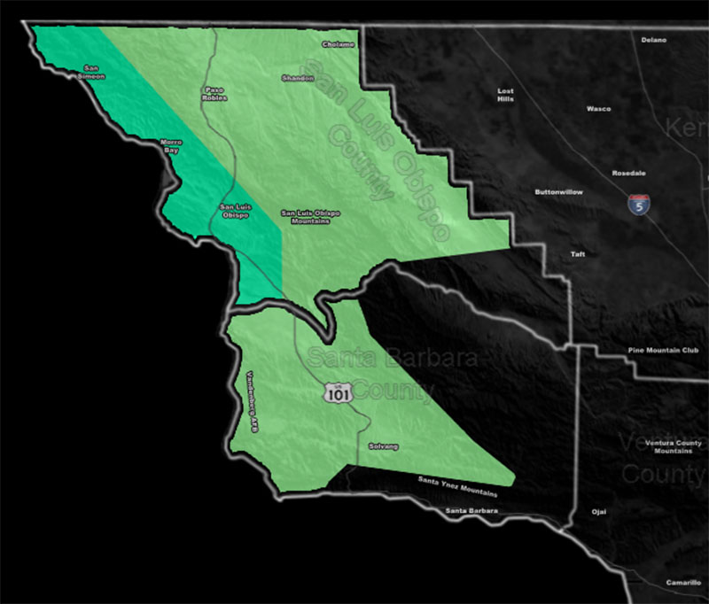
Issued Zones: San Luis Obispo County … Mainly the western half of Santa Barbara County, the Vandenberg/Lompoc forecast zones …
Site: Southern California Weather Force has issued a Flood Advisory and Short Term Forecast effective mainly Monday 9-19-2022 …
Date Issued: 9/18/22 at 1:50pm local
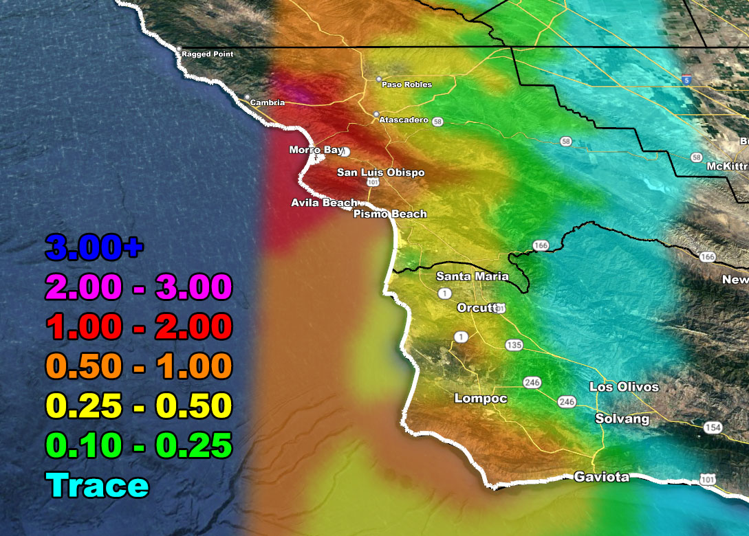
Forecast: The tail-end a strong storm system impacting Northern California will move through the area starting around midnight tonight and going through Monday. The most rain in a short period of time will be mainly along or near the coast, the highest in the San Luis Obispo forecast areas where the SCWF Flood Advisory is not in effect. Use the SCWF Rainfall Model below to see the prediction for this small compact event.
SCWF Supporting Members CLICK HERE to enter the GPS sector for the map below …
How to get these alerts with a premium subscription via e-mail by micro-climate zone AND/OR Get the GPS models for this event on your device enabled? If you read this from the website or social media links, this option is the best to go so you get them delivered every single time without having to look for them (100 percent delivery time)
Click Here To Join The Season Tier
Join The Main Southern California Weather Force Facebook Group (50 percent delivery time) – You can join the main SCWF page as well through that group.
Click Here To Join The Page Today
10 mile rule: These alerts issued on this site means that within your zone and 10 miles from you will see the event forecast for. You may or may not see the event but it means you are in the zone or 10 miles from where someone will.
Southern California Weather Force is a custom weather alert service that began in September 1999 off and is regarded as the most accurate weather service in the region, offering custom alerts, maps, and models to help save life and property. The work done here is never 100% accurate, but it comes pretty close. Southern California Weather Force runs on zones, so if an event happens in a zone that is 10 miles from the border of your zone, the forecast is still valid to activate your zone’s alert system. A company quote to the public is that of “The Joker” and tells other agencies in weather this all the time… “This world deserves a better class of meteorologist… and I’m gonna give it to them”… out-forecasting even the National Weather Service with lead-time and precision, which makes this service a focus of ridicule and envy in the weather community due to having such accuracy. Alerts issued here are issued custom from this office and this office alone. You may not even hear it elsewhere, but if one is issued near or in your area, listen up because “if you do not wish to die in weather, follow, it’ll save your life one day.”