
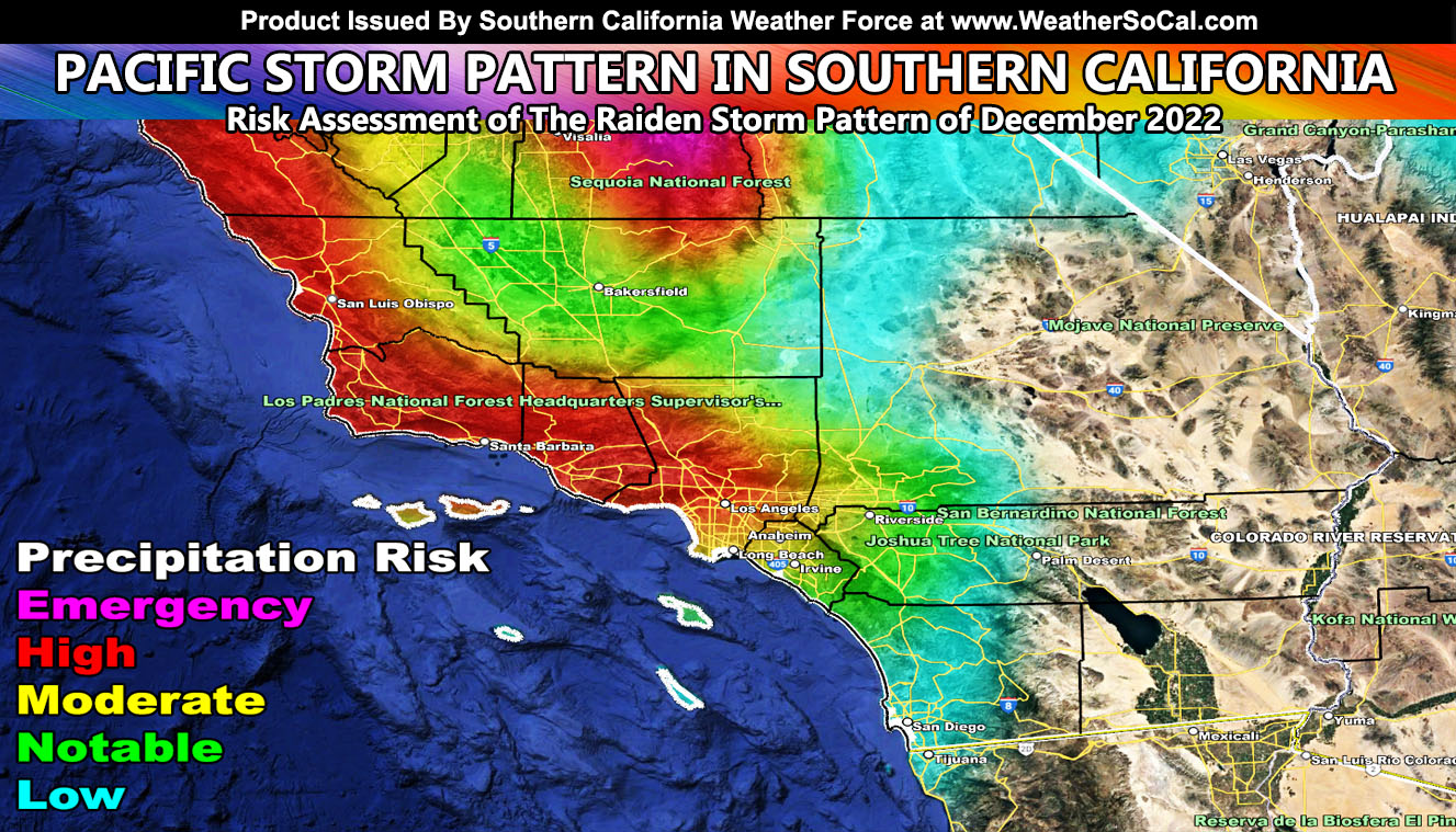
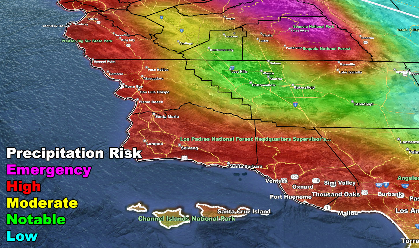
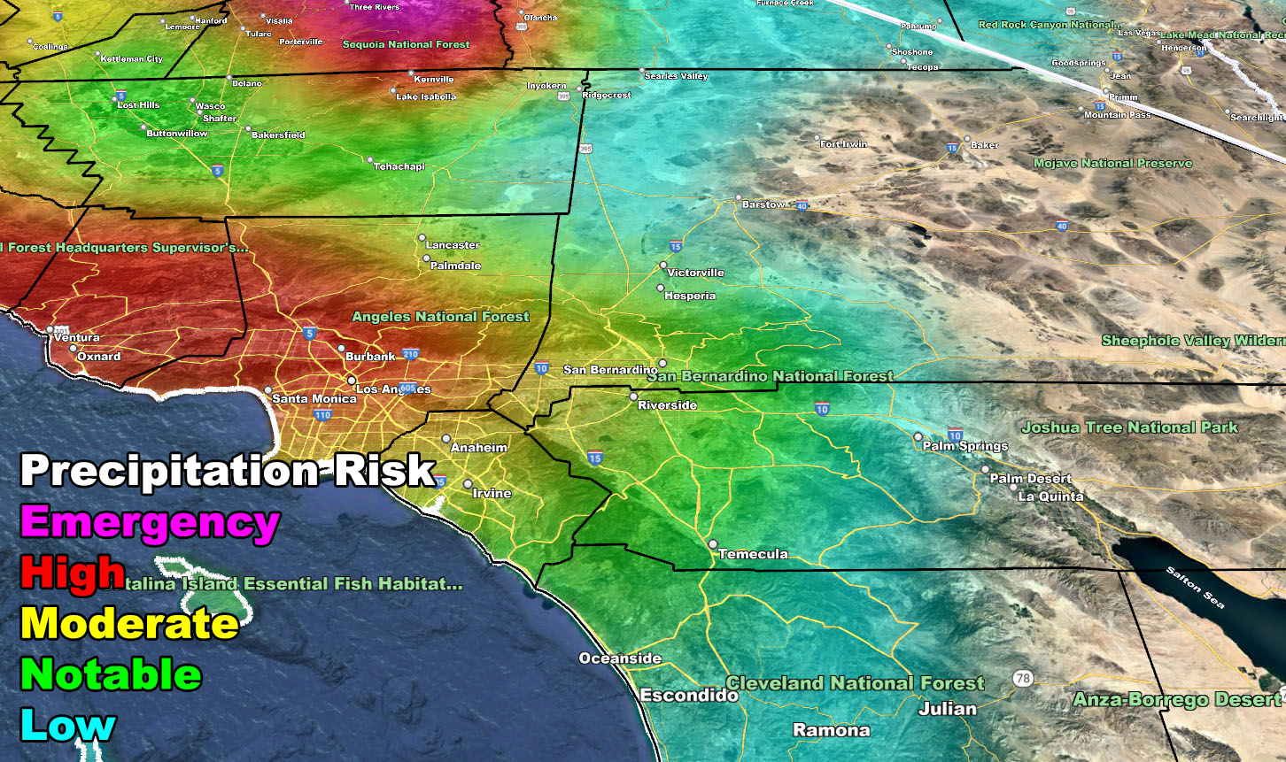
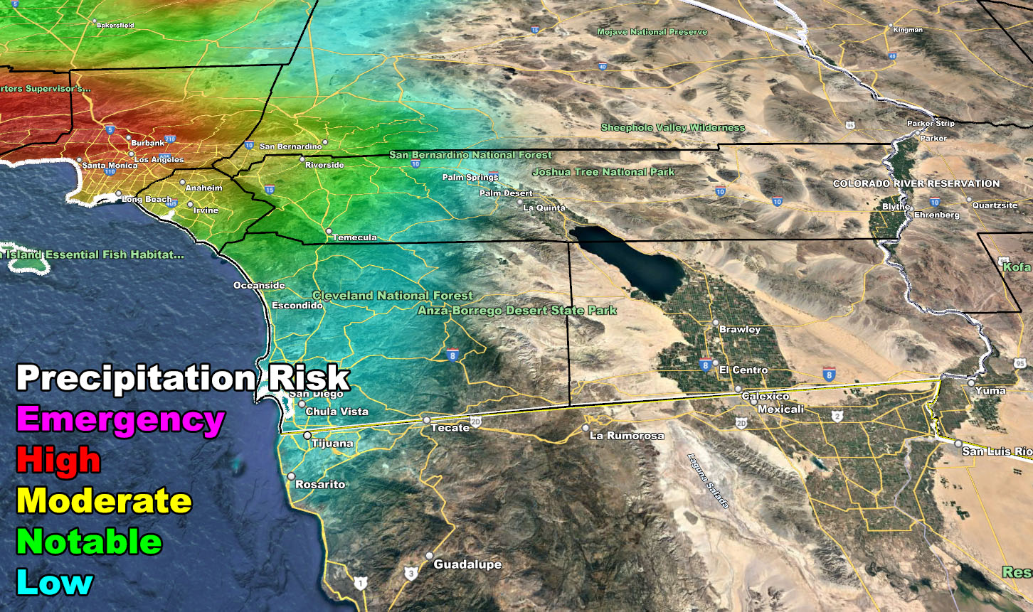
A major flooding scenario will hit the mountain, foothill, valley, and coastal areas of San Luis Obispo, Santa Barbara, Ventura, and parts of Los Angeles County by the end of this weekend and right on into the weekend as the Raiden Storm Pattern of December 2022 hits. Remember, moderate value and higher is considered a threat to you if you are in a flood and/or landslide zone so take it seriously and stock up on sandbags this week so read on for details and see the zoom-in SCWF model maps …
WANT THESE DELIVERED VIA THE APP? JOIN THE PATREON COMMUNITY TODAY FOR ALL THOSE PERKS INCLUDING BEING ON THE MICRO-CLIMATE ALERT SYSTEM BECAUSE NOT EVERY ALERT IS POSTED ON SOCIAL MEDIA FROM THIS WEATHER OFFICE – https://www.patreon.com/weatherforce
Join the Facebook Page for Further Updates If You Have Not Yet!
SOUTHERN CALIFORNIA WEATHER FORCE MAIN:
Back on November 18th, an article was released here at Southern California Weather Force of the next storm pattern to come (Click to read that article). This would be end month for the start and go right on into the first half of December. This would yet again yield the name Raiden Storm Pattern as no other source or model showed it when the article was published, so, like a book, it belongs to the ‘author’.
The type of system this will be is one that grabs moisture out of the tropics yet again. These types of systems do bring higher snow-levels along the main part of the frontal zone, but they do sometimes crash into the resort/mountain city levels at the end of the storm periods. From what I can see now, we will have higher snow-levels with this system as it will be tapping in that tropical moisture. Tropical moisture levels bring what I look for in flooding, and that product is the Precipitable Water values.
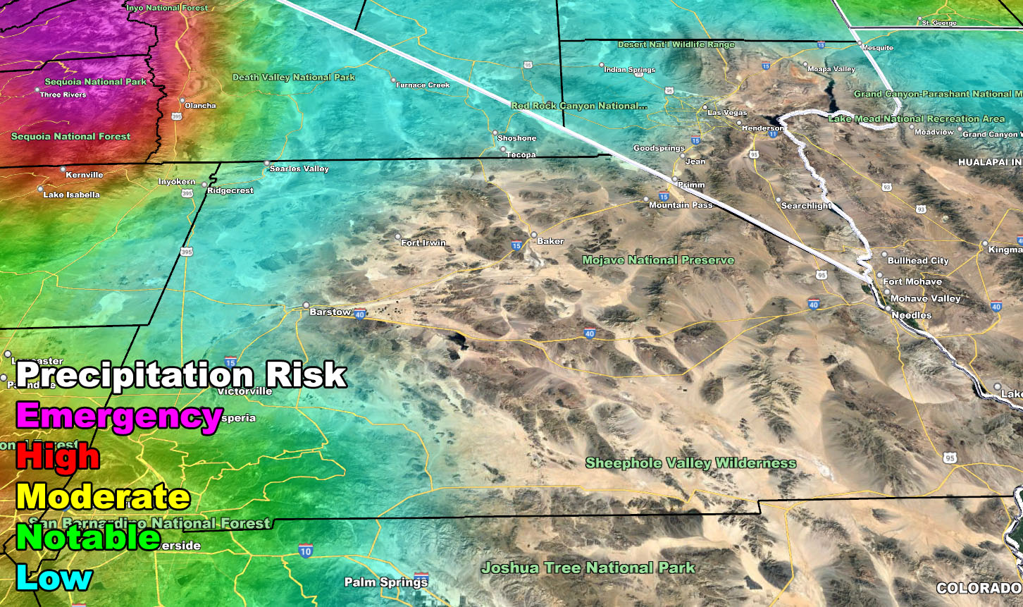
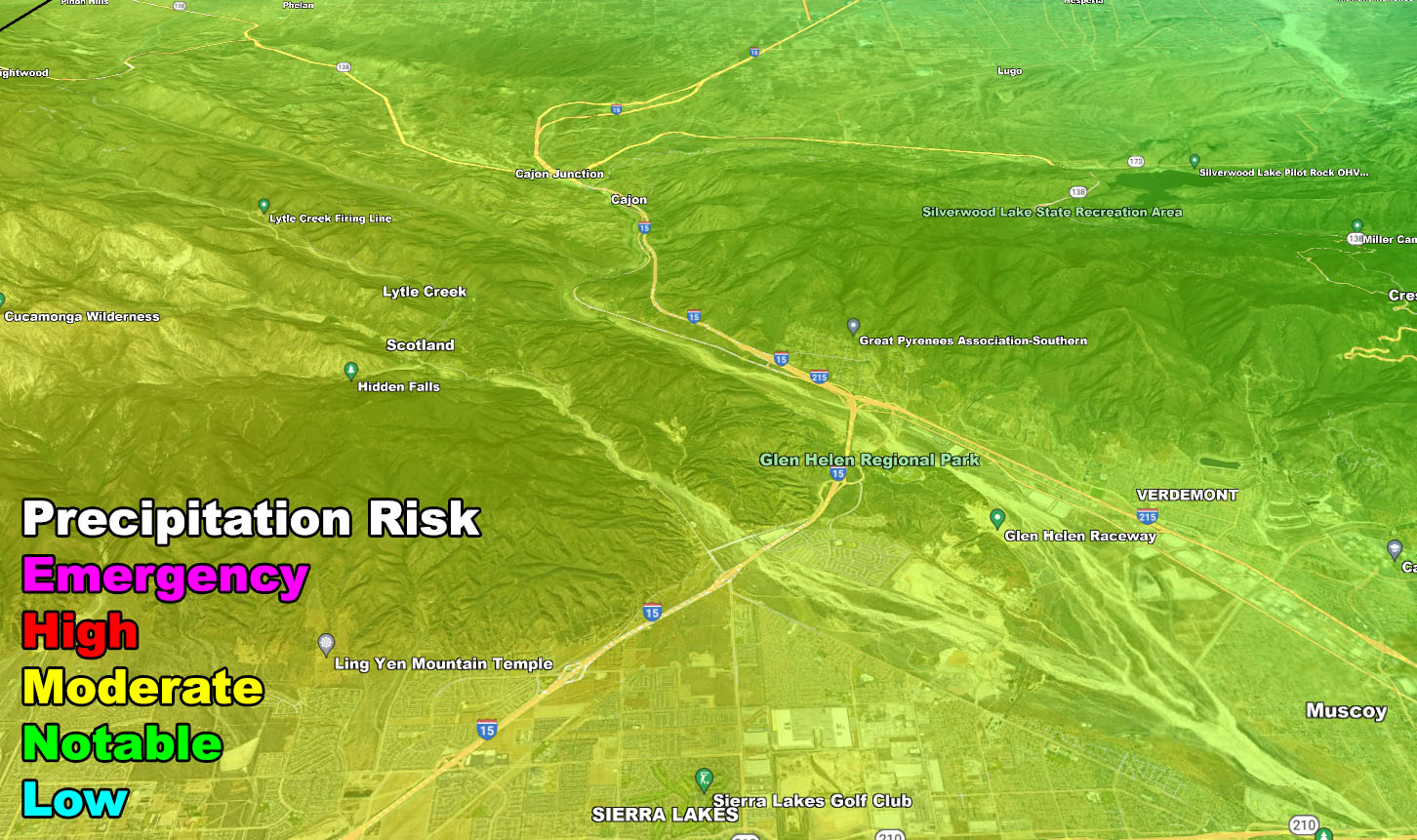
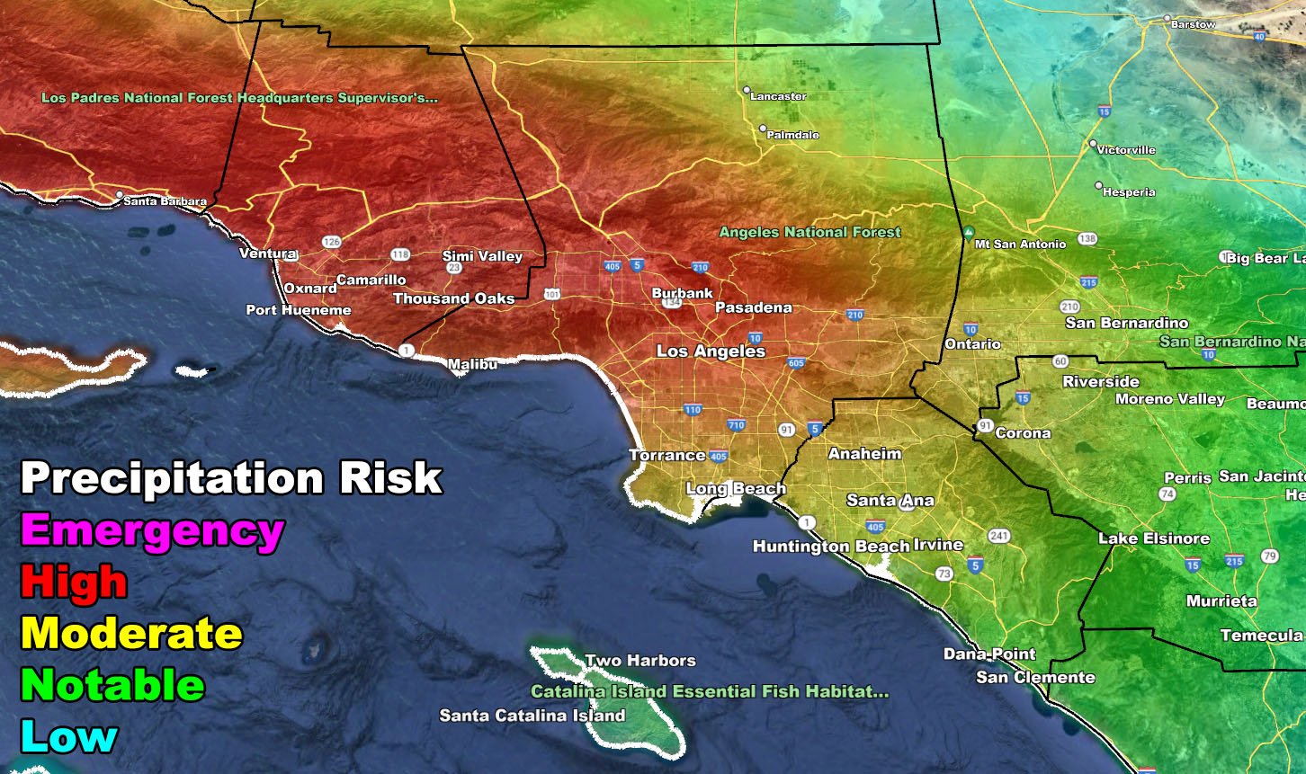
Given this, models will undoubtedly underestimate the amount of rain that will hit the hardest areas. Where models show 3″+ may very well be over 8-10″ of rainfall in the flood prone zones, the highest being the Santa Barbara/Ventura southern foothill and burn area zones. Flood Warnings and maybe even Flood Emergencies will need to be issued here at Southern California Weather Force when the time comes, but with the images below, you have your advanced risk assessment areas now.
It is important to note the type of system this is. Here at Southern California Weather Force the jurisdiction is 10 counties of Southern California, along with Clark County, Las Vegas, Nevada. You can note by the risk assessment that San Diego has far less risk than areas further north. This means that a strong southerly flow in the low levels will be present, so strong winds along the front will certainly be likely. The Southern California Weather Force category system for determining strength of the coming storm will assign a starting category as the week moves along and more data is crunched. It looks very likely as a solid category 4 or 5 in the hardest hit areas of the risk zones.
The maps below have the risk zones in all corners of the SCWF jurisdiction zones.
WANT THESE DELIVERED VIA THE APP? JOIN THE PATREON COMMUNITY TODAY FOR ALL THOSE PERKS INCLUDING BEING ON THE MICRO-CLIMATE ALERT SYSTEM BECAUSE NOT EVERY ALERT IS POSTED ON SOCIAL MEDIA FROM THIS WEATHER OFFICE – https://www.patreon.com/weatherforce
Join The Main Southern California Weather Force Facebook Group (50 percent delivery time) – You can join the main SCWF page as well through that group.
Click Here To Join The Page Today