
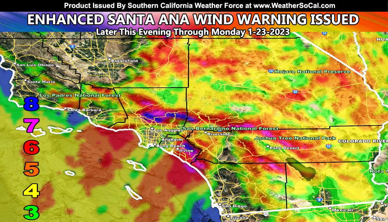
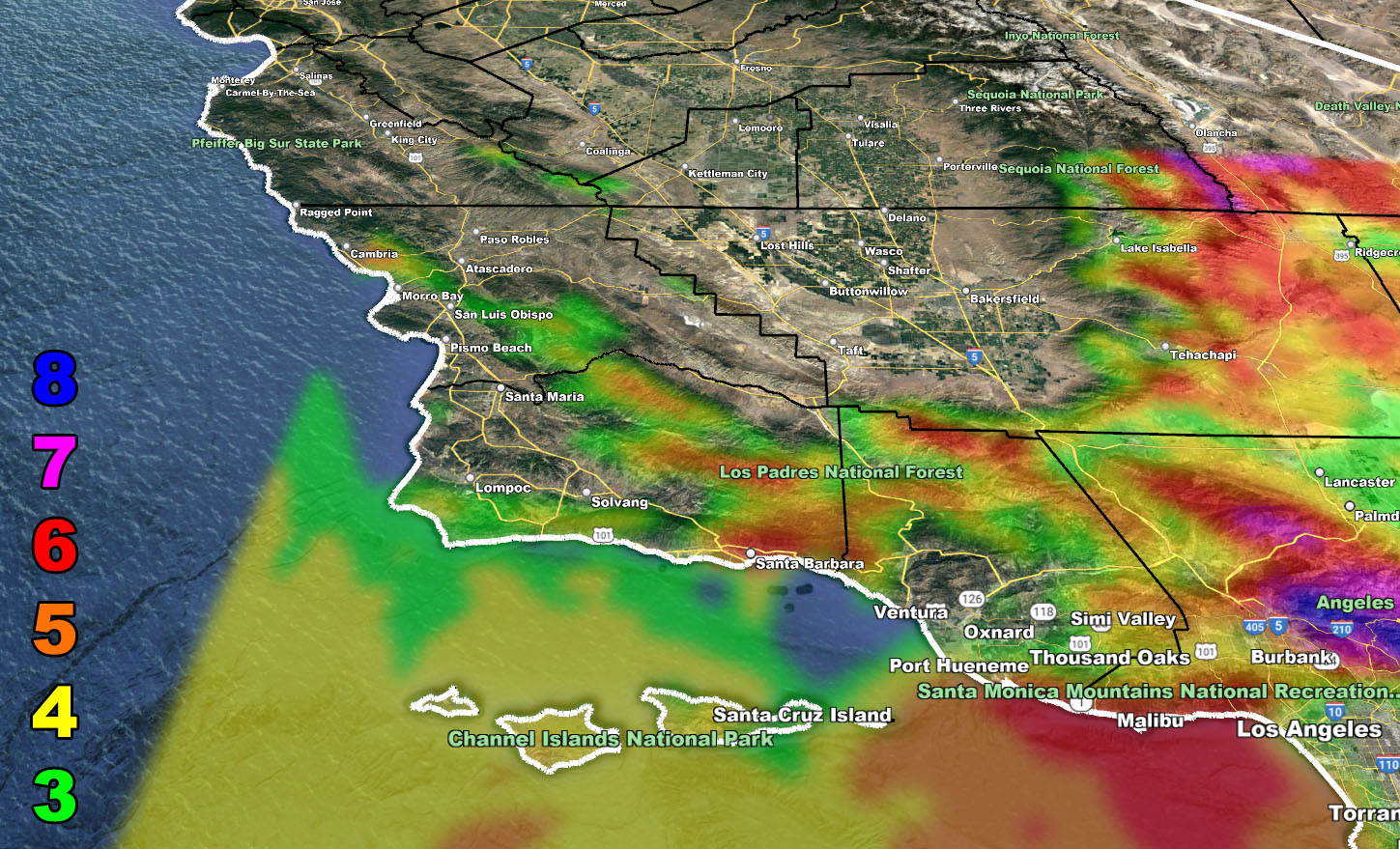
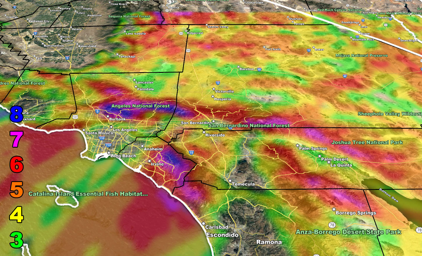
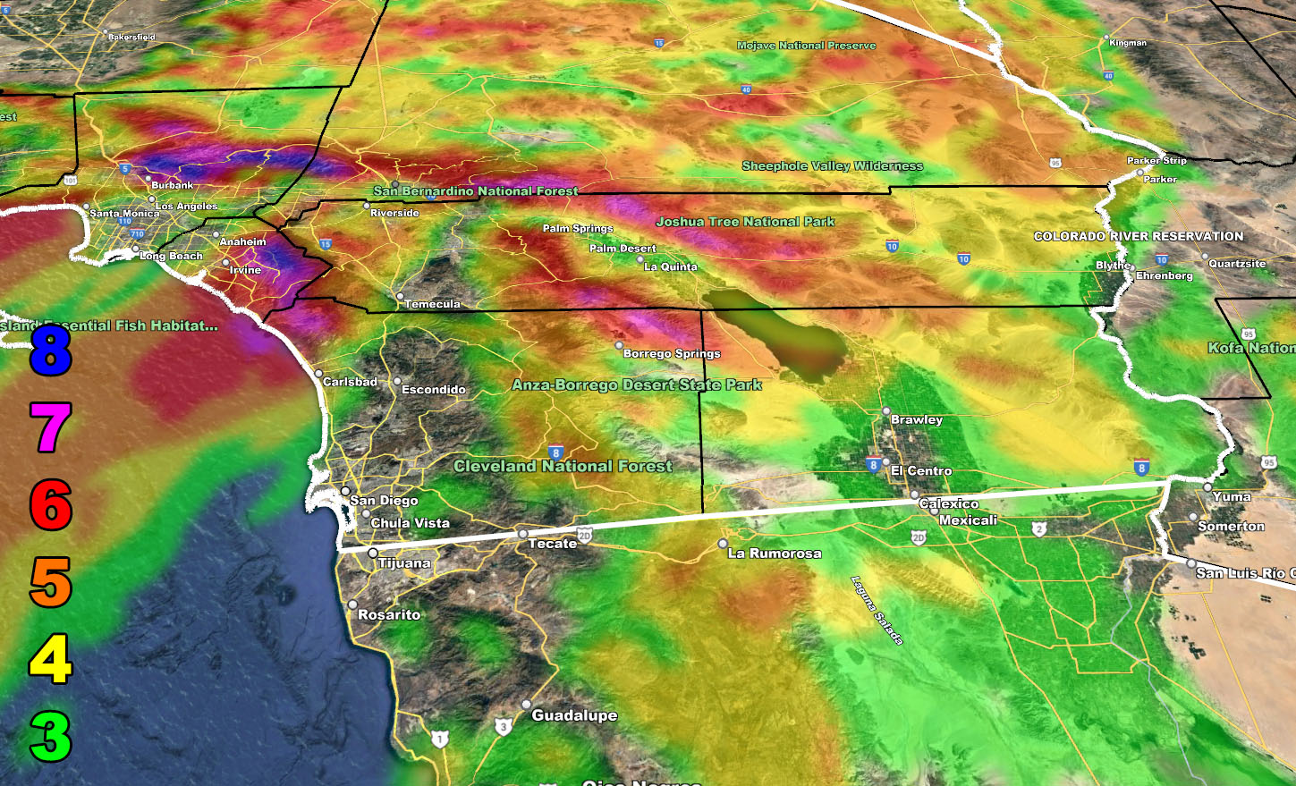
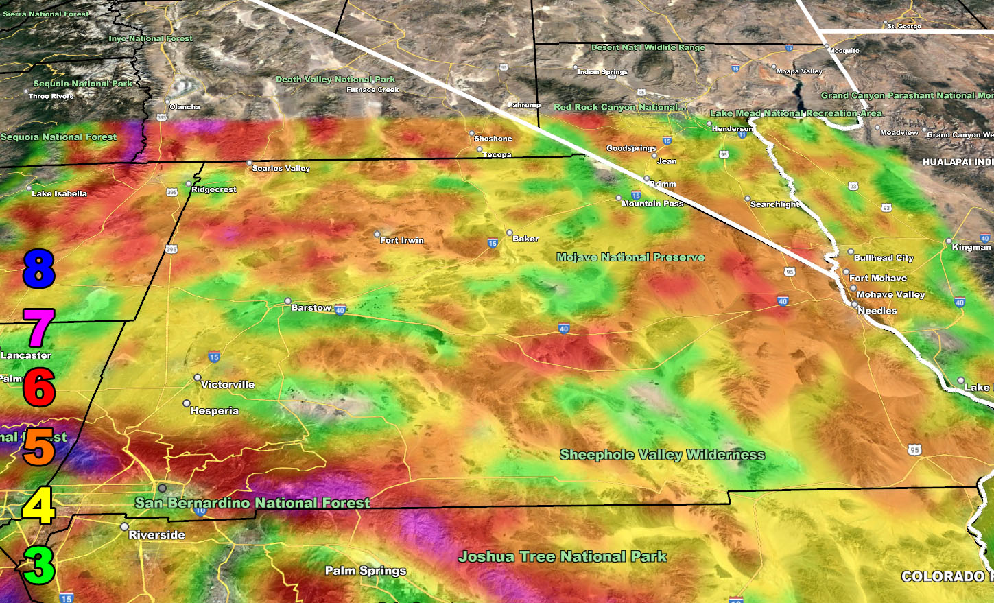
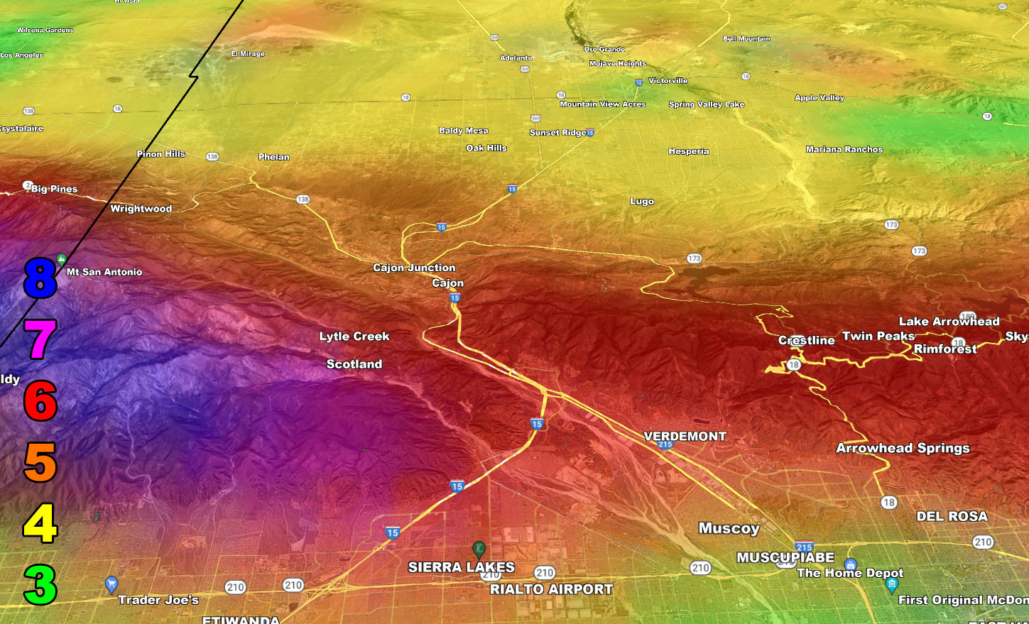
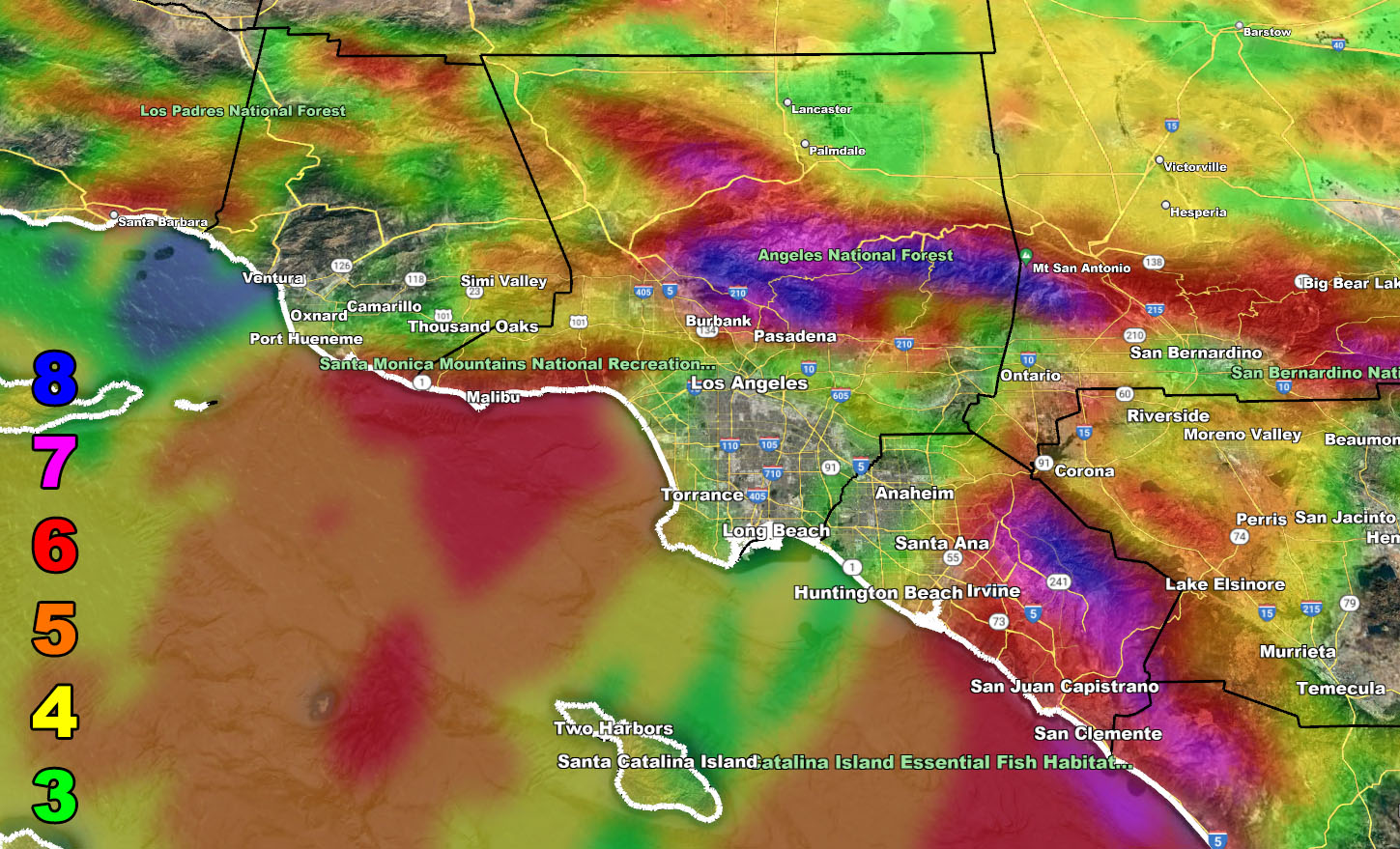
Southern California Weather Force has issued the Enhanced Santa Ana Wind Warning for damaging Santa Ana Winds, arriving later this evening and peaking through the overnight and into Monday so for the maps and what level you are in with the SCWF Wind Model read on …
WANT THESE DELIVERED WITH ALL THOSE PERKS INCLUDING BEING ON THE MICRO-CLIMATE ALERT SYSTEM AND MODELS DURING EVENTS BECAUSE NOT EVERY ALERT IS POSTED ON SOCIAL MEDIA FROM THIS WEATHER OFFICE – JOIN TODAY BY CLICKING HERE – Southern California Weather Force Subscriber System – Southern California Weather Force
Join the Facebook Page for Further Updates If You Have Not Yet!
SOUTHERN CALIFORNIA WEATHER FORCE MAIN:
As stated a week ago (Click here to read that post), the Medium Range wording said that stronger Santa Ana Winds would move in the week of January 22, 2023. As such, this forecast was taken care of and you can use the maps below for your areas as there is nothing else more to say about it. Some of you will not see anything, others will be in the damaged areas.
I will note to you that Ontario International Airport will have delays and/or diverts with this pattern.
MEDIUM RANGE: Another Santa Ana Wind Pattern will hit around Thursday of this week.
LONG RANGE: The pacific storm pattern looks to return to California by the end of the month but pick up steam more through the first week of February.
Wind Model – VALID LATER THIS EVENING THROUGH MONDAY
SUPPORTING MEMBERS: Click Here To See The GPS Version Of This Model In Your Member Section Tab.
Raiden Storm Wind Gust Intensity Scale –
8. Extensive widespread damage.
7. Trees are broken or uprooted, building damage is considerable. – High Profile Vehicle Roll-Over CERTAIN.
6. SOME Trees are broken or uprooted, building damage is possible. – High Profile Vehicle Roll-Over Likely, Do NOT recommend Traveling in this zone. This zone also is the starting zone where trees and powerlines will fall and damage cars and even kill people near or in them!
5. Slight damage occurs to buildings, shingles are blown off of roofs. HIGH WIND WARNING CRITERIA – High Profile Vehicle Roll-Over Possible if weight is not corrected.
4. Twigs and small branches are broken from trees, walking is difficult.
3. Large trees sway, becoming difficult to walk. POWER SHUTDOWN THRESHOLD DURING FIRE WEATHER / WIND ADVISORY CRITERIA
WANT THESE DELIVERED WITH ALL THOSE PERKS INCLUDING BEING ON THE MICRO-CLIMATE ALERT SYSTEM AND MODELS DURING EVENTS BECAUSE NOT EVERY ALERT IS POSTED ON SOCIAL MEDIA FROM THIS WEATHER OFFICE – JOIN TODAY BY CLICKING HERE – Southern California Weather Force Subscriber System – Southern California Weather Force
Join The Main Southern California Weather Force Facebook Group (50 percent delivery time) – You can join the main SCWF page as well through that group.
Click Here To Join The Page Today