
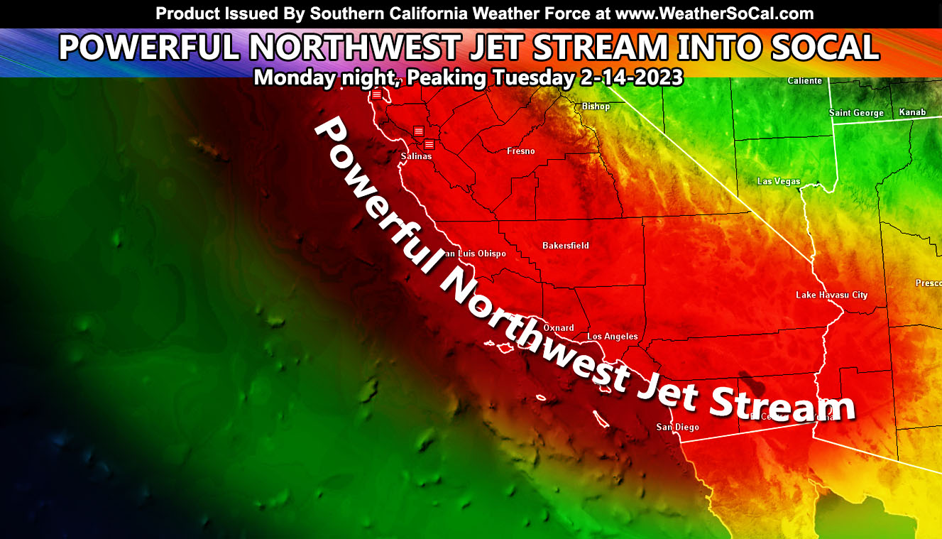
Southern California Weather Force has issued a regional wind alert for most of Southern California as a classic northwest slider system moves into the region starting tonight, peaking on Tuesday and Tuesday night with some areas seeing damaging winds and others not, so for your area’s model forecasts read on for details and please pay attention to those details and images as I do not want to hear anyone complain their area is not seeing this event when the forecast clearly would confirm it …
WANT THESE DELIVERED WITH ALL THOSE PERKS INCLUDING BEING ON THE MICRO-CLIMATE ALERT SYSTEM AND MODELS DURING EVENTS BECAUSE NOT EVERY ALERT IS POSTED ON SOCIAL MEDIA FROM THIS WEATHER OFFICE – JOIN TODAY BY CLICKING HERE – Southern California Weather Force Subscriber System – Southern California Weather Force
Join the Facebook Page for Further Updates If You Have Not Yet!
SOUTHERN CALIFORNIA WEATHER FORCE MAIN:
Wind gusts will start today for the mountain and desert regions as onshore flow starts to take hold. The wind gusts through Tuesday will increase in all areas then, including the coast/basin/valley areas. Since this is regional, I will go ahead and outline the key areas.
- 90% of Southern California will have advisory level 30+ mph wind gusts.
- There will be some rain with it, not much, but the information for that is below.
- Trees and/or powerlines will be down in the stronger hit areas.
- Strong winds on Tuesday should prevent small crafts from being out in the island region (bight) of Southern California. If you plan on being out there, you will have 40-50 mph wind gusts out of the west-northwest then, so it is not recommended.
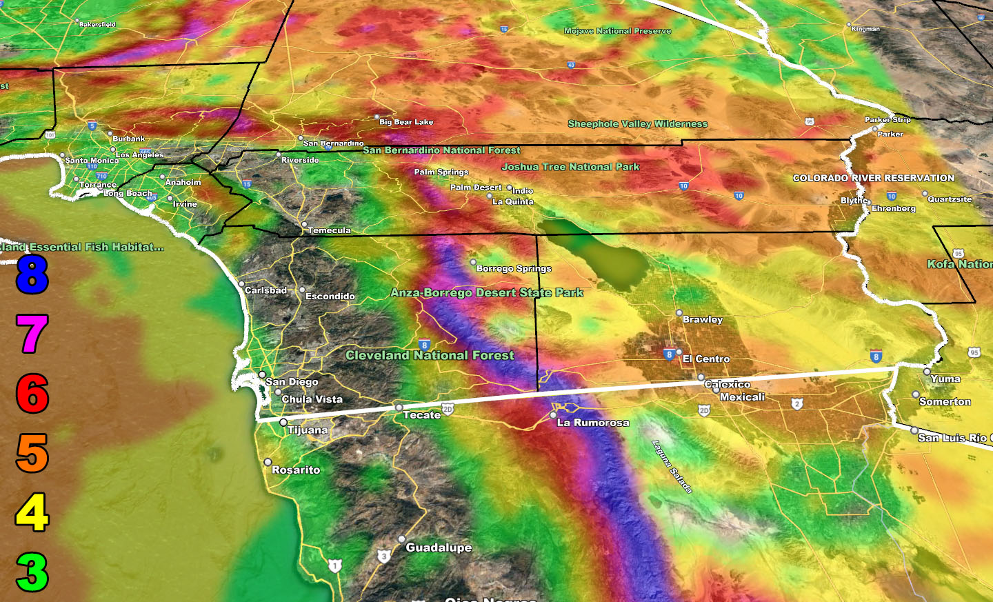
- The hardest hit area will be around the San Diego/Imperial Border along I-8 where high profile vehicles will be certain to tip over.
- The weakest of the rain/wind will be parts of the Riverside/Corona areas of the Inland Empire, where I call it ‘The Screw Zone’, meaning if you want active weather then you won’t see much as other areas will.
- Winds will weaken on Wednesday, leaving a weak offshore (Santa Ana Wind Pattern) flow into Thursday.
- Another system comes in this weekend, but it could be a southern slider and favor the stronger hits into San Diego, but it is being monitored.
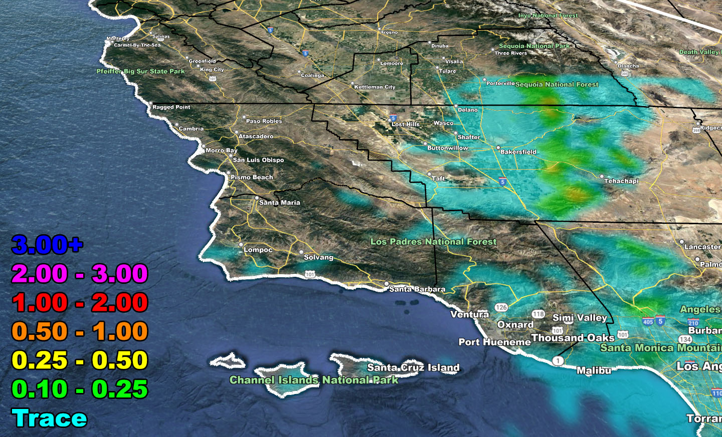
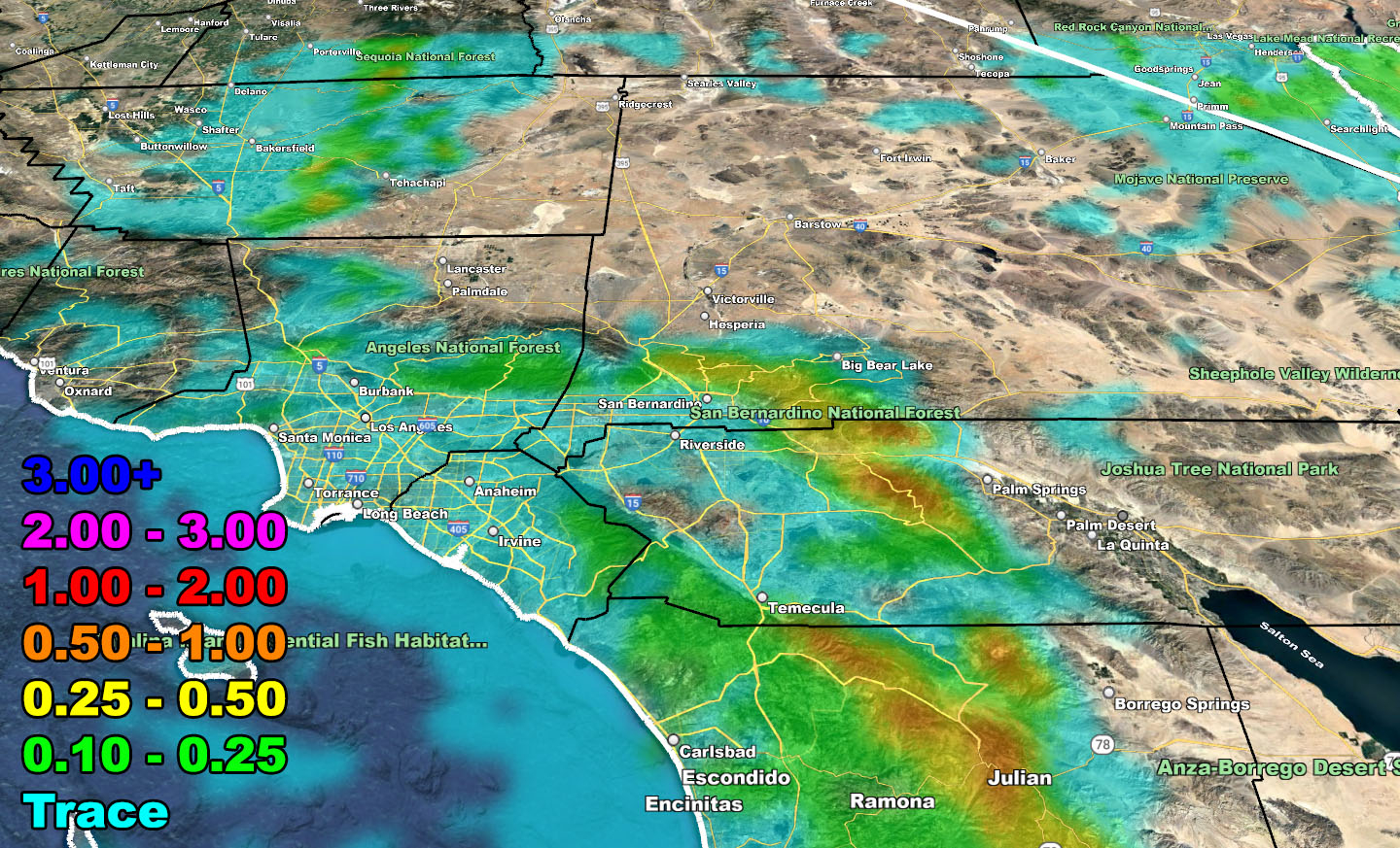
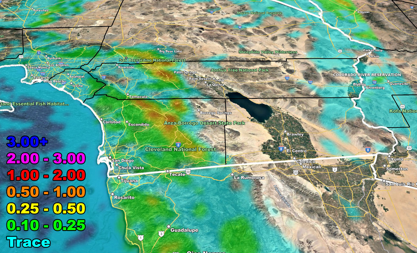
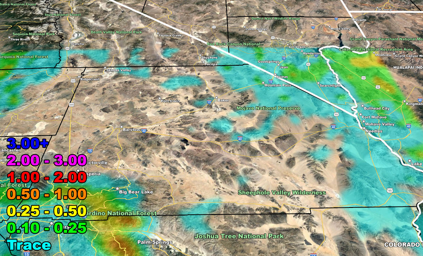
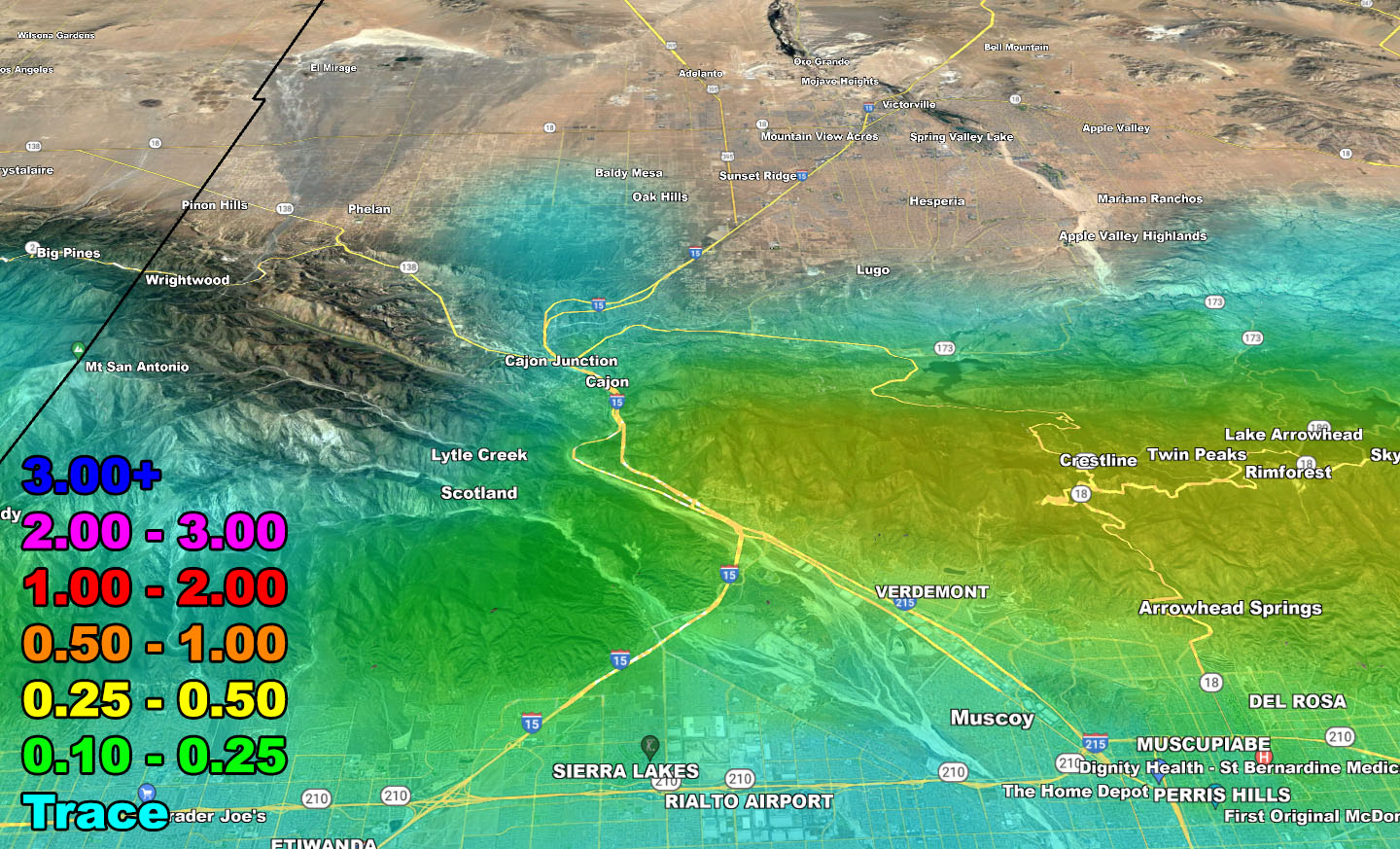
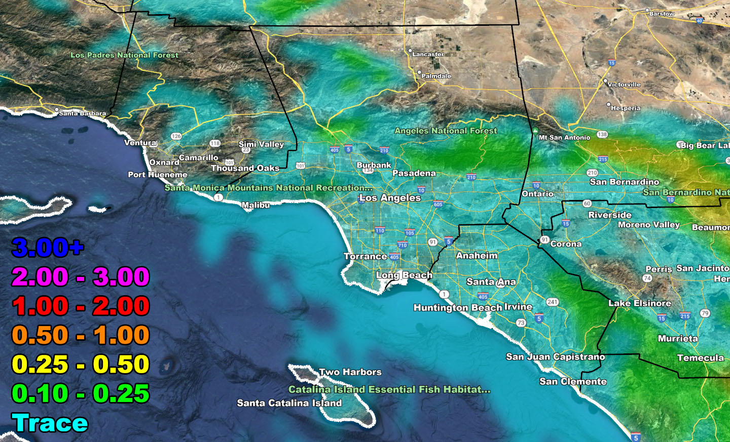
Please use the information below for the SCWF rain and wind models Monday night through Tuesday …
DO NOT FORGET TO LOOK AT THE VALID TIMING IT IS FOR
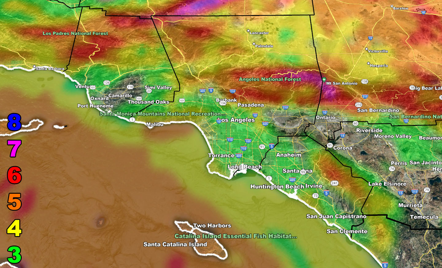
Rain Model – MONDAY NIGHT THROUGH TUESDAY 2-14-2023
SUPPORTING MEMBERS: Click Here To See The GPS Version Of This Model In Your Member Section Tab.
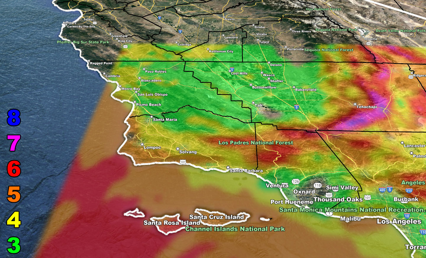
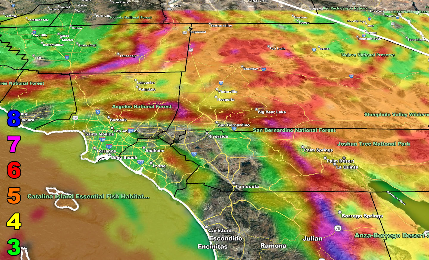
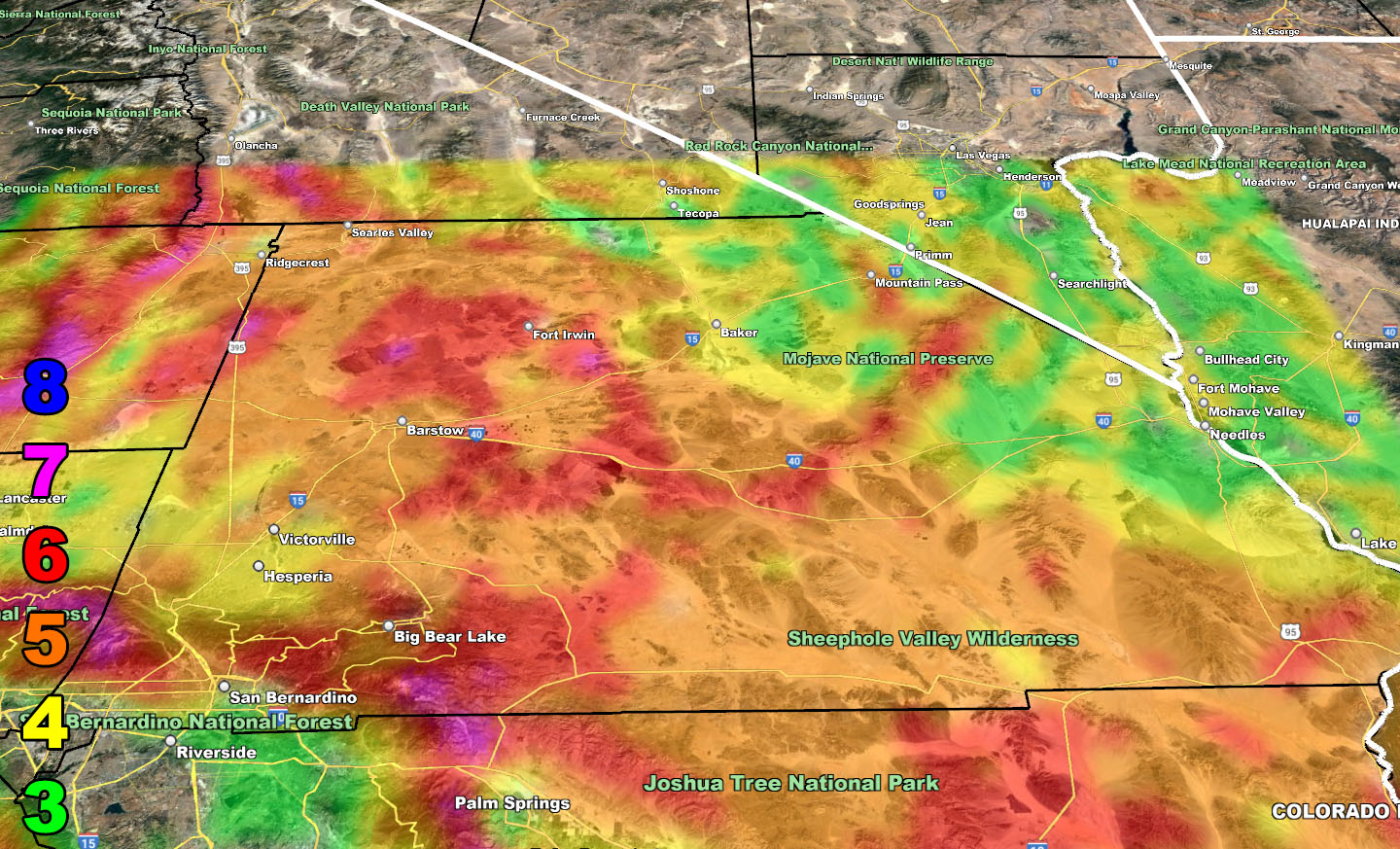
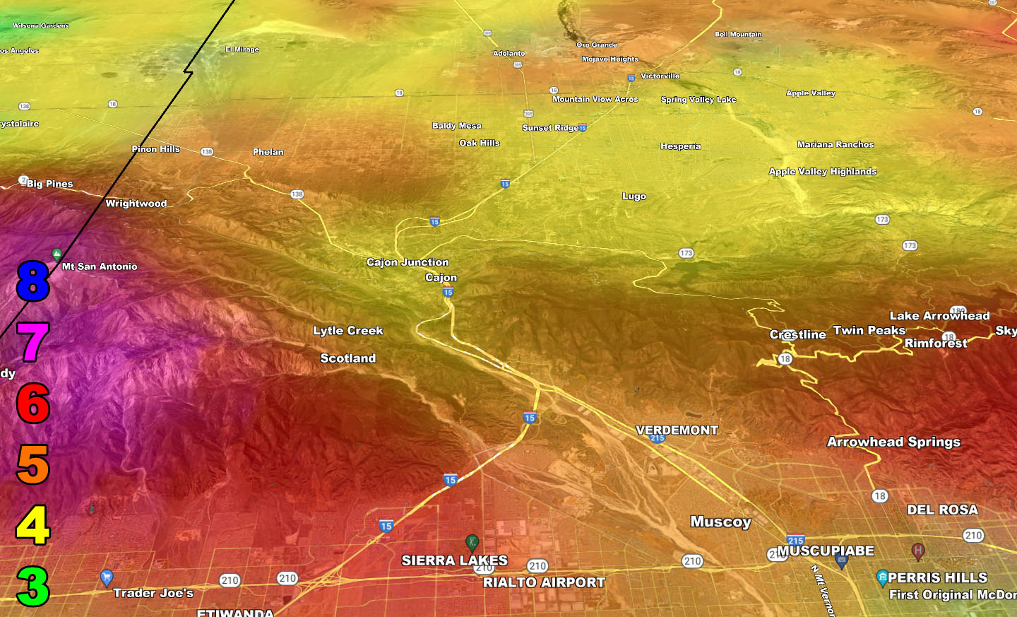
Wind Model – MONDAY NIGHT THROUGH TUESDAY 2-14-2023
SUPPORTING MEMBERS: Click Here To See The GPS Version Of This Model In Your Member Section Tab.
Raiden Storm Wind Gust Intensity Scale –
8. Extensive widespread damage.
7. Trees are broken or uprooted, building damage is considerable. – High Profile Vehicle Roll-Over CERTAIN.
6. SOME Trees are broken or uprooted, building damage is possible. – High Profile Vehicle Roll-Over Likely, Do NOT recommend Traveling in this zone. This zone also is the starting zone where trees and powerlines will fall and damage cars and even kill people near or in them!
5. Slight damage occurs to buildings, shingles are blown off of roofs. HIGH WIND WARNING CRITERIA – High Profile Vehicle Roll-Over Possible if weight is not corrected.
4. Twigs and small branches are broken from trees, walking is difficult.
3. Large trees sway, becoming difficult to walk. POWER SHUTDOWN THRESHOLD DURING FIRE WEATHER / WIND ADVISORY CRITERIA
WANT THESE DELIVERED WITH ALL THOSE PERKS INCLUDING BEING ON THE MICRO-CLIMATE ALERT SYSTEM AND MODELS DURING EVENTS BECAUSE NOT EVERY ALERT IS POSTED ON SOCIAL MEDIA FROM THIS WEATHER OFFICE – JOIN TODAY BY CLICKING HERE – Southern California Weather Force Subscriber System – Southern California Weather Force
Join The Main Southern California Weather Force Facebook Group (50 percent delivery time) – You can join the main SCWF page as well through that group.
Click Here To Join The Page Today