
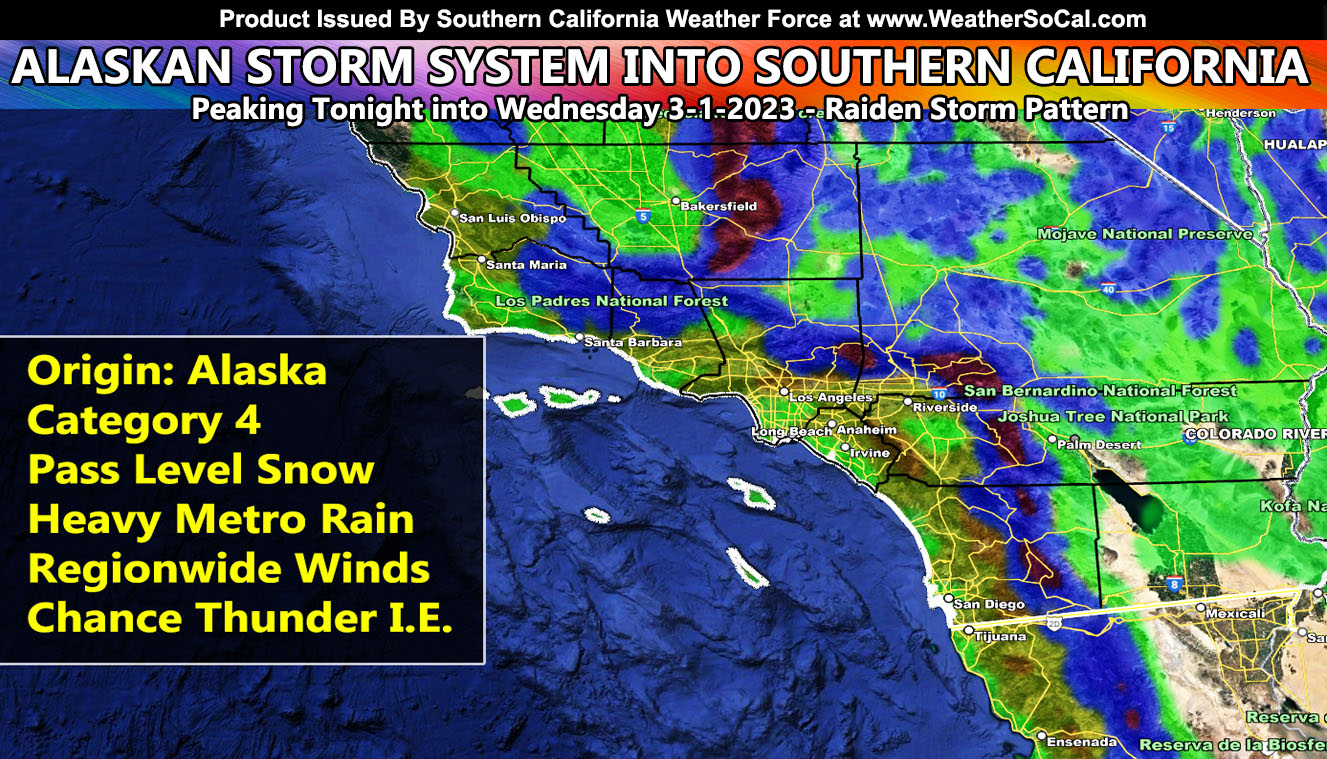
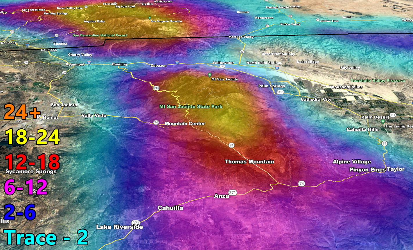
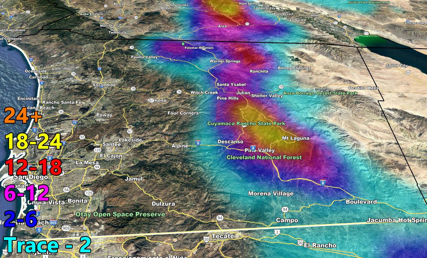
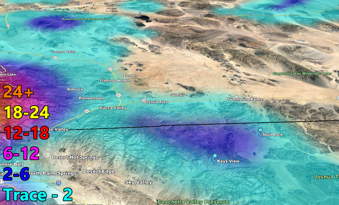
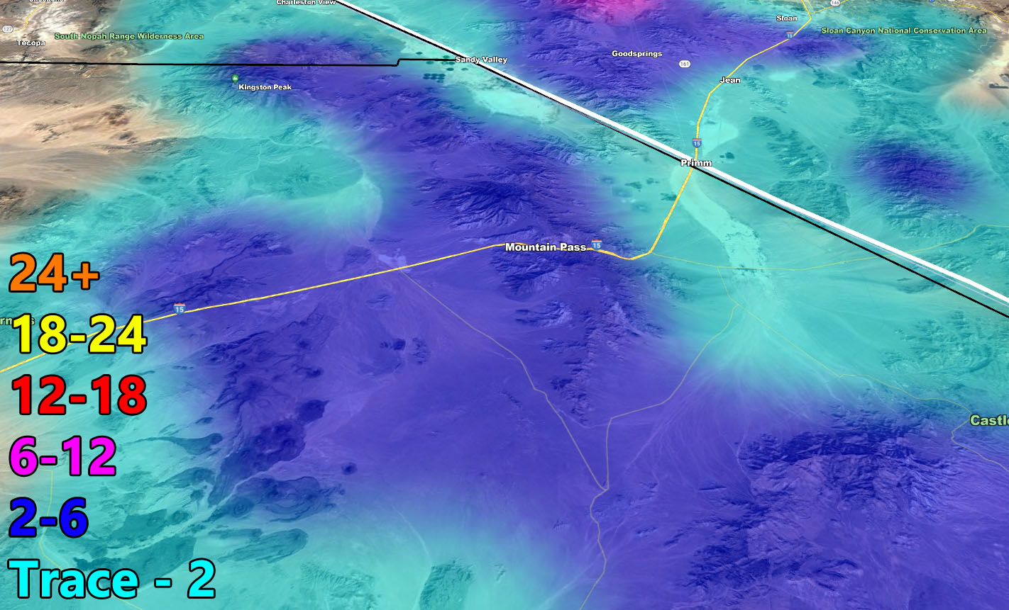
On previous forecasts I stated the current Raiden Storm Pattern would end with one more system on March 1st. That such system will be moving through on a peak between this evening and into Wednesday, bringing renewed mountain and mountain pass snow, along with heavy rain in the metro areas at times. Given the track of this system, regionwide strong winds will also accompany the timeframe. Long Range looks to be shaping up with more storms to come so read on for details and see the rain, snow, and wind maps inside.
Join the Facebook Page for Further Updates If You Have Not Yet!
SOUTHERN CALIFORNIA WEATHER FORCE MAIN:
SPRING 2023 MEMBERSHIP TIER OPEN – WANT THESE DELIVERED WITH ALL THOSE PERKS INCLUDING BEING ON THE MICRO-CLIMATE ALERT SYSTEM AND MODELS DURING EVENTS BECAUSE NOT EVERY ALERT IS POSTED ON SOCIAL MEDIA FROM THIS WEATHER OFFICE – JOIN TODAY BY CLICKING HERE – Southern California Weather Force Subscriber System – Southern California Weather Force
As always with this region, my area of responsibility spans 10 counties so I will be pulling out the focus spots once again and let the maps in the information below speak for your area.
- This system will peak tonight into Wednesday.
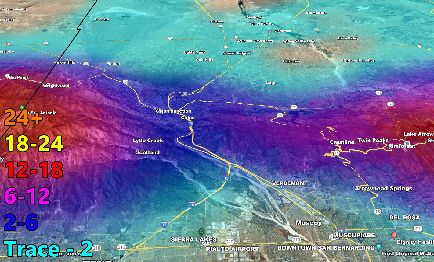
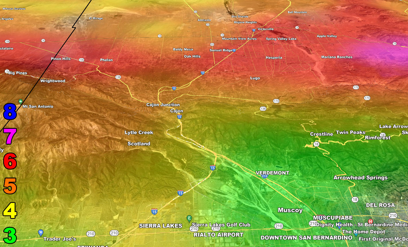
- Mountain Pass snow on Wednesday is likely.
- CHP escorts for Cajon Pass and a Closure of I-5 Grapevine will be the story.
- Areas of flooding for the metros/low elevation zones.
- Gusty winds mountain/deserts today and everywhere else on Wednesday
- Instability and lift promote an Inland Empire Thunderstorm Chance on Wednesday
- A break afterwards, but the start of another storm pattern is around March 5th, light at first and then peaking around March 9th or so. This will be taken care of in a separate article and if a Long-Range Weather Advisory/Warning needs to be issued, it will be. This will be the next Raiden Storm Pattern, or Raiden Storm Pattern of March 2023.
With any-case, please use the information directions below for this storm’s forecast for rain, snow, and wind.
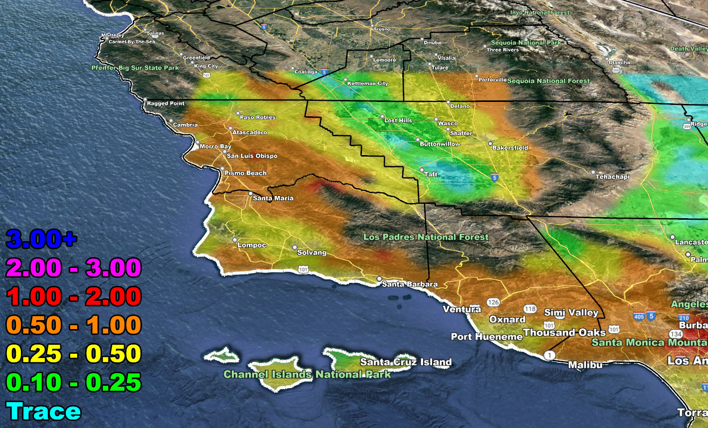
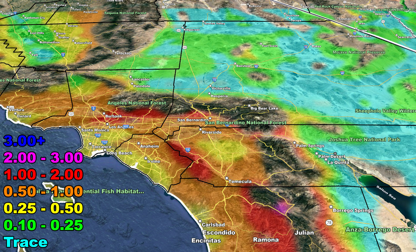
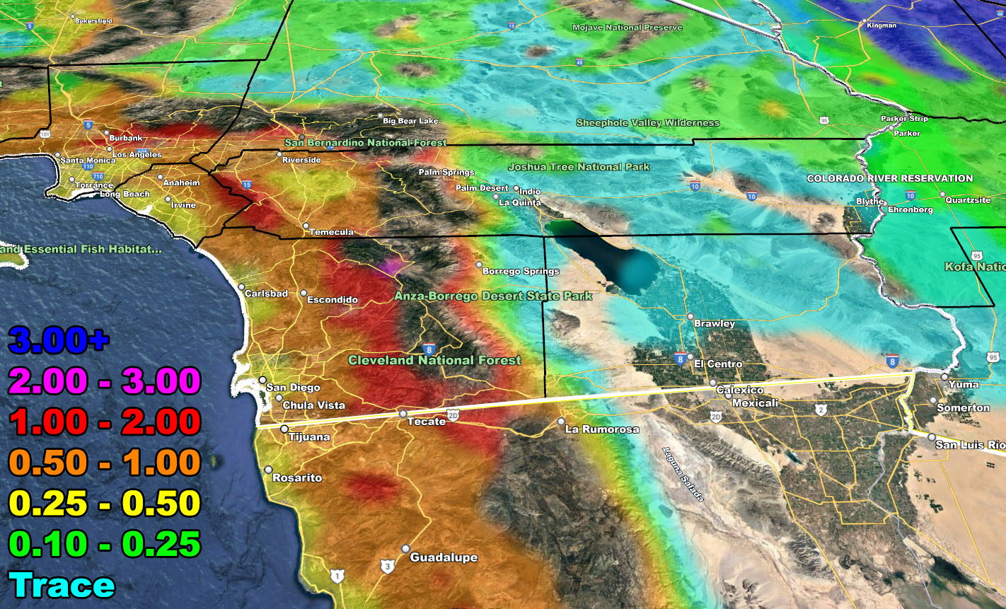
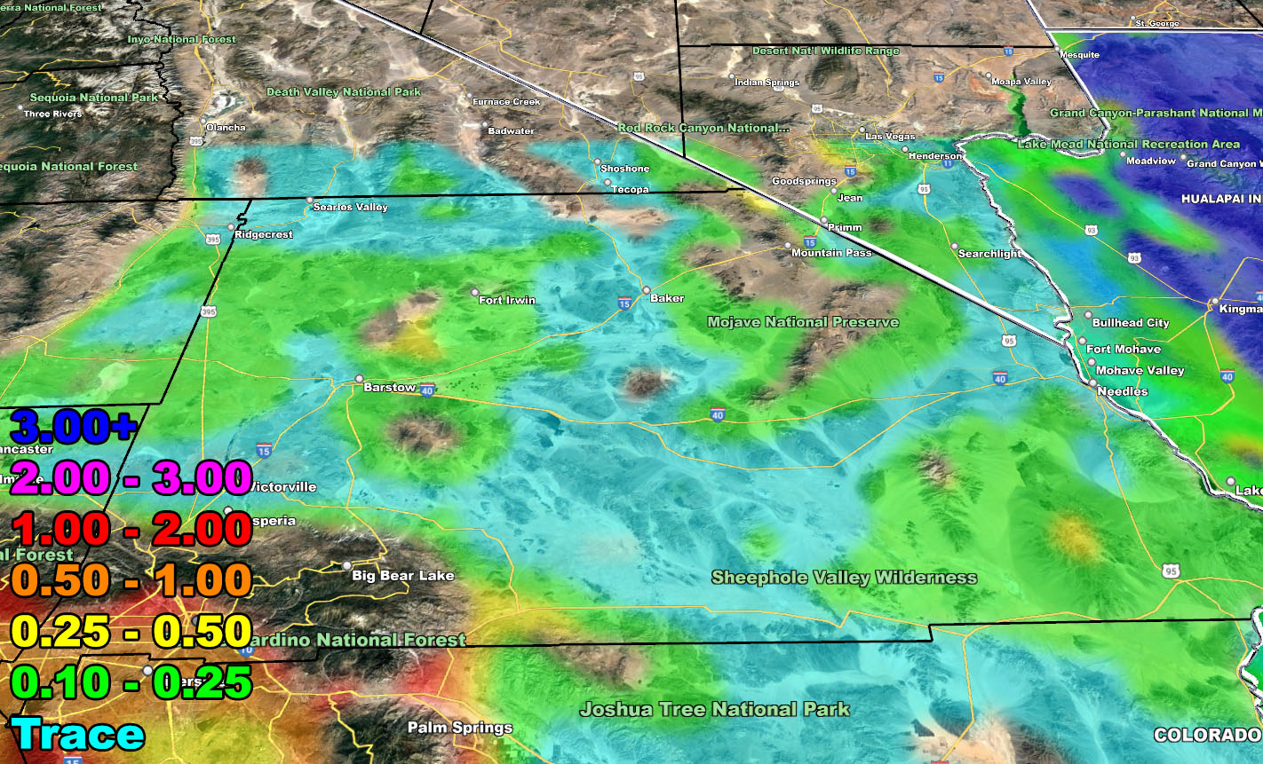
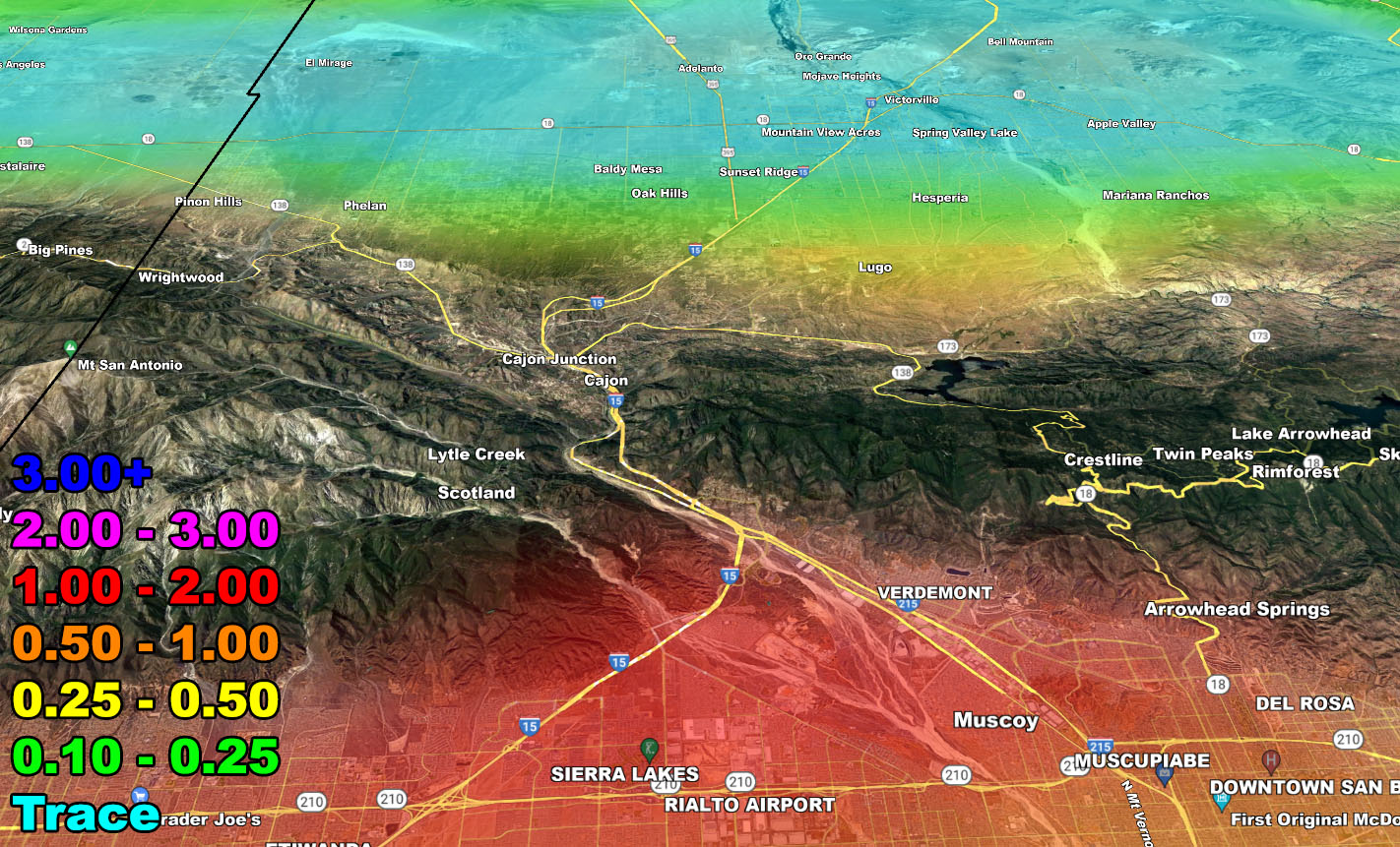
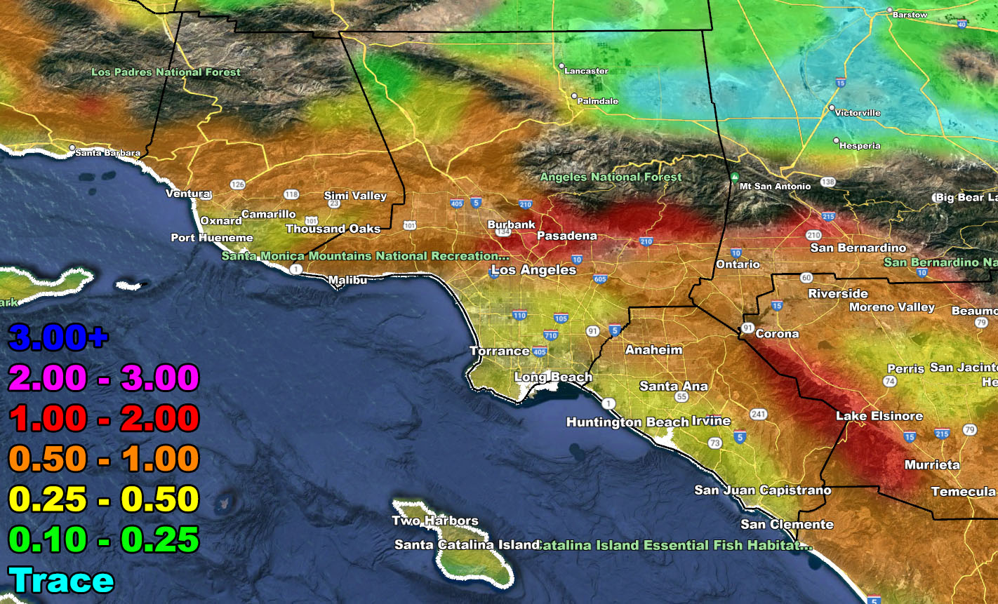
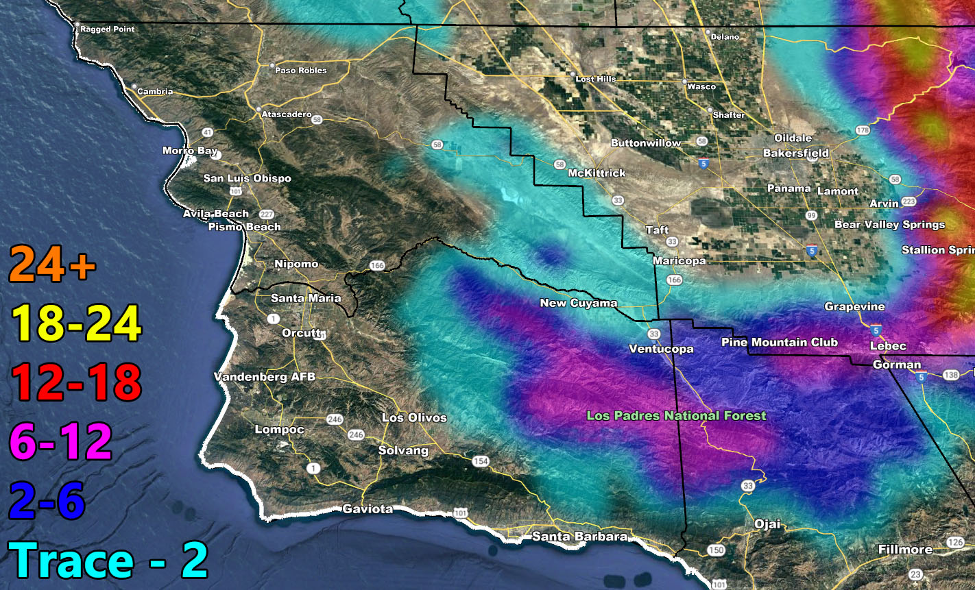
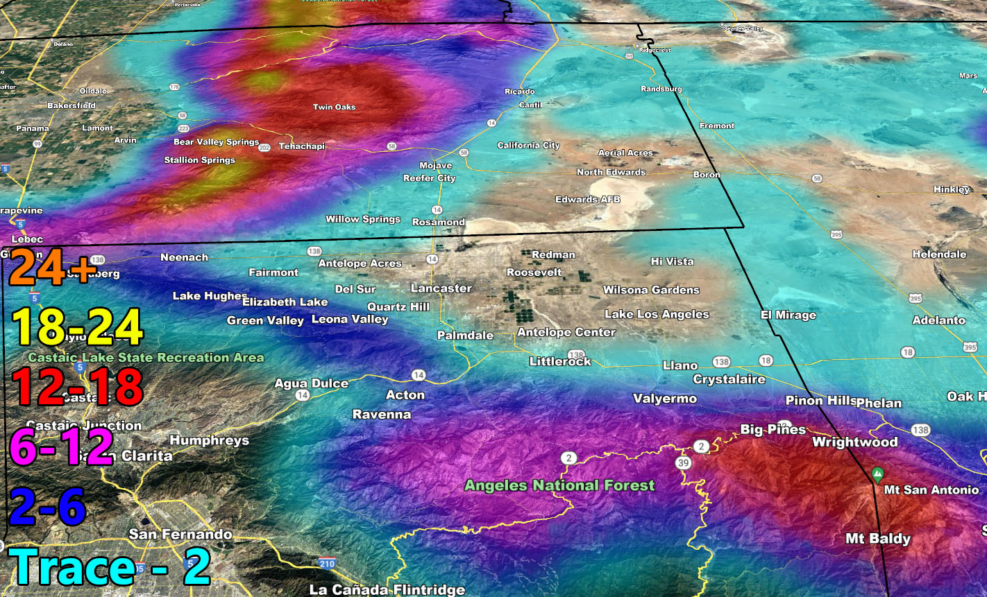
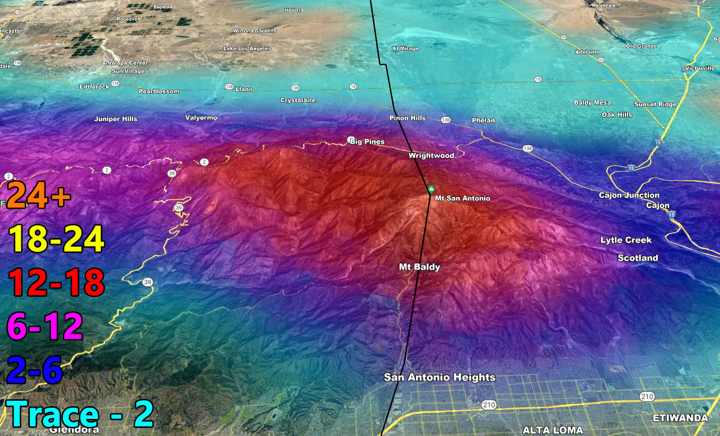
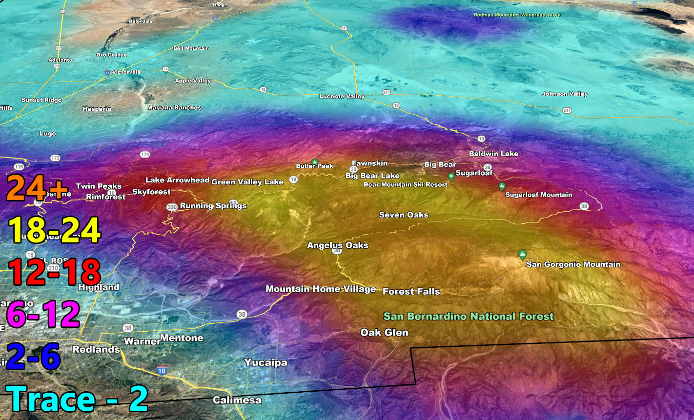
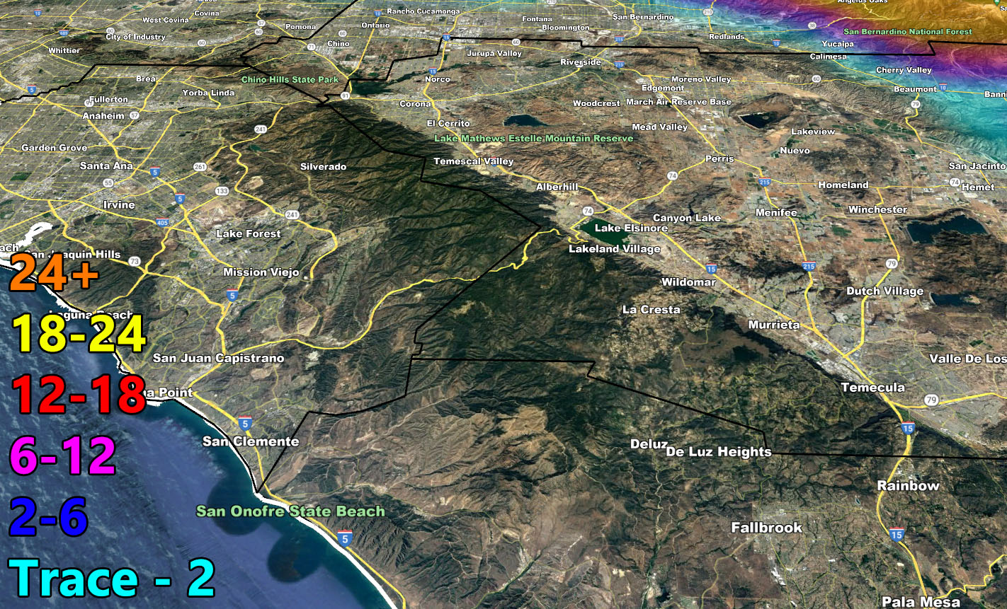
Rain Model – TUESDAY THROUGH WEDNESDAY 3-1-2023
SUPPORTING MEMBERS: Click Here To See The GPS Version Of This Model In Your Member Section Tab.
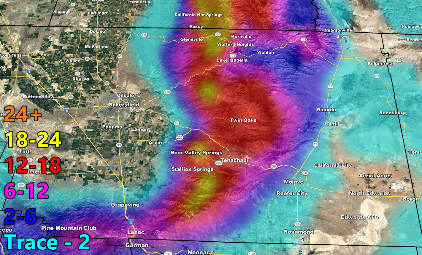
Snow Model – TUESDAY THROUGH WEDNESDAY 3-1-2023
SUPPORTING MEMBERS: Click Here To See The GPS Version Of This Model In Your Member Section Tab.
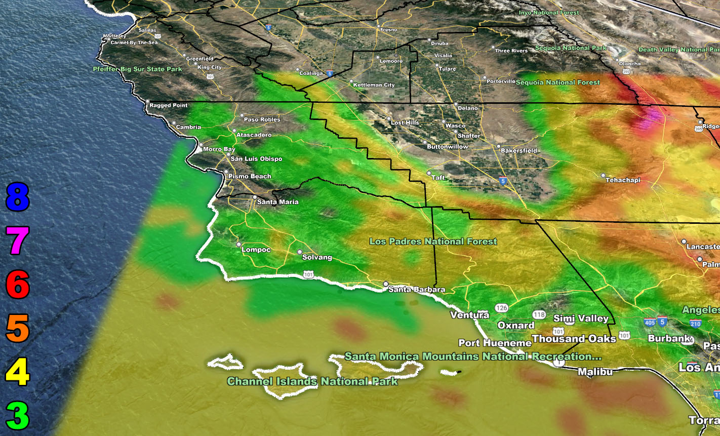
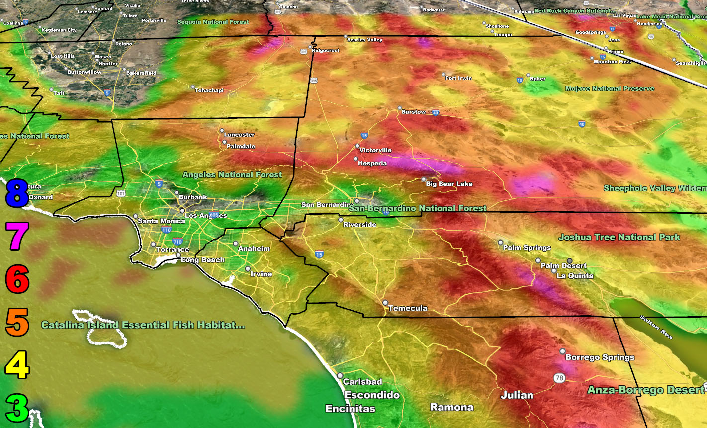
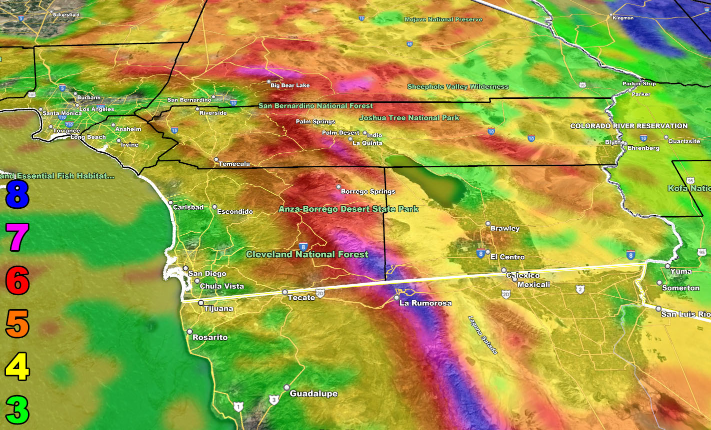
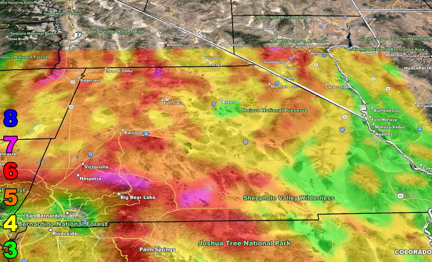
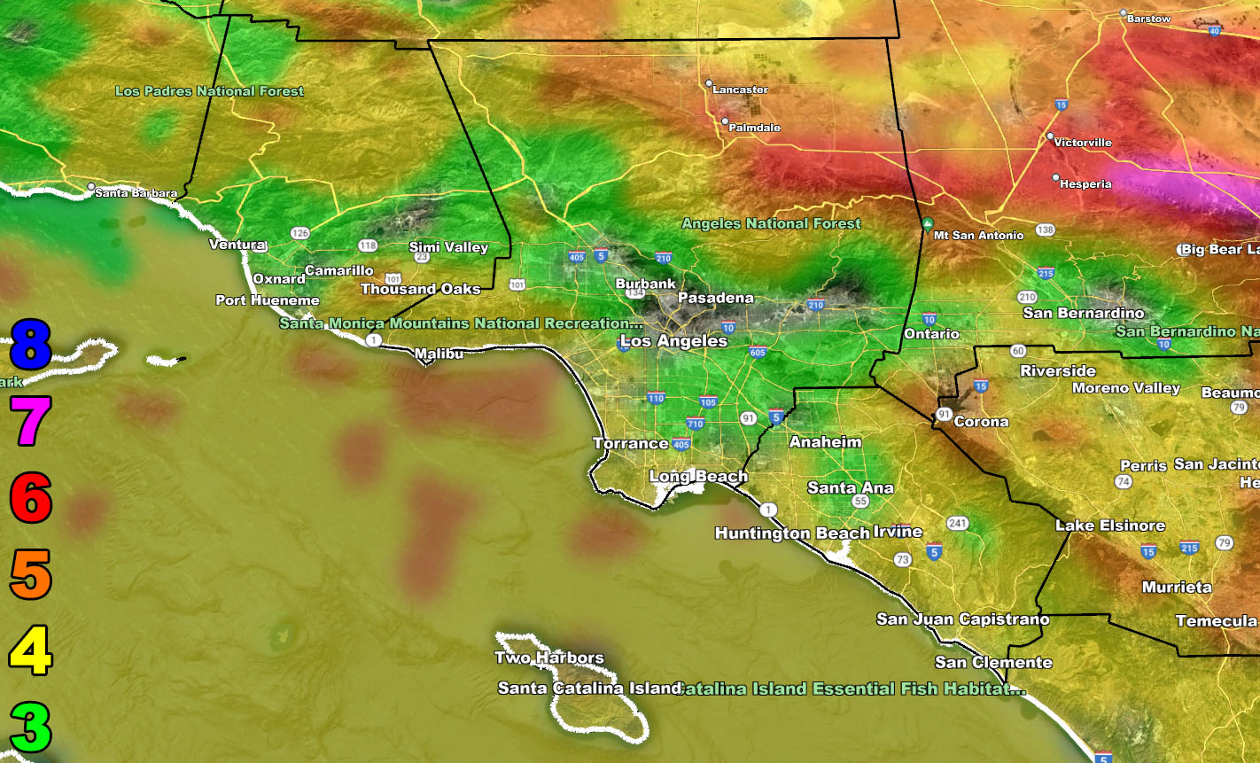
Wind Model – TUESDAY THROUGH WEDNESDAY 3-1-2023
SUPPORTING MEMBERS: Click Here To See The GPS Version Of This Model In Your Member Section Tab.
Raiden Storm Wind Gust Intensity Scale –
8. Extensive widespread damage.
7. Trees are broken or uprooted, building damage is considerable. – High Profile Vehicle Roll-Over CERTAIN.
6. SOME Trees are broken or uprooted, building damage is possible. – High Profile Vehicle Roll-Over Likely, Do NOT recommend Traveling in this zone. This zone also is the starting zone where trees and powerlines will fall and damage cars and even kill people near or in them!
5. Slight damage occurs to buildings, shingles are blown off of roofs. HIGH WIND WARNING CRITERIA – High Profile Vehicle Roll-Over Possible if weight is not corrected.
4. Twigs and small branches are broken from trees, walking is difficult.
3. Large trees sway, becoming difficult to walk. POWER SHUTDOWN THRESHOLD DURING FIRE WEATHER / WIND ADVISORY CRITERIA
Join The Main Southern California Weather Force Facebook Group (50 percent delivery time) – You can join the main SCWF page as well through that group.
Click Here To Join The Page Today