
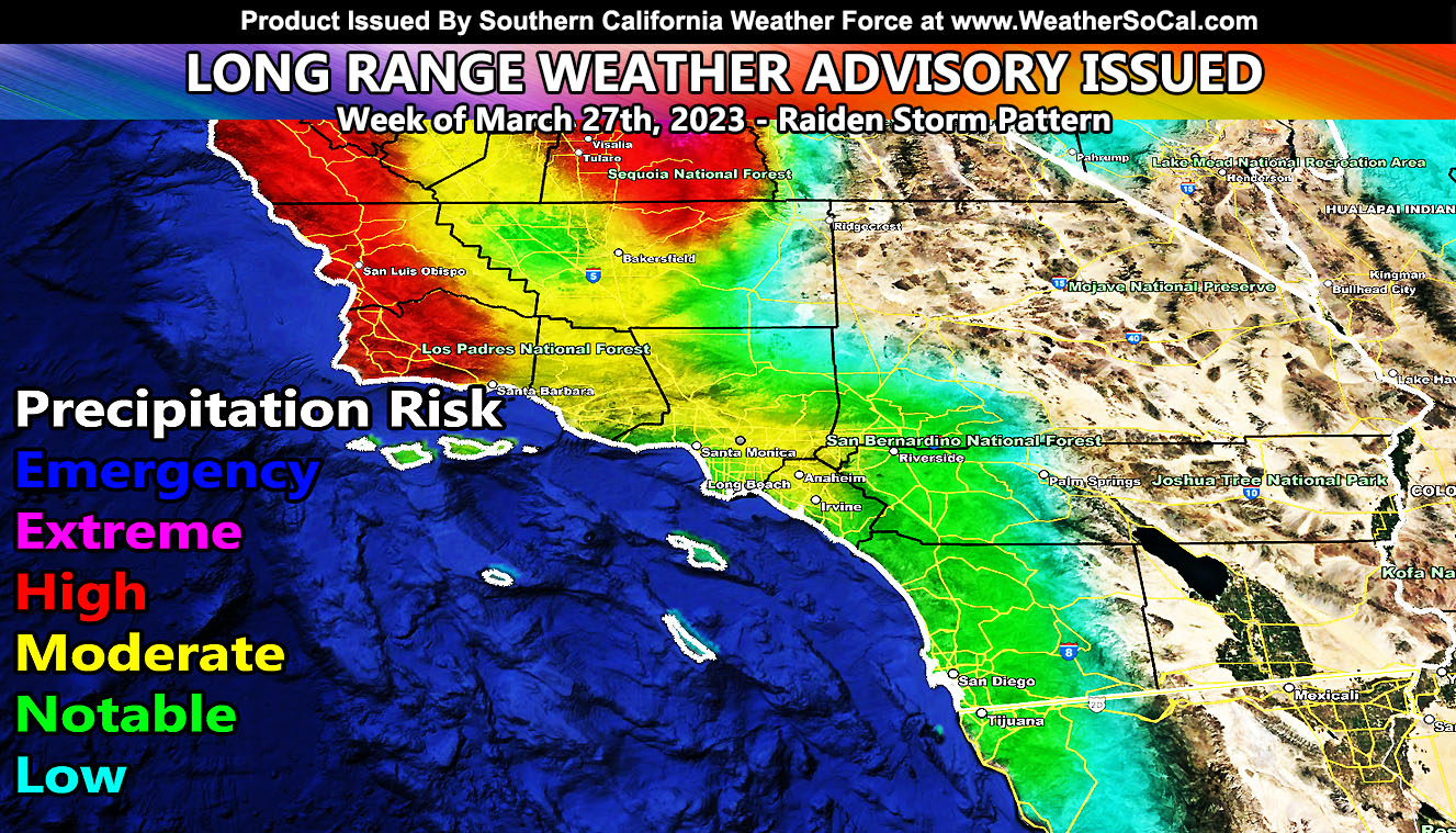
Southern California Weather Force has issued a Long-Range Weather Advisory for the week of March 27th, 2023, as the Pacific Ocean will deliver yet another storm system into the region, continuing to up the rain and snowfall totals. This is a follow-up to the Super Long Range Weather Watch issued by this office on March 18th so read on for details …
Southern California Weather Force models continue to zero in on the next system in the projected series we will get through the rest of this season. On March 18th, an article was released by this weather office claiming the very likelihood that we have around five more storm systems for California before the season finally diminishes and returns to warm and dry conditions, just on time for summer. That article wording can be found by Clicking Here.
As for this advisory. This next system will also be as cold as this one is now. Far End March standards, a snow-level with sticking snow at 4,000 FT and non-sticking down to 3,000 FT is a rare thing to have. But this will happen during the allotted advisory period above. I’m going to center this system around Tuesday night into Wednesday, the 28-29th period on the first cold front moving through. This type of system has a two-part hit with the colder air behind the front by around 12-18 hours so it looks like either Wednesday or Thursday the 30th will be more of a pass-level snow event with the levels I mentioned above. With any case, this system will affect the time period between Tuesday the 28th and Thursday the 30th.
Oh, and for the lower desert, again the best I can say is this just means more strong west winds for you. Sorry …
As the Super Long Range Weather Watch stated, we will get a break for the most part for the first week of April as we get in-between major longwave systems. But there will be more to come as the pattern comes back through April with the continued threat of the Raiden Storm Pattern(s).
El Nino is fast developing and while I do not go with La Nina or El Nino as a 100% what will happen to our area, it is still a factor into my models. The call I made in Fall for a colder/wetter season has far surpassed what has happened during a standard La Nina. While my formulas will always remain secret, I remain to watch the long range unfold.
To see my original 2022-2023 season forecast from Fall, Click here for that – https://www.southerncaliforniaweatherforce.com/2022/10/23/breaking-scwf-2022-2023-seasonal-weather-forecast-released-not-a-normal-la-nina/
SPRING 2023 MEMBERSHIP TIER OPEN – WANT THESE DELIVERED WITH ALL THOSE PERKS INCLUDING BEING ON THE MICRO-CLIMATE ALERT SYSTEM AND MODELS DURING EVENTS BECAUSE NOT EVERY ALERT IS POSTED ON SOCIAL MEDIA FROM THIS WEATHER OFFICE, AND THAT INCLUDES THE GPS MODEL UPDATES – JOIN TODAY BY CLICKING HERE – Southern California Weather Force Subscriber System – Southern California Weather Force
Join the Facebook Page for Further Updates If You Have Not Yet!
SOUTHERN CALIFORNIA WEATHER FORCE MAIN:
Join The Main Southern California Weather Force Facebook Group (50 percent delivery time) – You can join the main SCWF page as well through that group.
Click Here To Join The Page Today