
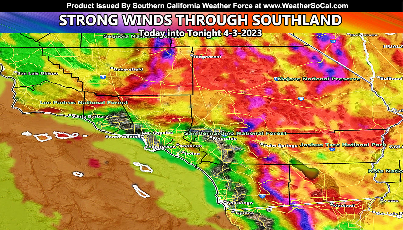
Strong winds are blowing across the mountain and desert areas as an inside slider moves across the region. I am back after a few days mourning period for a loss of a family member so let’s get back to work. Read on for details and see the wind maps …
Join the Facebook Page for Further Updates If You Have Not Yet!
SOUTHERN CALIFORNIA WEATHER FORCE MAIN:
SPRING 2023 MEMBERSHIP TIER OPEN – WANT THESE DELIVERED WITH ALL THOSE PERKS INCLUDING BEING ON THE MICRO-CLIMATE ALERT SYSTEM AND MODELS DURING EVENTS BECAUSE NOT EVERY ALERT IS POSTED ON SOCIAL MEDIA FROM THIS WEATHER OFFICE – JOIN TODAY BY CLICKING HERE – Southern California Weather Force Subscriber System – Southern California Weather Force
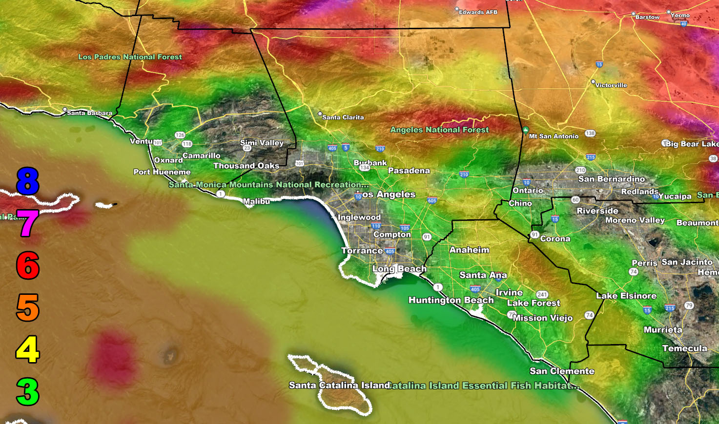
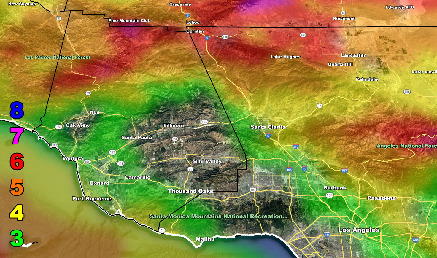
A strong 150 mph upper jet stream is leaving Southern California with a strong west to east flow. Recommending today not to travel in the bight (Island Region) as these winds will be gale force or higher. The Mountain and Desert regions have already started their winds, but they will fast move southward into all metro areas as today moves along.
The Raiden Storm Wind Intensity Models have been released and you may view the information below. While it may seem no value for LAX is showing up, those that live there will feel as if it is advisory level due to it not being too common.
Winds this afternoon/evening/night through the metros will shift from west to east to a more northwest to southeast approach, which is why coming down I-5 through Los Angeles and into Orange County’s interior will also have these advisory level winds. It is very possible this will prevent Disneyland from setting off fireworks due to wind direction and speed from the castle.
The winds will wan by Tuesday morning.
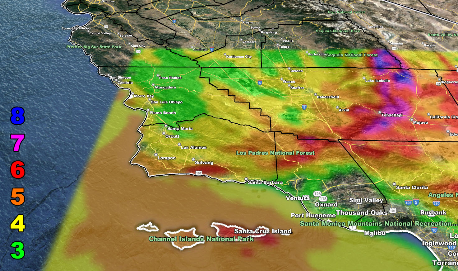
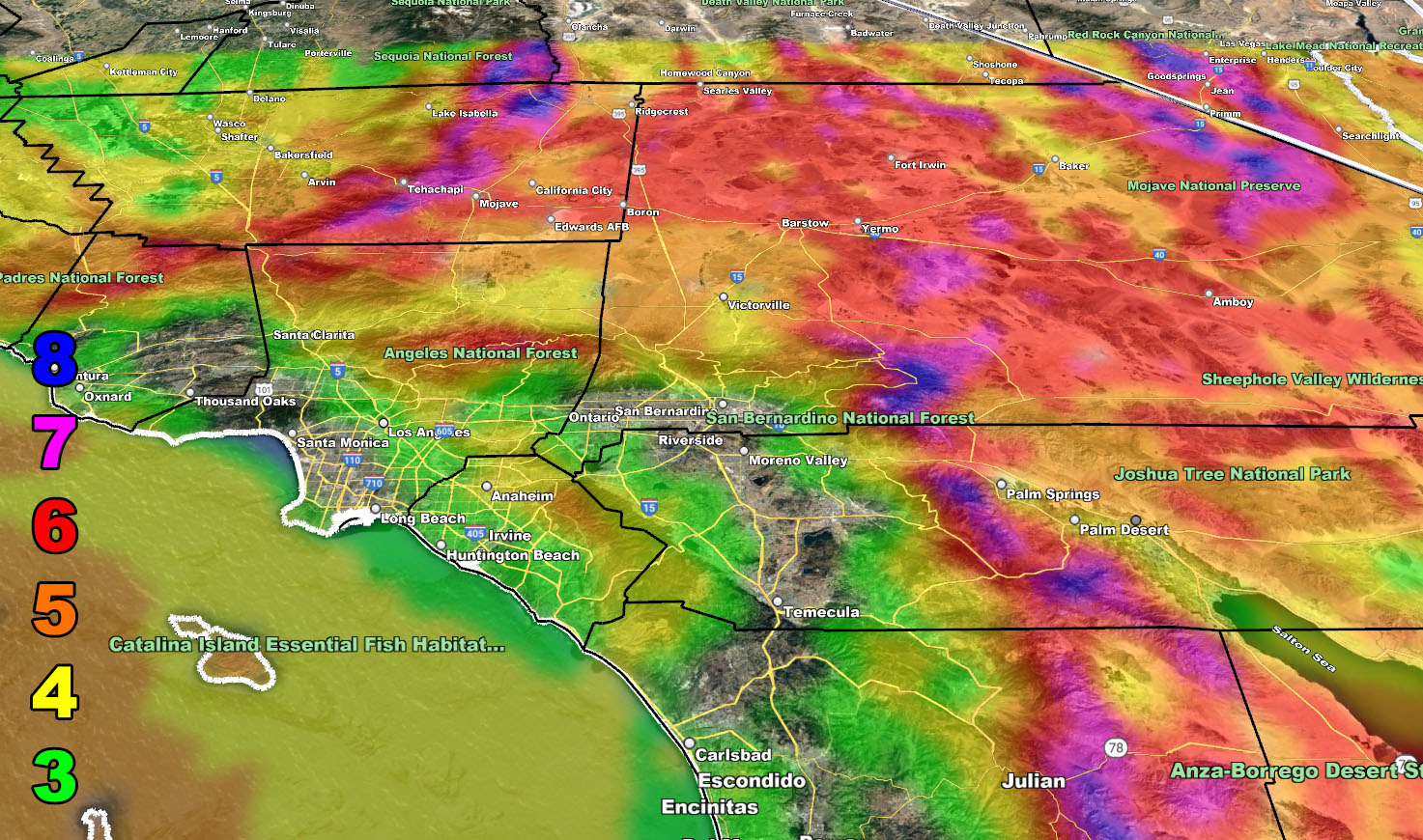
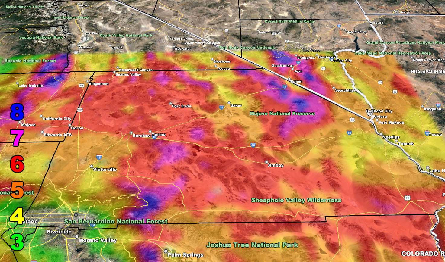
Wind Model – TODAY INTO TONIGHT – 4-3-2023
SUPPORTING MEMBERS: Click Here To See The GPS Version Of This Model In Your Member Section Tab.
Raiden Storm Wind Gust Intensity Scale –
8. Extensive widespread damage.
7. Trees are broken or uprooted, building damage is considerable. – High Profile Vehicle Roll-Over CERTAIN.
6. SOME Trees are broken or uprooted, building damage is possible. – High Profile Vehicle Roll-Over Likely, Do NOT recommend Traveling in this zone. This zone also is the starting zone where trees and powerlines will fall and damage cars and even kill people near or in them!
5. Slight damage occurs to buildings, shingles are blown off of roofs. HIGH WIND WARNING CRITERIA – High Profile Vehicle Roll-Over Possible if weight is not corrected.
4. Twigs and small branches are broken from trees, walking is difficult.
3. Large trees sway, becoming difficult to walk. POWER SHUTDOWN THRESHOLD DURING FIRE WEATHER / WIND ADVISORY CRITERIA


Join The Main Southern California Weather Force Facebook Group (50 percent delivery time) – You can join the main SCWF page as well through that group.
Click Here To Join The Page Today