
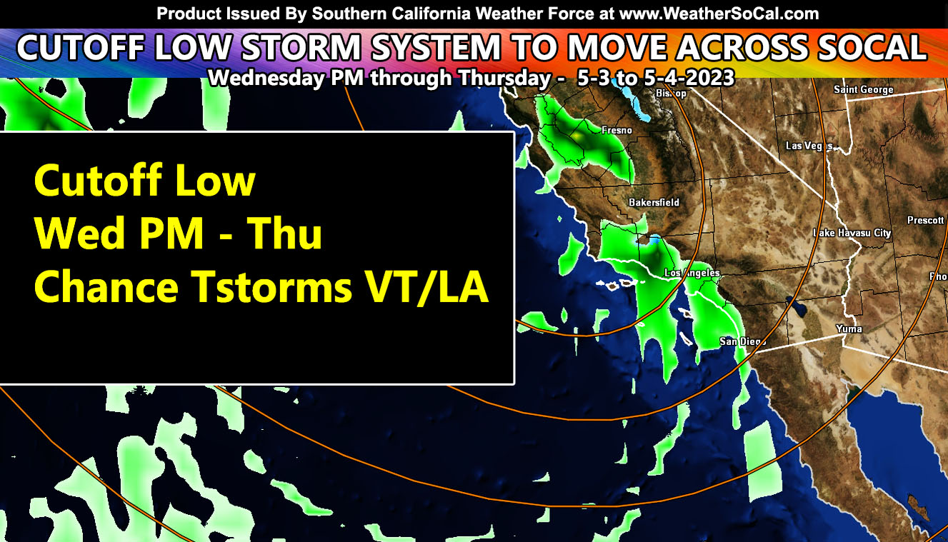
A storm system that is west of San Francisco today will move down the coast, just offshore for the next 30 hours and then move into the Southern California coastal regions overnight on Wednesday and into Thursday.
The system is causing thunderstorms in Central and Northern California today. The system is expected to rotate into the Southern California Weather Force jurisdiction later Wednesday, maximizing Thursday morning. The system is not a very powerful one, but due to the fact that some urban street flooding will be with it for the metros of Santa Barbara, Ventura, and Los Angeles County, the system is of moderate strength potential.
The upper-level divergence (lift) section of the front will target those three counties mentioned above on Thursday. Thunderstorm dynamics are available with it in those zones.
Snow-levels with the system will be enough for some snowfall in the Big Bear Lake areas. A snow-level projected around 5,000 FT will be the story, due to May having high sun angles.
Final rain and snowfall maps will be available tomorrow by 11am, along with any weather advisory and/or thunderstorm watch that needs to be issued, which looks to center Ventura and Los Angeles County as storms come from offshore.