
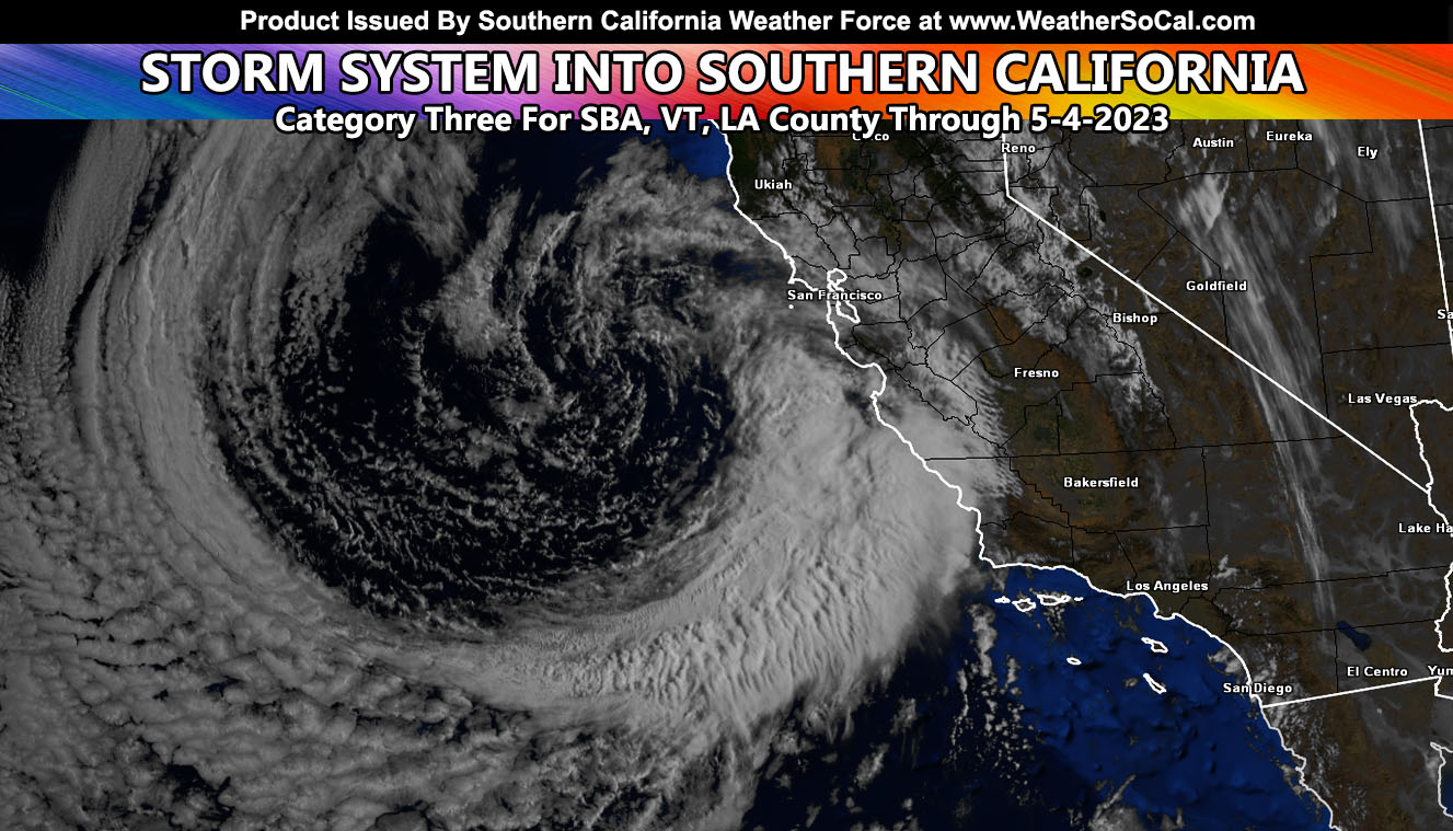
On previous live forecasts, May 4th would be the center of the next storm system, which is currently moving toward the forecast area after having affected areas up north yesterday. This system will target Los Angeles County, Ventura County, and Santa Barbara County with the highest amount of rainfall and thunderstorm risks. I’ve issued a Thunderstorm Watch for these areas and for further details on rain, snow, and wind forecasts, read on …
Southern California Weather Force has issued a Thunderstorm Watch effective between 10pm tonight and early Thursday morning for Los Angeles, Ventura, and Santa Barbara County.
A storm system west of California will rotate into Southern California overnight tonight, mainly on Thursday morning. A frontal zone associated with the system will move from west to east, maximizing across Los Angeles, Ventura, and Santa Barbara County, as far west as Vandenberg Space Force Base.
Upper-level divergence (lift) with the system will look to move over all sectors of the watch area. In addition to the lightning threat, a Flood Advisory is also in effect here at Southern California Weather Force. Hail and funnel clouds will accompany the system.
Join the Facebook Page for Further Updates If You Have Not Yet!
SOUTHERN CALIFORNIA WEATHER FORCE MAIN:
As always with this region, my area of responsibility spans 10 counties so I will be pulling out the focus spots once again and let the maps in the information below speak for your area.
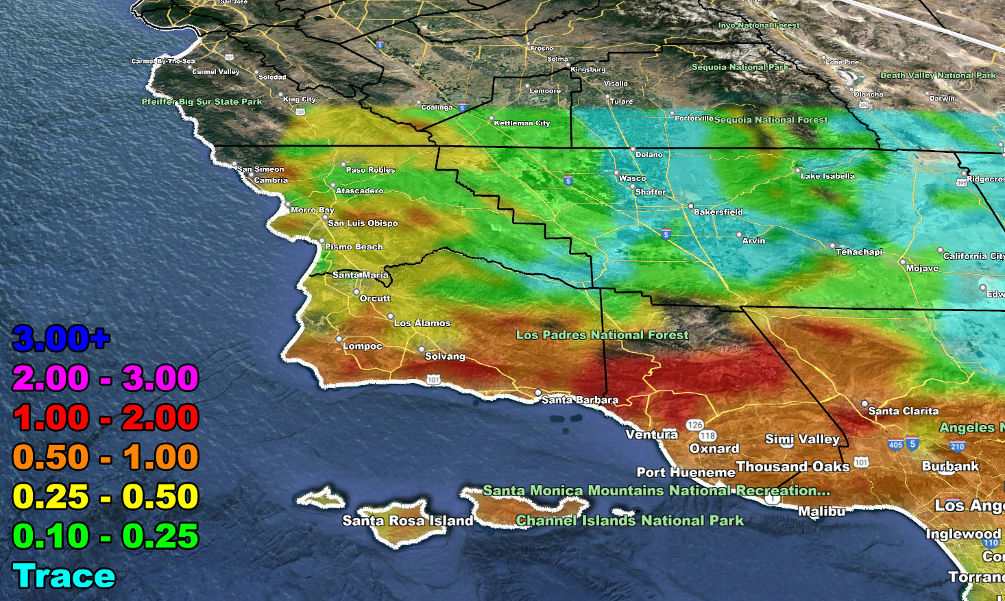
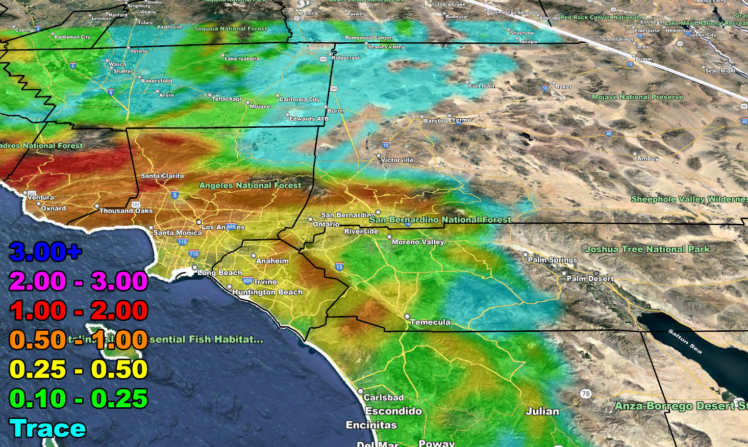
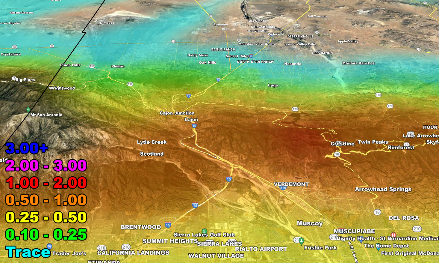
- This system will peak tonight into Thursday.
- Snow-Levels will be around 5,000 FT, not affecting the main mountain passes.
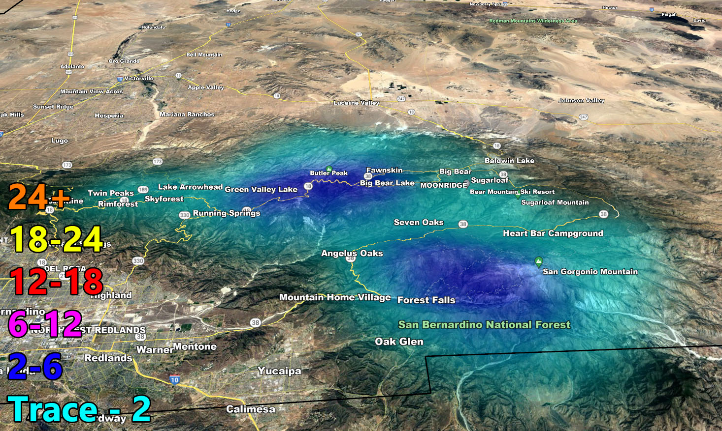
- Areas of urban street flooding for Santa Barbara, Ventura, Los Angeles County.
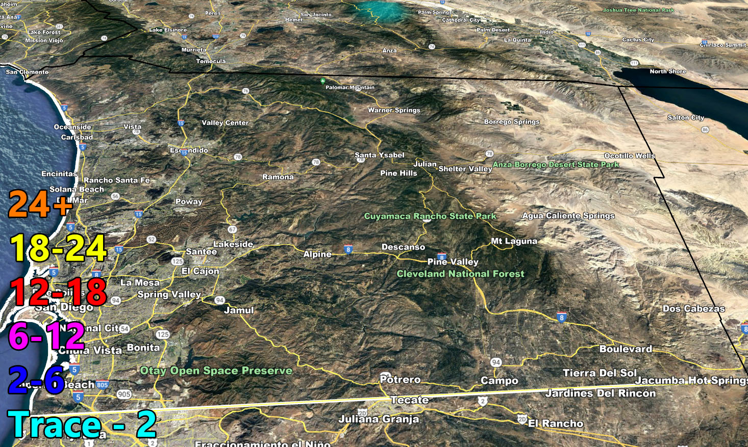
- San Diego will not see heavy rainfall or amounts with this system.
- Gusty winds mountain/deserts today through Thursday morning the strongest along I-8 in Imperial County at 50 mph.
- Instability and lift promote thunderstorm chances for Santa Barbara, Ventura, and Los Angeles County.
- We have yet another break, but we should squeeze another system in the area between May 15th and May 22nd as a window.
With any-case, please use the information directions below for this storm’s forecast for rain, snow, and wind.
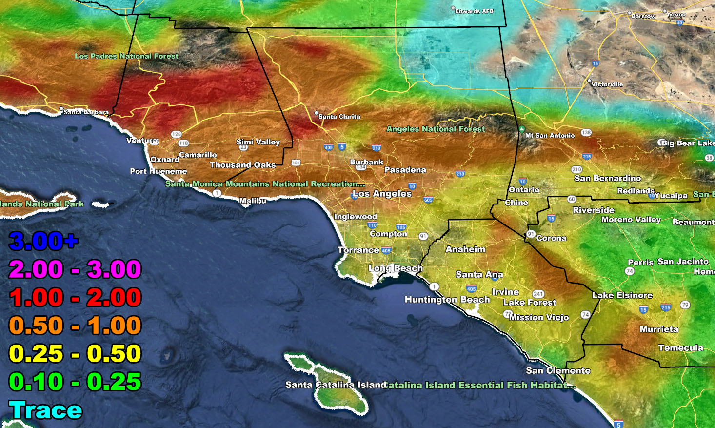
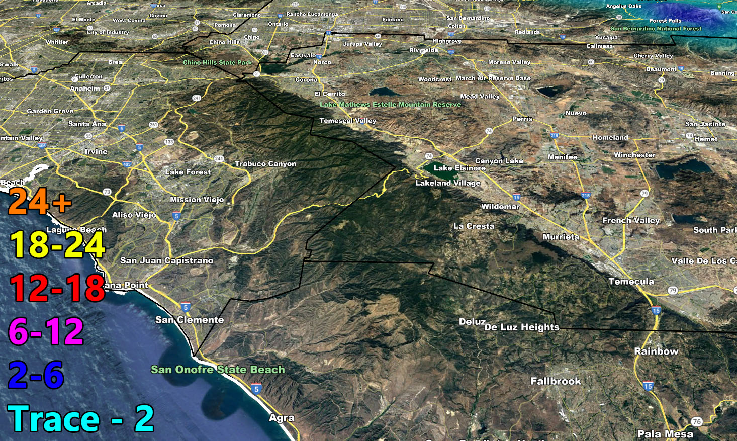
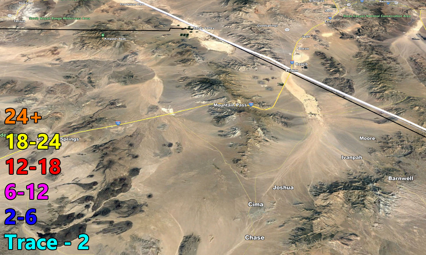
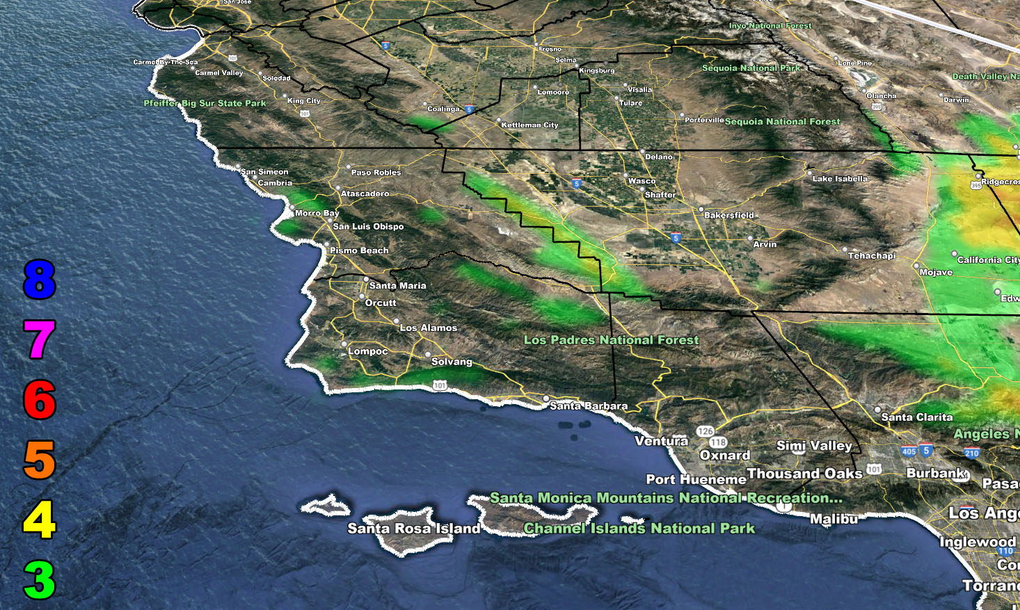
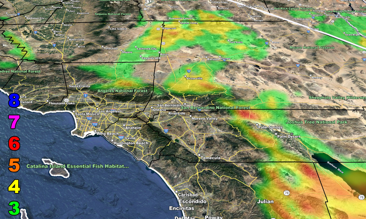
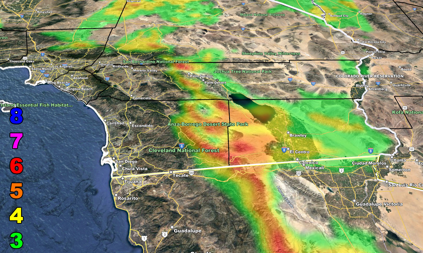
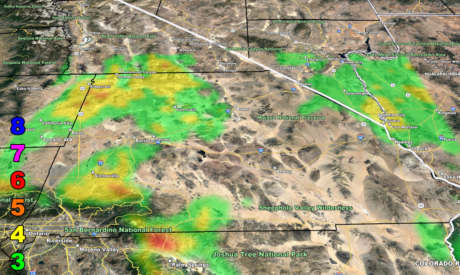
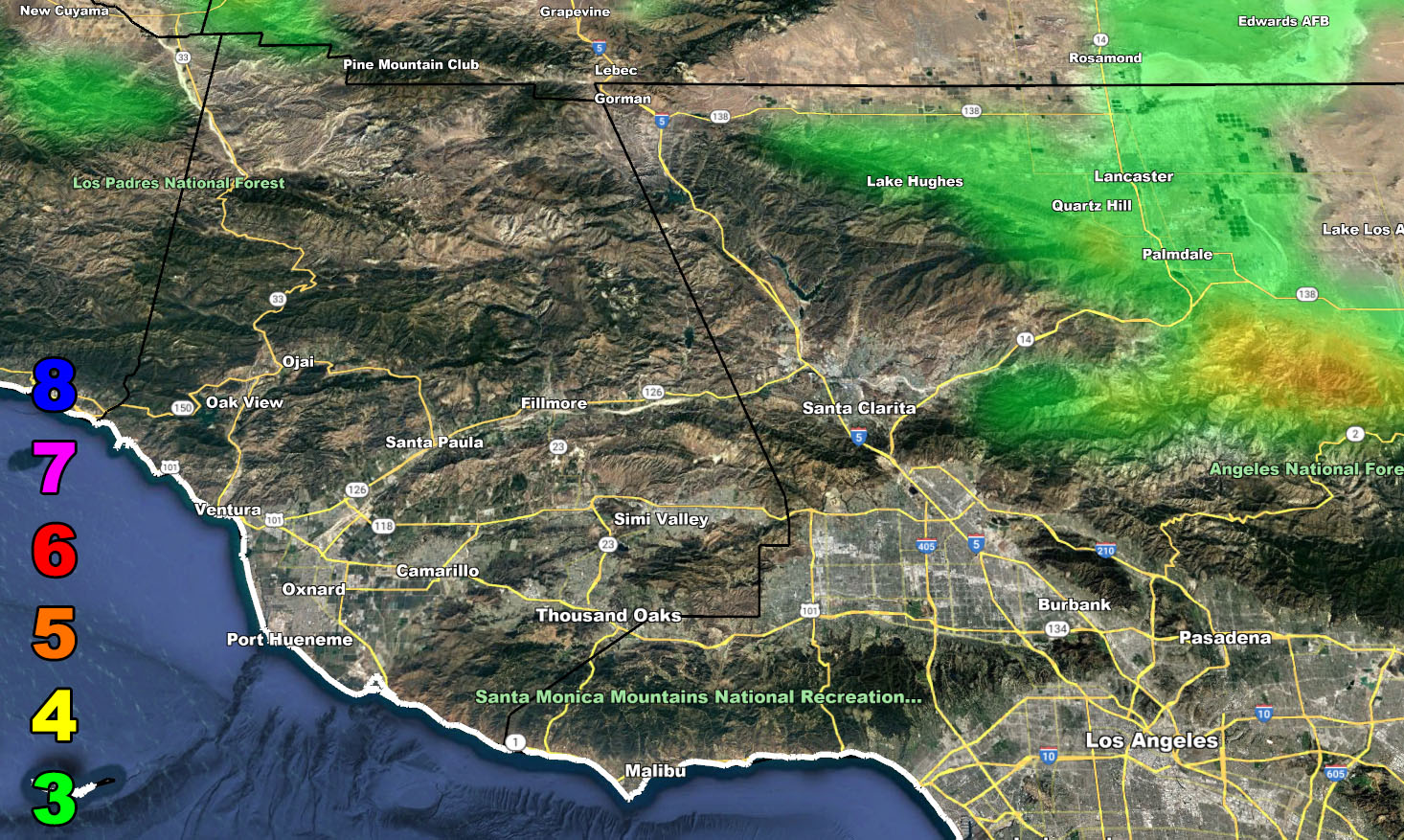
Rain Model – TONIGHT THROUGH THURSDAY 5-4-2023
SUPPORTING MEMBERS: Click Here To See The GPS Version Of This Model In Your Member Section Tab.


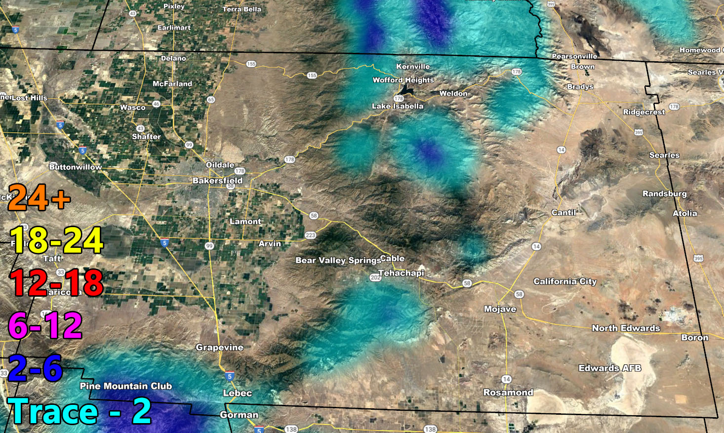
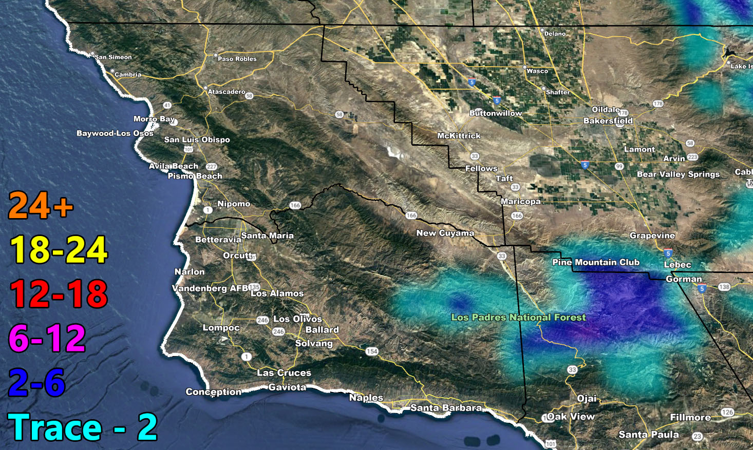
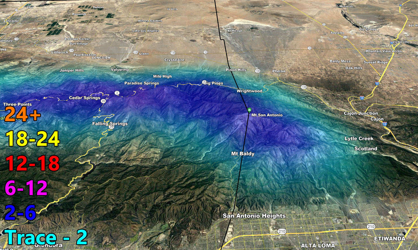
Snow Model – TONIGHT THROUGH THURSDAY 5-4-2023
SUPPORTING MEMBERS: Click Here To See The GPS Version Of This Model In Your Member Section Tab.


Wind Model – THIS EVENING THROUGH THURSDAY MORNING – 5-4-2023
SUPPORTING MEMBERS: Click Here To See The GPS Version Of This Model In Your Member Section Tab.
Raiden Storm Wind Gust Intensity Scale –
8. Extensive widespread damage.
7. Trees are broken or uprooted, building damage is considerable. – High Profile Vehicle Roll-Over CERTAIN.
6. SOME Trees are broken or uprooted, building damage is possible. – High Profile Vehicle Roll-Over Likely, Do NOT recommend Traveling in this zone. This zone also is the starting zone where trees and powerlines will fall and damage cars and even kill people near or in them!
5. Slight damage occurs to buildings, shingles are blown off of roofs. HIGH WIND WARNING CRITERIA – High Profile Vehicle Roll-Over Possible if weight is not corrected.
4. Twigs and small branches are broken from trees, walking is difficult.
3. Large trees sway, becoming difficult to walk. POWER SHUTDOWN THRESHOLD DURING FIRE WEATHER / WIND ADVISORY CRITERIA


Join The Main Southern California Weather Force Facebook Group (50 percent delivery time) – You can join the main SCWF page as well through that group.
Click Here To Join The Page Today