
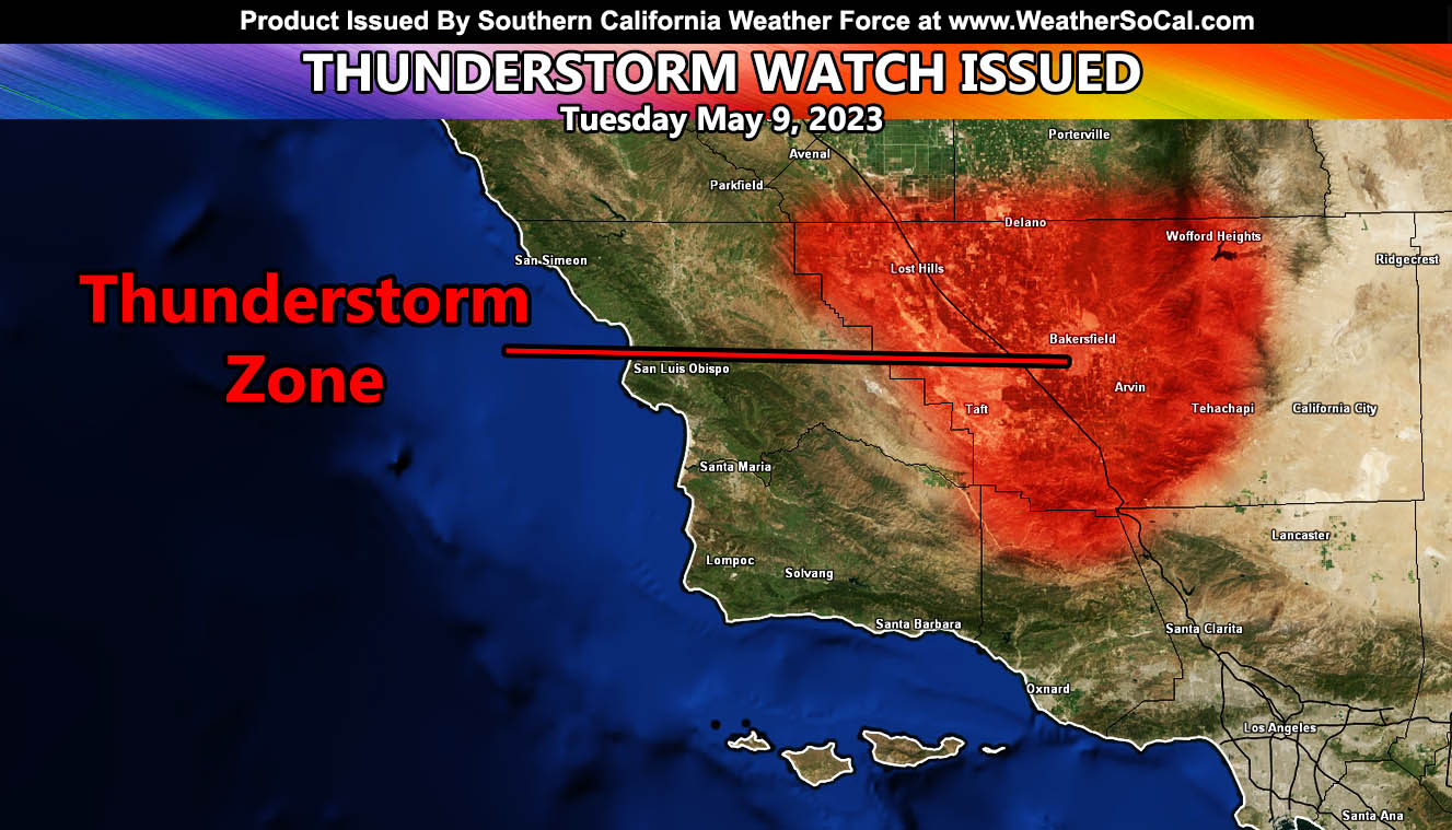
Southern California Weather Force has issued a Thunderstorm Watch effective from this afternoon until midnight tonight, effective for Kern County at the center of the watch, including Bakersfield and the Kern County Mountain zones.
A cutoff low that will slide south of the forecast area will bring the risk of thunderstorms for Kern County. Instability is expected to develop by this afternoon and evening, with the upper-level lifting zone moving into the region as well. As this happens, rapid moisture influx will bring precipitation to the area. The highest precipitation amounts will be the Gorman Pass through the Kern County Mountains, including Tehachapi where up to a half inch or more is expected.
In addition to the lightning, some hail and strong winds will accompany the storm as well as funnel clouds due to the cold air aloft.
ELSEWHERE: Since SCWF has 10 counties under the jurisdiction across Southern California, this same system will also bring a bit of rainfall for areas inland for LA/OC/SD and the IE, including the surrounding mountain areas this evening through Wednesday morning. No snow is expected … but since the tree pee rain will not be strong, any forecast alerts other than Kern County will not go out. We also will have gusty west to east winds in all mountain and desert areas …