
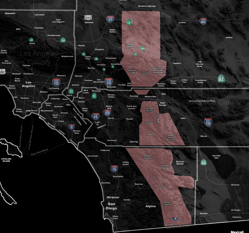
Issued Zones: Lucerne Valley … Eastern San Bernardino Mountains … Riverside and San Diego Mountains …
Site: Southern California Weather Force has issued a Thunderstorm Watch, effective this afternoon until 6pm …
Date Issued: 5/18/23 at 9:45am local
Forecast: Mid-level moisture in a similar onset of the monsoon will be in the area today. A convergence boundary stretching from Lucerne Valley south through the San Bernardino, Riverside, and San Diego Mountains will bring showers and thunderstorms today, between noon and 6pm, ending before sunset as a loss of heating occurs.
10 mile rule: These alerts issued on this site means that within your zone and 10 miles from you will see the event forecast for. You may or may not see the event but it means you are in the zone or 10 miles from where someone will.
Southern California Weather Force is a custom weather alert service that began in September 1999 off and is regarded as the most accurate weather service in the region, offering custom alerts, maps, and models to help save life and property. The work done here is never 100% accurate, but it comes pretty close. Southern California Weather Force runs on zones, so if an event happens in a zone that is 10 miles from the border of your zone, the forecast is still valid to activate your zone’s alert system. A company quote to the public is that of “The Joker” and tells other agencies in weather this all the time… “This world deserves a better class of meteorologist… and I’m gonna give it to them”… out-forecasting even the National Weather Service with lead-time and precision, which makes this service a focus of ridicule and envy in the weather community due to having such accuracy. Alerts issued here are issued custom from this office and this office alone. You may not even hear it elsewhere, but if one is issued near or in your area, listen up because “if you do not wish to die in weather, follow, it’ll save your life one day.”