
Southern California Weather Force has issued a Long-Range Weather Advisory for increasing Eastern Pacific Hurricane activity that will eventually affect Southern California with showers and thunderstorms.
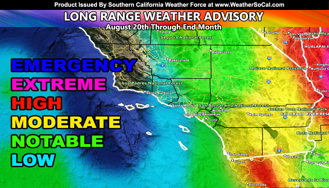
For a week now, the long-range risk assessment model has shown activity after August 20th until the end of the month. This is in direct response to a large hurricane that will form off Mexico this week. Each day the risk assessment is getting stronger. As you can see in the article image, the Southern California Weather Force risk assessment model clearly shows higher values across the area, rare for this time of year.
As stated in the beginning of the season for the summer forecast, increasing activity toward the end of the season into September will follow this developing El Nino. Risk assessment shows notable values as far west as Los Angeles and Kern County. The pattern means that the hurricane will bring strong upper dynamics into the region, out of the southeast, as noted with the higher values in the low desert regions on up through Las Vegas. San Diego looks to also be in the line of higher dynamics for rain and thunderstorms as well during the coming period.
Southern California Weather Force will continue to monitor this pattern and update accordingly …
Master General Meteorologist – Raiden Storm
Get these alerts over the new Android and Iphone app and/or e-mail service by becoming a full member subscriber today and never miss an update from this office. Remember, you cannot just make an account on the app and get notifications. You must select your zones and then go through the payment process.
Click here to learn more.