
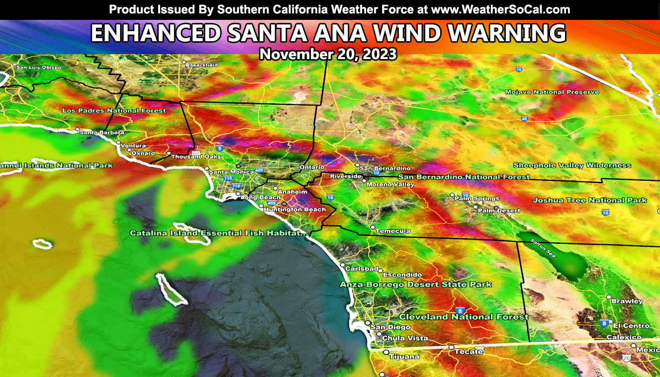
Southern California Weather Force has issued the Enhanced Santa Ana Wind Warning, which will be stronger than the last warning back on October 27th.
Previous updates used the medium resolution SCWF wind model. This update is using the super high resolution wind model, in-which the zoom in images can be found within this write-up.
A strong ridge to the west will bring cold air into the Great Basin between Nevada and Utah this now. The combination of freezing air in that area and average temperatures here will bring what is called a thermal support pattern. This will bring winds out of the desert and through the mountain passes.
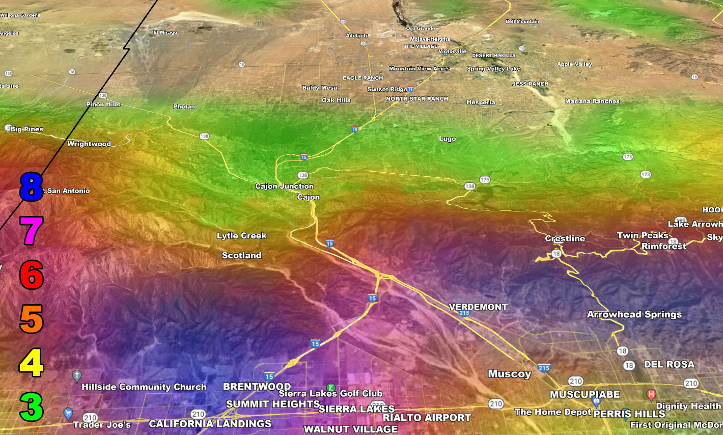
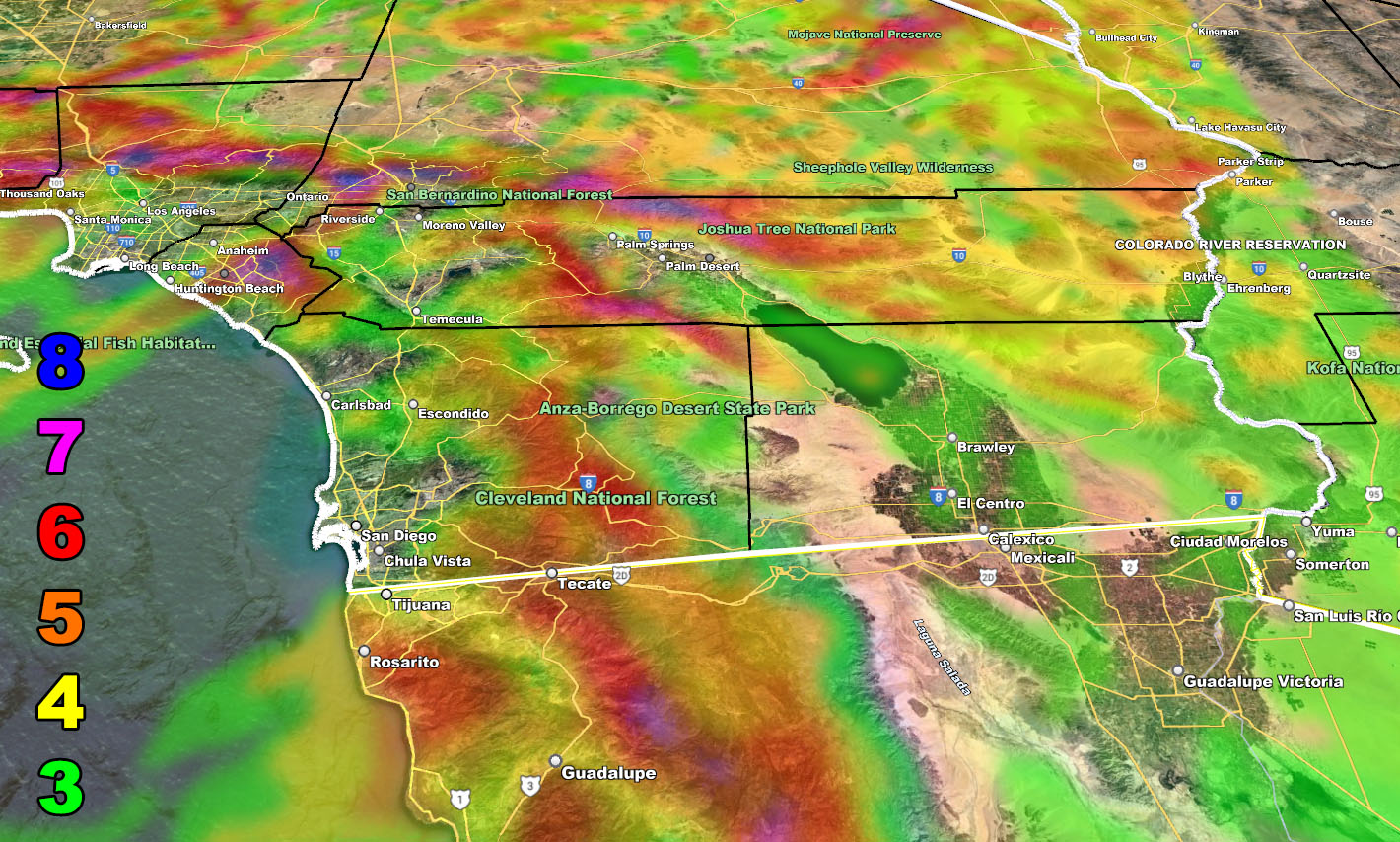
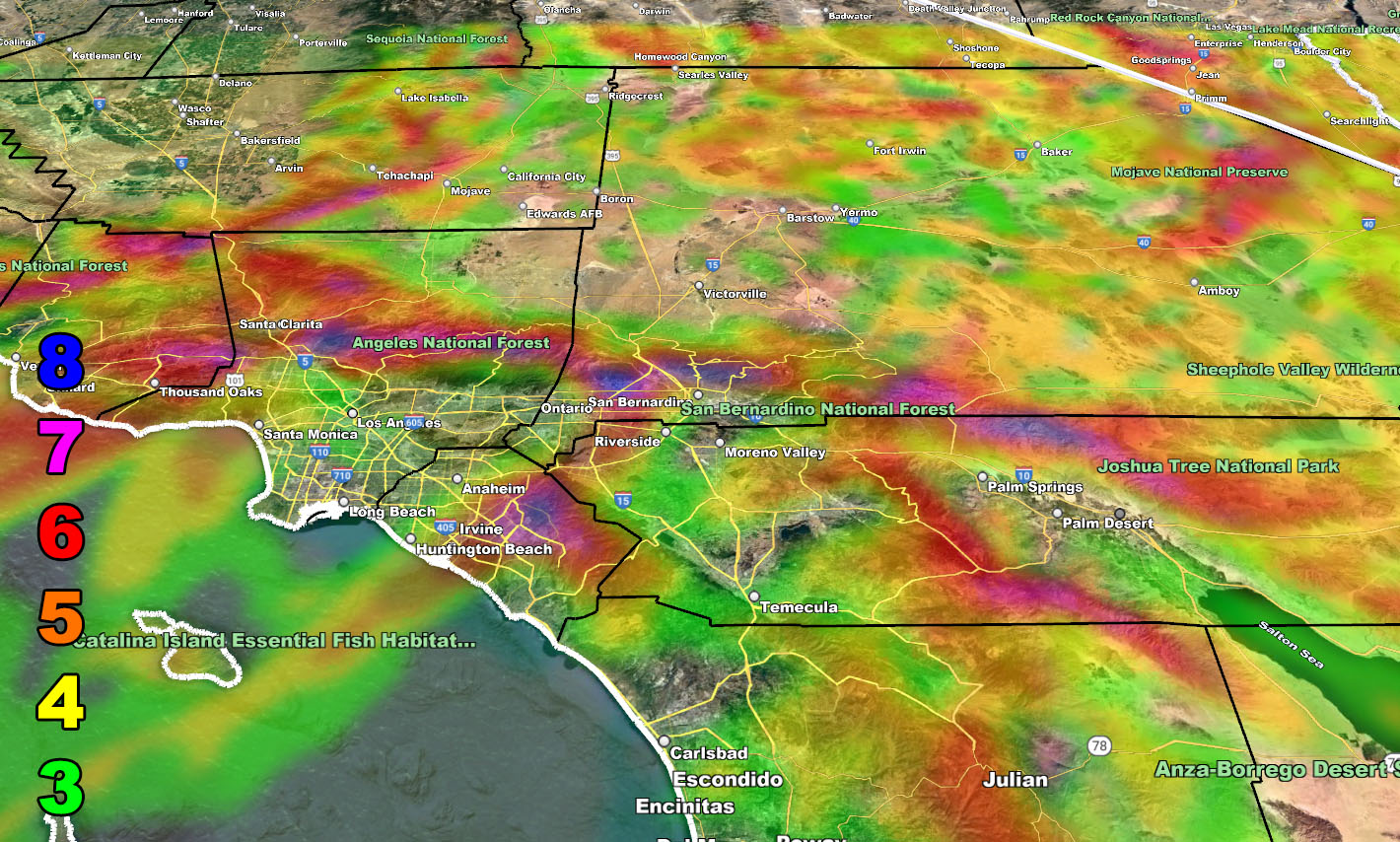
ONTARIO AIRPORT: This will cause delays or even diverts as Level 7 has been detected on the SCWF super high resolution wind model.
CAJON PASS: Level 8 has been detected on the SCWF super high resolution wind model. This means that during the period of this event, especially early Monday, we will have roll-overs of high-profile vehicles, 100% certain we will see that out there below the Cajon Pass in the 210/15/215 triangle zone.
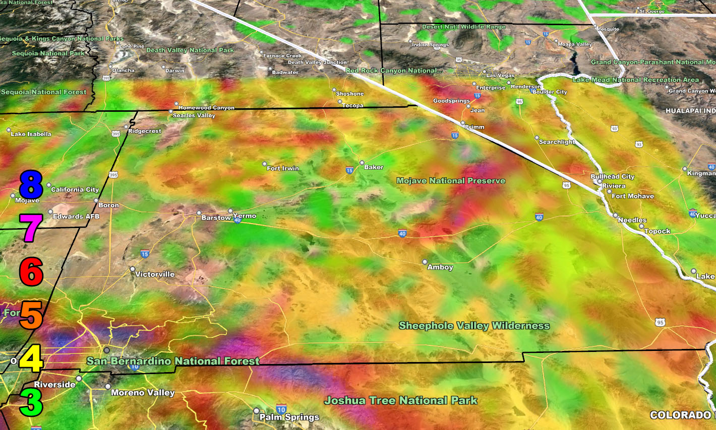
Those of you in the San Diego County Mountains around Campo have a modest level 4, so not too bad, and this will wait till Monday as Sunday you will not have the winds like the rest of the area will have.
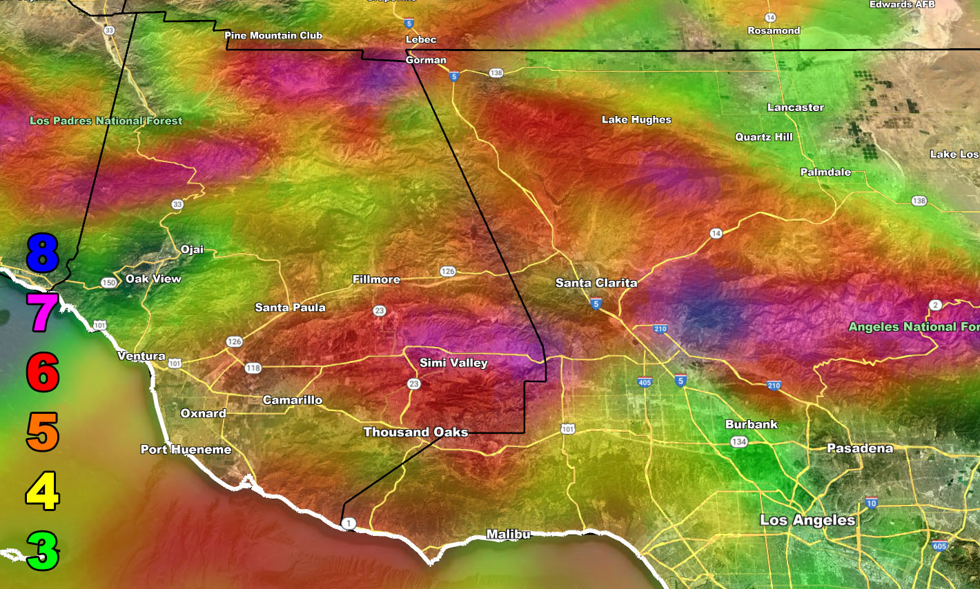
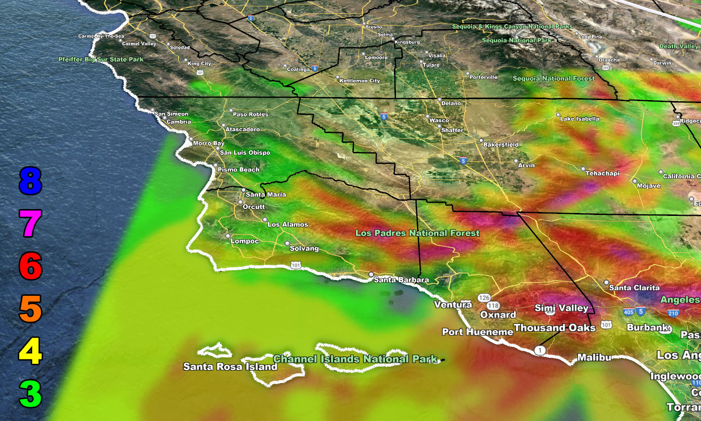
I also have included the following images below in zones for who will see what compared to the Raiden Storm Wind Intensity Scale, which does affect some of the desert areas from Kern/Los Angeles, and even out to the Morongo Basin/Coachella Valley and Imperial zones, even areas along the Colorado River Valley through Needles.
Raiden Storm Wind Gust Intensity Scale –
8. Extensive widespread damage.
7. Trees are broken or uprooted, building damage is considerable. – High Profile Vehicle Roll-Over CERTAIN.
6. SOME Trees are broken or uprooted, building damage is possible. – High Profile Vehicle Roll-Over Likely, Do NOT recommend Traveling in this zone. This zone also is the starting zone where trees and powerlines will fall and damage cars and even kill people near or in them!
5. Slight damage occurs to buildings; shingles are blown off of roofs. HIGH WIND WARNING CRITERIA – High Profile Vehicle Roll-Over Possible if weight is not corrected.
4. Twigs and small branches are broken from trees, walking is difficult.
3. Large trees sway, becoming difficult to walk. POWER SHUTDOWN THRESHOLD DURING FIRE WEATHER / WIND ADVISORY CRITERIA
Master General Meteorologist – Raiden Storm
Get these alerts over the new Android and Iphone app and/or e-mail service by becoming a full member subscriber today and never miss an update from this office. Remember, you cannot just make an account on the app and get notifications. You must select your zones and then go through the payment process.
ALSO IMPORTANT: Once you set your zones you will see notifications being BLANK UNTIL YOU GET AN ALERT. You are new on the member app, it doesn’t know you from past notifications. So just because it is blank in the beginning of service does not mean it does not work.
Click here to learn more.