
Across Southern California:
Multiple events are anticipated as we progress through December. Initially, there will be several Santa Ana wind events accompanied by intermittent warming throughout the month. This will be followed by a storm system expected to affect the region from December 15th to December 22nd, just before Christmas which is looking to be on the dry side but there is some uncertainty involved so stay tuned for that.
Forecast Outlook:
Santa Ana Details:
Currently, the area is experiencing warm conditions and strong winds due to ongoing offshore flow and a weakening ridge, which is expected to continue through today before a cooling period begins, lasting until Thursday. This cooling will also assist in the reformation of the marine layer along the coast. Following this, another Santa Ana wind event is predicted for the weekend, as a ridge builds up from the southwest. This event will bring gusty northeast to easterly winds, intensifying from Friday night through Sunday.
The strongest winds are expected on Saturday, accompanied by a moderate warm-up. An advisory is likely to be issued as the weekend nears. Strong gusts are expected in most mountain areas from Santa Barbara to Los Angeles counties, as well as in the San Bernardino area, the south coast, and the Santa Clarita Valley.
The San Diego mountains and valleys, including the El Cajon Pass, are also expected to experience strong winds. Further details on wind speeds will be provided in the upcoming advisory.
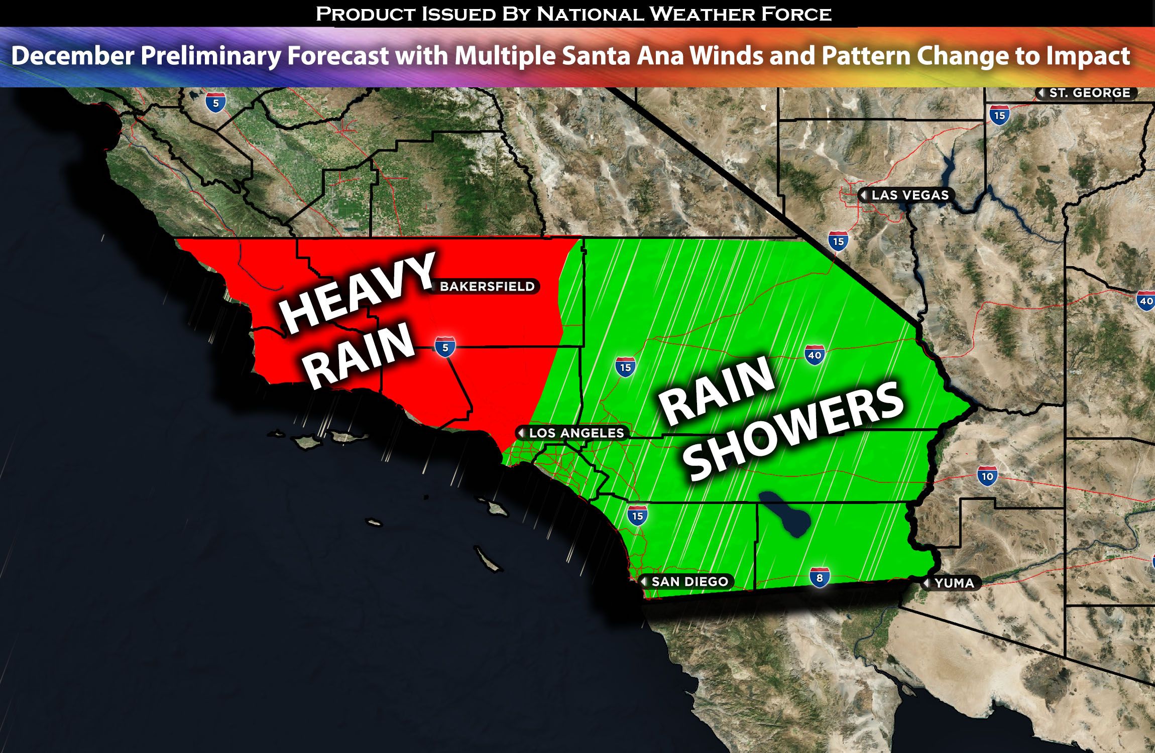
Storm Pattern Details:
The weather pattern is set to change around December 15th when a system (a trough) is expected to dive down into the area. However, the impact is expected to be minimal as most of the moisture is projected to be concentrated further north, towards central/northern California. Overall, more details are to come as we get closer to the event with rainfall amounts and specific impact.
Stay tuned for the next update, which will provide timing details, more specific information on impacted locations, and threats for specific micro-zones in the coming days.
——————-
Sina⚡⚡
With over a decade of experience in forecasting severe thunderstorms, this individual is a seasoned forecaster and developer. Their expertise in severe weather forecasting and computer science is entirely self-taught, complemented by a foundation in Atmospheric Science from UNCO and an IT background from WGU. They have dedicated their efforts to developing innovative tools that enhance the accuracy of analyzing large hail and tornadoes. As a significant contributor to the National Weather Force, they have played a crucial role in providing accurate and timely information, as well as developing tools to keep those affected well-informed.