
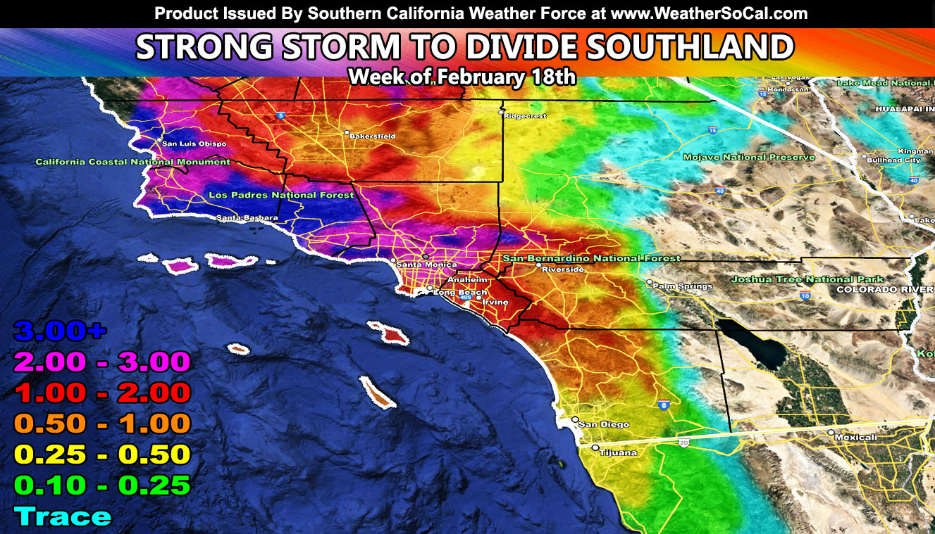
Southern California Weather Force has issued a Flood Watch for the following areas, effective Sunday through Wednesday for the week of February 18th, 2024;
San Luis Obispo, Santa Barbara, Ventura, Los Angeles (minus deserts), and Orange County … The Northern Inland Empire Ontario, Fontana and the Cajon Pass …
A strong but slow-moving storm system will start to bring a division to Southern California Sunday through Wednesday, with the main target shifting to the watch areas listed above.
This system has been moving numbers around for a while but has been the most consistent in monitoring for Los Angeles westward. It will drop more rain in the watch area, with less for areas south and east, so in areas like San Diego and most of the Inland Empire, you will see less, which is welcomed by some of you for relief. This system is a tail-end Charlie, meaning the very southern end of the frontal zone hitting California.
Tail-end Charlie type systems tend to give less rain to Bakersfield as well. Mt. Pinos is in the way of the southerly flow, so you get into a rain-shadow. Same is true for the High Desert, and most of the Inland Empire zones. Inland Empire’s rain-shadow comes from the taller peaks of the Santa Ana Mountains surrounding Santiago Peak. Live in the low desert? Forget it, major rain-shadow with this.
This has higher snow-levels as well, so not much if any is to be expected to accumulate.
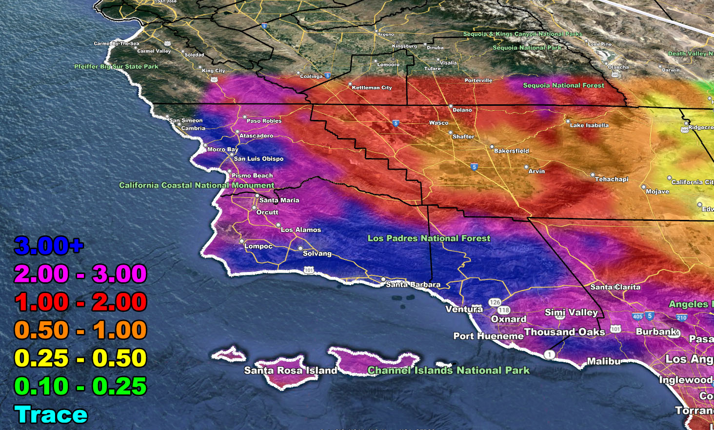
Timing of the start of the rain – (Window Sunday through Wednesday) – Does not include Saturday’s SLO/SBA Coast Rain
San Luis Obispo / Santa Barbara / Ventura – Sunday evening/night
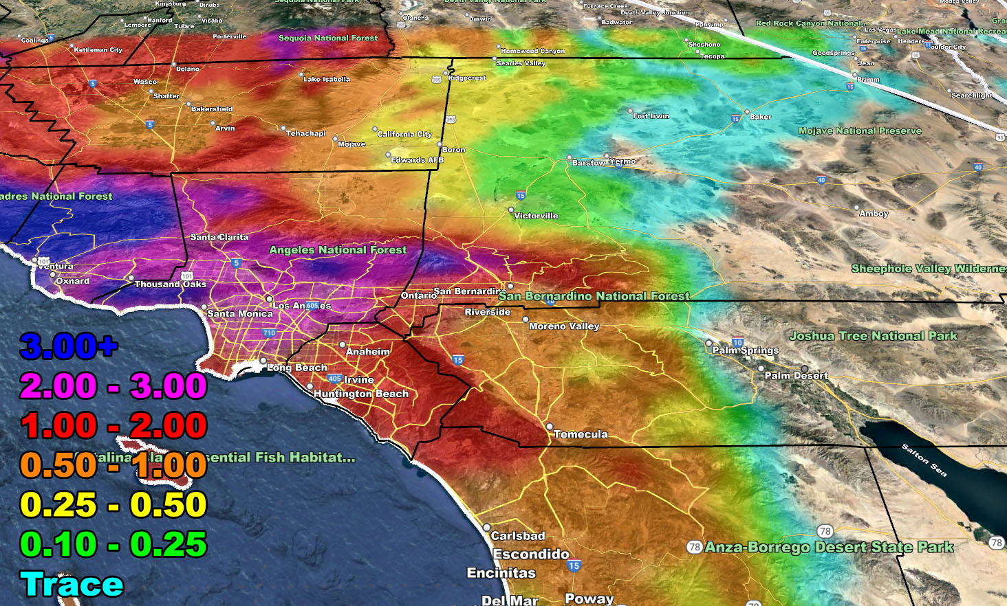
Los Angeles / Orange County – Monday
Inland Empire / High Desert – Monday overnight into Tuesday
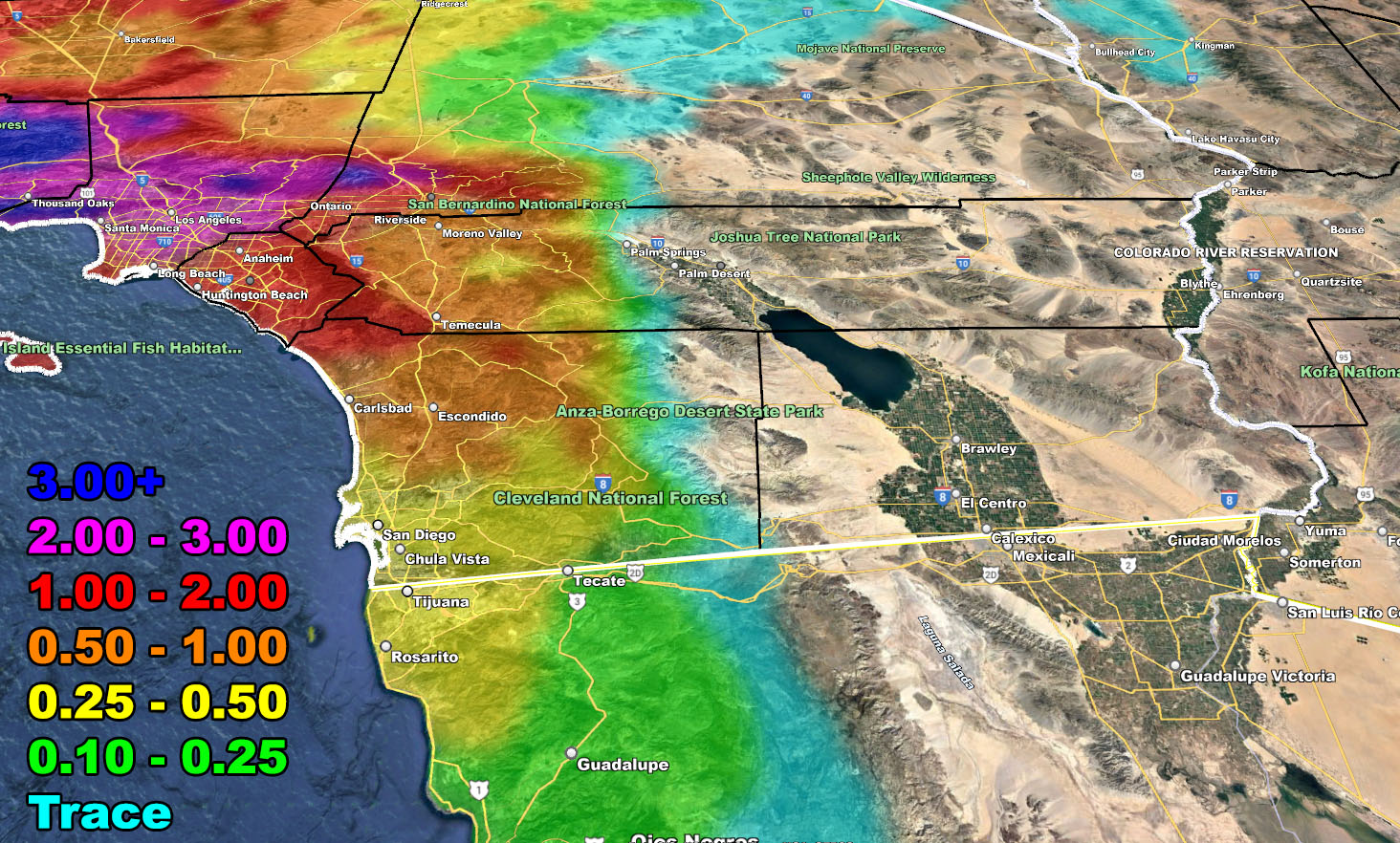
San Diego – Tuesday night into Wednesday
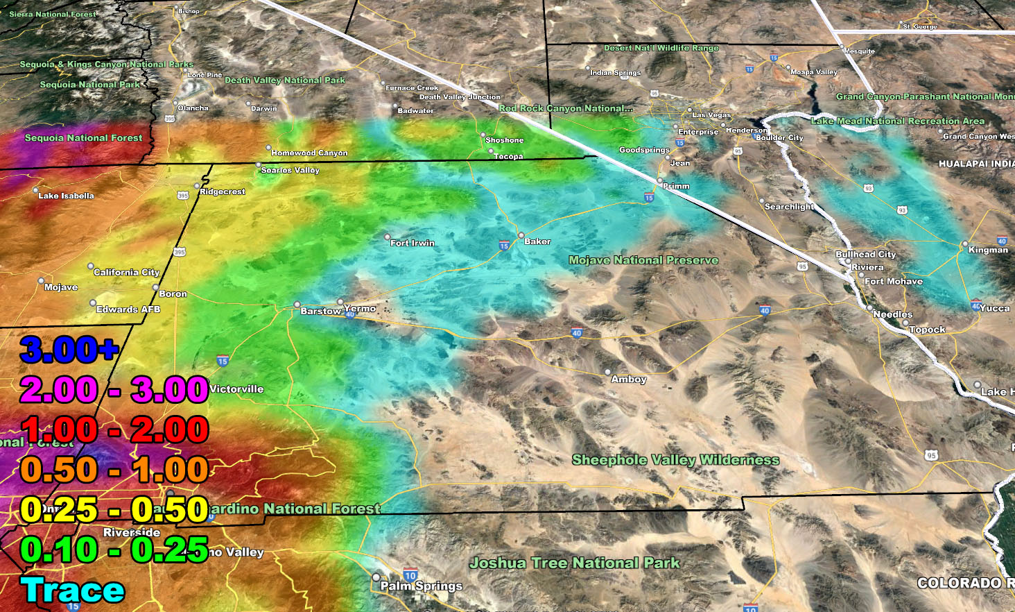
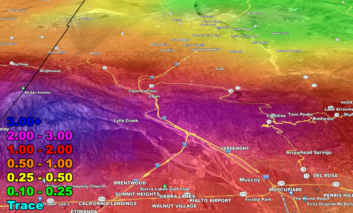
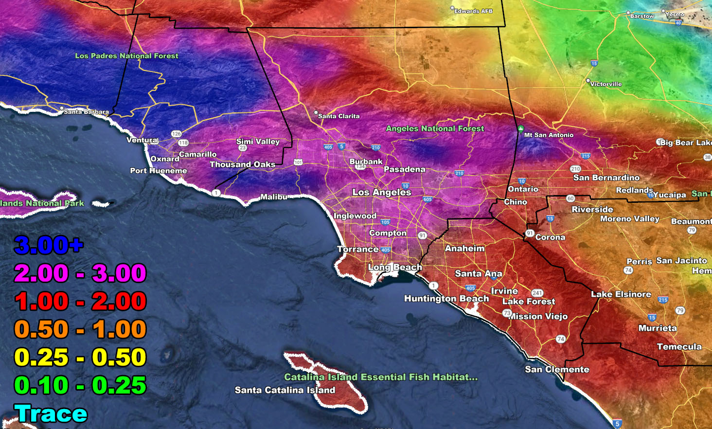
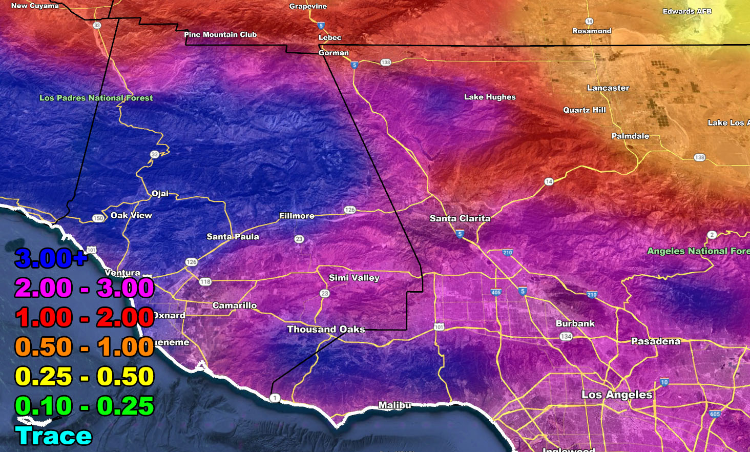
For the rest of the forecast, use the model images here –
RAIN
– Raiden Storm –
https://www.southerncaliforniaweatherforce.com
Master General Meteorologist – is a consulting meteorologist for over 50 companies, including energy, agriculture, aviation, marine, leisure, and many more areas. He has certs from Mississippi State for broadcast met and Penn State forecasting certs MET 101, 241, 341 and 361 as a meteorologist, but before then was completely self-taught, barely learning a thing from the schools that he did not already know.
Both short and long-range is very important to know in those jobs so you can bet on accuracy here. He is versed in fields like Western USA, Tornadoes, Floods, Hurricanes, High Winds, Fire Behavior, Snow and Blizzards, Short Range, Long Range, Seasonal, and Life-Threatening decisions with over 25 years’ experience, out forecasting all weather services available today with lead-time and precision, which makes him a focus of ridicule and envy.
NOTE: Alerts are posted on here, be it a tornado watch, etc, and these alerts are issued from this office and nowhere else. At times, which is often, you will see an alert forecast posted on here that you do not see elsewhere.