
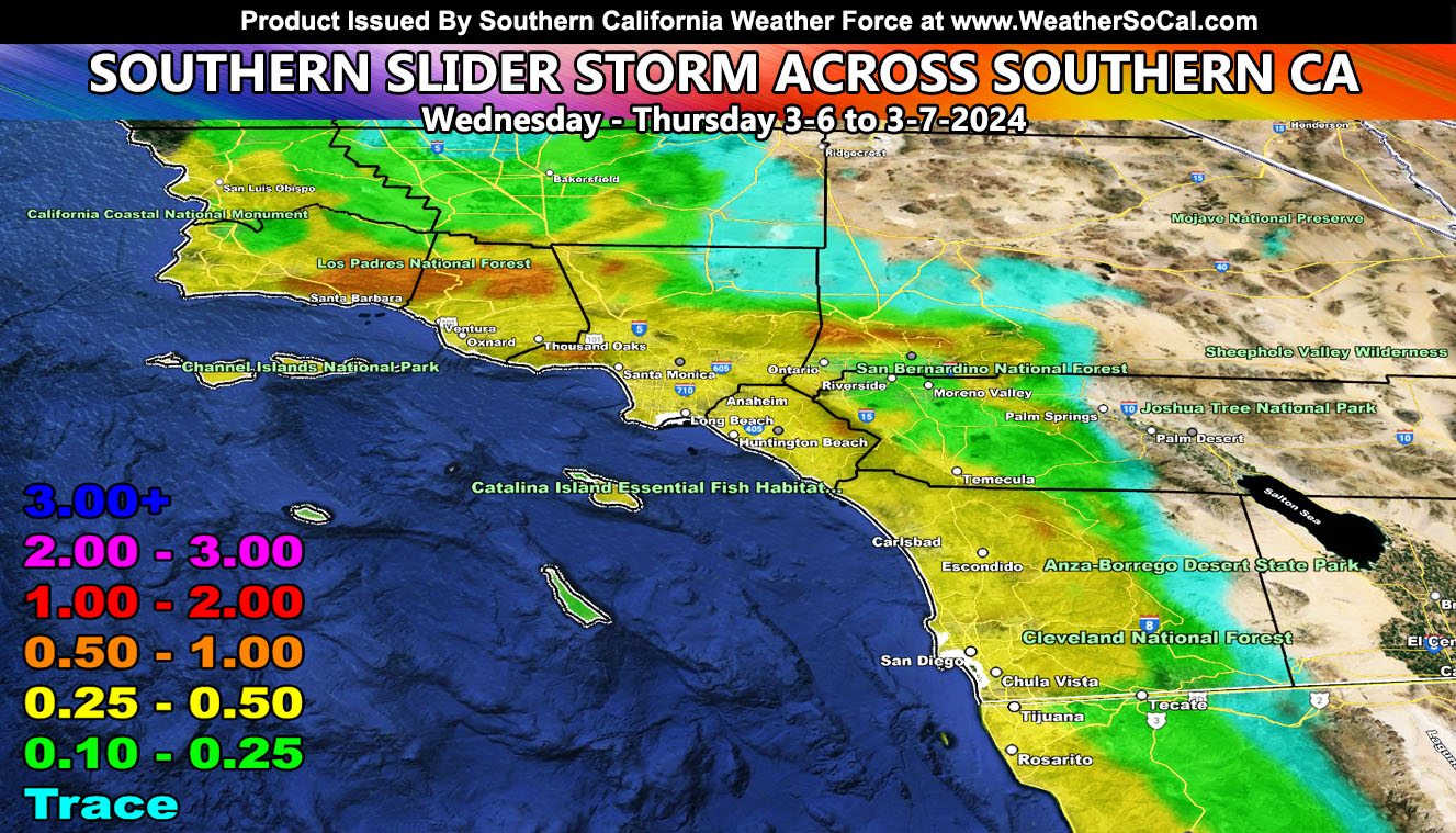
You have heard of inside slider systems, which move just to the north of us right? Well, the Southern California Weather Force term for a rare and extremely hard to forecast system to the south is called a ‘Southern Slider’. This will happen on Wednesday and Thursday across the metro Southern California zones.
A system out in the Pacific will move into the region on Wednesday. Southern California Weather Force models are zoning in on the direction of this cutoff system. Keep in mind this is a cutoff system, and things can change, but what fun is that if you don’t forecast correctly? This system will move just to the south of the Southern California forecast area. This means that only the metros and adjacent zones like the mountains can be affected by it.
Snow levels look to be at resort level with it, but I do have my doubts like the last system on just how much mid-level moisture we have to work with. If this system goes even further south, we have less to work with. So, at this time, I will be keeping any winter weather watches or advisories off the table and going with a meager event in the local mountains.
This is a cutoff system, which means it will have a northwest flow behind it, quite cold in the upper levels. This means that a target for convection on Thursday could very well be from the SCV through Los Angeles and the Inland Empire areas, with the Los Angeles and San Bernardino Mountains not out of the question for a target area for additional activity. This part is tough this far out, but I will monitor it.
Stay tuned to Southern California Weather Force for more updates on this and other future events.
– Raiden Storm –
https://www.southerncaliforniaweatherforce.com
Master General Meteorologist – is a consulting meteorologist for over 50 companies, including energy, agriculture, aviation, marine, leisure, and many more areas. He has certs from Mississippi State for broadcast met and Penn State forecasting certs MET 101, 241, 341 and 361 as a meteorologist, but before then was completely self-taught, barely learning a thing from the schools that he did not already know.
Both short and long-range is very important to know in those jobs so you can bet on accuracy here. He is versed in fields like Western USA, Tornadoes, Floods, Hurricanes, High Winds, Fire Behavior, Snow and Blizzards, Short Range, Long Range, Seasonal, and Life-Threatening decisions with over 25 years’ experience, out forecasting all weather services available today with lead-time and precision, which makes him a focus of ridicule and envy.
NOTE: Alerts are posted on here, be it a tornado watch, etc, and these alerts are issued from this office and nowhere else. At times, which is often, you will see an alert forecast posted on here that you do not see elsewhere.