
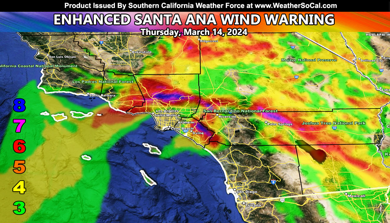
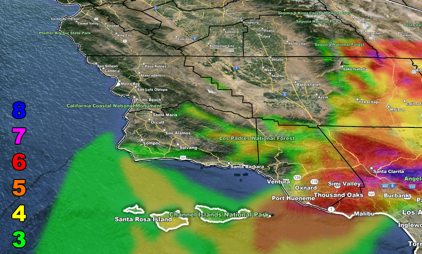
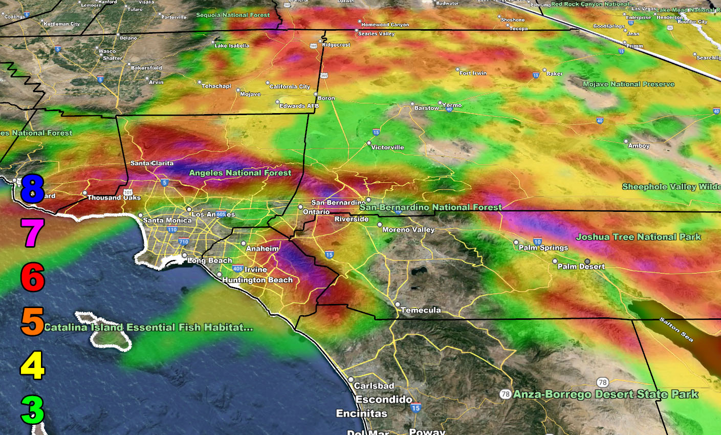
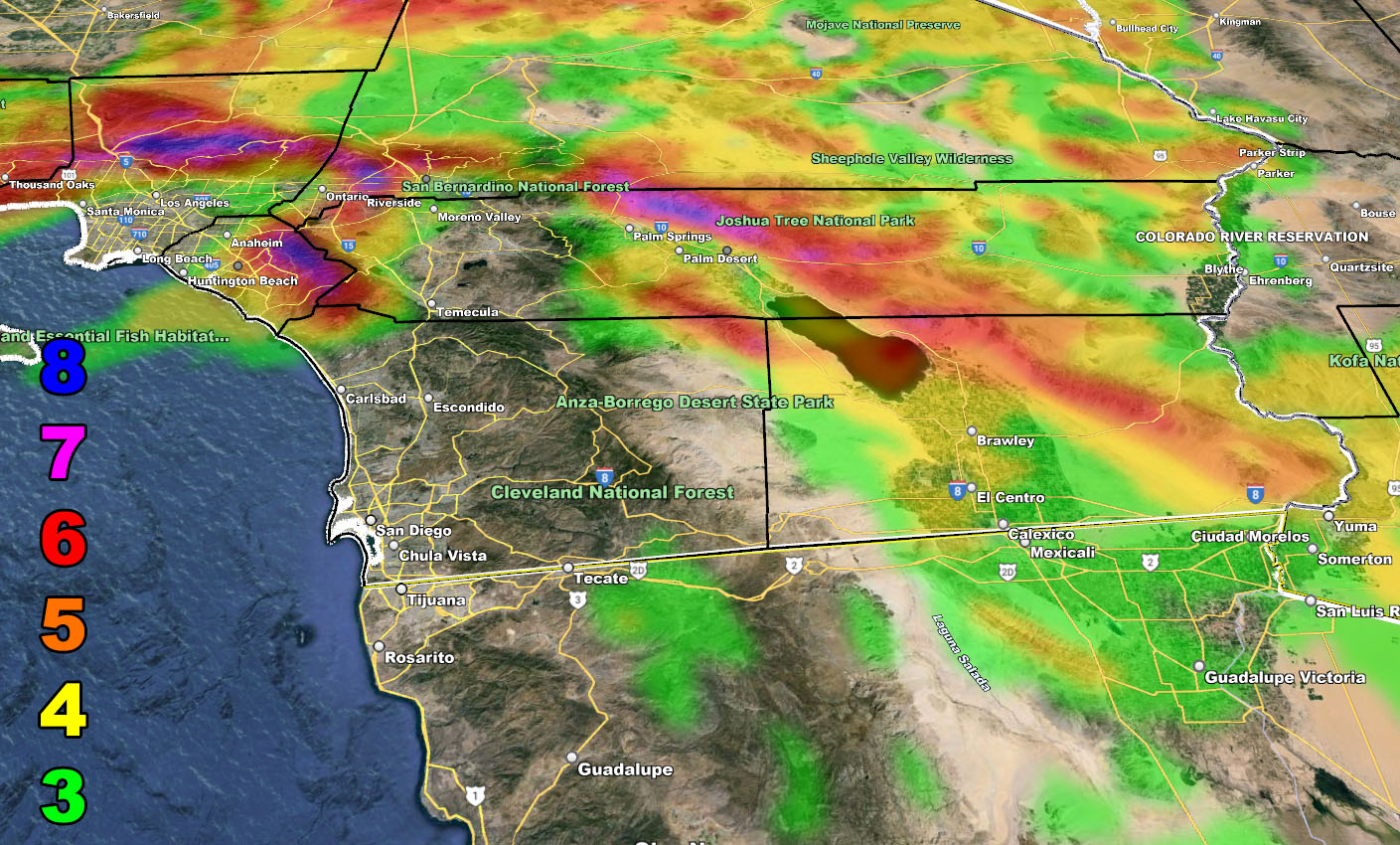
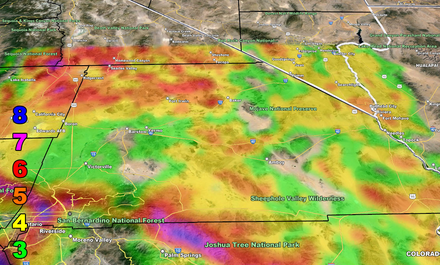
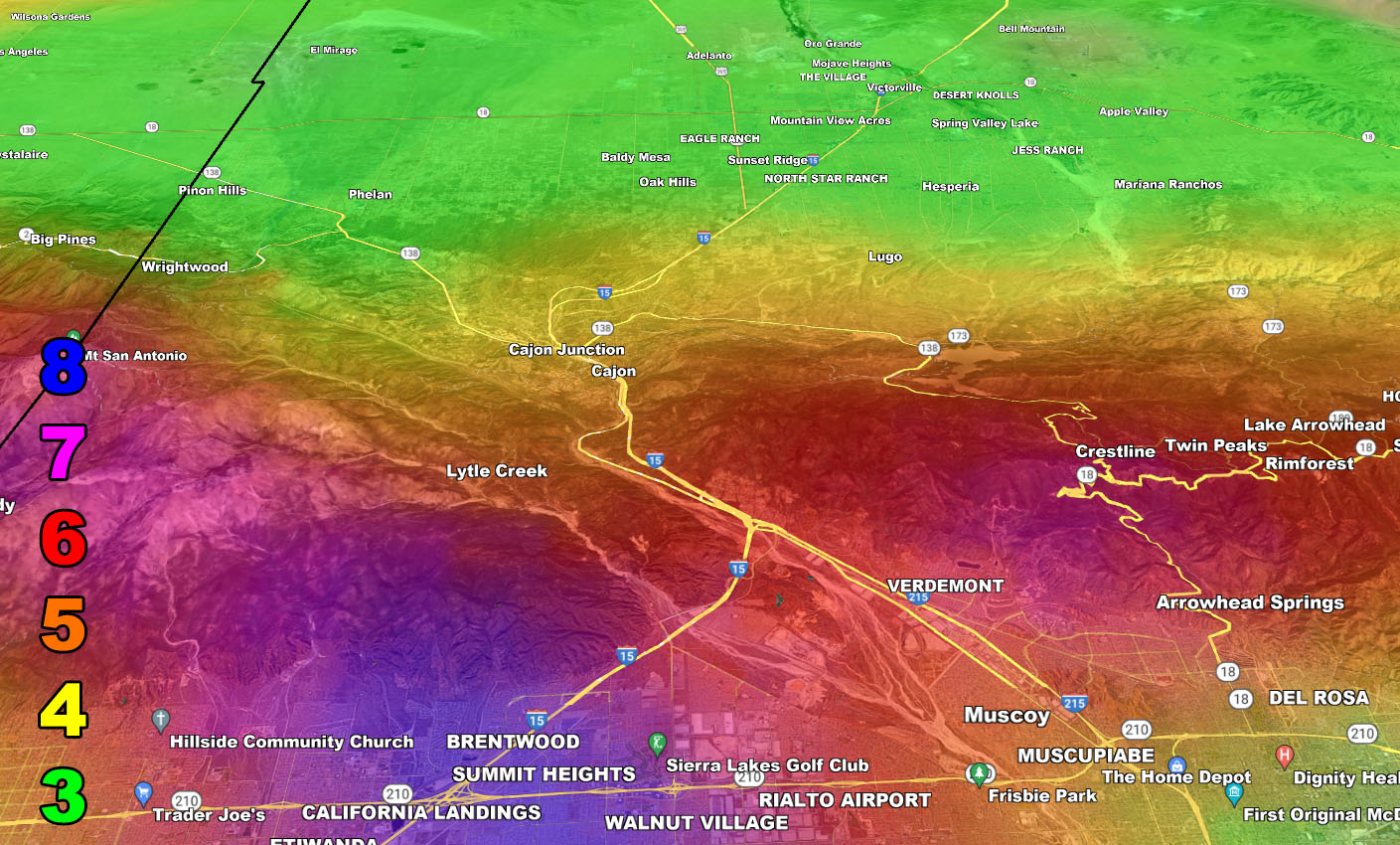
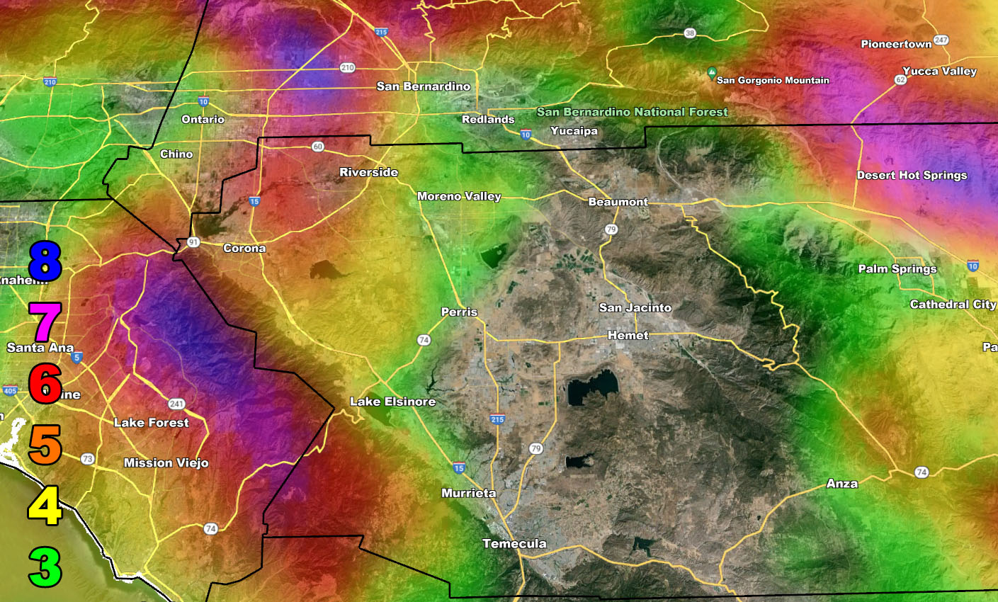
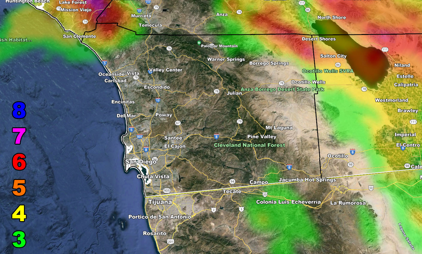
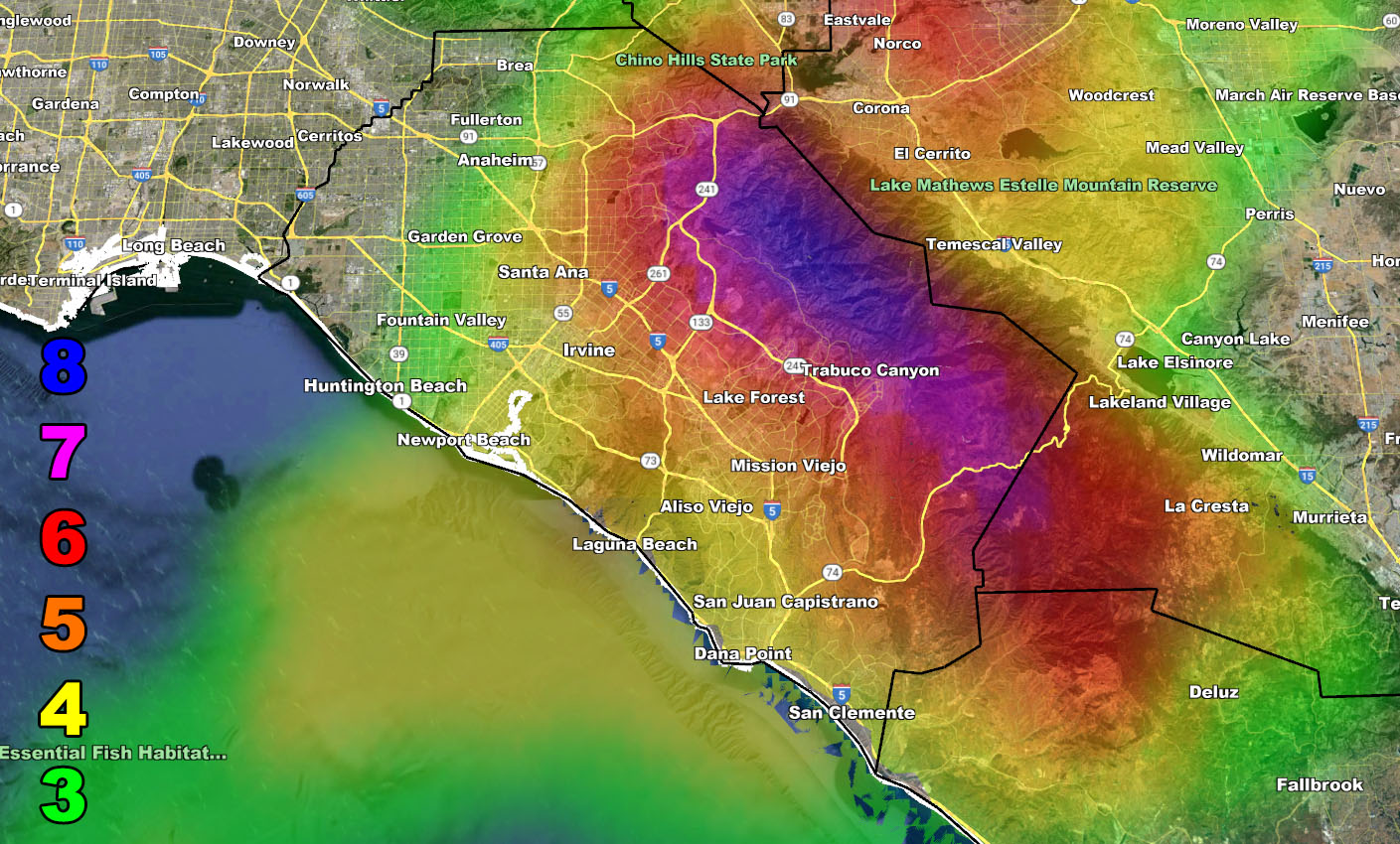
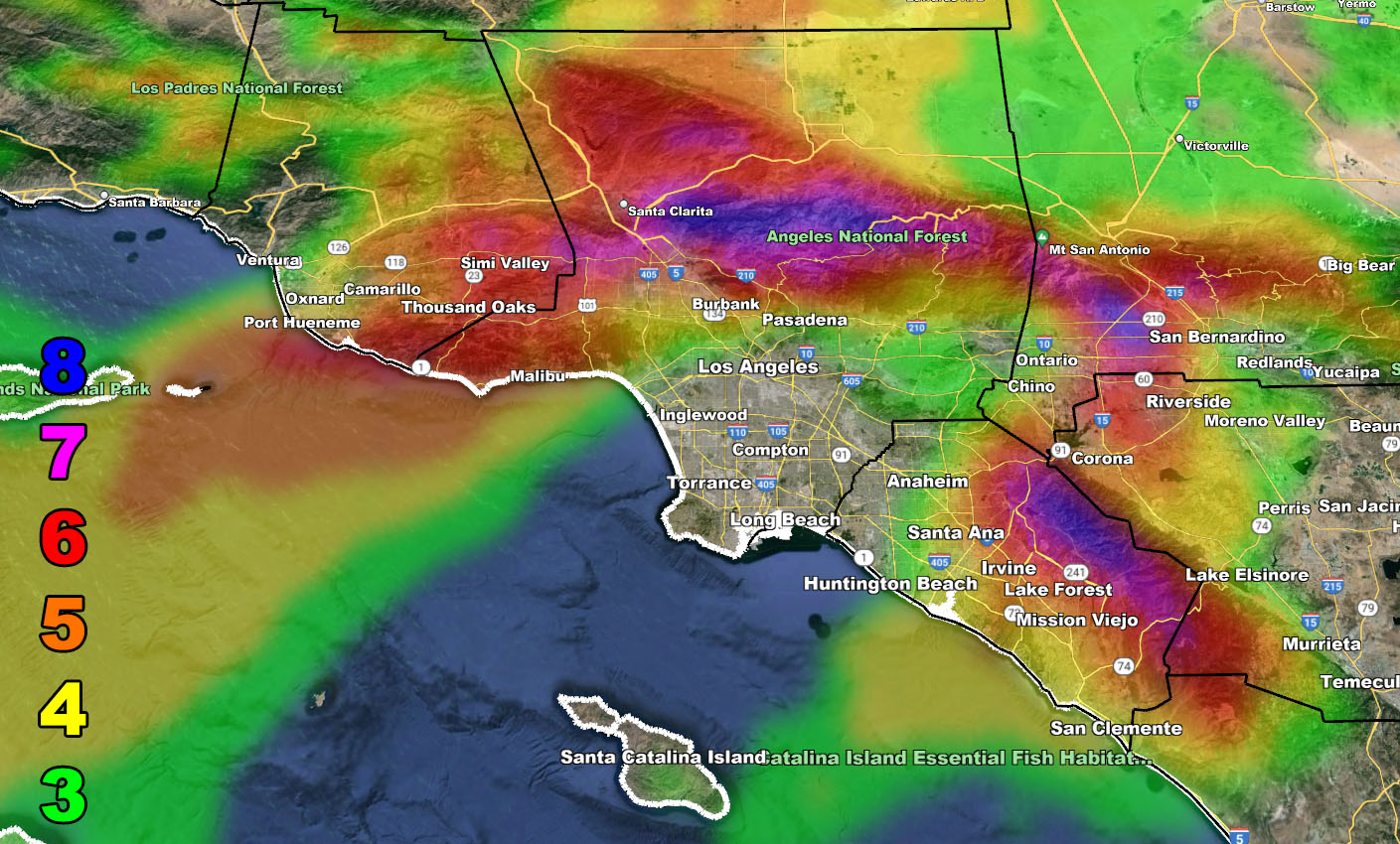
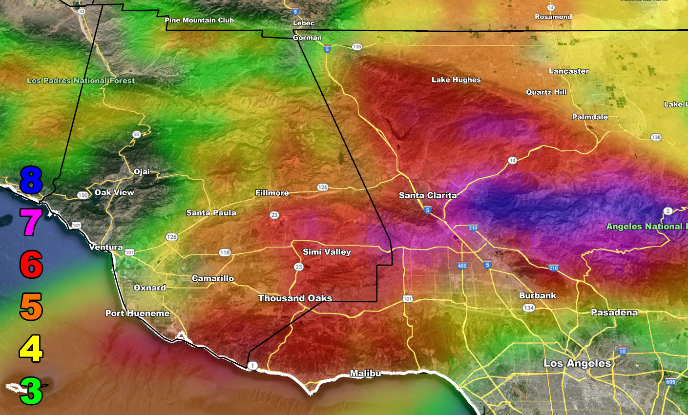
This will be rather quick, because for the last week I have been predicting such, so I will summarize in bullet points. Keep in mind the zoom-in maps have now been added with a full Inland Empire, Orange County, and San Diego County additional and will be provided in future updates from now on, bringing three new zoom-in maps for you.
- This is a level 8 event for below the Cajon Pass at the 15 and 210 interchange, which means if you are driving a high-profile vehicle, you are at greater risk of tipping over.
- This will impact from the Western inland Empire through Orange County as well, along the Santa Ana River, hence the name Santa Ana Winds. Also do not argue Santana Winds because that is not true. These are not devil winds nor will they be warm. These are cold winds.
- They will be strongest between early morning around 2-3am to around 1pm on Thursday. This is a quick event per say and not prolonged.
- This is from a cutoff low, which will meander for several days. There could be moisture that comes into the area at times, the most moisture will hit the Las Vegas forecast area, certain for rain or even thunderstorms. The rest of us will need to wait for my word on what we will have. I do NOT want messages or comments stating, ‘my app says this’. Your weather apps absolutely suck compared to what I offer for realism in these situations. I will handle the coming pattern and any impulses to come over the next several days.
- San Diego, you are not in my warning for these winds. They are northerly, which means you do not have them. You need easterly flow to bring them through your mountain passes to the east of you.
- Long Range, as I stated a week ago, does show some storm activity after the 20th, likely the last 10 days window of this month.
- Use the images for the zoom in Southern California Weather Force Wind Intensity Model stated within this write up –
WIND
Reference A – (Initial first call of this event) – https://www.southerncaliforniaweatherforce.com/2024/03/07/long-range-weather-advisory-issued-possible-strong-santa-ana-wind-event-within-a-week/
Stay tuned to Southern California Weather Force for more updates on this and other future events.
– Raiden Storm –
https://www.southerncaliforniaweatherforce.com
Master General Meteorologist – is a consulting meteorologist for over 50 companies, including energy, agriculture, aviation, marine, leisure, and many more areas. He has certs from Mississippi State for broadcast met and Penn State forecasting certs MET 101, 241, 341 and 361 as a meteorologist, but before then was completely self-taught, barely learning a thing from the schools that he did not already know.
Both short and long-range is very important to know in those jobs so you can bet on accuracy here. He is versed in fields like Western USA, Tornadoes, Floods, Hurricanes, High Winds, Fire Behavior, Snow and Blizzards, Short Range, Long Range, Seasonal, and Life-Threatening decisions with over 25 years’ experience, out forecasting all weather services available today with lead-time and precision, which makes him a focus of ridicule and envy.
NOTE: Alerts are posted on here, be it a tornado watch, etc, and these alerts are issued from this office and nowhere else. At times, which is often, you will see an alert forecast posted on here that you do not see elsewhere.