
Southern California Weather Force has issued the final forecast in relation to the early initial forecast on a storm system that will start over Vandenberg / San Luis Obispo this evening, shoving eastward through the night and into tomorrow (Saturday). Rain and snow maps are available for this event, but since it has already been predicted here at Southern California Weather Force beforehand (Reference A Below), I will keep that initial forecast and go with bullet point summaries.
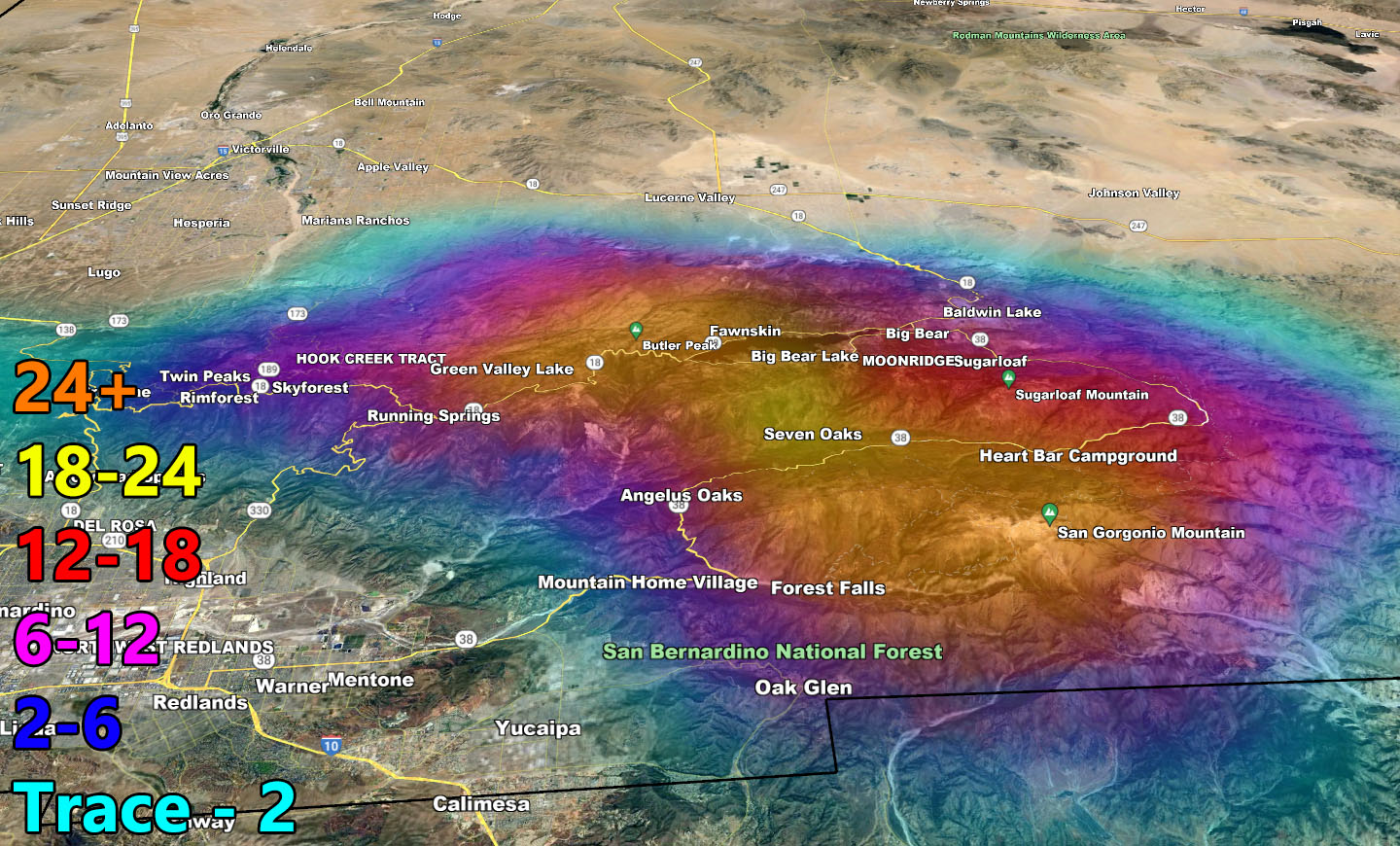
- Big Bear Lake will see over a foot of snow this weekend.
- SpaceX is launching at 7:30pm tonight, however I will say 100% it should scrub as that is precisely when the front hits Vandenberg. Had it launched, we would have seen another sunset show like the previous.
- Southern California Weather Force Flood Watches in effect for the metros.
- Southern California Weather Force Winter Storm Warnings in effect for the Los Angeles, San Bernardino, Ventura, and Riverside County Mountains.
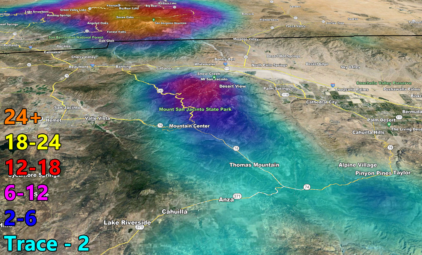
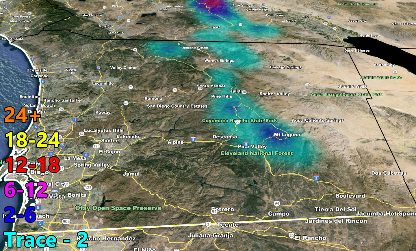
- Southern California Weather Force Winter Weather Advisories in effect for the Kern Mountains, including the Tehachapi floor for a dusting of snow, and over into the San Diego Mountains.
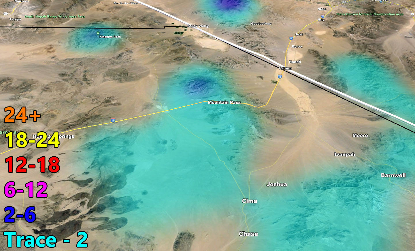
- This will not close the mountain passes but be aware the snow-level can bring some snow over the weekend, along with ice. Mountain Pass, between Baker and Stateline on I-15 will have ice and snow this weekend, but accumulation will be minimal.
- This storm front will have a chance a waterspouts or small tornadoes.
- This system will have a chance of thunderstorms through the weekend. Additional alerts can be zoned in on as that time comes.
Reference A – Initial Storm Forecast Call – https://www.southerncaliforniaweatherforce.com/2024/03/26/strong-weekend-storm-system-eyes-southern-california-for-weekend-of-march-30-2024-details/
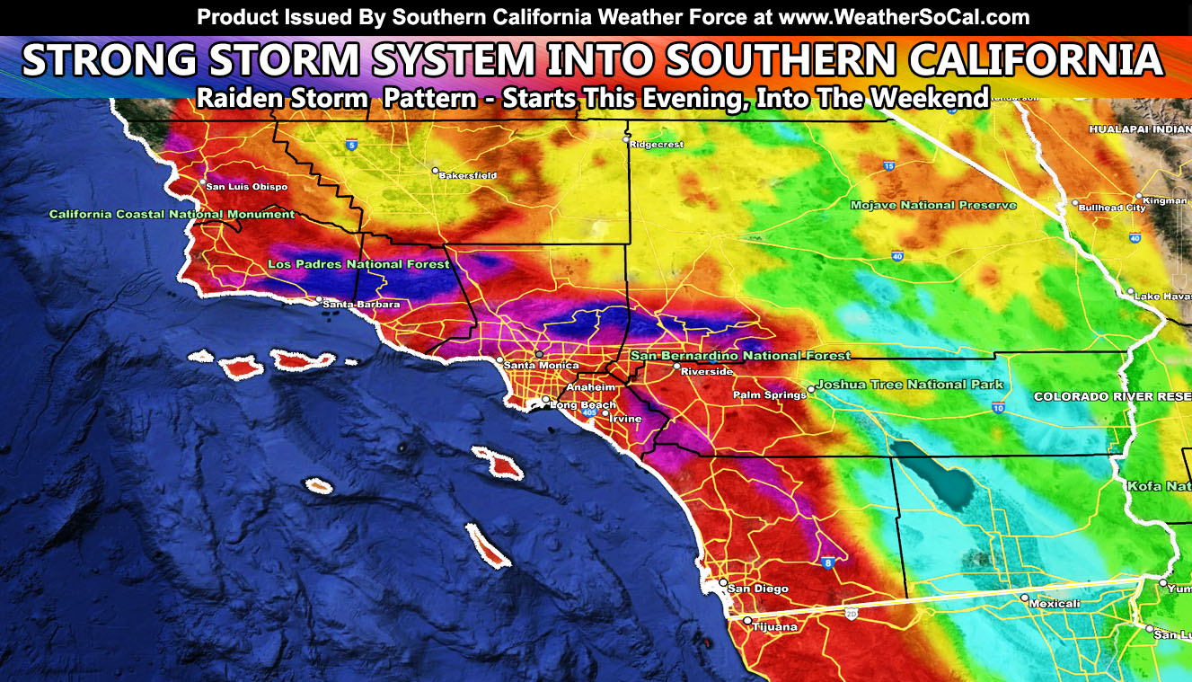
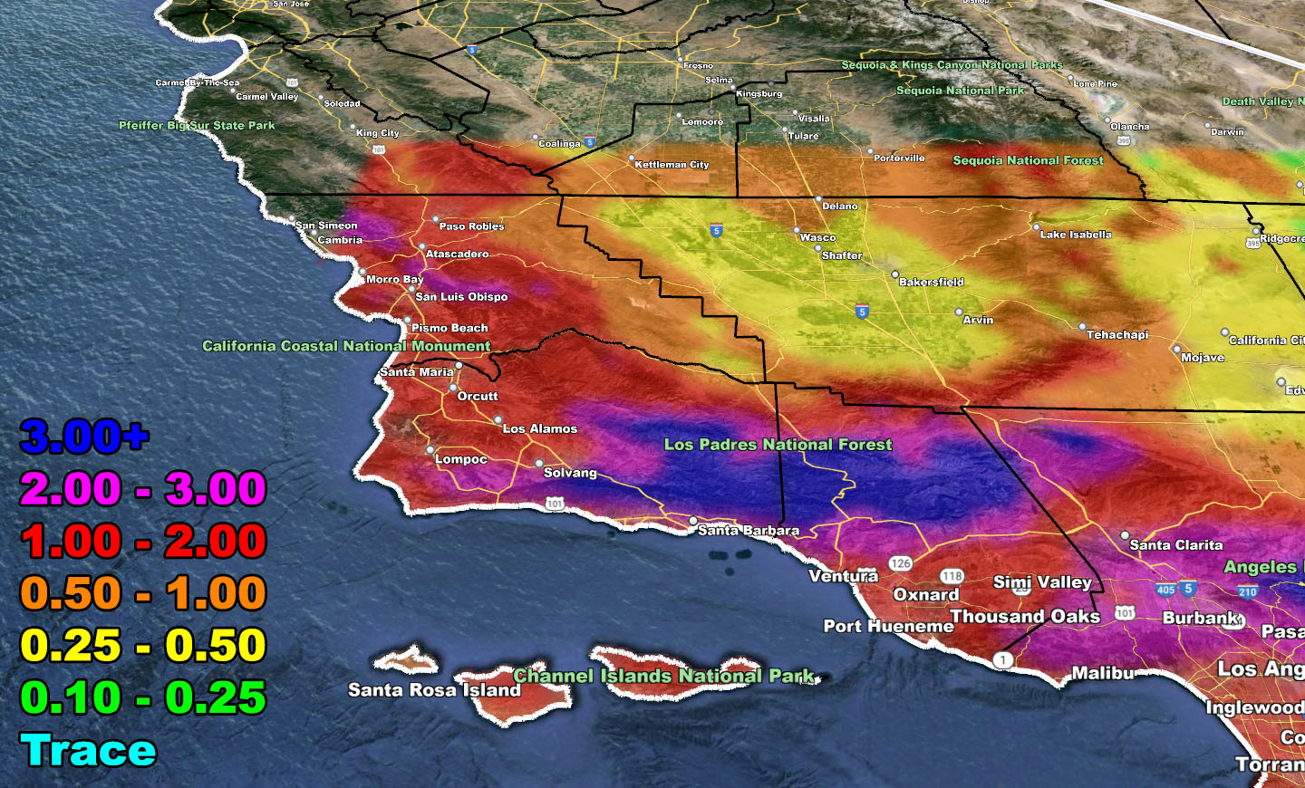
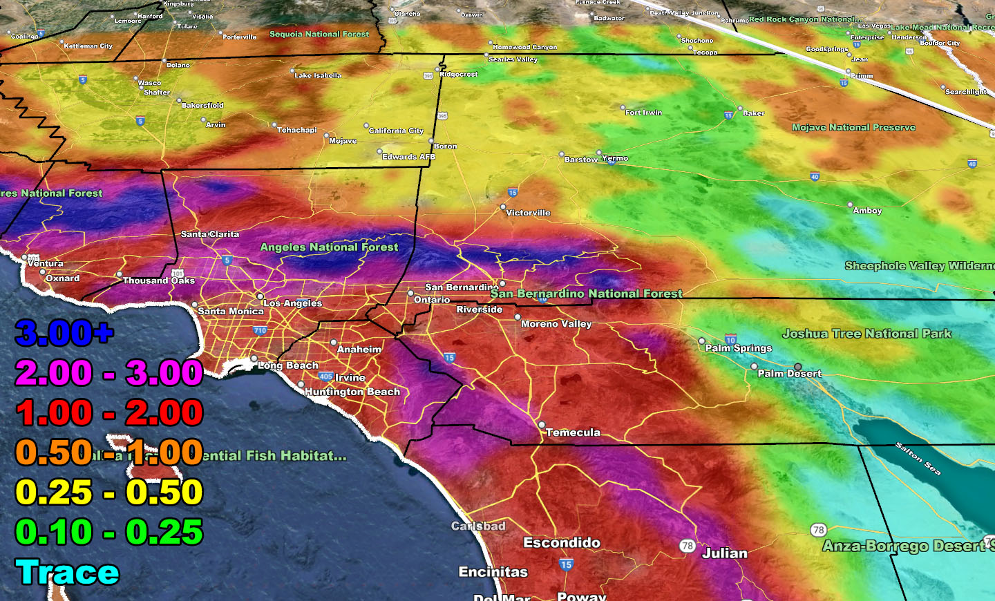
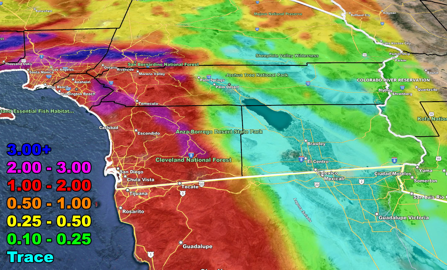
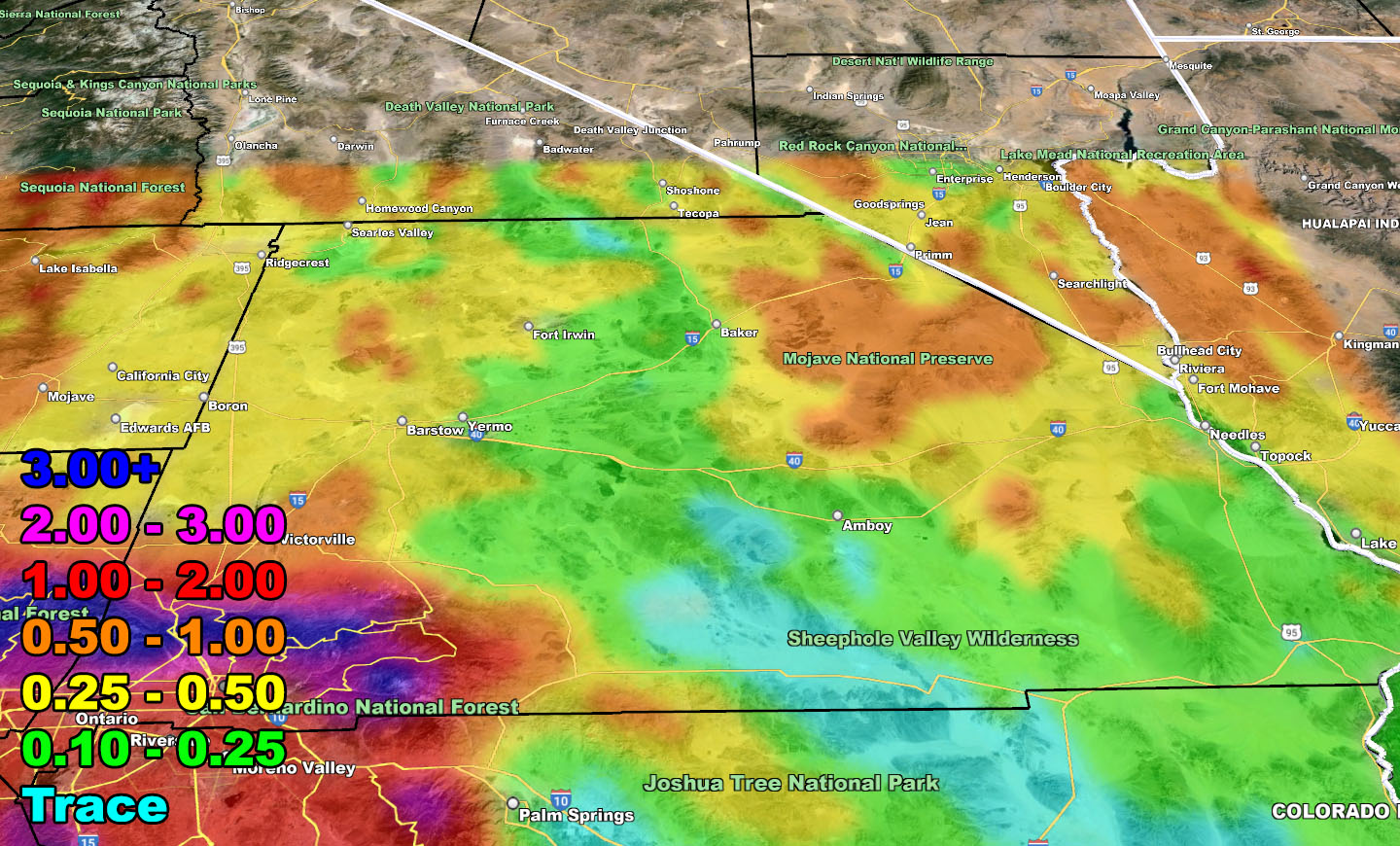
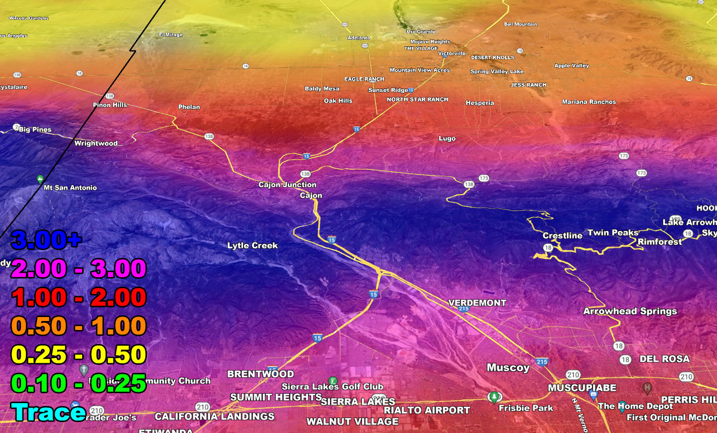
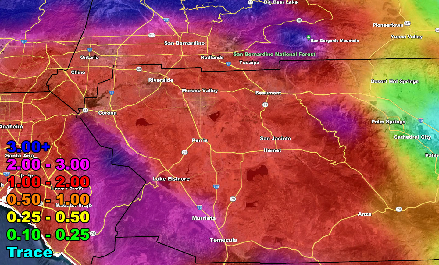
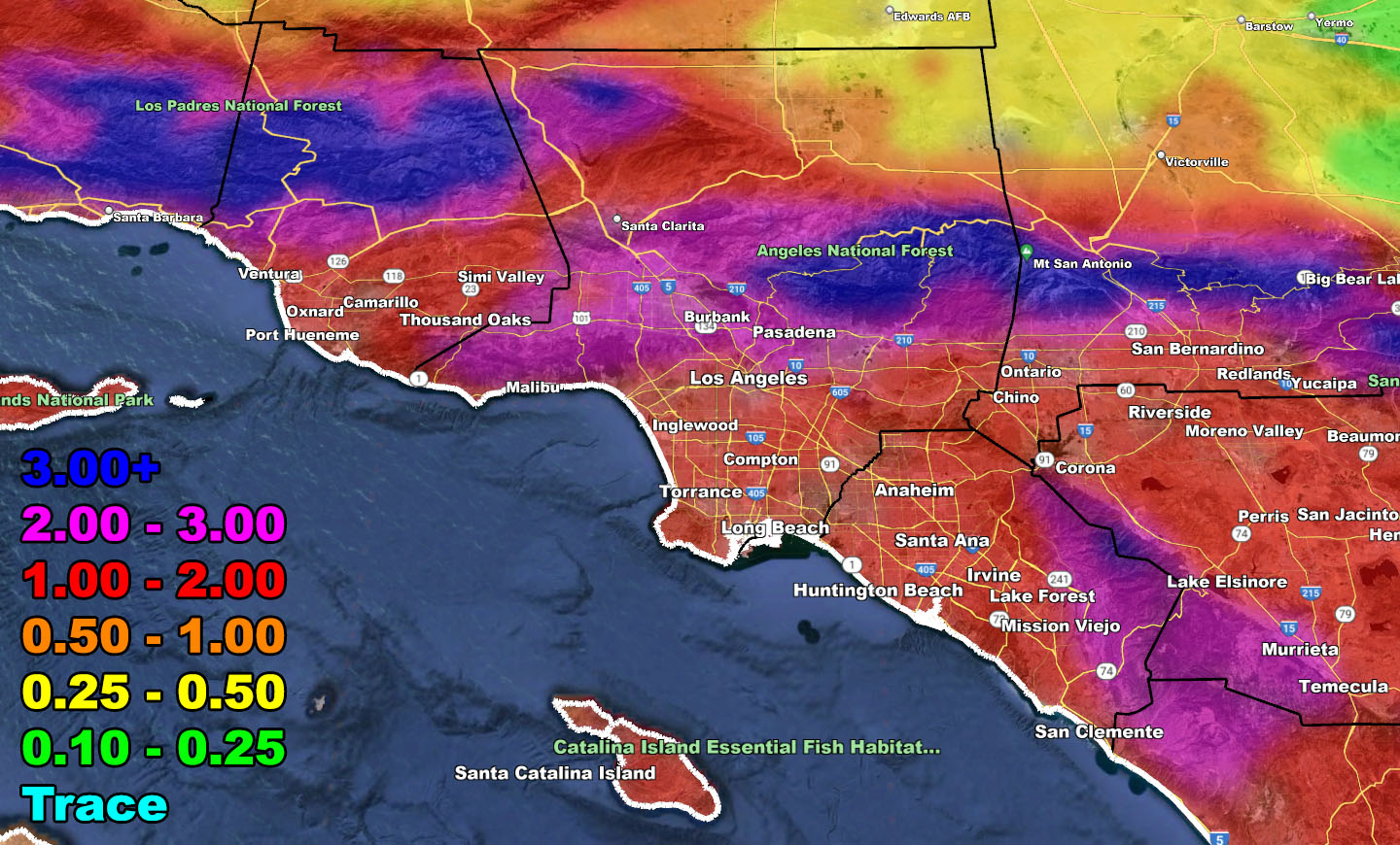
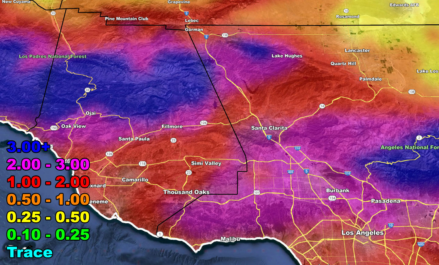
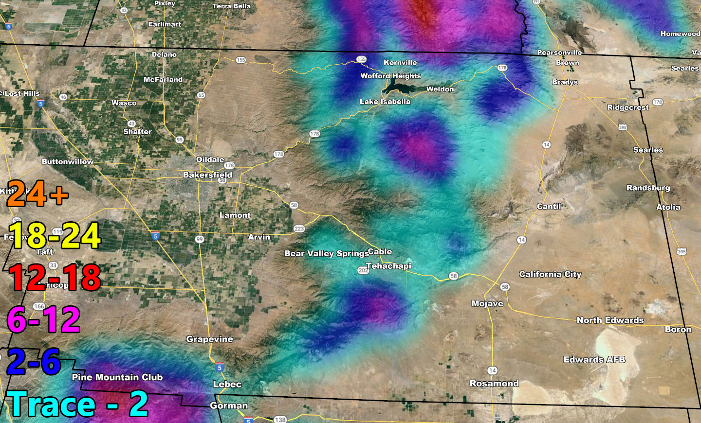
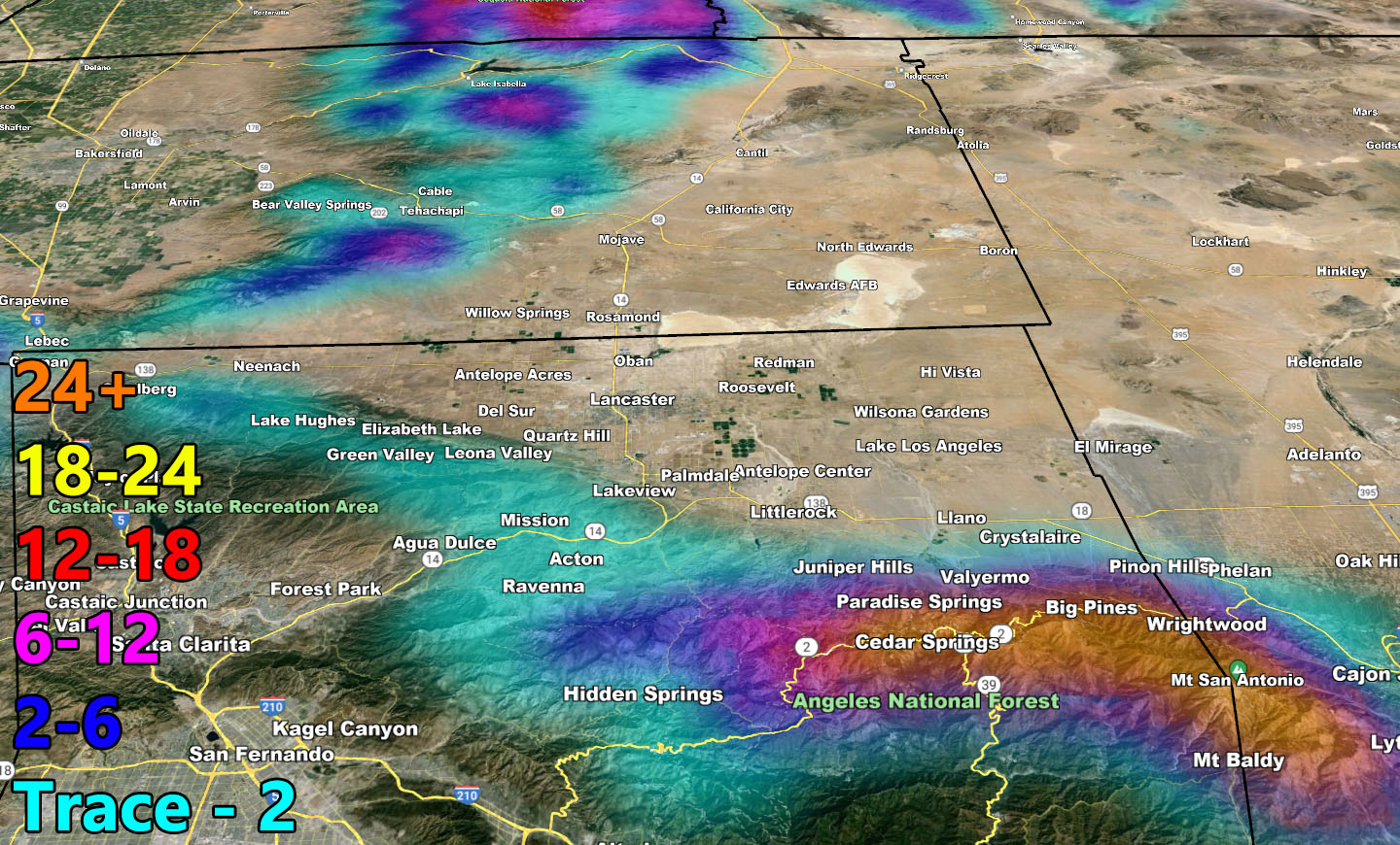
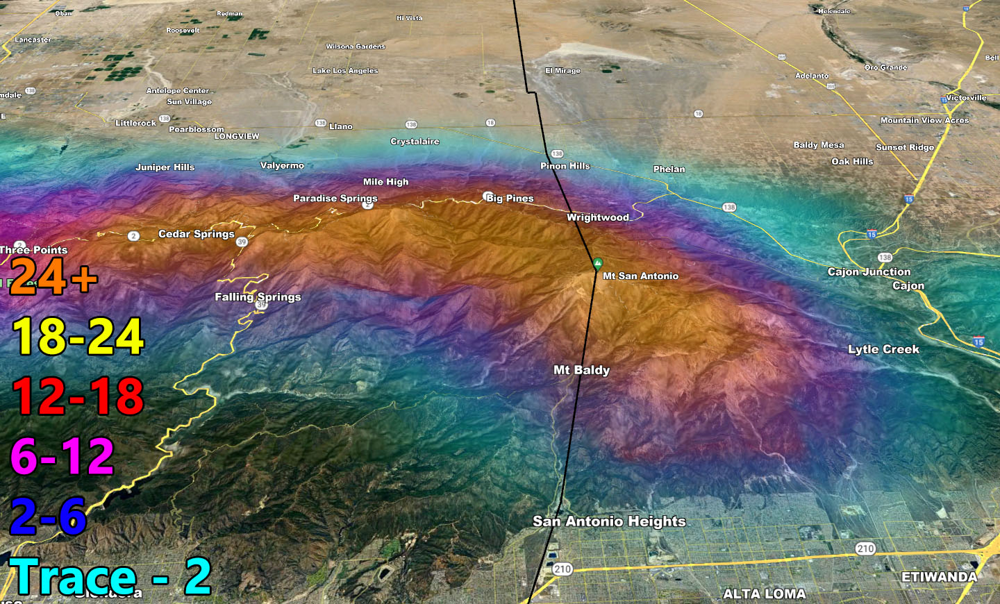
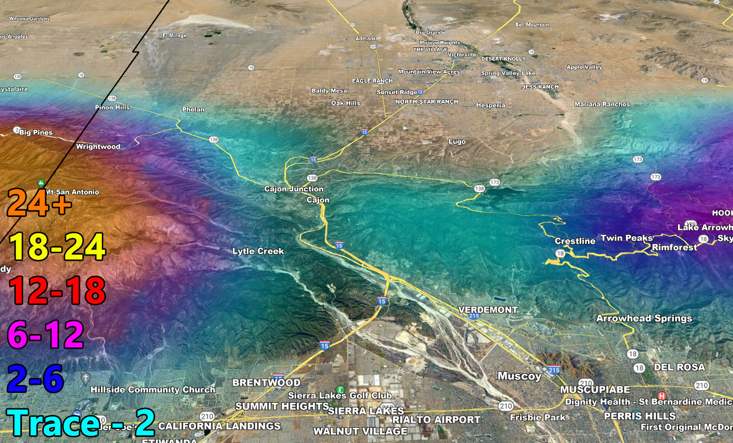
With any case, use the rain and snow images below.
RAIN
SNOW
– Raiden Storm –
https://www.southerncaliforniaweatherforce.com
Master General Meteorologist – is a consulting meteorologist for over 50 companies, including energy, agriculture, aviation, marine, leisure, and many more areas. He has certs from Mississippi State for broadcast met and Penn State forecasting certs MET 101, 241, 341 and 361 as a meteorologist, but before then was completely self-taught, barely learning a thing from the schools that he did not already know.
Both short and long-range is very important to know in those jobs so you can bet on accuracy here. He is versed in fields like Western USA, Tornadoes, Floods, Hurricanes, High Winds, Fire Behavior, Snow and Blizzards, Short Range, Long Range, Seasonal, and Life-Threatening decisions with over 25 years’ experience, out forecasting all weather services available today with lead-time and precision, which makes him a focus of ridicule and envy.
NOTE: Alerts are posted on here, be it a tornado watch, etc, and these alerts are issued from this office and nowhere else. At times, which is often, you will see an alert forecast posted on here that you do not see elsewhere.