
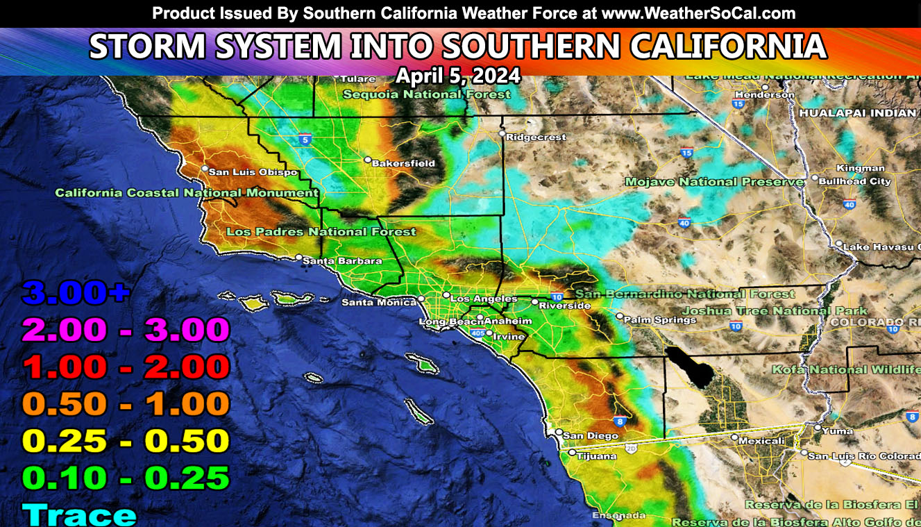
Southern California Weather Force has issued the final forecast for a system that will enter the forecast area today but maximize on Friday and be out of here on Friday night.
As predicted here at Southern California Weather Force on the March 26th article, the first week of April would see another system move in. This is that system so here are your bullet point summaries.
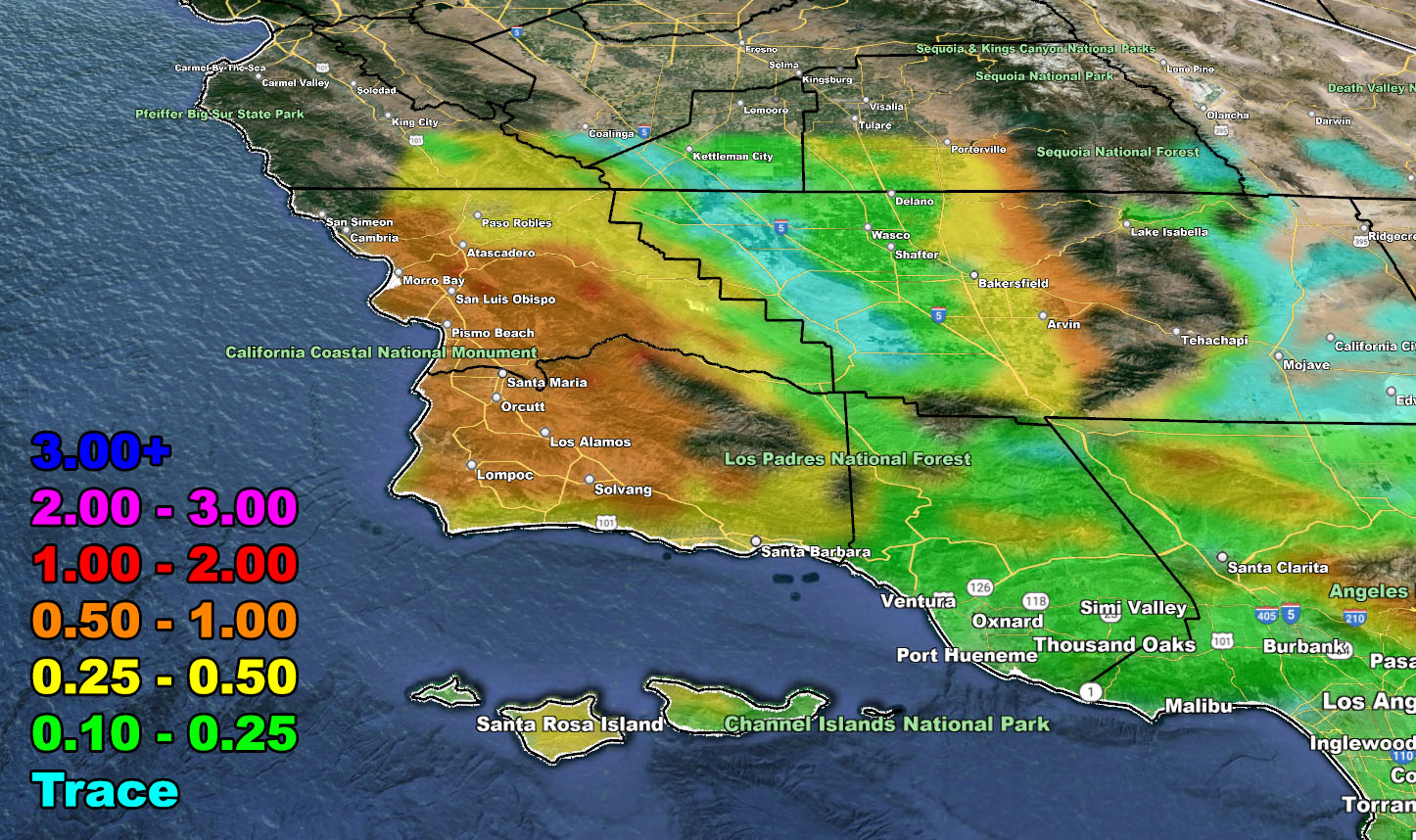
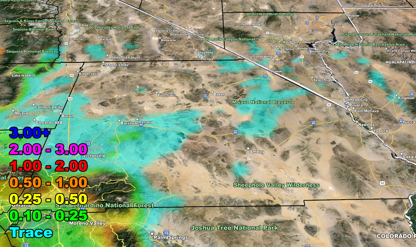
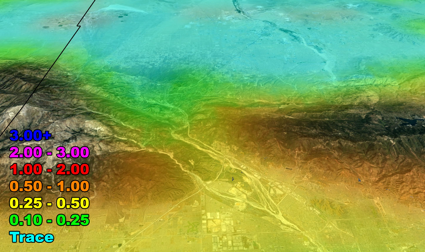
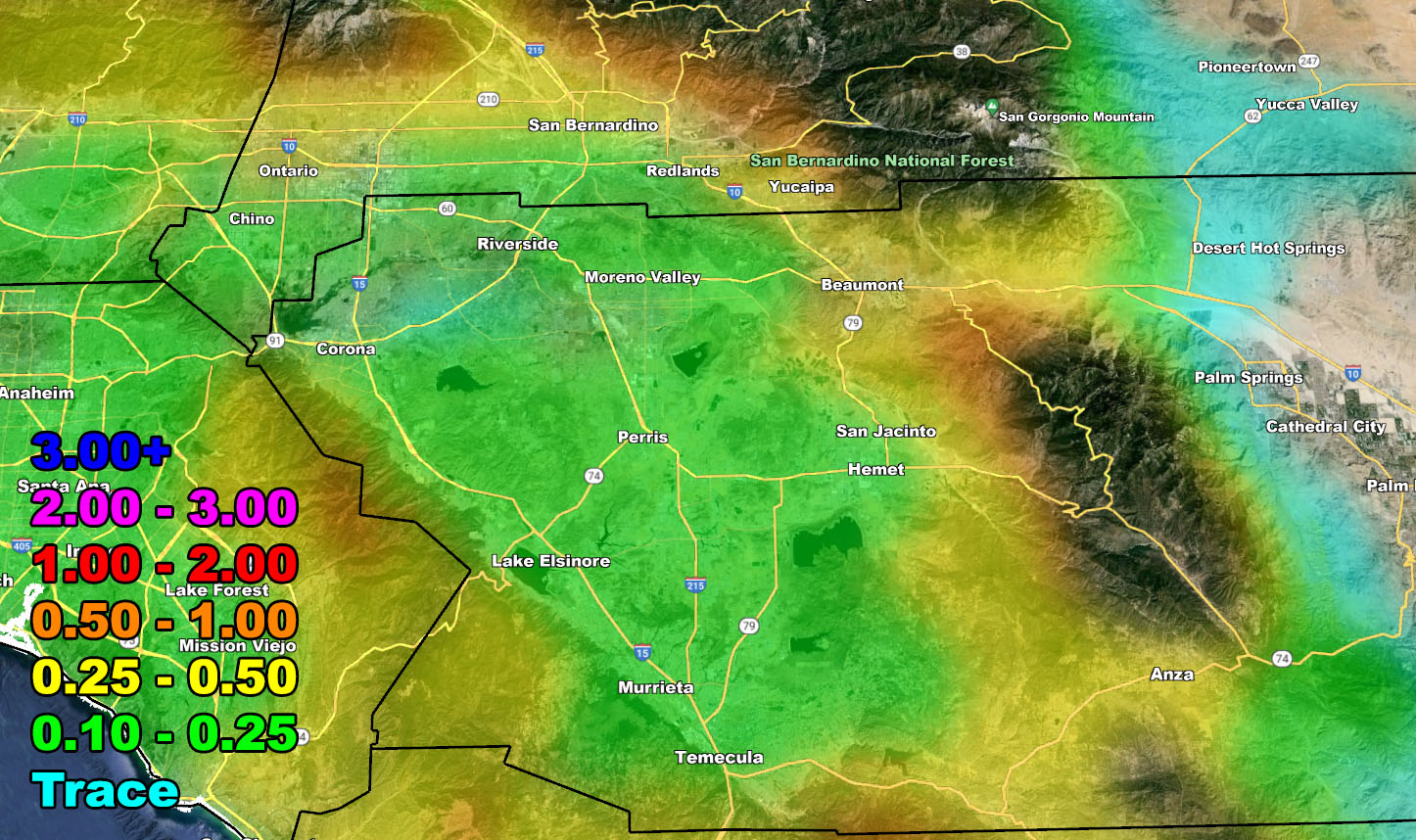
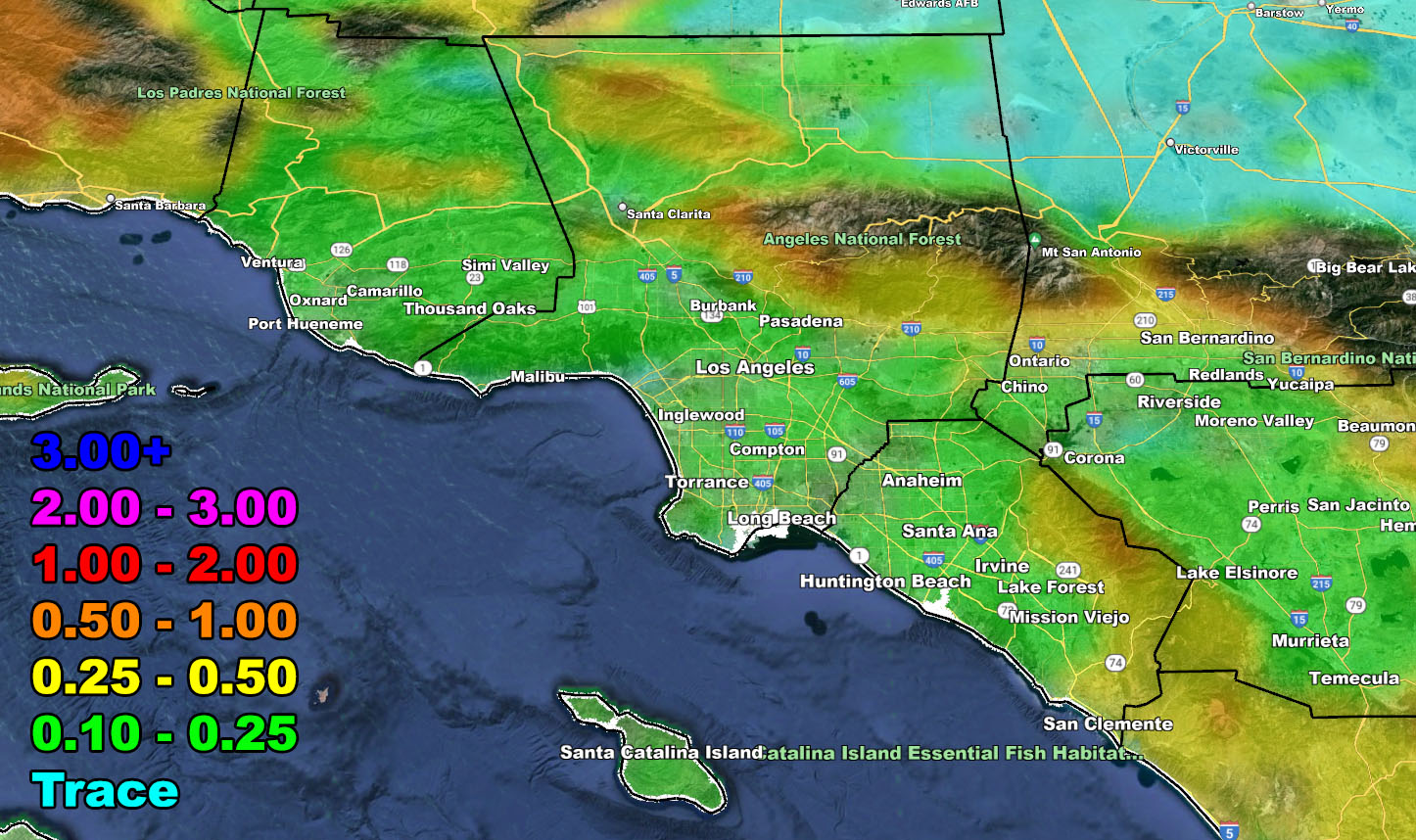
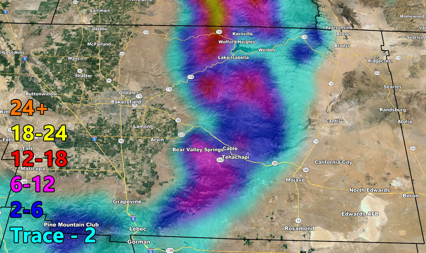
- This system will drop 4 inches of snow at the Tehachapi Airport floor.
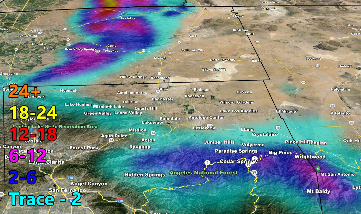
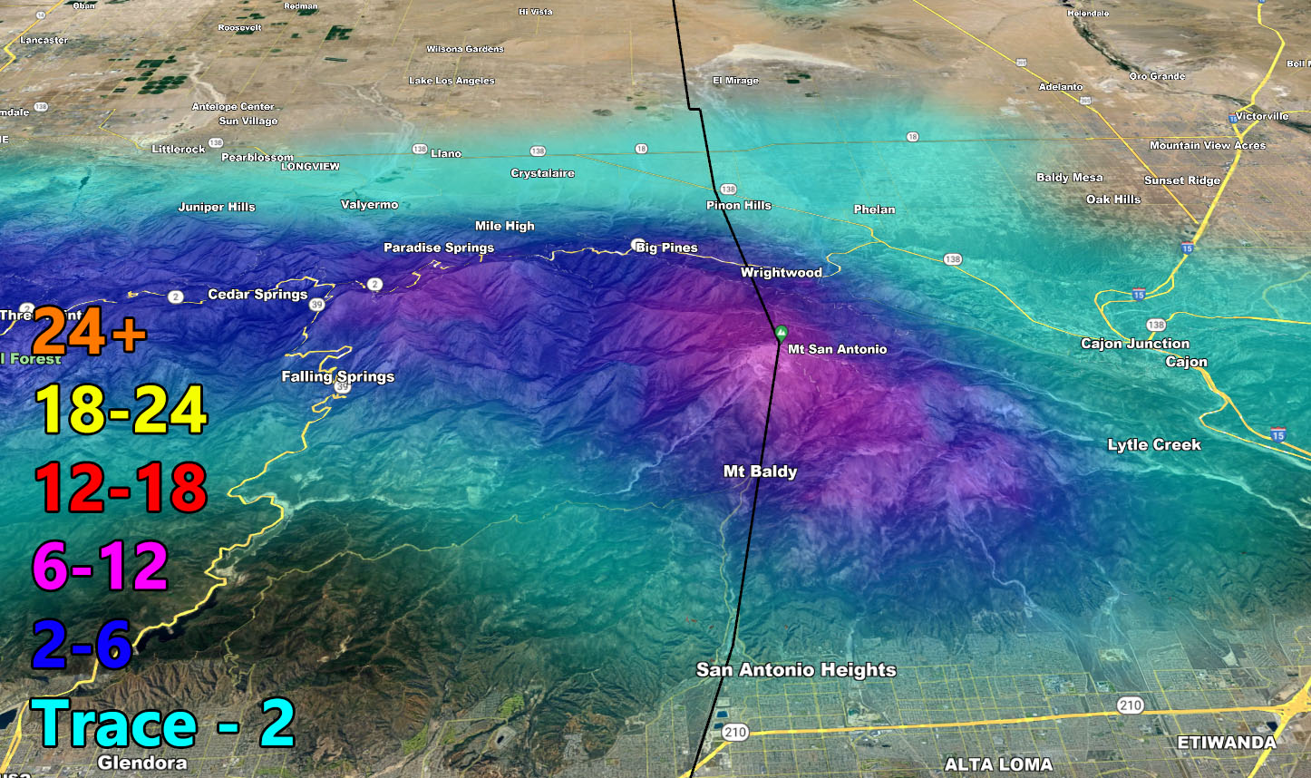
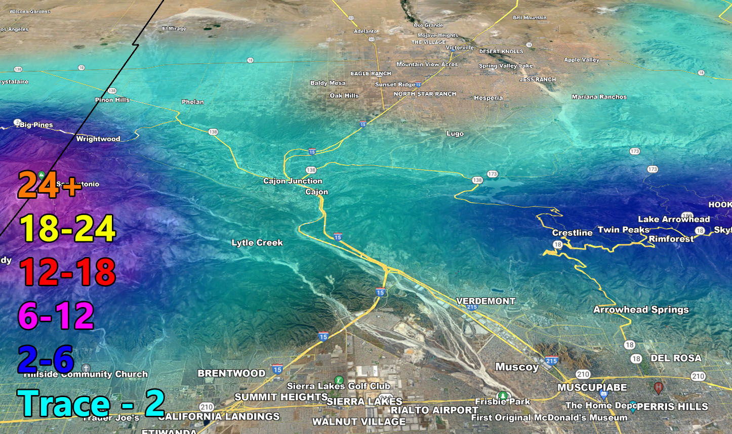
- This system has snow-levels below 4,000 FT, which means mountain passes will be affected on Friday, including Gorman and Cajon, but not enough to close them.
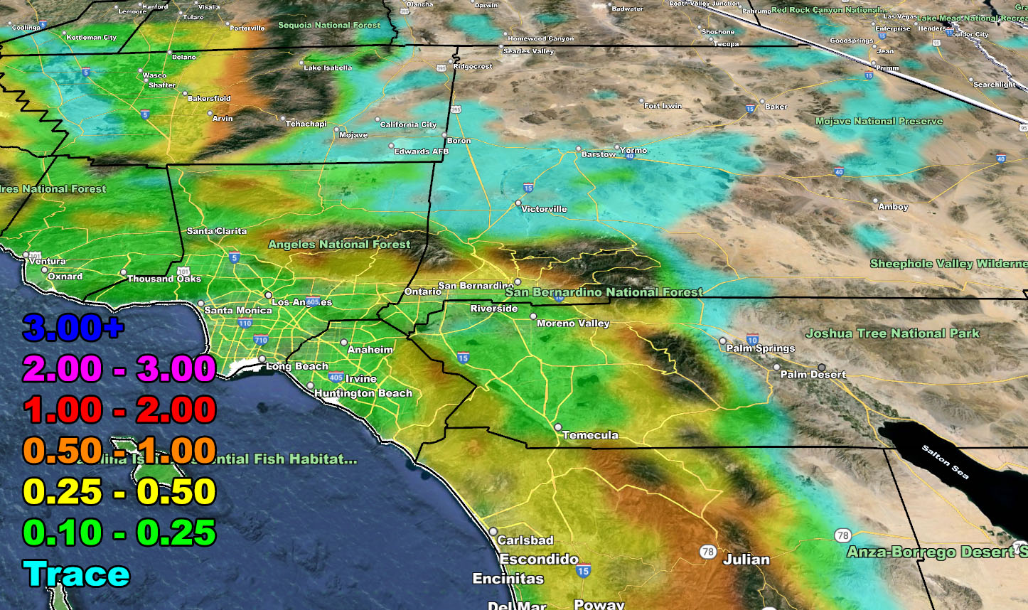
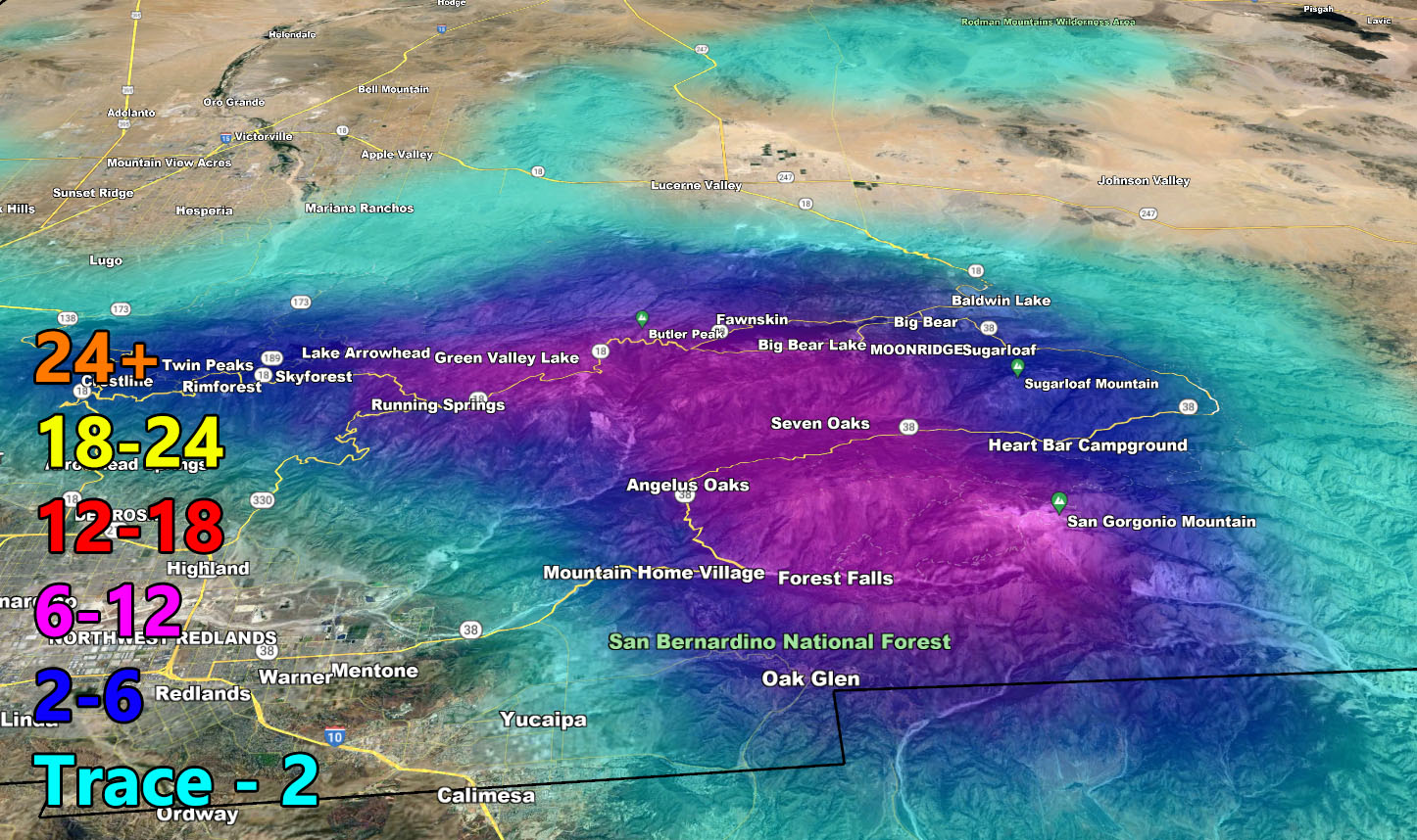
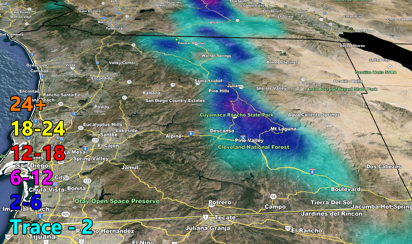
- Big Bear Lake, Airport level will see 4-6 inches, while the city west of it in town sees 6-12, more likely the 6-8″ mark.
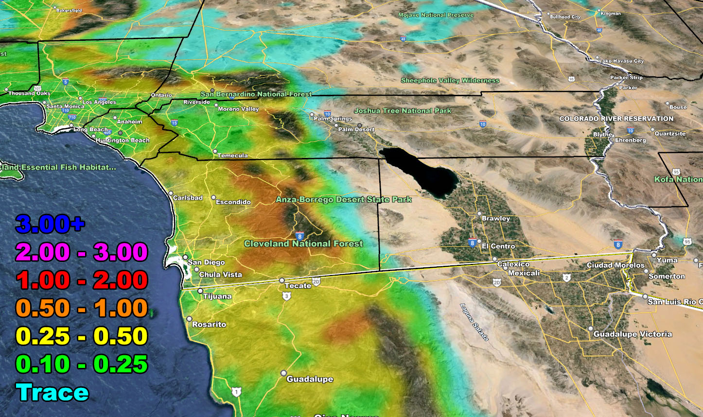
- This system will bring high winds to all mountain and desert locations.
- A dusting of snow will happen at the top of the Santa Ana Mountains, Santiago Peak.
- Thunderstorms will be highly likely on Friday for the metro areas, which also will include non-metro zones of the High Desert, Antelope Valley, Edwards Air Force Base zones as well, and of course Kern County through the Bakersfield Valley areas too.
- Additional updates will be given, but for now, use the maps included in this as most of this is for Friday. This will kick out Friday night.
- I am planning on going to chase the eclipse shadow and Southern California Weather Force will be closed until Wednesday
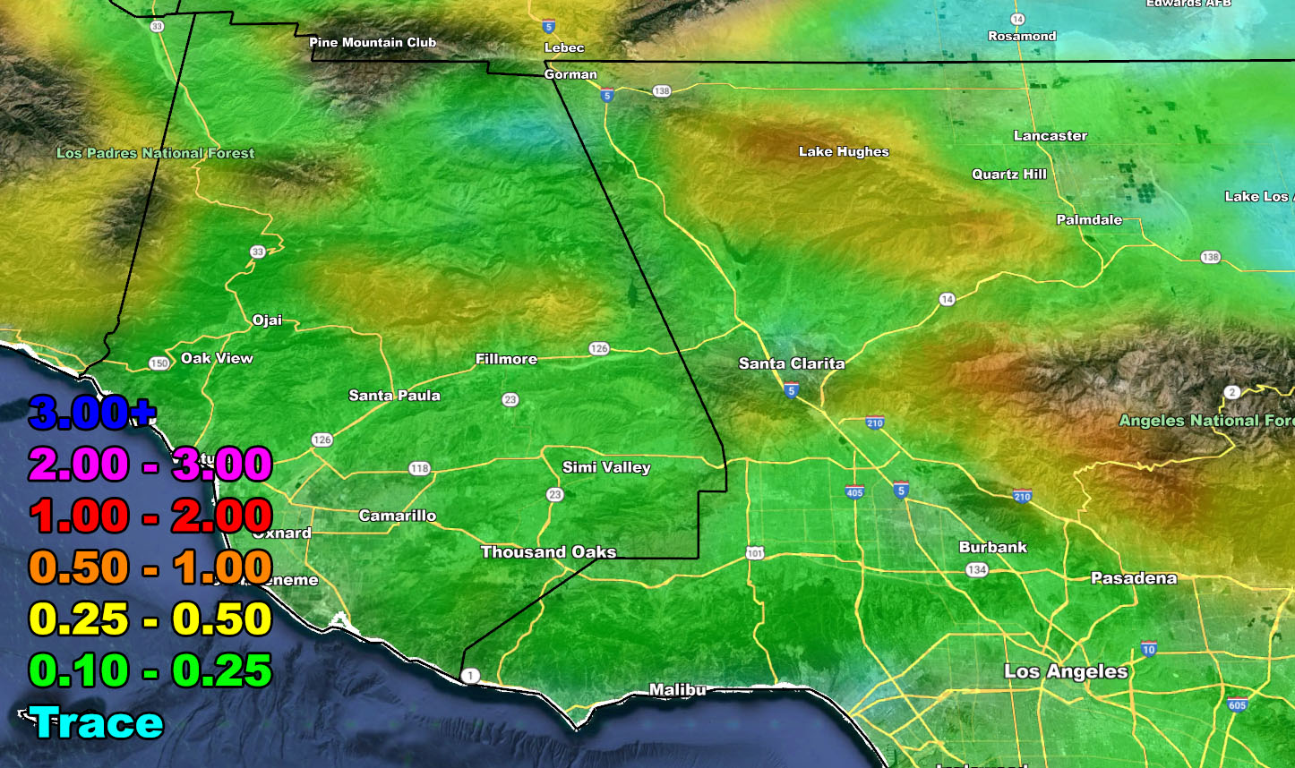
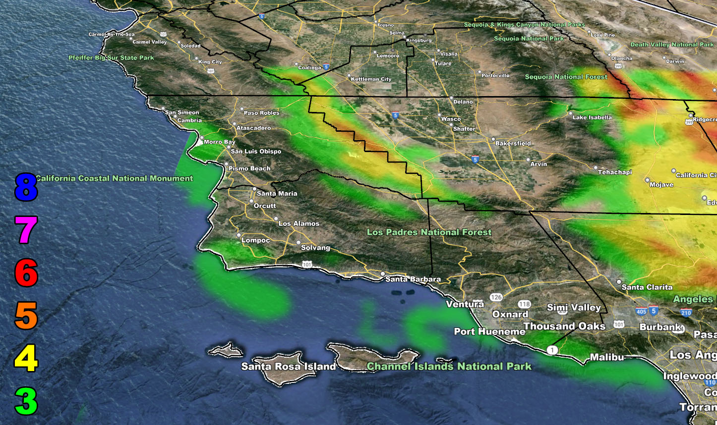
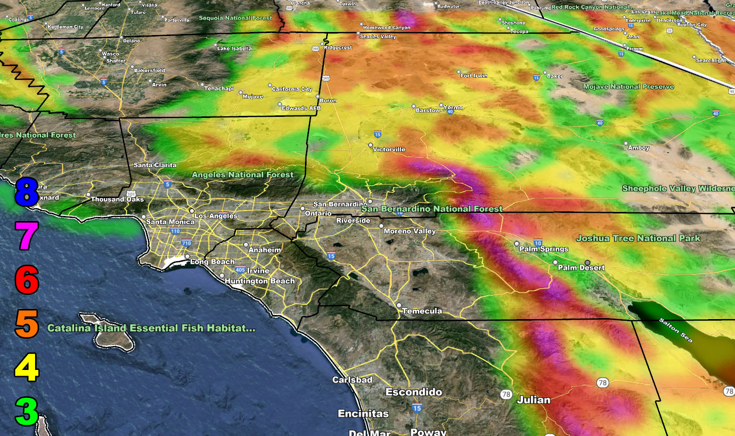
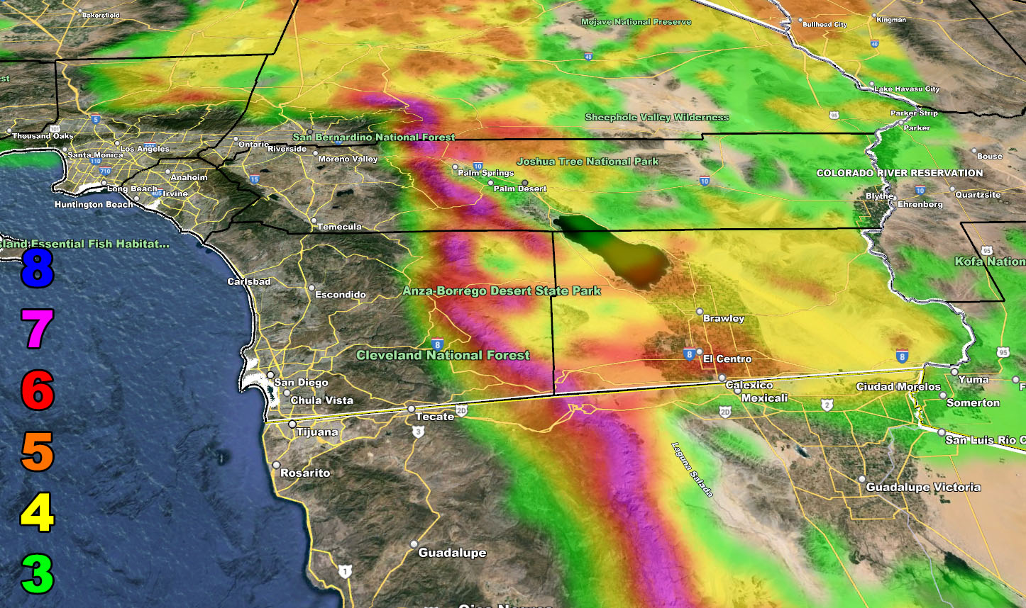
RAIN
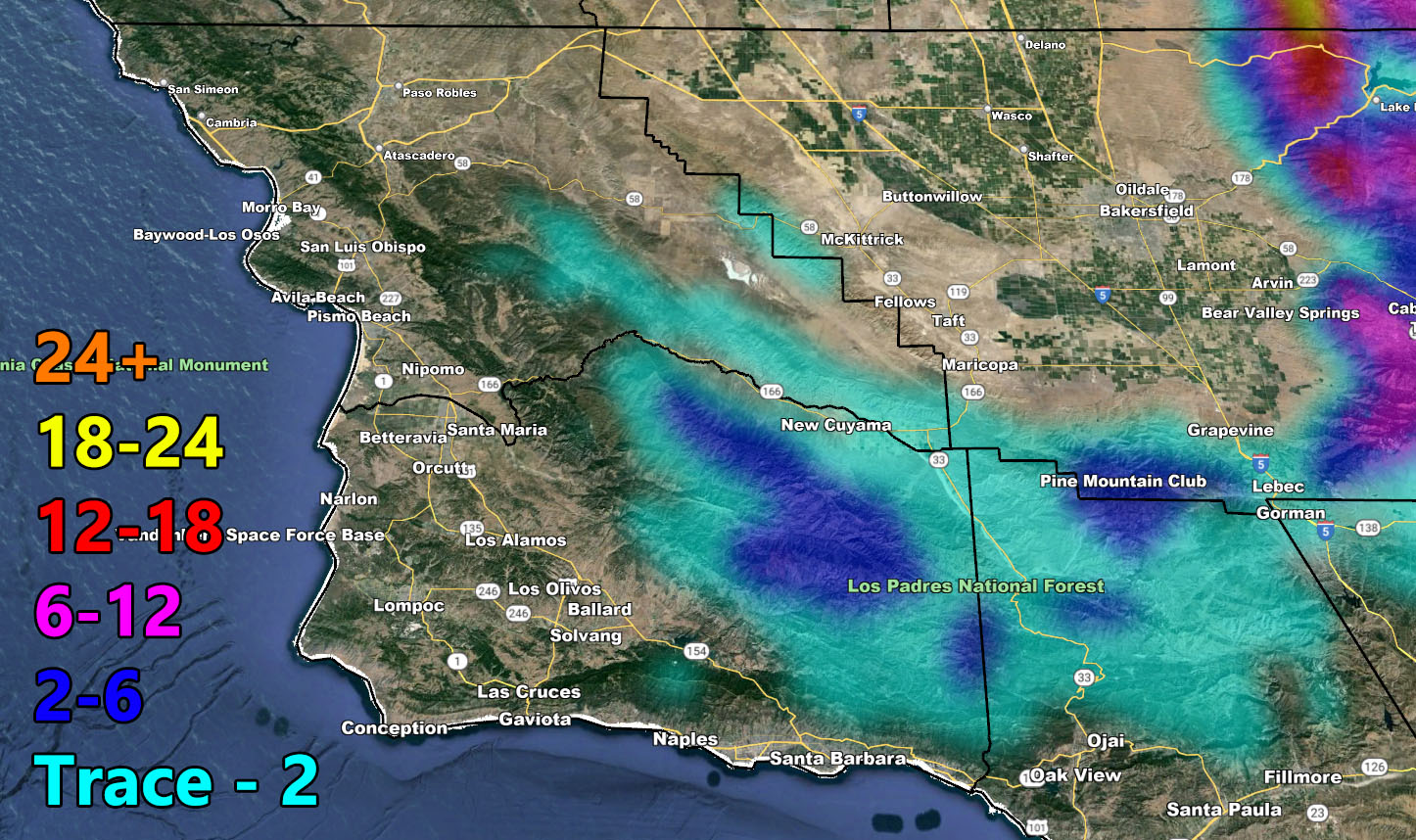
SNOW
WIND
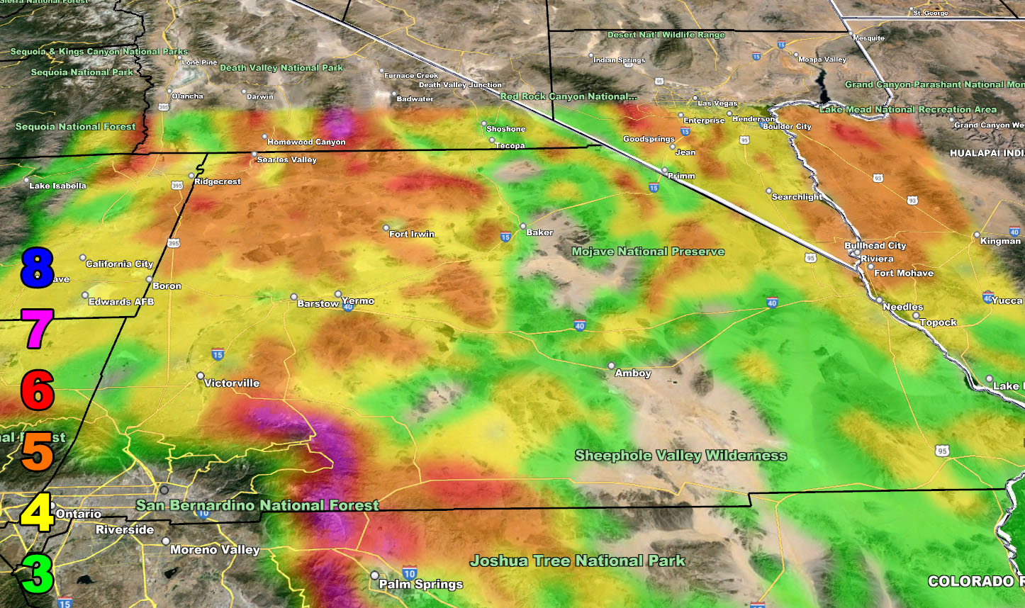
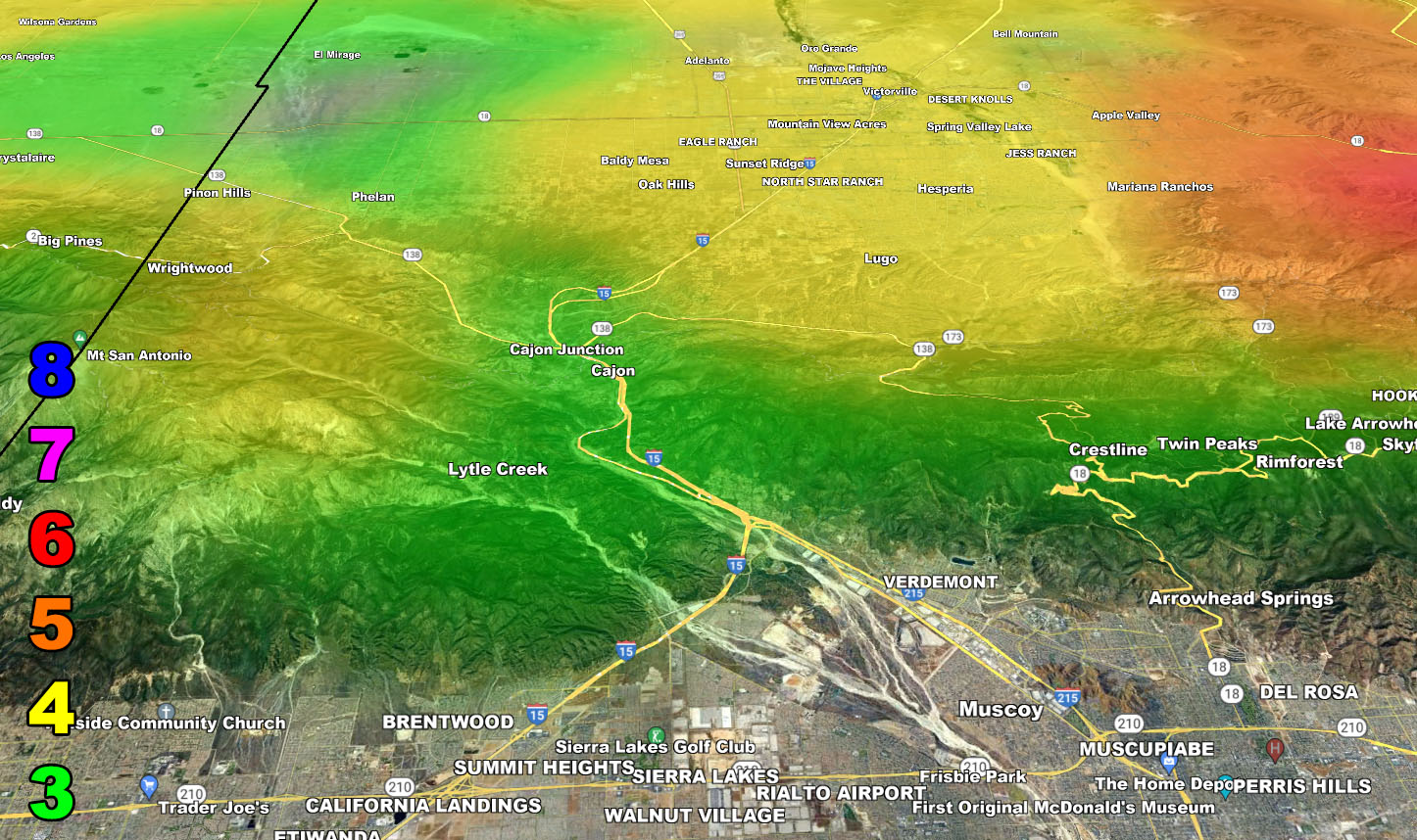
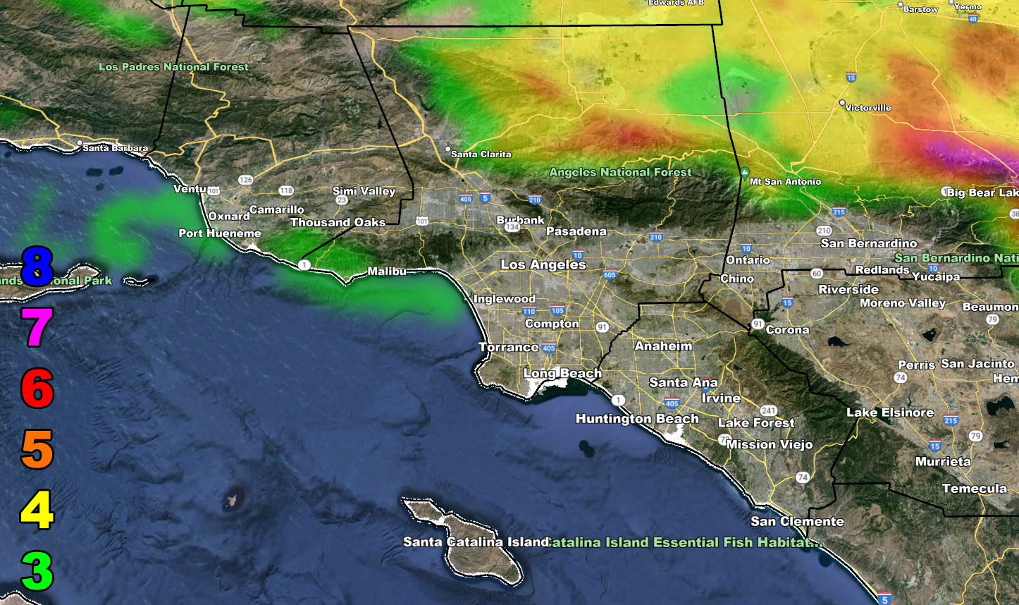
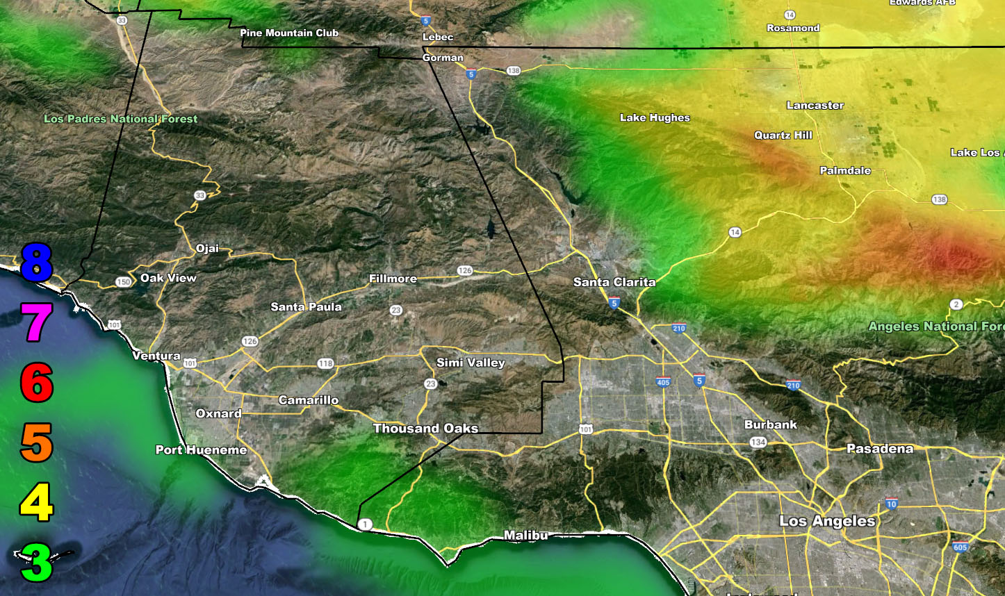
Raiden Storm Wind Gust Intensity Scale –
8. Extensive widespread damage.
7. Trees are broken or uprooted, building damage is considerable. – High Profile Vehicle Roll-Over CERTAIN.
6. SOME Trees are broken or uprooted, building damage is possible. – High Profile Vehicle Roll-Over Likely, Do NOT recommend Traveling in this zone. This zone also is the starting zone where trees and powerlines will fall and damage cars and even kill people near or in them!
5. Slight damage occurs to buildings; shingles are blown off of roofs. HIGH WIND WARNING CRITERIA – High Profile Vehicle Roll-Over Possible if weight is not corrected.
4. Twigs and small branches are broken from trees, walking is difficult.
3. Large trees sway, becoming difficult to walk. POWER SHUTDOWN THRESHOLD DURING FIRE WEATHER / WIND ADVISORY CRITERIA
– Raiden Storm –
https://www.southerncaliforniaweatherforce.com
Master General Meteorologist – is a consulting meteorologist for over 50 companies, including energy, agriculture, aviation, marine, leisure, and many more areas. He has certs from Mississippi State for broadcast met and Penn State forecasting certs MET 101, 241, 341 and 361 as a meteorologist, but before then was completely self-taught, barely learning a thing from the schools that he did not already know.
Both short and long-range is very important to know in those jobs so you can bet on accuracy here. He is versed in fields like Western USA, Tornadoes, Floods, Hurricanes, High Winds, Fire Behavior, Snow and Blizzards, Short Range, Long Range, Seasonal, and Life-Threatening decisions with over 25 years’ experience, out forecasting all weather services available today with lead-time and precision, which makes him a focus of ridicule and envy.
NOTE: Alerts are posted on here, be it a tornado watch, etc, and these alerts are issued from this office and nowhere else. At times, which is often, you will see an alert forecast posted on here that you do not see elsewhere