
Southern California Weather Force has issued the final forecast for a system that will enter the forecast area this weekend.
Here are your bullet point summaries.
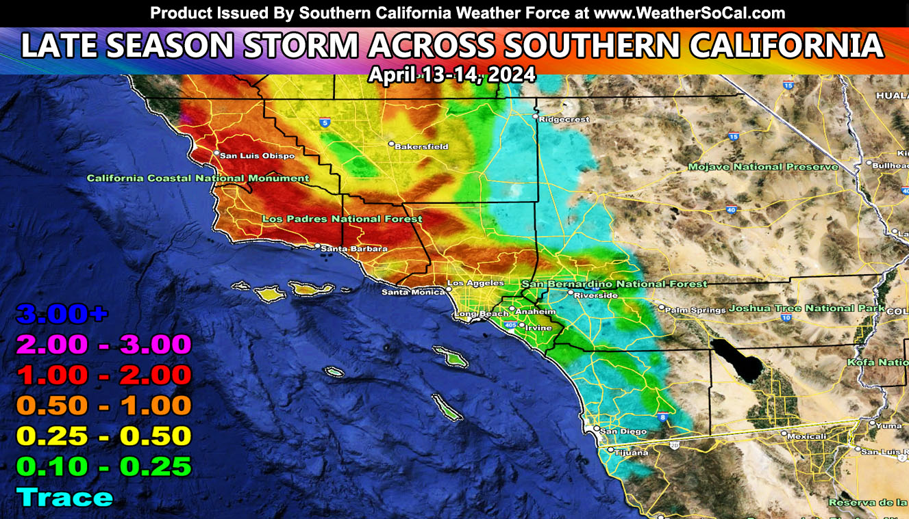
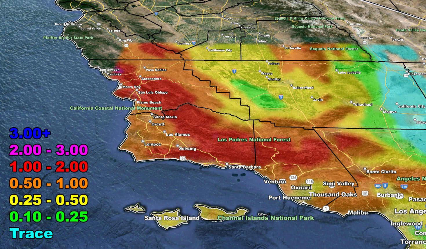
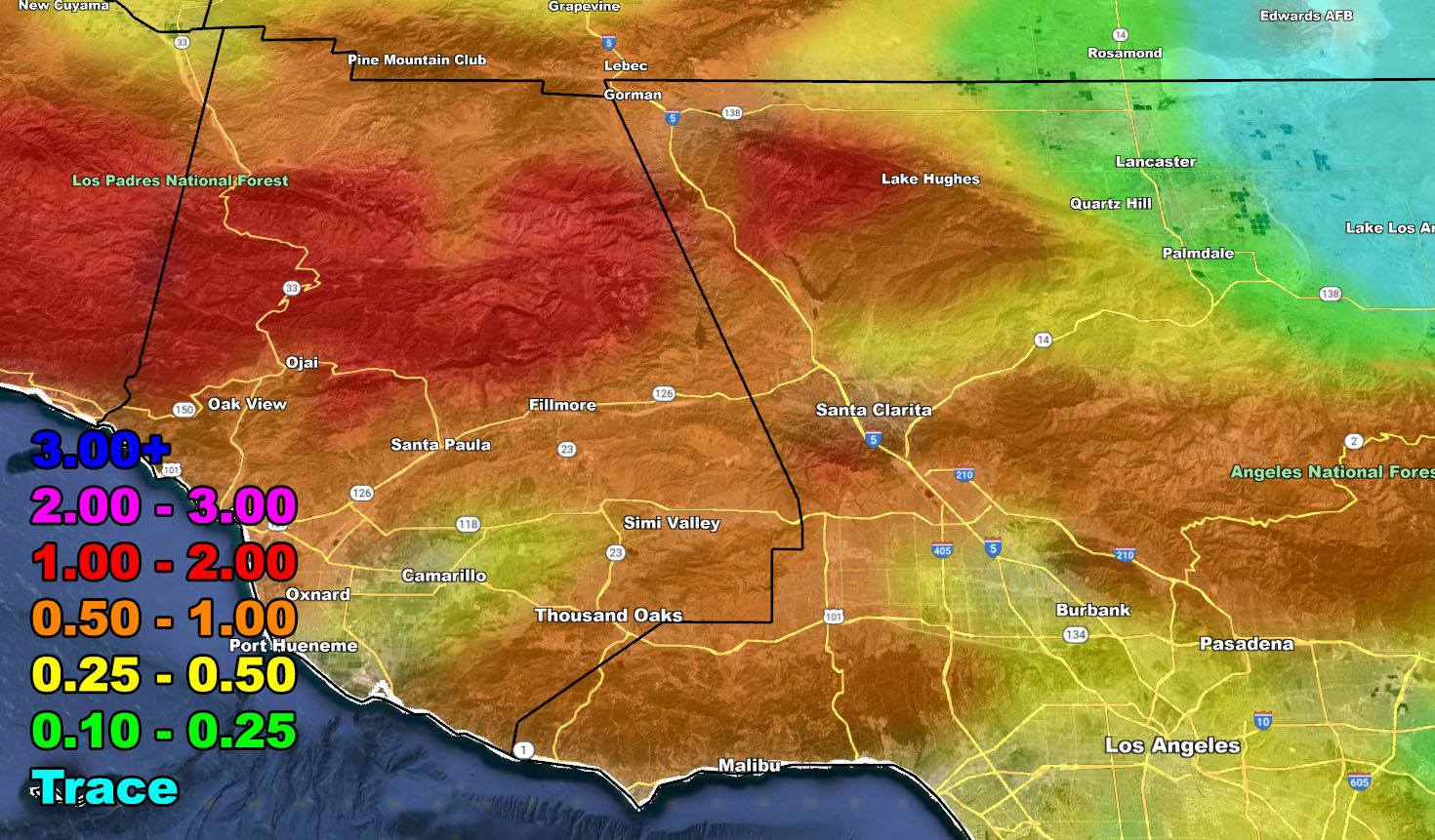
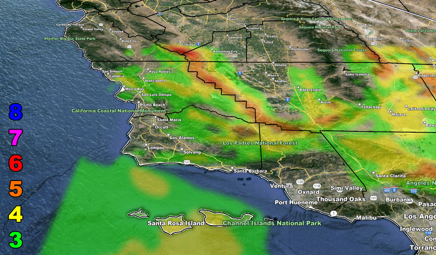
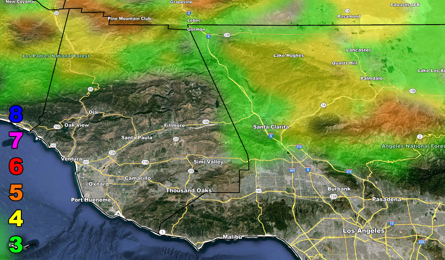
- This storm system will impact San Luis Obispo, Kern, Santa Barbara, and Ventura forecast zones the most, with a Flood Watch now issued here at Southern California Weather Force in those zones.
- Thunderstorms will be possible in the said flood watch zones above.
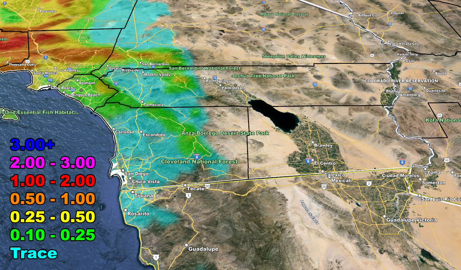
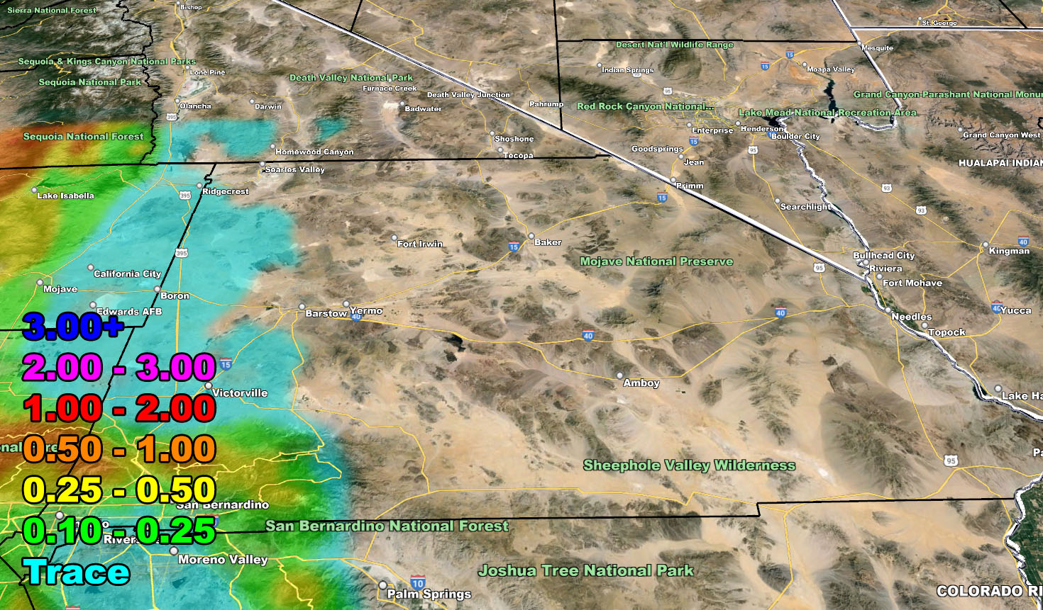
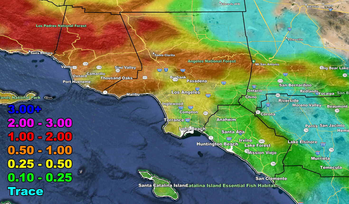
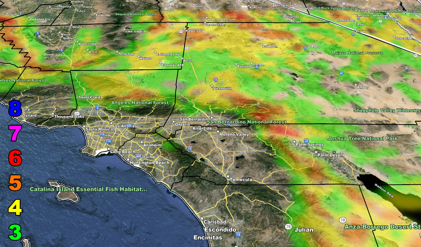
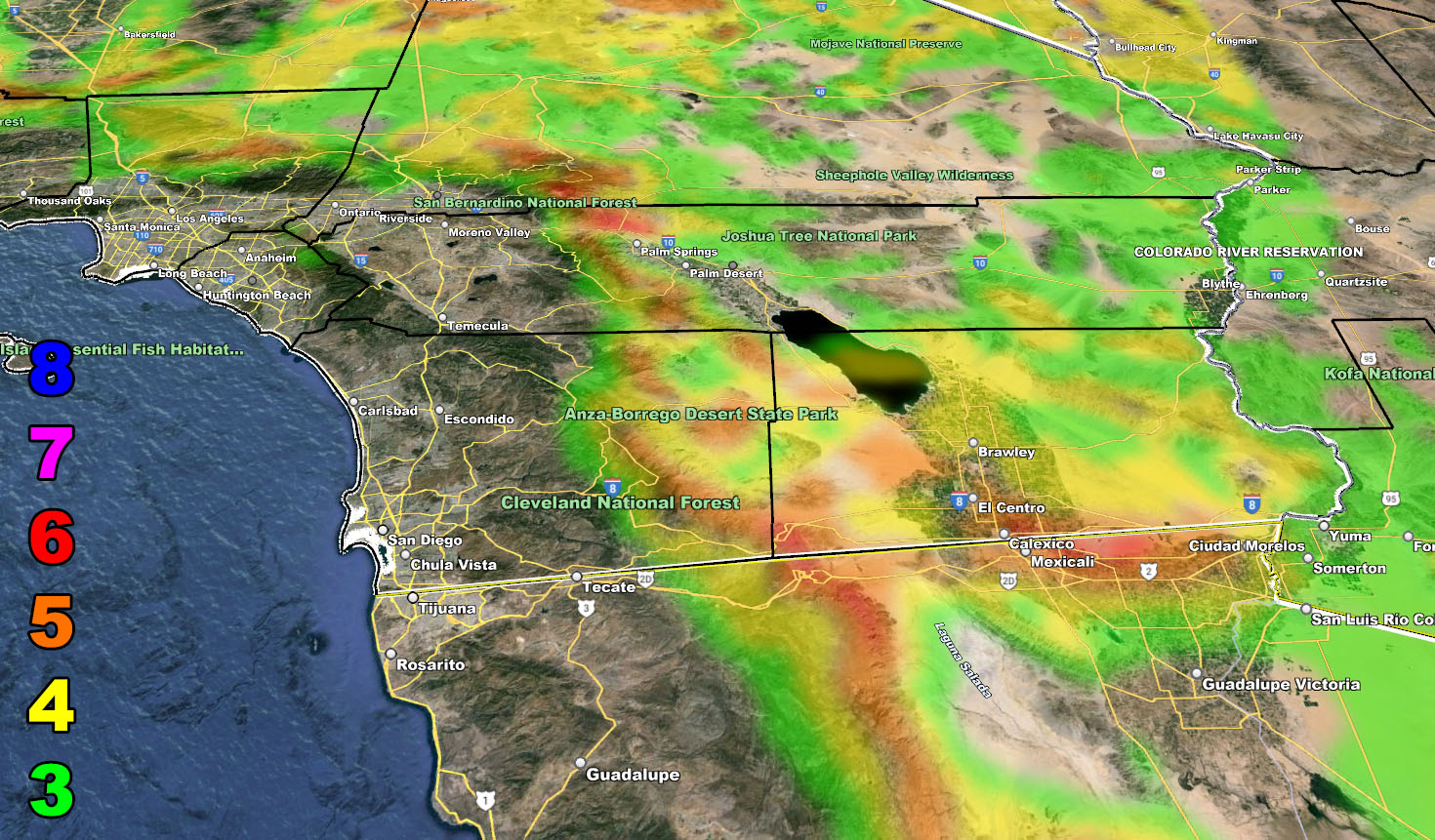
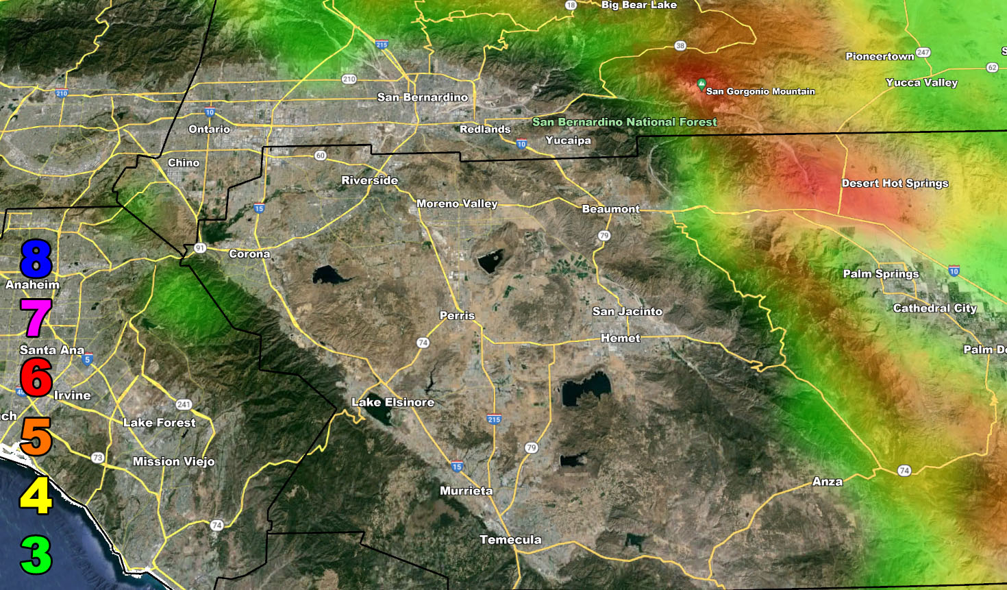
- San Diego will see far less rain from this, due to the orientation of the frontal zone that sweeps through, see the rain model for that detail.
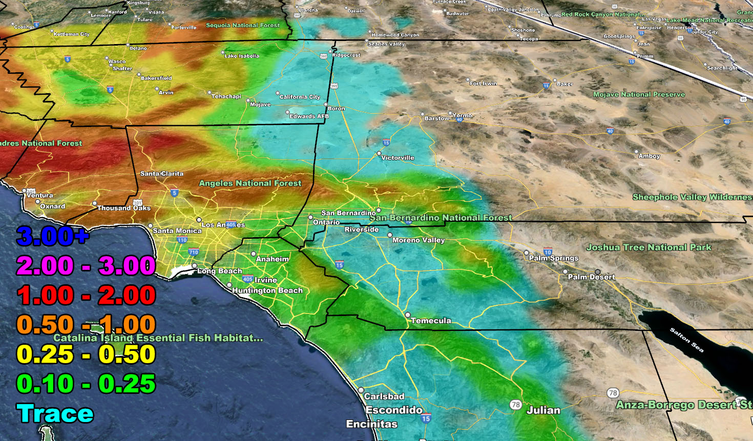
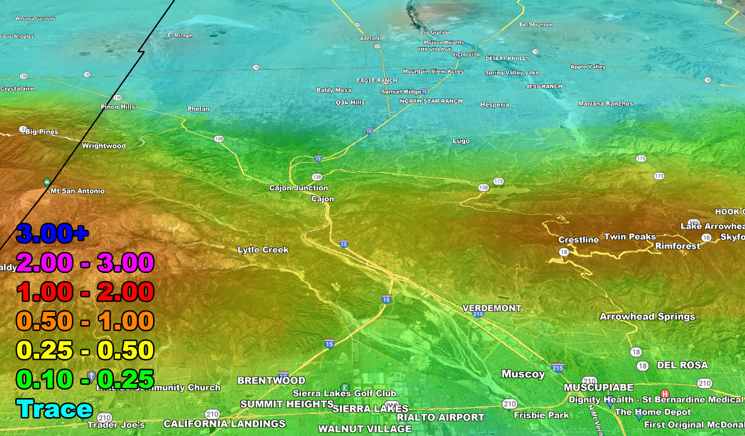
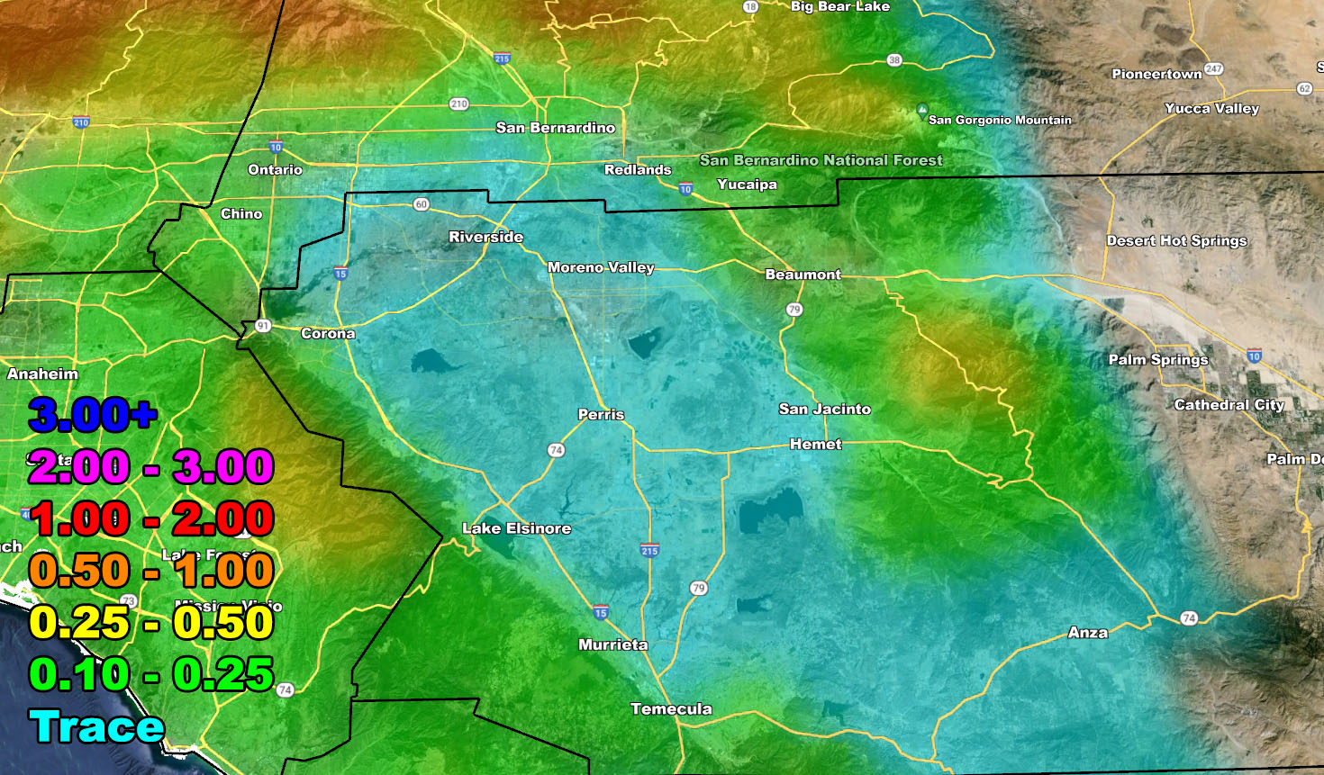
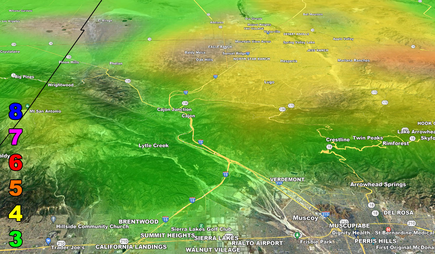
- Rain model shows that most of the Inland Empire will see less rain as well, all due to the rain-shadow effect from the Santa Ana Mountains.
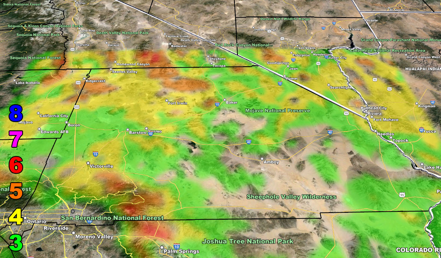
- All Mountain and Desert zones will see gusty winds through the weekend.
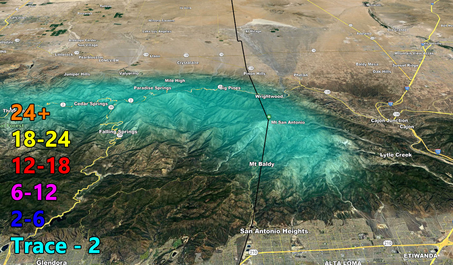
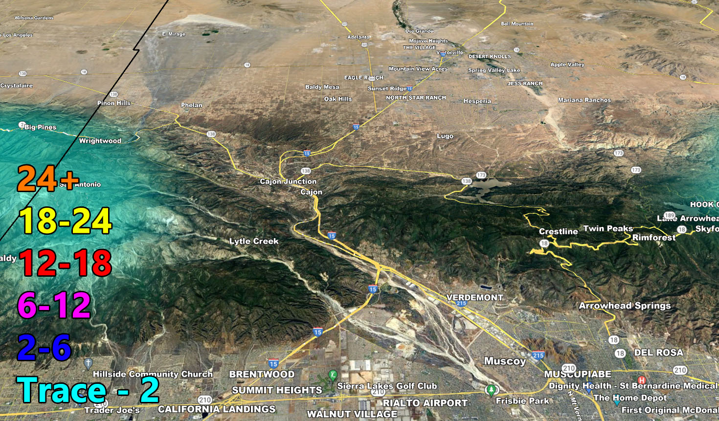
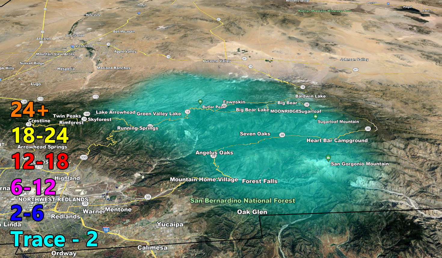
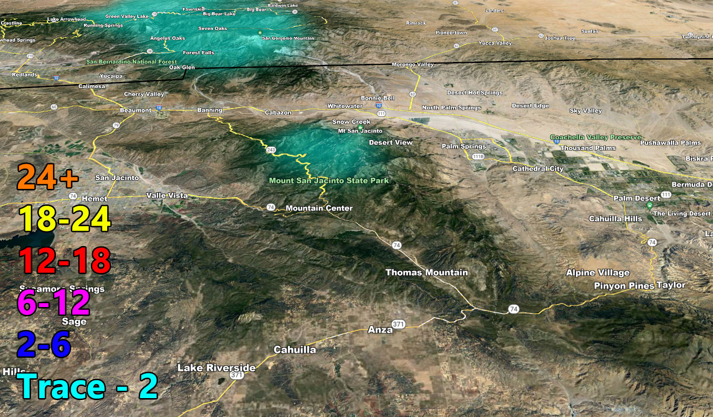
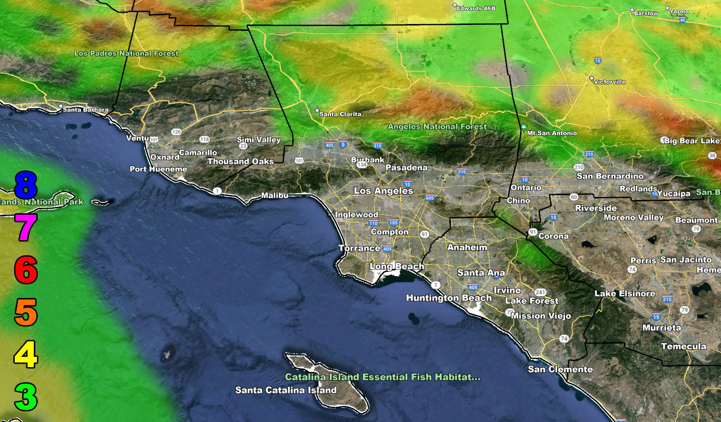
RAIN
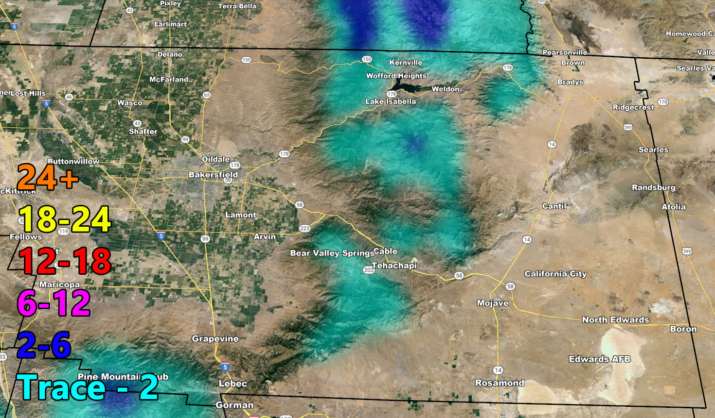
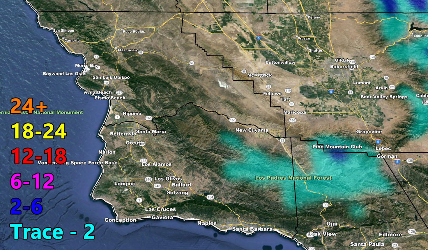
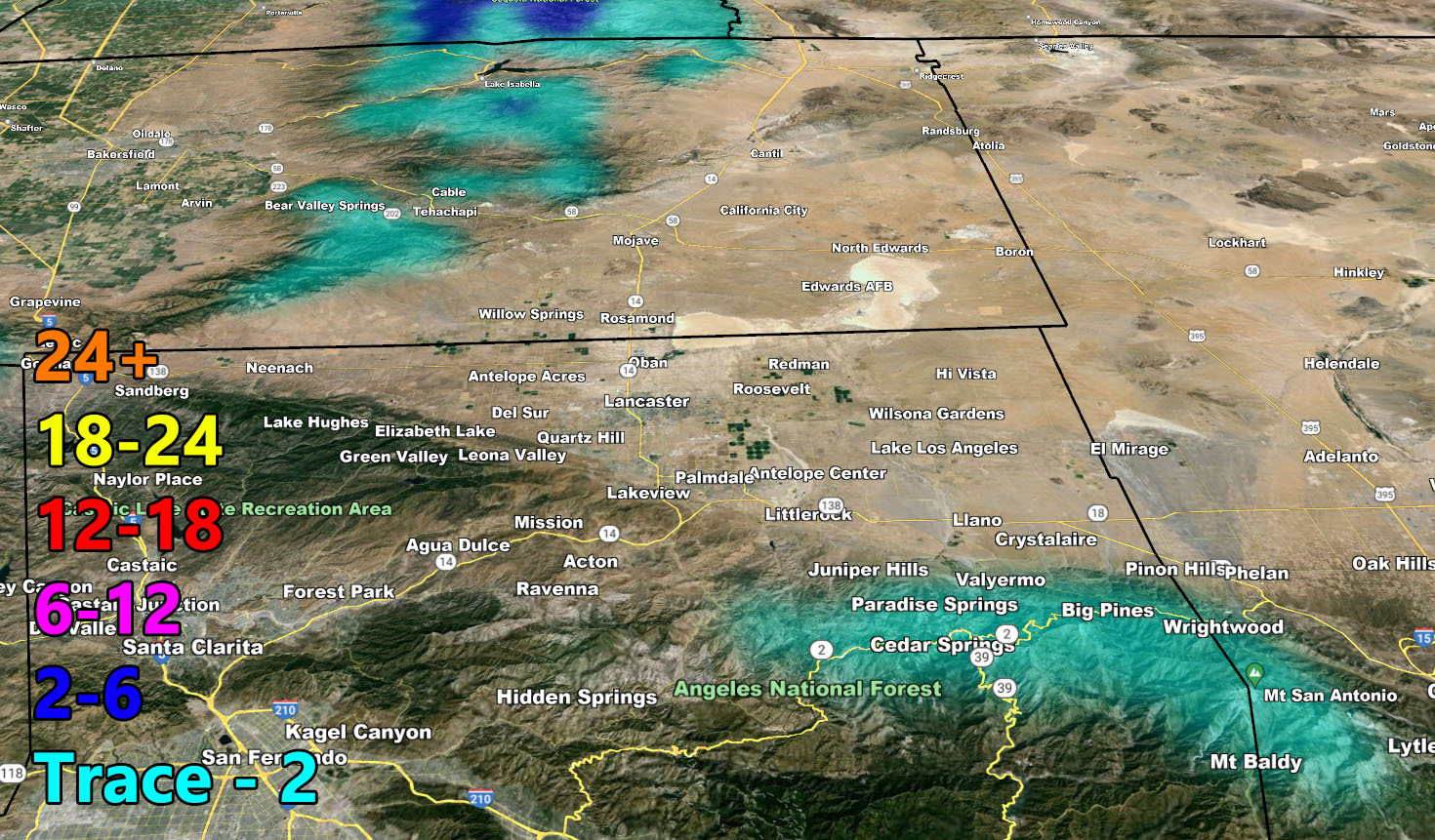
SNOW
WIND
Raiden Storm Wind Gust Intensity Scale –
8. Extensive widespread damage.
7. Trees are broken or uprooted, building damage is considerable. – High Profile Vehicle Roll-Over CERTAIN.
6. SOME Trees are broken or uprooted, building damage is possible. – High Profile Vehicle Roll-Over Likely, Do NOT recommend Traveling in this zone. This zone also is the starting zone where trees and powerlines will fall and damage cars and even kill people near or in them!
5. Slight damage occurs to buildings; shingles are blown off of roofs. HIGH WIND WARNING CRITERIA – High Profile Vehicle Roll-Over Possible if weight is not corrected.
4. Twigs and small branches are broken from trees, walking is difficult.
3. Large trees sway, becoming difficult to walk. POWER SHUTDOWN THRESHOLD DURING FIRE WEATHER / WIND ADVISORY CRITERIA
– Raiden Storm –
https://www.southerncaliforniaweatherforce.com
Master General Meteorologist – is a consulting meteorologist for over 50 companies, including energy, agriculture, aviation, marine, leisure, and many more areas. He has certs from Mississippi State for broadcast met and Penn State forecasting certs MET 101, 241, 341 and 361 as a meteorologist, but before then was completely self-taught, barely learning a thing from the schools that he did not already know.
Both short and long-range is very important to know in those jobs so you can bet on accuracy here. He is versed in fields like Western USA, Tornadoes, Floods, Hurricanes, High Winds, Fire Behavior, Snow and Blizzards, Short Range, Long Range, Seasonal, and Life-Threatening decisions with over 25 years’ experience, out forecasting all weather services available today with lead-time and precision, which makes him a focus of ridicule and envy.
NOTE: Alerts are posted on here, be it a tornado watch, etc, and these alerts are issued from this office and nowhere else. At times, which is often, you will see an alert forecast posted on here that you do not see elsewhere.