
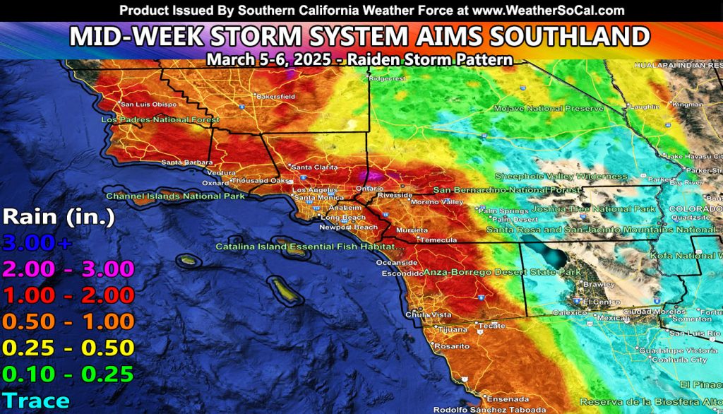
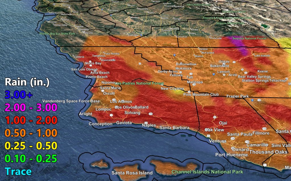
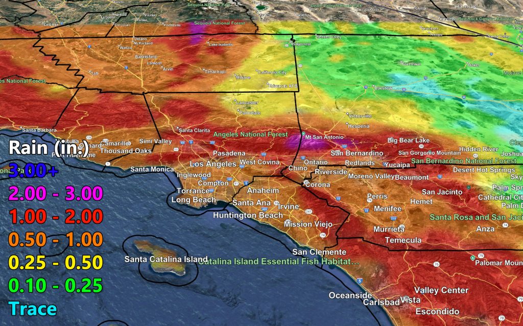
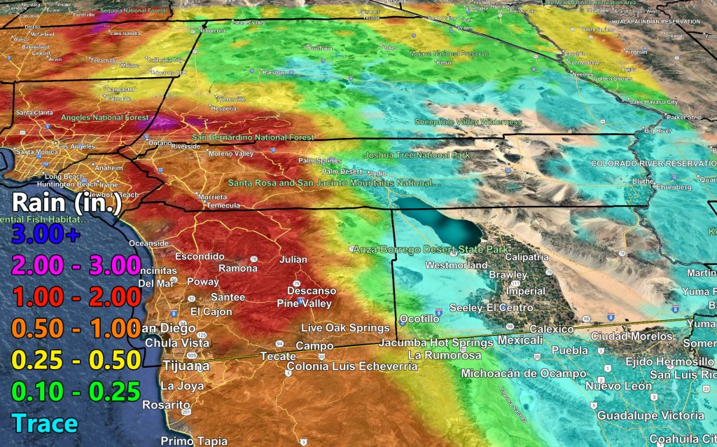
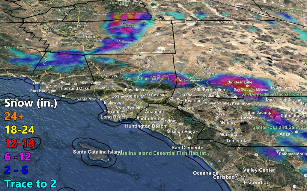
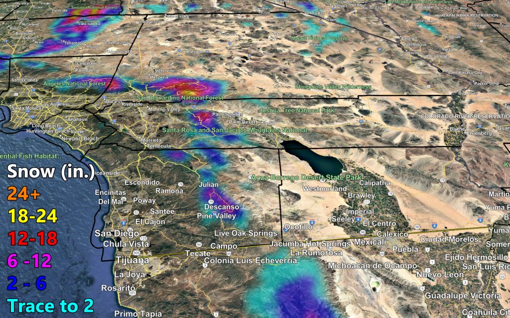
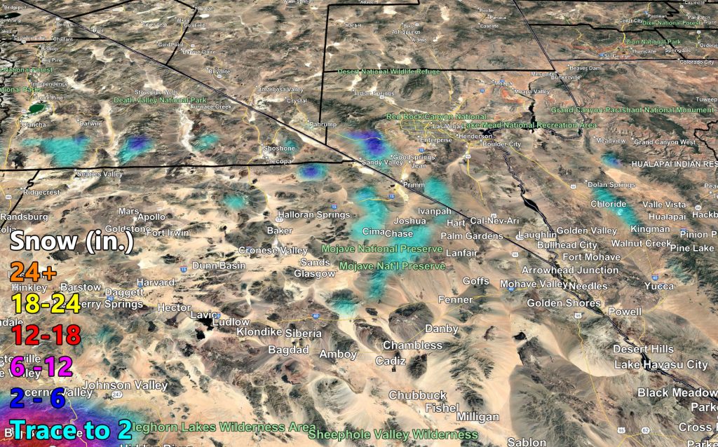
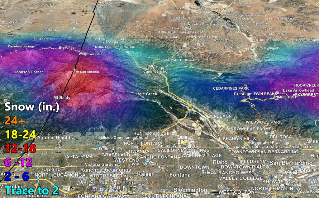
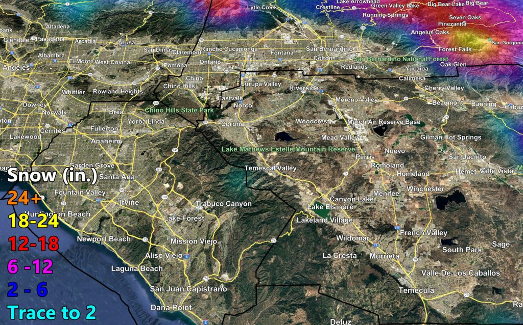
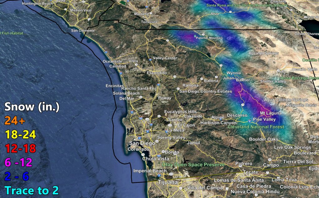
Southern California Weather Force has issued a preliminary forecast for rain and snow for Southern California, which will cross the forecast area Wednesday into Thursday of this week.
The second system within the multiple systems expected this month within the Raiden Storm Pattern will be hitting mid-week. A couple of things about it. It will be a potent cold front for the Wednesday period, and Thursday will have a secondary front, which will be what brings the 8,000 FT snow levels on Wednesday to just below the 4,000 FT mark.
Thursday stands to have the lower pass-level snow levels through the Cajon / Gorman Pass locations, including down to the Tehachapi floor levels.
Thursday’s batch will also have the risk of thunderstorms, and for some of you at and above the snow-level it will be thundersnow.
The Raiden Storm Pattern will continue from March 10th onward with several systems expected, and then beyond that it is being monitored.
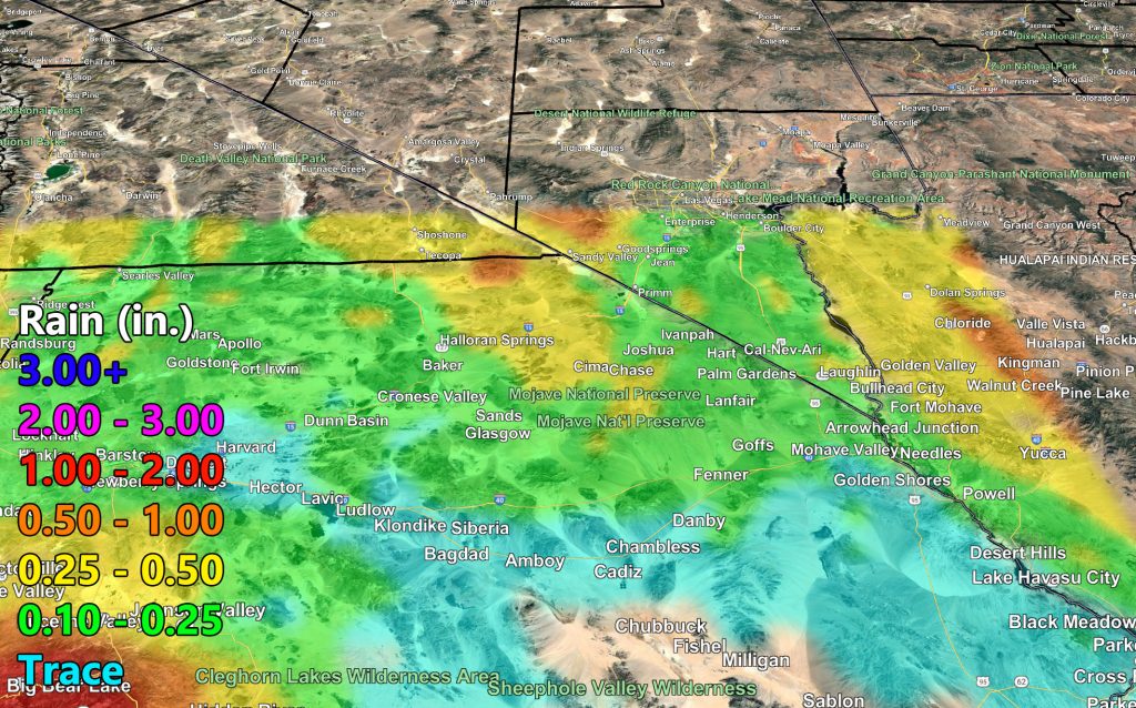
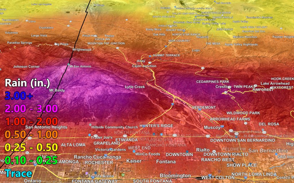
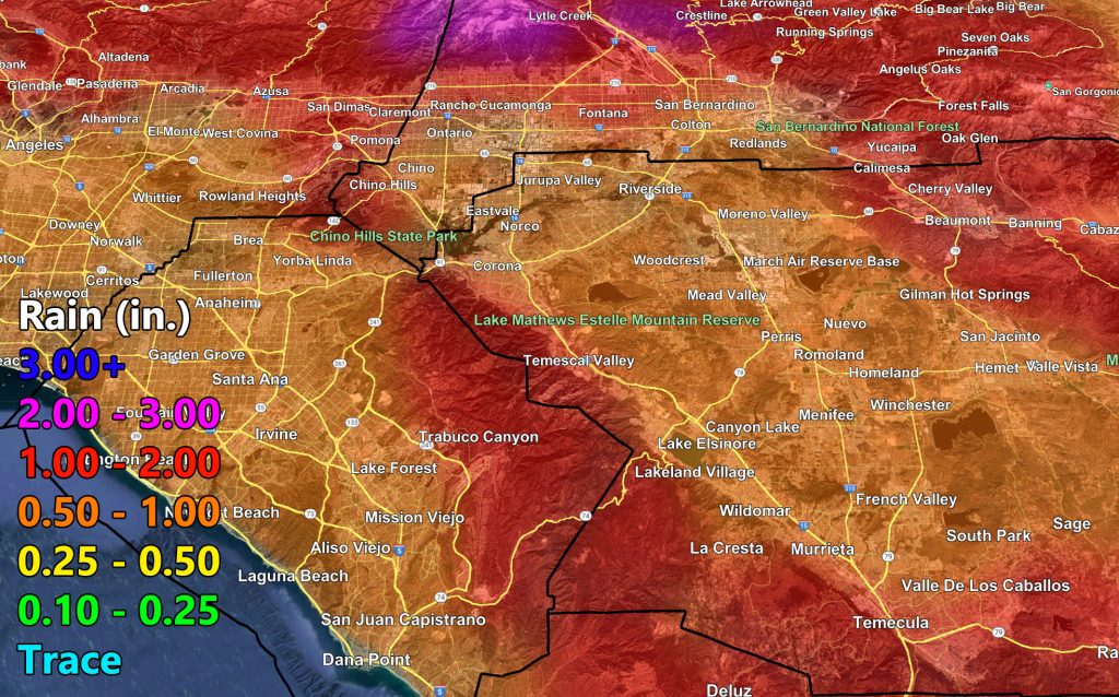
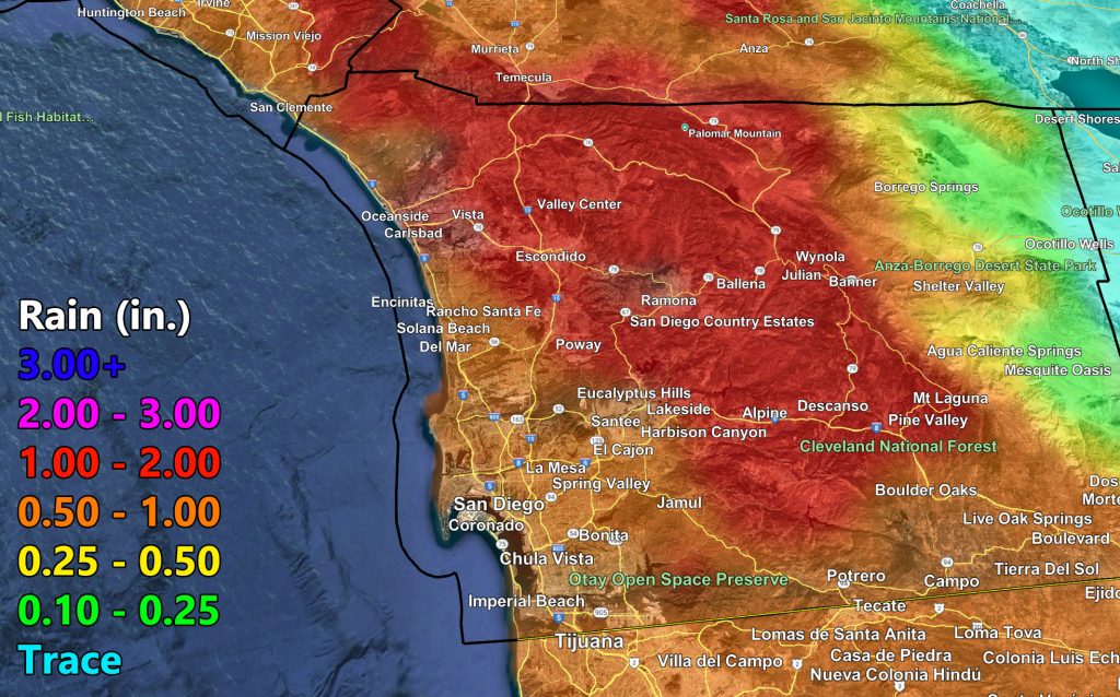
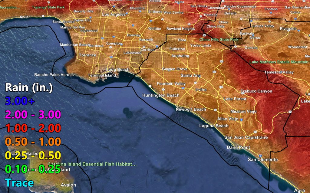
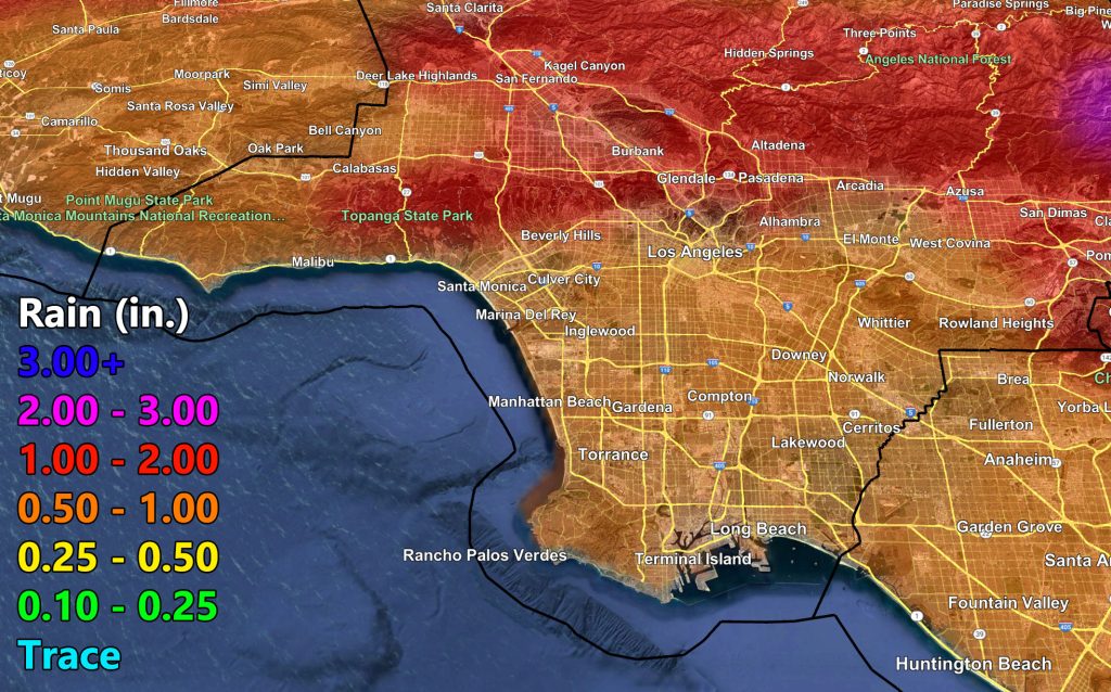
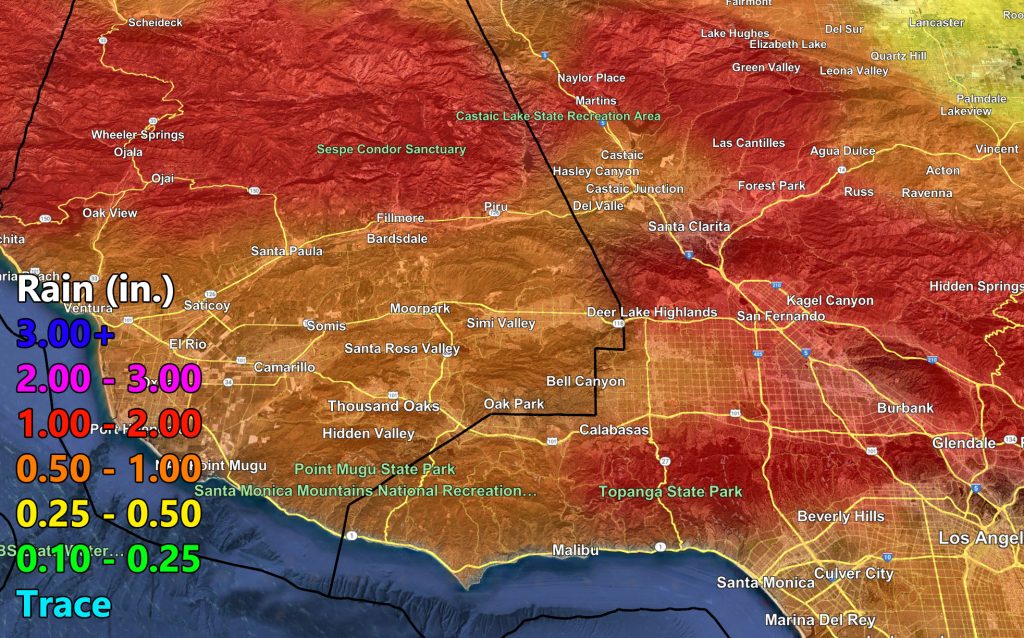
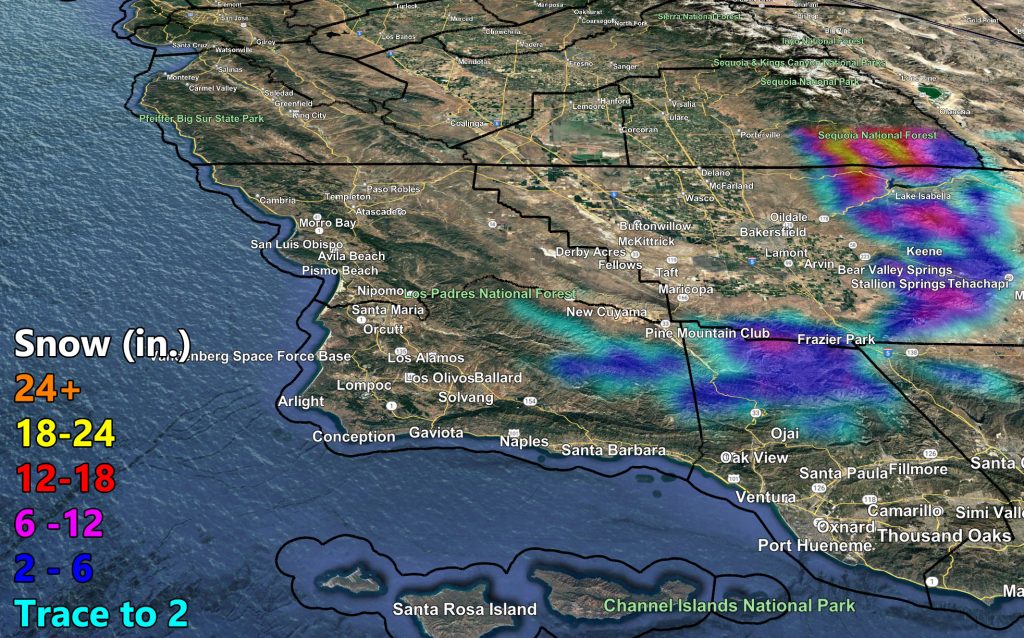
Stay tuned to official forecasts here at Southern California Weather Force and use the preliminary rain and snow models below –
RAIN
SNOW
Raiden Storm
Master General Meteorologist