
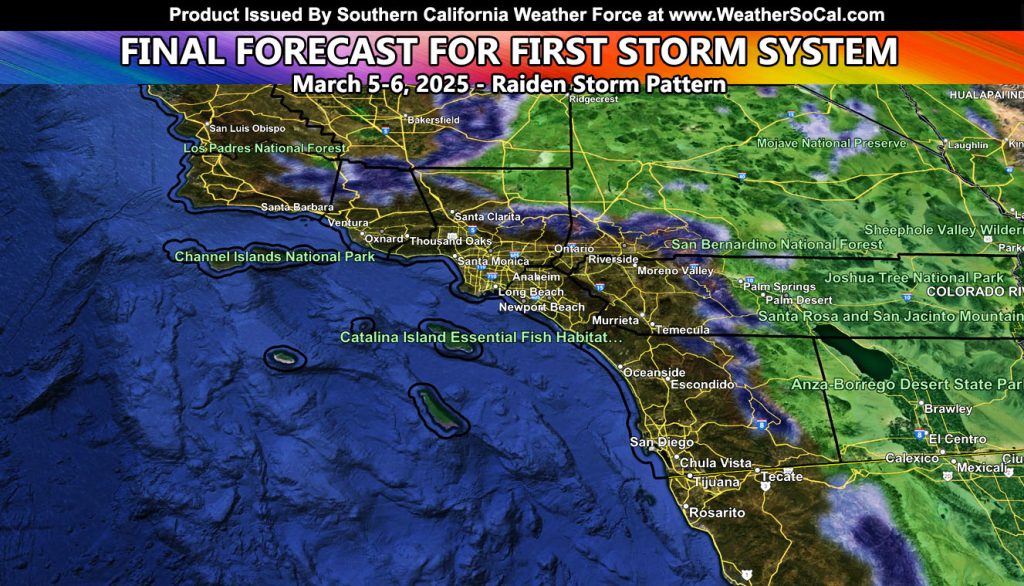
Southern California Weather Force has issued a final forecast for rain and snow for Southern California, which will cross the forecast area Wednesday into Thursday of this week. What I can tell you is this is the same forecast as the previous issued one so read below on the final details, and make sure you look at the zoom-in rain and snow models provide on the main site.
FROM PREVIOUS FORECAST
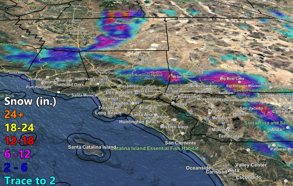
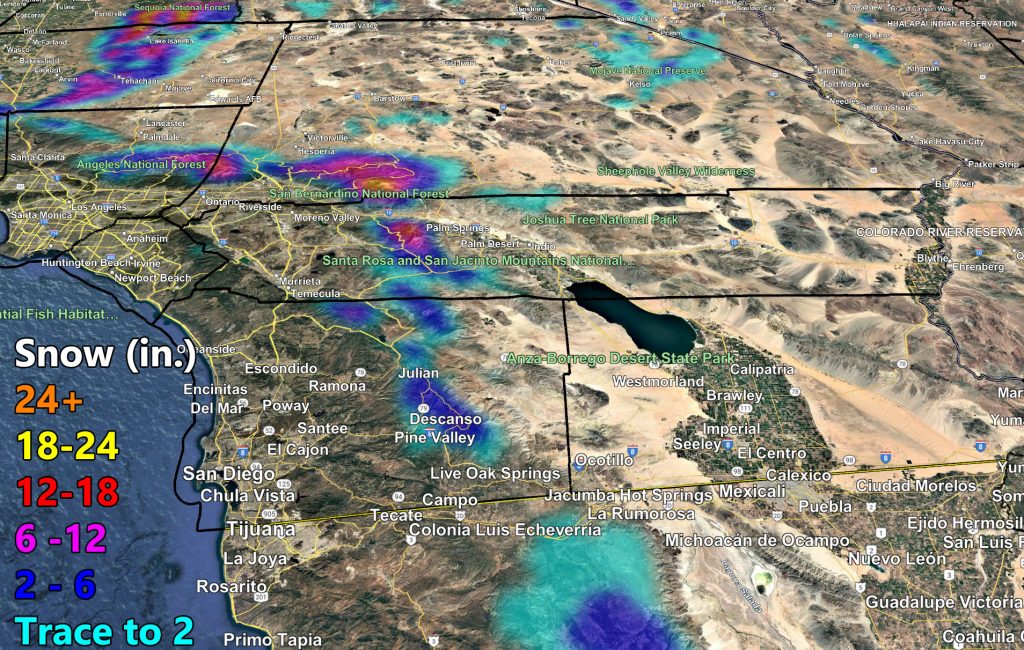
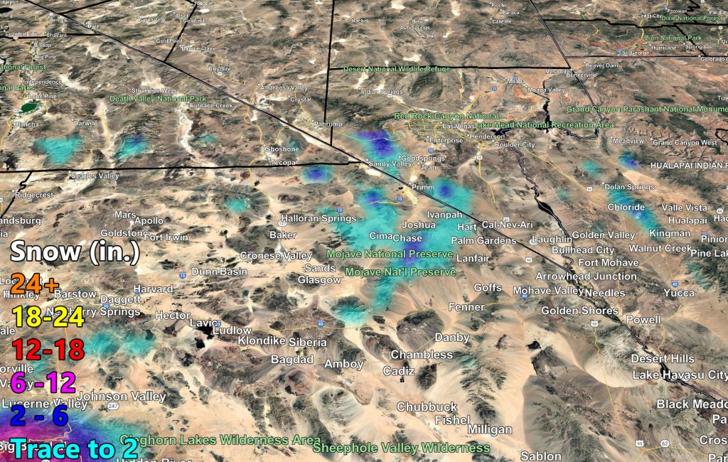
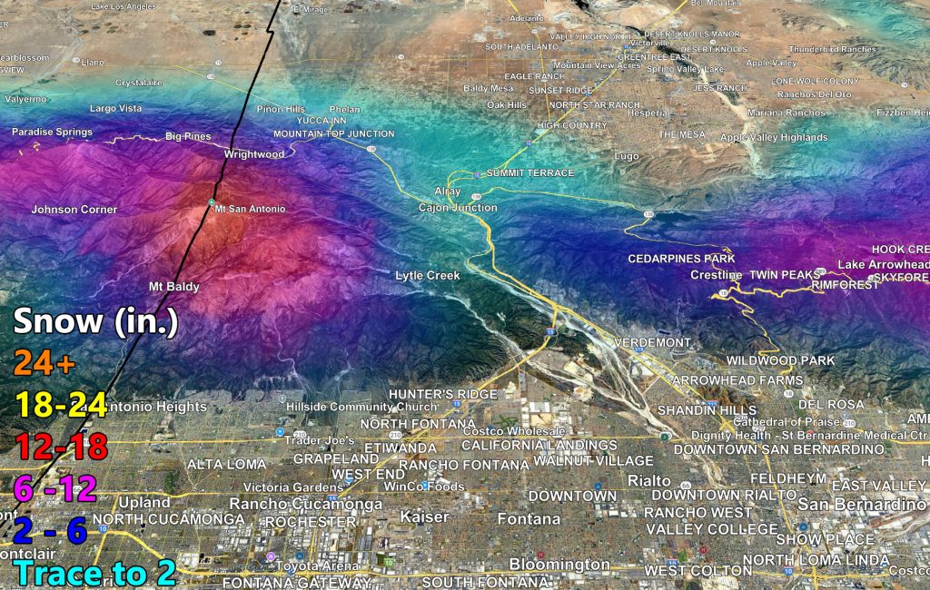
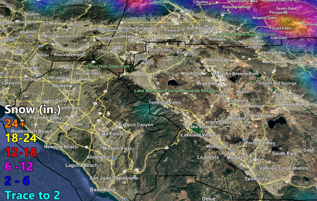
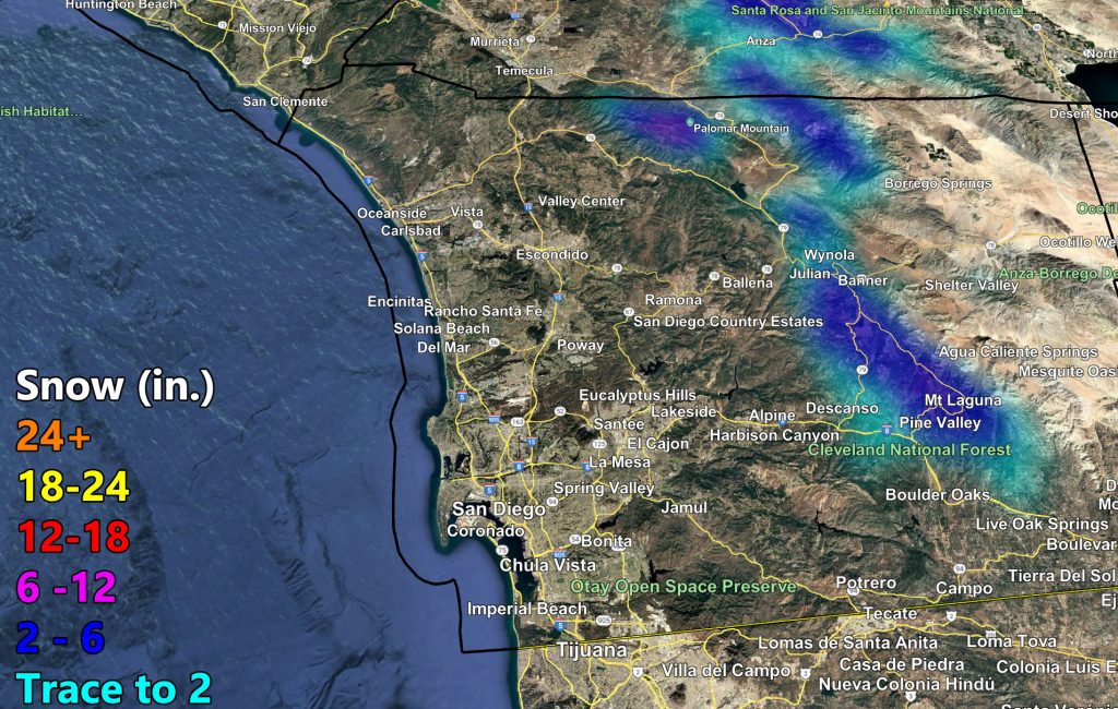
The second system within the multiple systems expected this month within the Raiden Storm Pattern will be hitting mid-week. A couple of things about it. It will be a potent cold front for the Wednesday period, and Thursday will have a secondary front, which will be what brings the 8,000 FT snow levels on Wednesday to just below the 4,000 FT mark.
Thursday stands to have the lower pass-level snow levels through the Cajon / Gorman Pass locations, including down to the Tehachapi floor levels.
Thursday’s batch will also have the risk of thunderstorms as well, and for some of you at and above the snow-level it will be thundersnow.
We will have gusty winds in all sectors, especially along the coast with the double-frontal zone days and the mountain and desert zones.
The Raiden Storm Pattern will continue from March 10th onward with several systems expected, and then beyond that it is being monitored. Each storm system after this week will continue to be stronger than the one before it as the jet stream sinks and continues to remain southward as the Spring 2025 pattern takes hold.
Weather Advisory or Thunderstorm Watches will be issued 12 hours before the expected storms if needed.
Stay tuned to official forecasts here at Southern California Weather Force and use the final rain and snow models below –
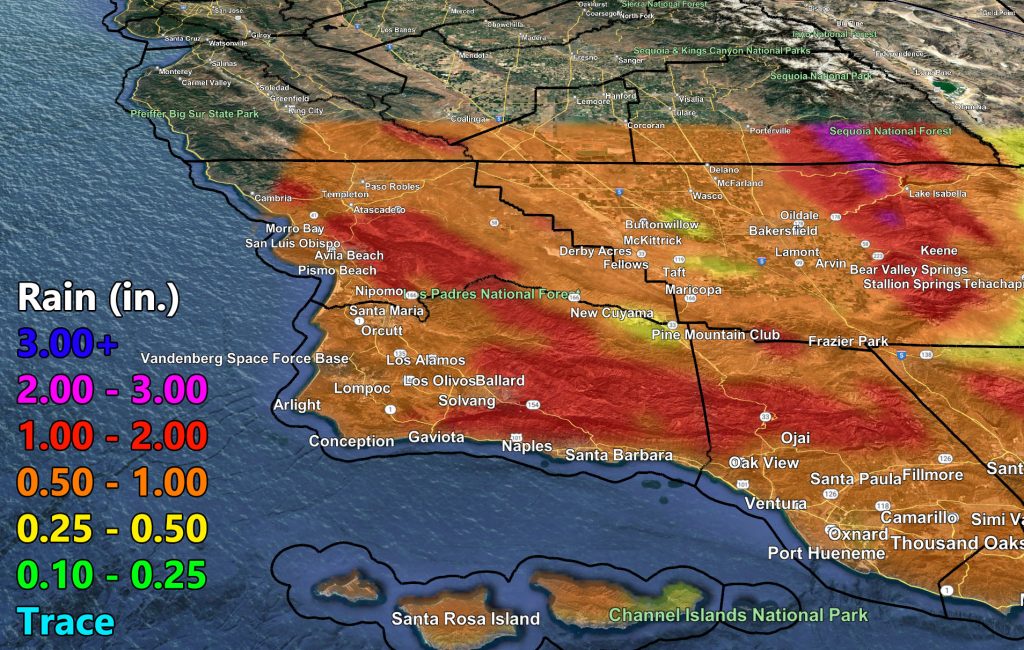
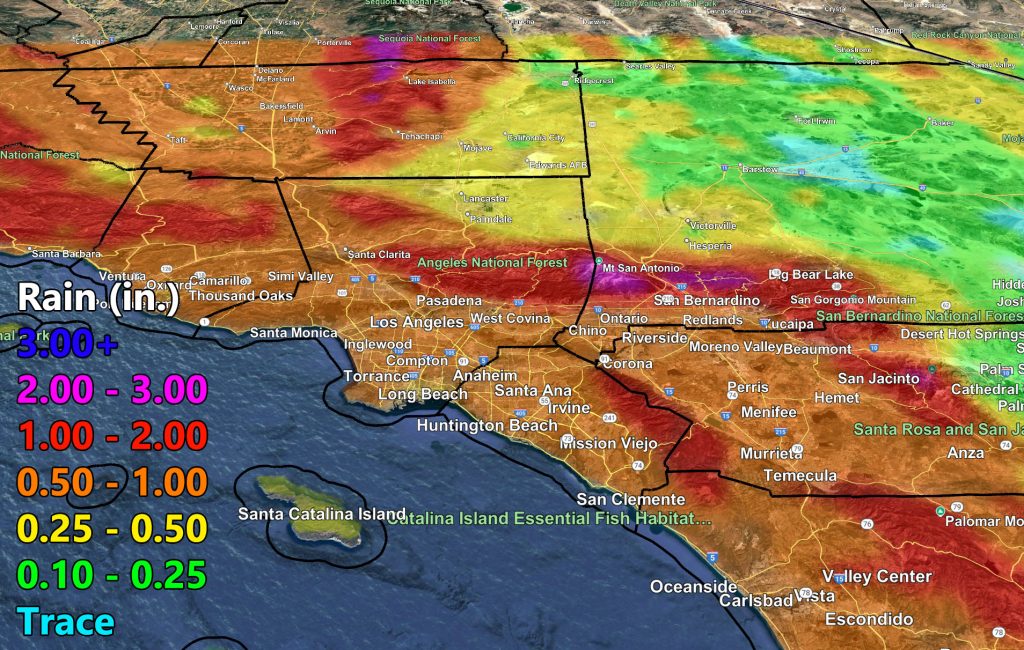
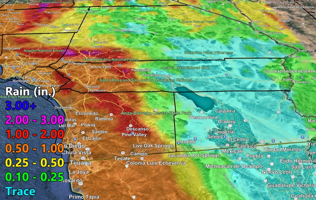
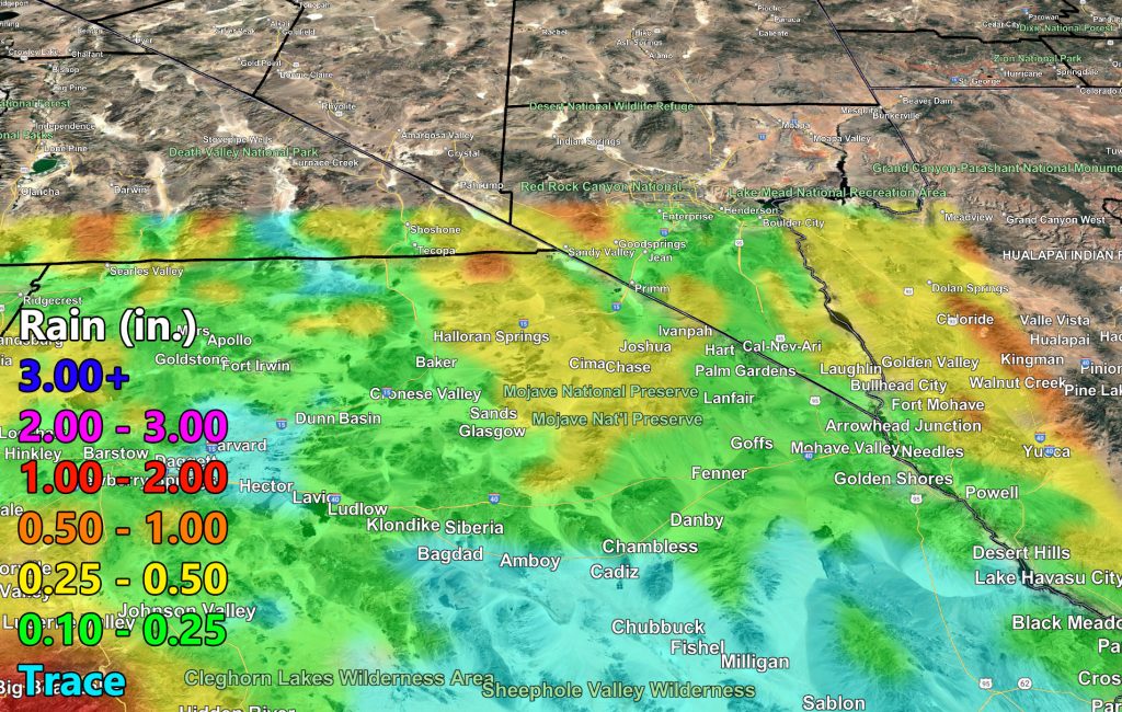
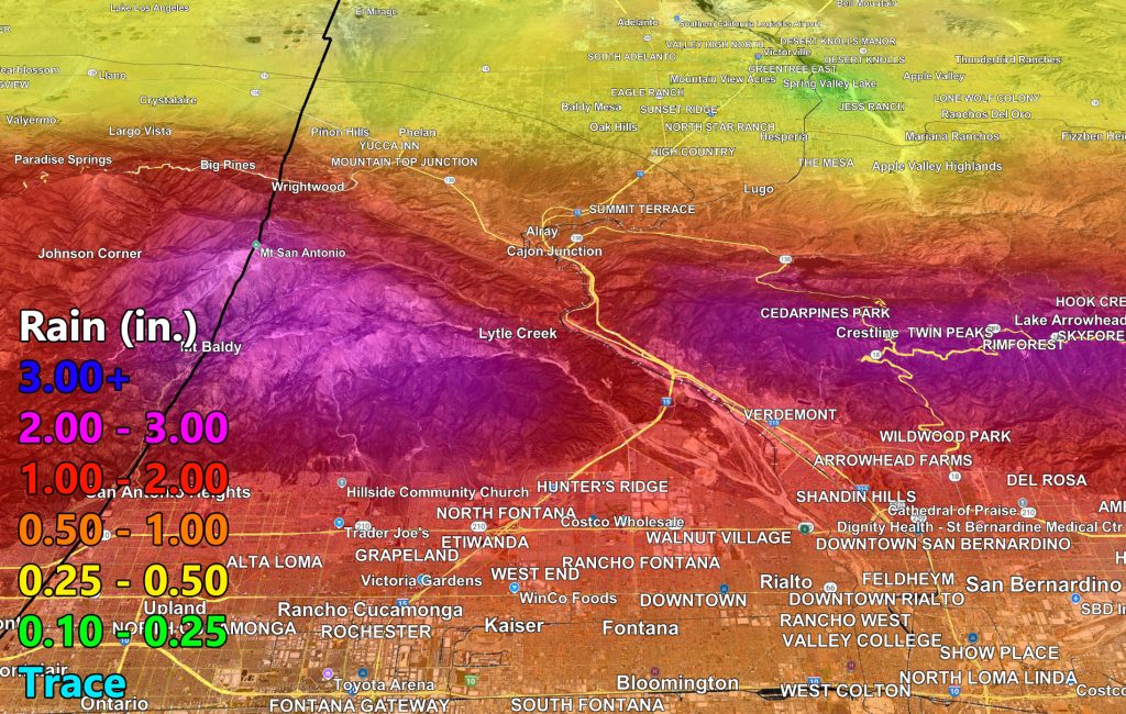
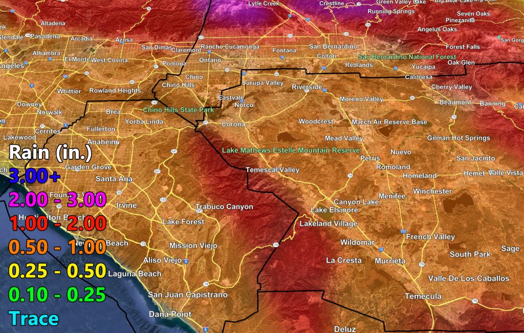
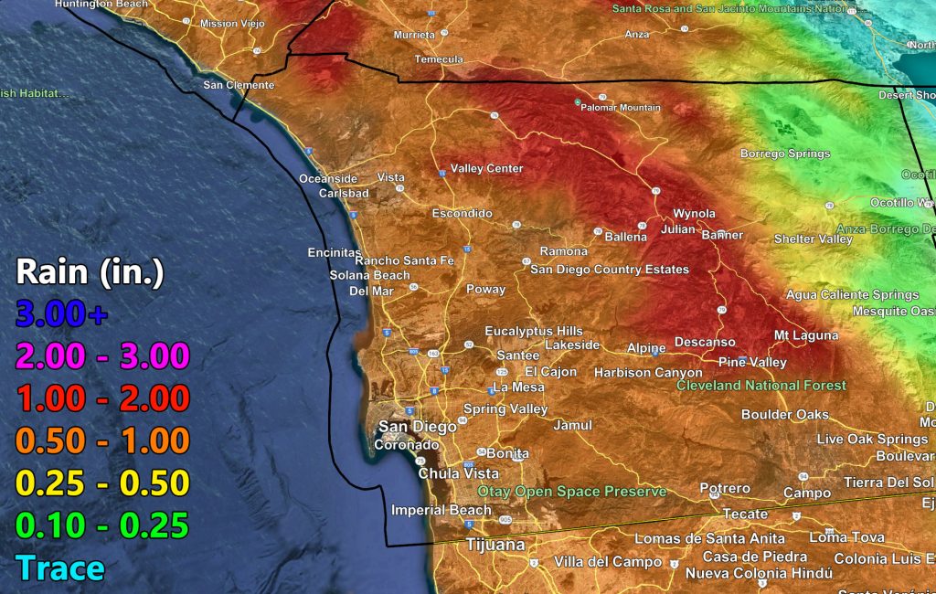
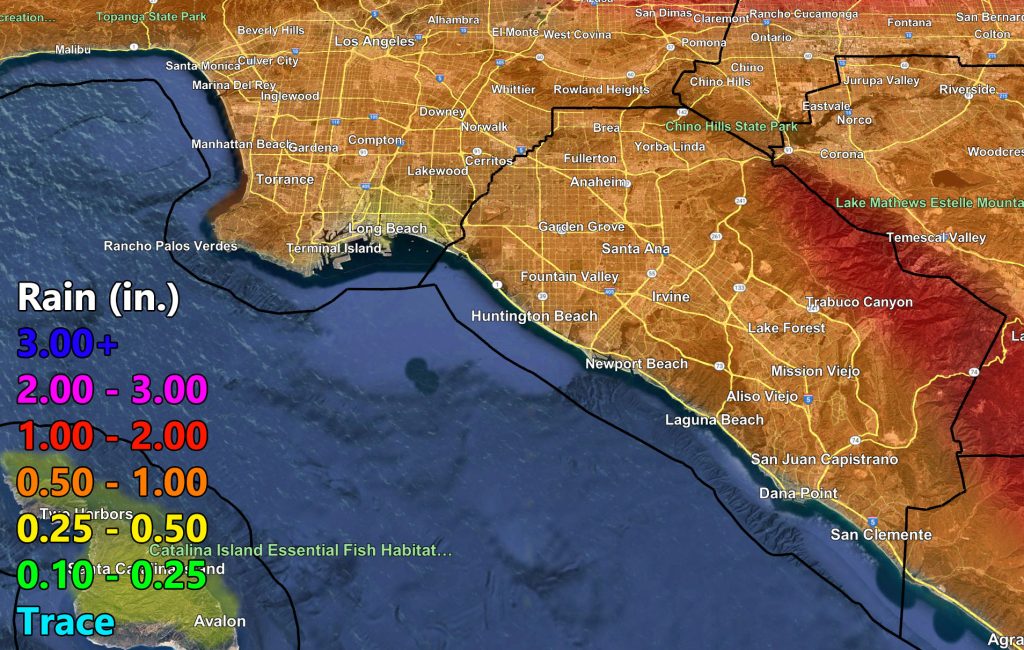
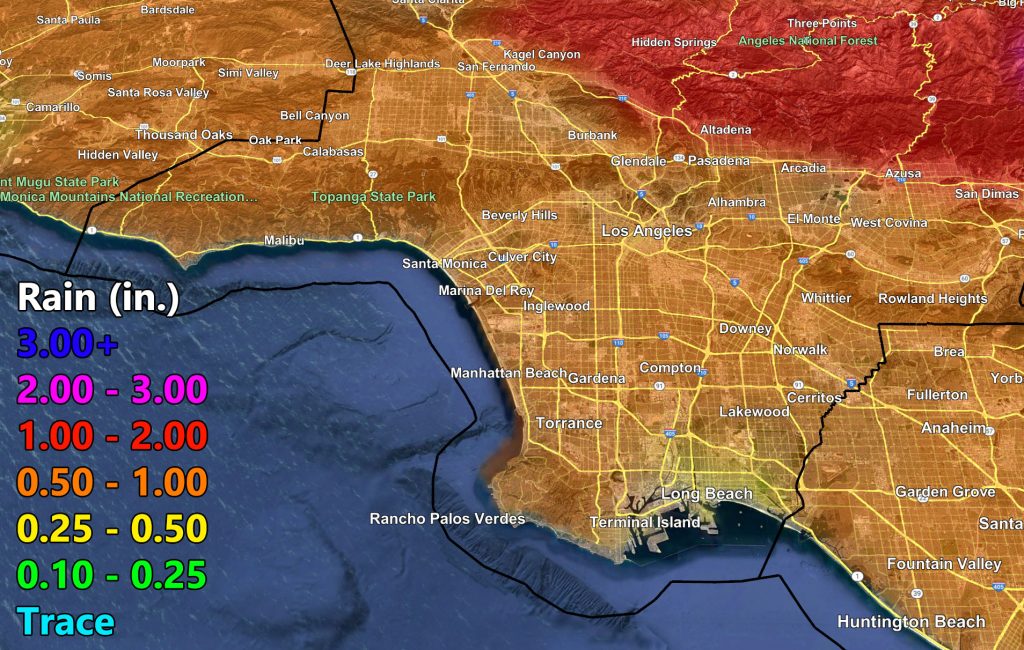
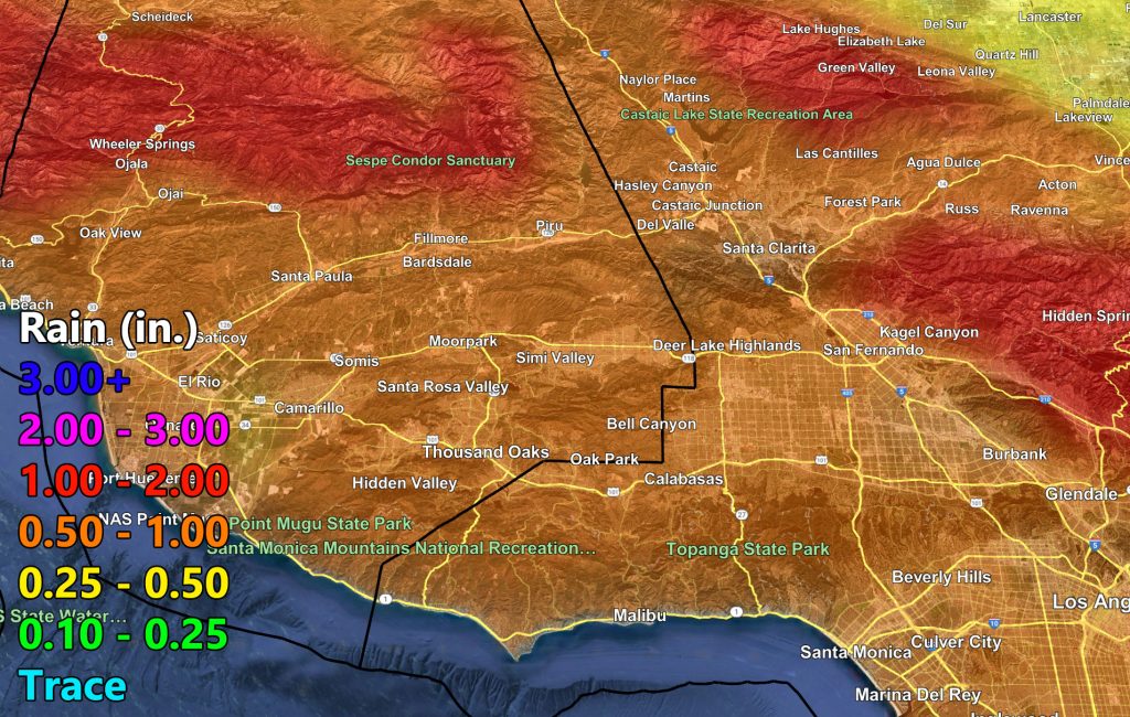
RAIN
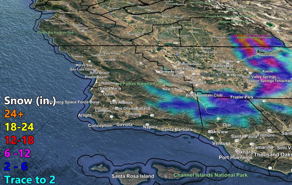
SNOW
Raiden Storm
Master General Meteorologist