
March 2018 went as expected so moving onto April 2018 we have a change in the pattern once again as we move through the spring pattern. In March, a trough west of the Pacific Northwest guaranteed good storms moving into California. Now.. given this trough is moving north into Canada and weakening fast, a ridge in the Northern Pacific will be far enough west to bring storms up and over it and into Northern and Central California out of the northwest.
These are called northwest sliders, similar to what we’ve seen this season with fronts hitting the San Luis Obispo and Kern County areas more than Los Angeles or San Diego. Northwest sliders tend to also bring higher wind gusts as the storms brush the forecast area.
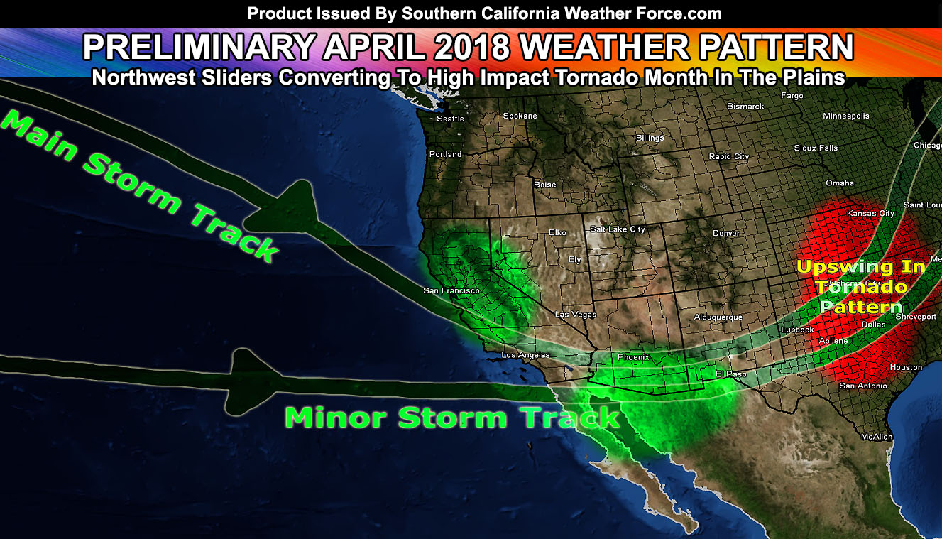
The main storm track is what that will be. The minor storm track is the tropical jet stream that is south of the forecast area and any storm moving through there would bring an upswing in rain activity into Arizona and as it meets the arctic (northern track) jet stream it will bring an upswing in tornadoes across Tornado Alley, giving April a higher chance for tornadoes in that area due to the lack of any blocking ridge over the Rockies.
Most of April seems it will be without any major storm systems across Southern California … but toward the mid-end to end part of the month it is possible we’ll see a straggler system come through. The pattern suggests that we will see average to just above average temperatures and average to just below average rainfall.