
[vc_row][vc_column width=”1/1″][vc_column_text]
[/vc_column_text][vc_column_text]
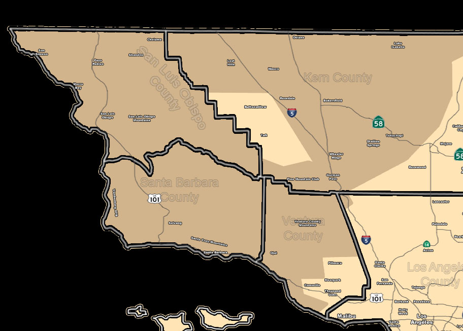
Issued Zones: SBA/SLO County … Kern Mountain/Valley zones …
Site: SouthernCaliforniaWeatherForce.com has issued a Wind Advisory effective now through Monday …
Date: 1/2/16 at 6:30am PT
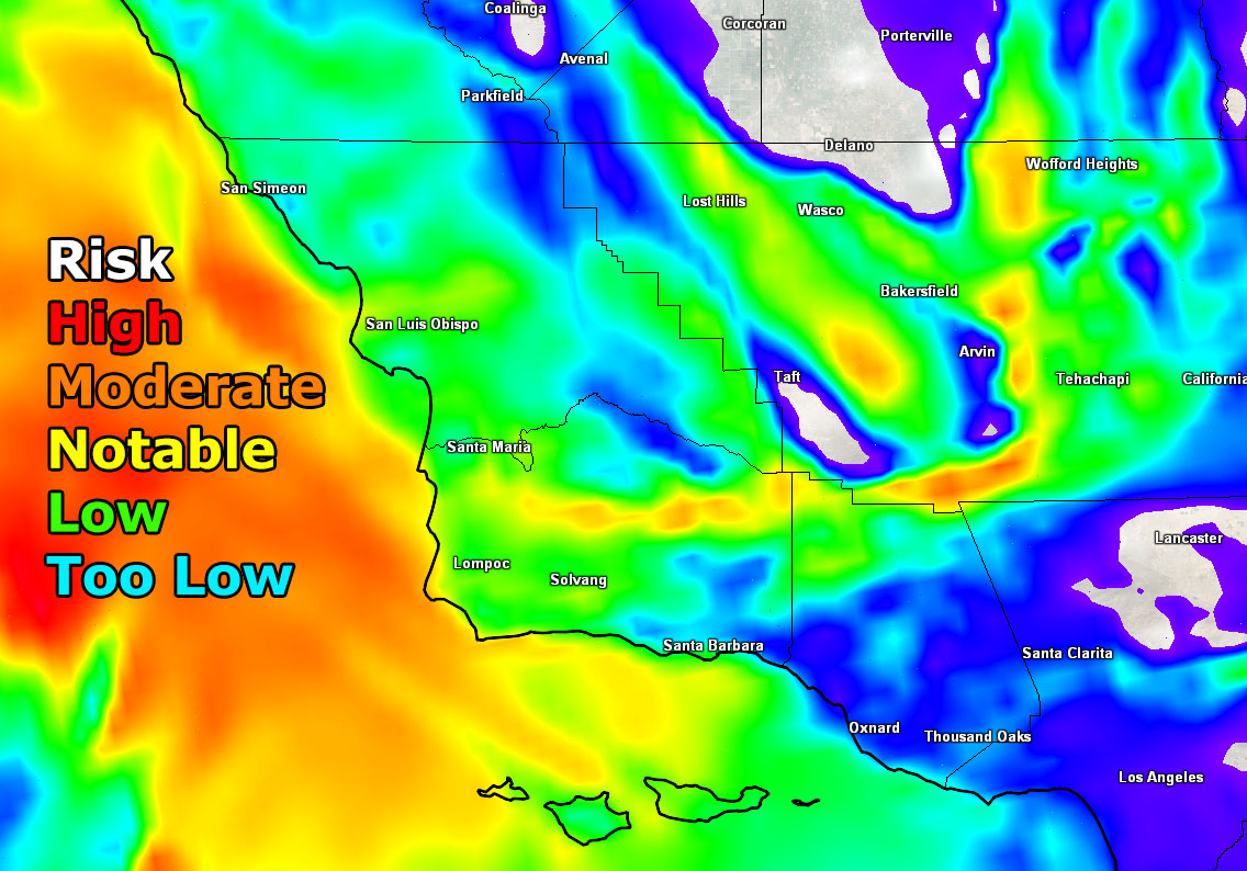
Forecast: A surface low northwest of the forecast area on Sunday into Monday will bring strong southeast wind gusts through the areas listed in the zones.
Wind gusts will start as early as today in the Kern Mountains, including the Gorman Pass. Gusts overnight tonight into Sunday could range in the 50+ mph mark and thus High Wind Warning status on that pass.
Lebec may see damaging winds so any crosswind activity will be hazardous for high profile vehicles. T
he rest of the forecast area would see these winds on Sunday into Sunday night … ranging from 30-45 mph, and gusty at Pine Mountain Club during this event.
The image below is Sunday at noon, when it should be the most widespread out of the valleys into Kern.
10 mile rule: These alerts issued on this site means that within your zone and 10 miles from you will see the event forecast for. You may or may not see the event but it means you are in the zone or 10 miles from where someone will.
Forecaster: KM
[/vc_column_text][/vc_column][/vc_row][vc_row][vc_column width=”1/1″][vc_column_text] If this doesn\’t say “you like this” below then click the LIKE button if you thought this was good information! This helps spread the word by just ONE LIKE … Do it every time if you enjoy these … Thanks for helping! [/vc_column_text][vc_facebook type=”button_count”][/vc_column][/vc_row][vc_row][vc_column width=”1/1″][/vc_column][/vc_row]