
[vc_row][vc_column][vc_column_text]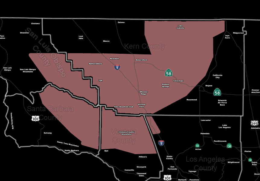
[/vc_column_text][vc_column_text]Issued Zones: VT/SBA Mountains … Southeast SLO County … Kern Mountains, including PMC and Gorman … Southern Kern Valleys …
Site: SouthernCaliforniaWeatherForce.com has issued a Thunderstorm Watch effective today … member only micro-climate alert.
Date: 4/9/16 at 6:30am PT
Forecast: Upper level dynamics will play a major role along with instability in the watch area today, starting near noon as instability develops and going through the evening.
Storm motion will be slow to the north so the development band coming off the VT/SBA Coast will get an additional push up the SBA/VT/KERN Mountains and thunderstorms will be likely as a result.
Total convective cloud tops of over 30,000 FT will make for numerous lightning strikes with the system.
IF the system moves far enough north, Bakersfield will be affected … but you are within the range of this forecast to include you in such …
Hail will accompany the system in the strongest cells … a snow level remaining above 7,000 FT …
10 mile rule: These alerts issued on this site means that within your zone and 10 miles from you will see the event forecast for. You may or may not see the event but it means you are in the zone or 10 miles from where someone will.
Forecaster: KM[/vc_column_text][/vc_column][/vc_row][vc_row][vc_column][vc_column_text]
If this doesn\’t say “you like this” below then click the LIKE button if you thought this was good information! This helps spread the word by just ONE LIKE … Do it every time if you enjoy these … Thanks for helping!
[/vc_column_text][vc_facebook type=”button_count”][/vc_column][/vc_row][vc_row][vc_column][/vc_column][/vc_row]