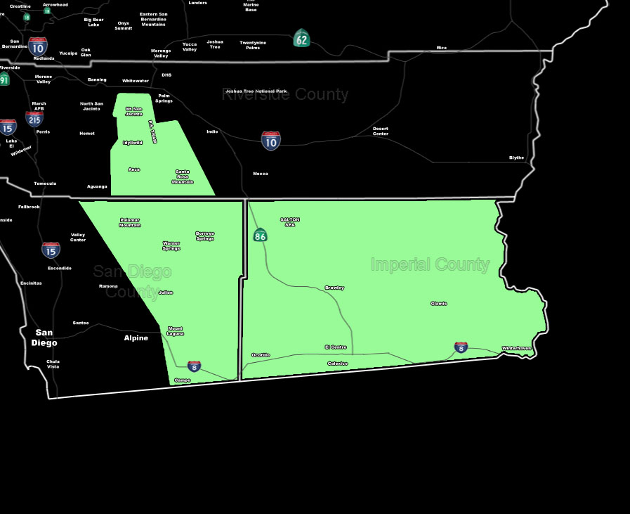
[vc_row][vc_column][vc_column_text] [/vc_column_text][vc_column_text]Issued Zones: RIV/SD Mtns .. SD Deserts … Imperial Deserts …
Site: SouthernCaliforniaWeatherForce.com has issued a Weather Discussion effective now through today …
Date: 7/1/16 at 12:40pm PT
[sociallocker]
Forecast: Deep-layer moisture is not apparent in all levels with the satellite image showing drying over the area and strong uncertainty in the development of appreciable thunderstorms is questionable but the way this will go will be this …
Numbers here at SCWF clearly shows a bit of moisture in the low/mid levels with a capping in the upper levels.
To overcome this … strong lifting along the mountains and desert convergence zones will be needed so IF these go up .. they’ll be along the SD/RIV Mountains in the same areas with a slight risk of tstorms and leaning for more aerial shower activity … with outflow from Southwest Arizona moving east through Imperial County …
If the surge is strong and more moisture with it is present as it moves westward through the county … storm development would happen …
So a very touchy 50/50 type atmosphere we will be working with at the moment … but the best chance of better thunderstorms with less cape looks to be the SBD Mtn/Des areas … where our THUNDERSTORM WATCH is currently at.
10 mile rule: These alerts issued on this site means that within your zone and 10 miles from you will see the event forecast for. You may or may not see the event but it means you are in the zone or 10 miles from where someone will.
Forecaster: KM
[/sociallocker][/vc_column_text][/vc_column][/vc_row][vc_row][vc_column][vc_column_text]
If this doesn\’t say “you like this” below then click the LIKE button if you thought this was good information! This helps spread the word by just ONE LIKE … Do it every time if you enjoy these … Thanks for helping!
[/vc_column_text][vc_facebook type=”button_count”][/vc_column][/vc_row][vc_row][vc_column][/vc_column][/vc_row]
