
Rain has added up for areas east of Orange County with San Diego and the Eastern Deserts seeing the most rainfall from former Hurricane Paine but things are about to change with a major heatwave coming this weekend into early this next week along with the dreaded return of the Santa Ana Winds … Read on for details …
A system moving by to the north at the end of the week will bring in strong winds for the mountain and desert regions and advisories and maybe warnings will be needed for THURSDAY. After this system moves by it’ll cutoff in Arizona and begin the offshore flow process.
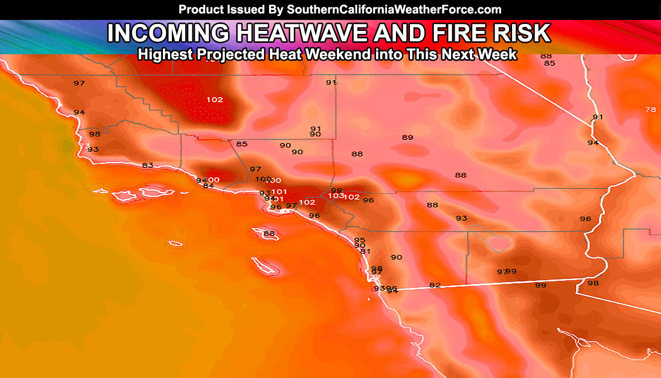
During the weekend it’ll be hotter each day with offshore flow and by early this next week the temperatures will peak with widespread triple digits in the metro areas and gusty Santa Ana Winds. Fire risks will be elevated for the OC/IE/LA/VT/SBA/KERN Areas.
The areas that did see rainfall such as San Diego, Imperial, and the Riverside Mountains will have less of a fire risk … but continued heat for those days could try to dry the area out from the rain you had.
Still .. the areas that did not see rain such as the fire zone in Santa Barbara County (Vandenberg) will be the areas to watch and this will continue for several days.
Remember and note that the SCWF September forecast mentioned equal chances of precipitation with cutoff systems and that came true … also noted the heatwave for the end of the month .. also coming true. The October 2016 forecast will be out by the beginning of next month so stay tuned …
References:
SCWF September Forecast: Remember and note that the SCWF September forecast mentioned equal chances of precipitation with cutoff systems and that came true … also noted the heatwave for the end of the month .. also coming true. The October 2016 forecast will be out by the beginning of next month so stay tuned …
Click Here to view