
Thunderstorm Watch Area Update: Pacific Storm Felix Ramping Up; Thunderstorms Detected In Moving Toward Population Area Of Watch Box with lightning detection showing numerous lightning strikes offshore Santa Barbara and moving in. Rain has been on-going elsewhere and the thunderstorm model is holding strong so read more for details and see additional SCWF rain/flood risk models for this storm …
Join Southern California Weather Force main Facebook Page for future updates!
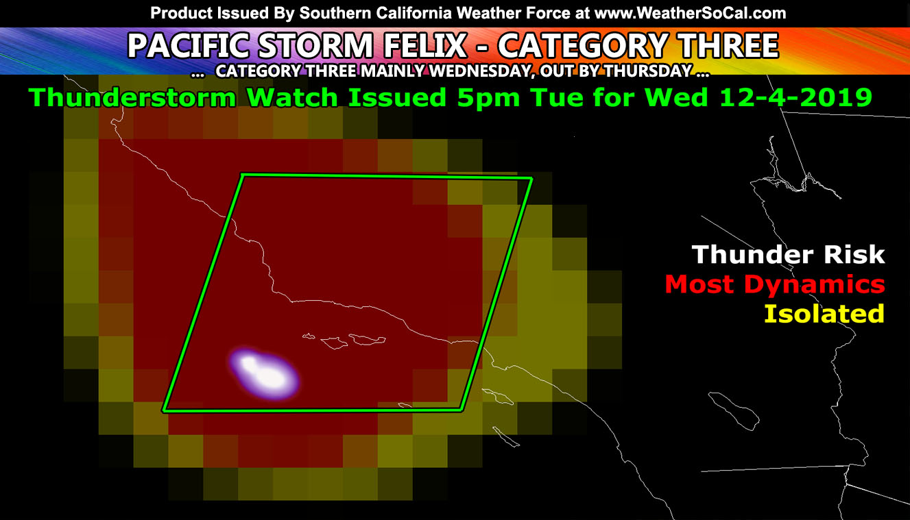
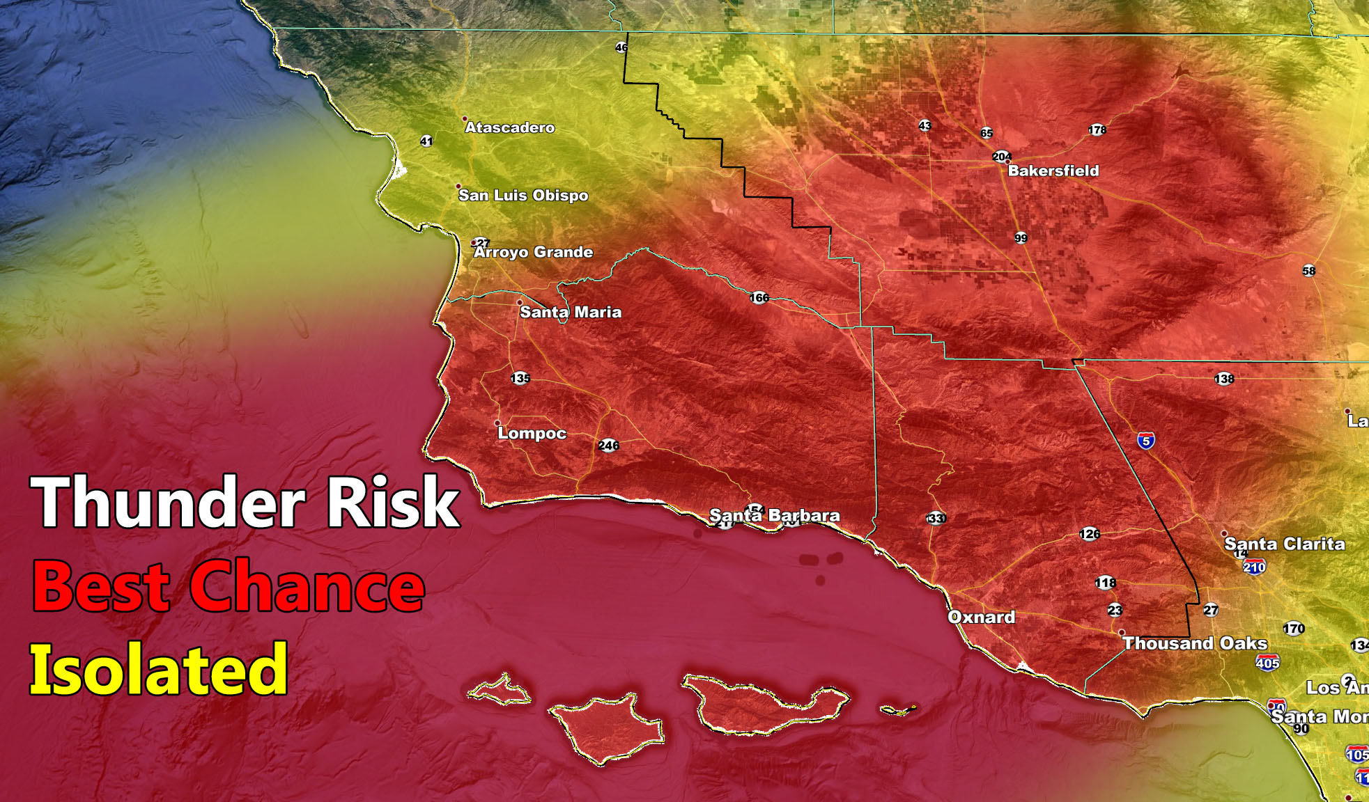
The Thunderstorm Watch went into affect yesterday at 5pm for today, a major lead-time forecast. Last night, I posted over on Southern California Weather Force Meteorologist FB the lightning detection 225 miles southwest of the Santa Barbara Coastal zones and that this area would be what sparks the thunderstorm watch box today. That has come to as detection (image in the article) has shown that lightning is indeed in the area. The SCWF Thunderstorm Risk model clearly shows a large area from Santa Barbara, San Luis Obispo, Kern, and Ventura County in the most dynamics zone with isolated on the warm-front for a 3 hour window showing up in Los Angeles, Orange, and some IE and High Desert locations completely separate from the cold-front producing thunderstorms in the thunderstorm watch. Hail is likely in the watch box area.
From previous update
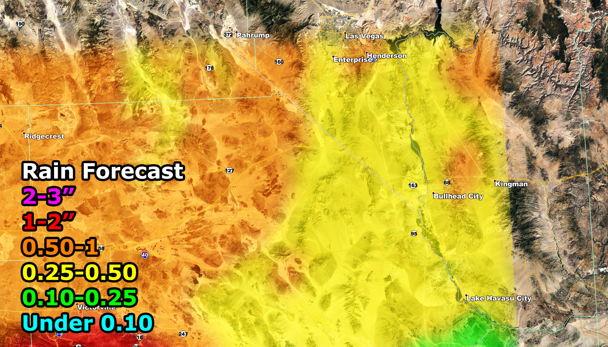
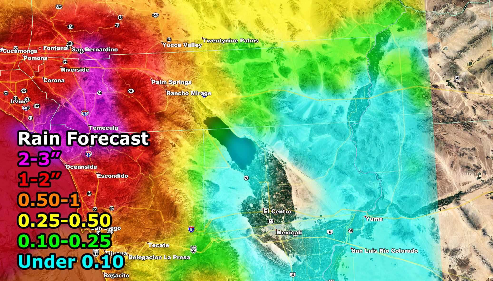
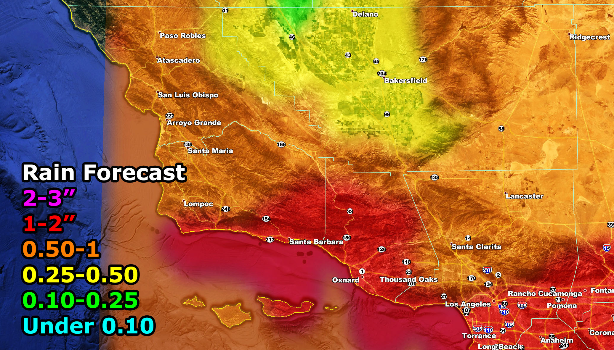
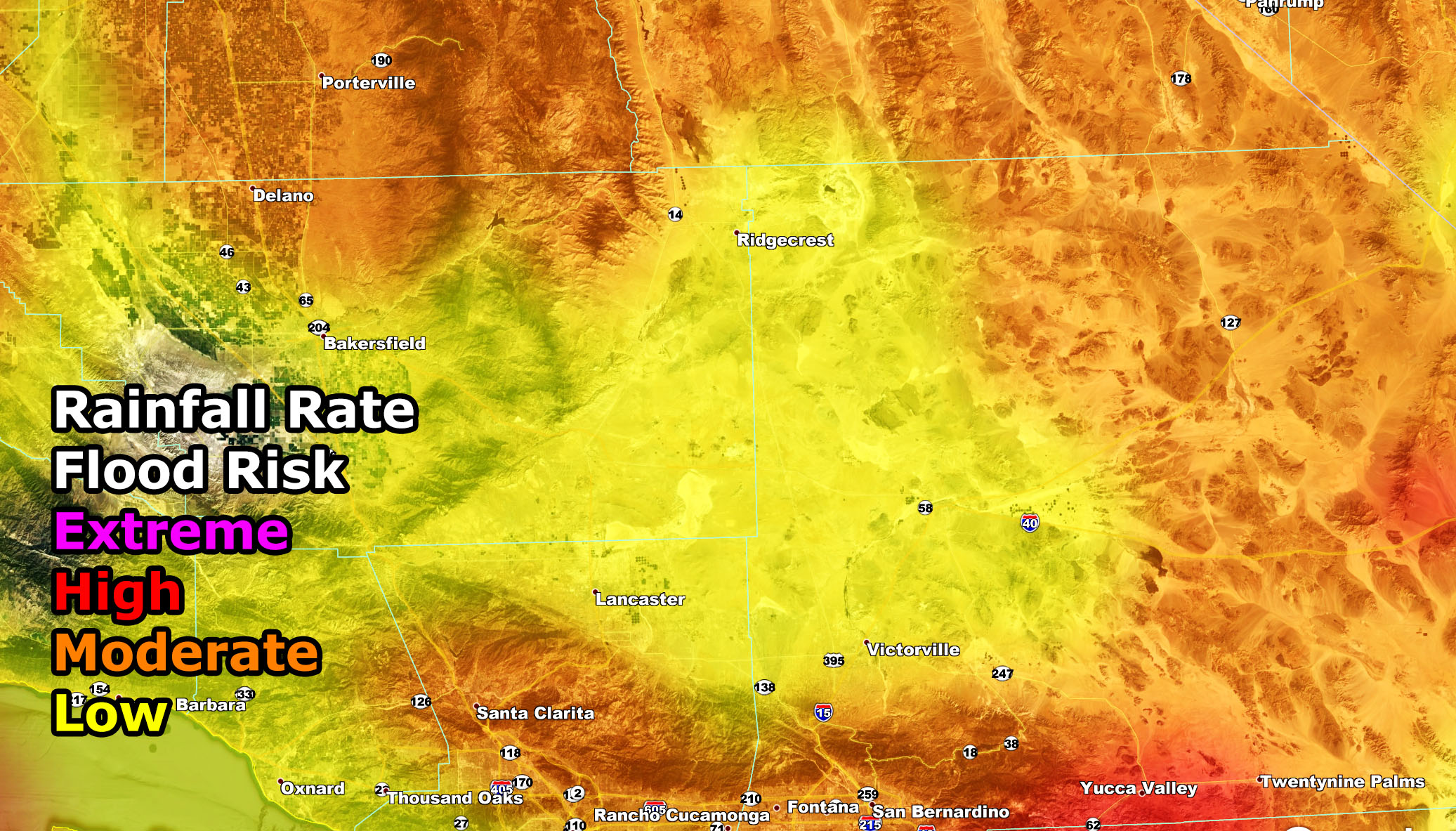
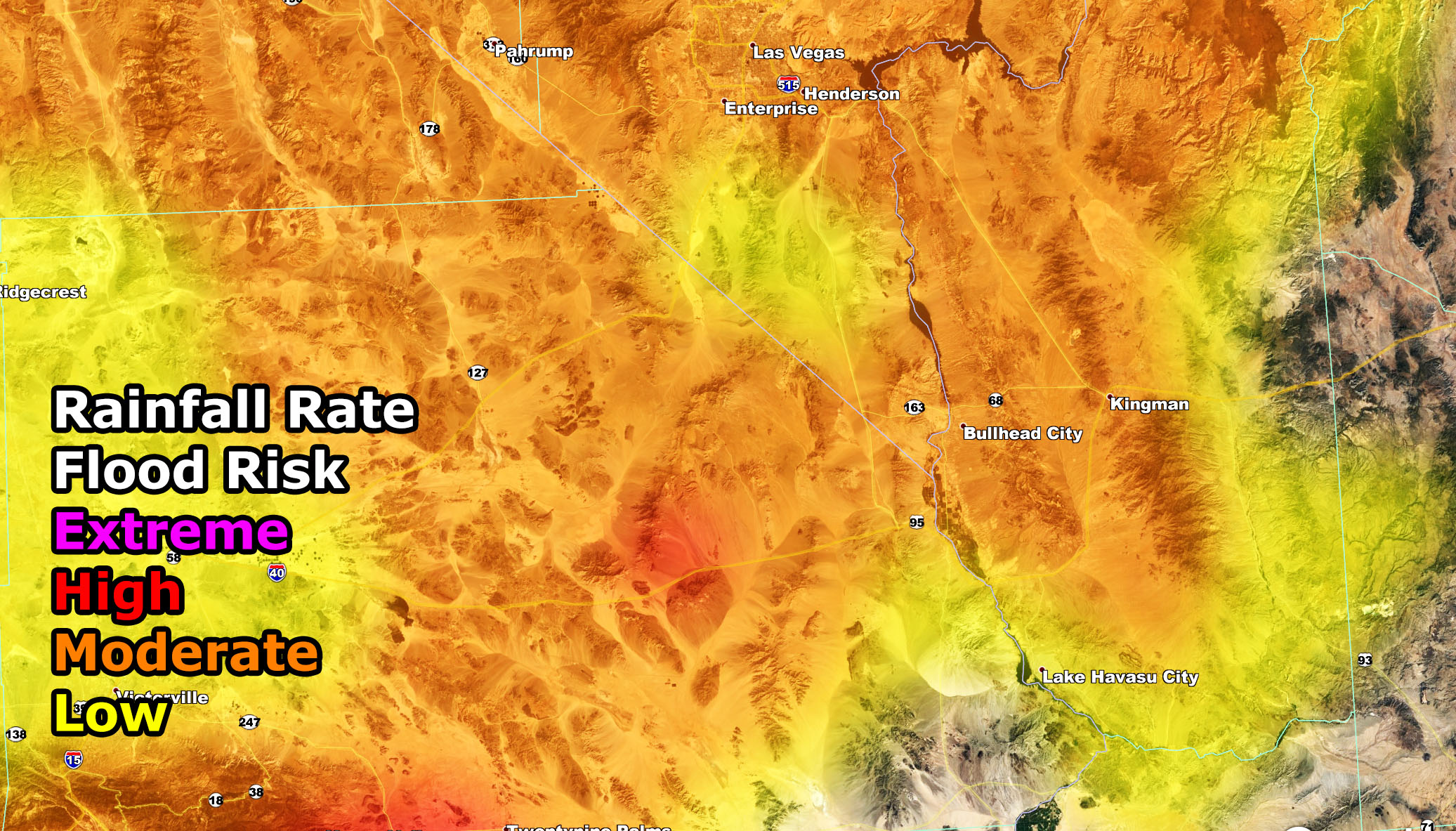
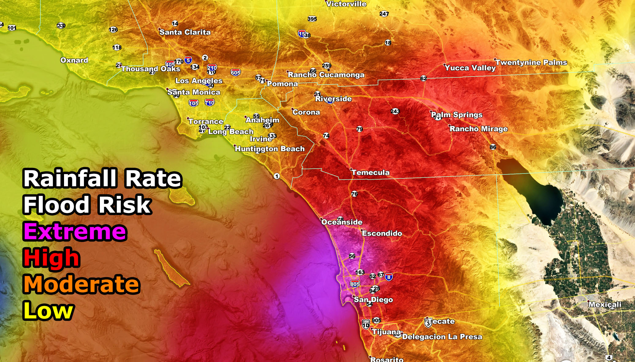
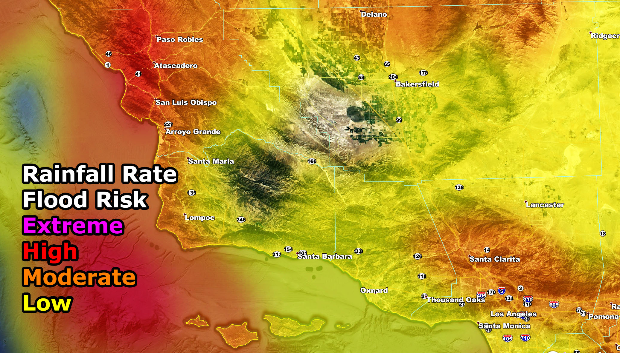
A SCWF Flood Warning and Watch has been issued for Western SLO/SBA Coast … Northern Kern Valleys and Lake Isabella … Northeast SBD Deserts including Las Vegas … Eastern VT County … LA County, not including Deserts … OC to IE … Cajon Pass … San Diego County … Coachella Valley to Morongo Basin …Pacific Storm Felix is due into Southern California lightly overnight tonight and gaining steam Wednesday morning through the early evening hours when it will disperse. The tropical moisture fetch from this system will target all areas of the region, however the Flood Warning alert is for most of San Diego County, north to the Santa Ana Mountains and into some of the Inland Empire zones, east to the Coachella Valley and Morongo Basin areas. This is where the core of the higher rainfall rates for flooding will happen and if you want to see the maps for that, check on below. Some areas in the warning will have 2-3″ of rainfall on my model. As for other areas, just check the maps below for your area on the maps.
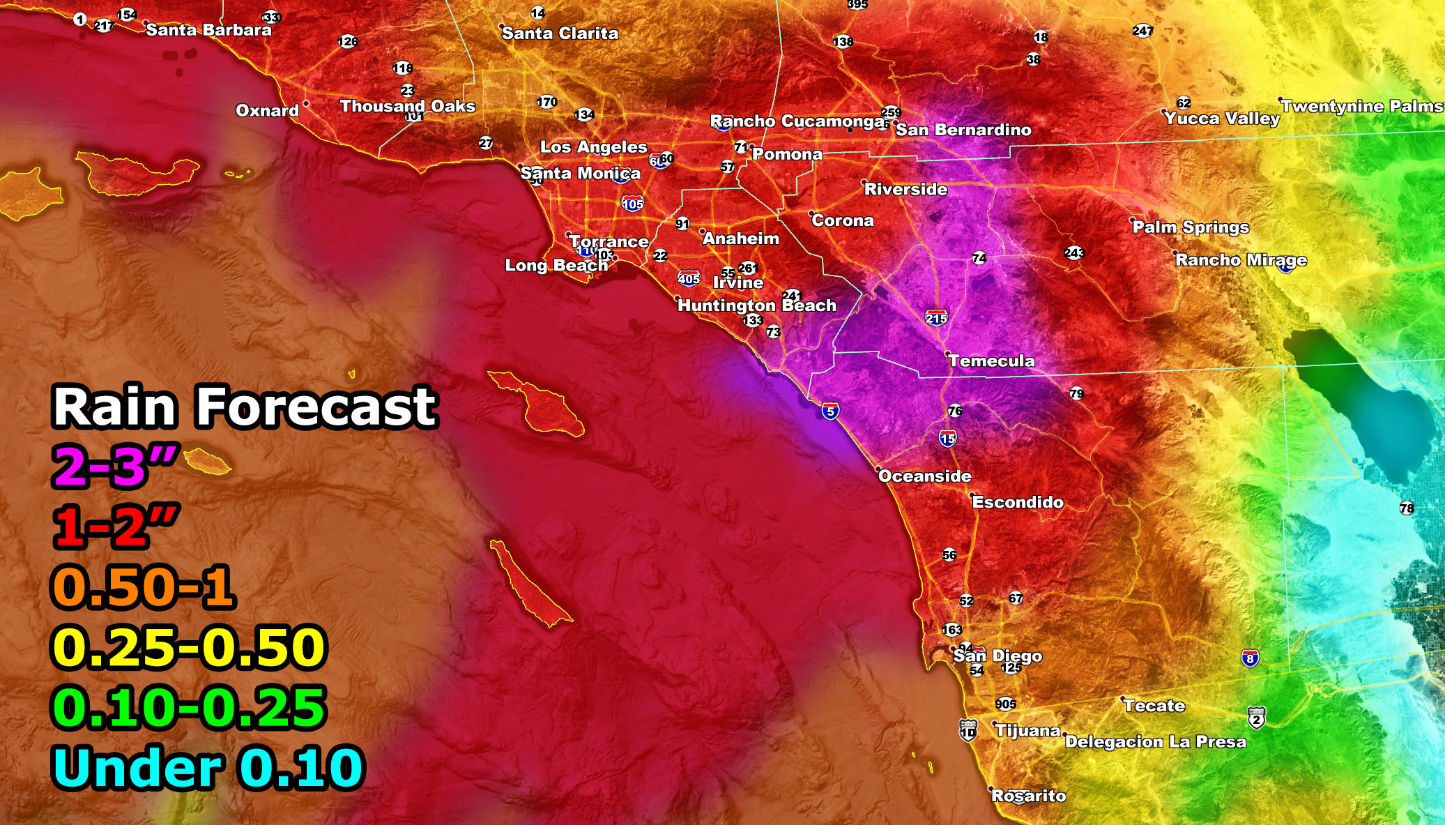
A SCWF Special Marine Statement is in effect for the entire bight region …Pacific Storm Felix is due into Southern California lightly overnight tonight and gaining steam Wednesday morning through the early evening hours when it will disperse. The tropical moisture fetch from this system will target all areas of the region with showers and thunderstorms. Use the map below for the SCWF Rainfall Forecast. Waves are expected to be the highest with 6-8′ expected for the OC/San Diego Coastal zones with this storm system with a stronger southwesterly low-level wind flow …
For snow, hit the Winter Weather Advisory alert here
This is a mixed-bag system with thunderstorms are possible as far as OC/IE but mainly centering Santa Barbara, Ventura, Kern areas. The Flood Risk is detached and is centered in the warm sector of the IE, and San Diego County areas, stretching northeast from there to the Coachella Valley/Morongo Basin areas.
More rain is expected in hit and miss fashion over the weekend. Will report on that after Felix.
NOTE: ALL Articles AND Videos posted on Southern California Weather Force main Facebook Page are charity events. Anyone sharing will be entered into a list and one person will be randomly selected to get cash for causes. This started on in October 2019 and SCWF has donated $1883.24 to date of this article and counting. … So share away.. the more shares on Facebook, the more help can be done for the community and it costs you nothing just like a lottery ticket. October 2019’s winner was Jessica J Dominguez, and she has claimed the prize. Are you next? – Check the latest amount to win by CLICKING HERE – Remember… that number is going to climb before the contest closes!
MICRO-CLIMATE ALERT FACEBOOK GROUPS: Find yours today!
Click here to join
As always, stay tuned to official forecasts from Southern California Weather Force for updates …
For The Main Weather Facebook Page Click Here and Join.
End Article
FACEBOOK PAGES TO JOIN!
SOUTHERN CALIFORNIA WEATHER FORCE MAIN: Southern California Weather Force Office Main Page
BEHIND THE SCENES FORECASTS/UPDATE PAGE: Southern California Weather Force Meteorologist Page
FOR THE CALIFORNIA FAULT STRESS MODEL PAGE: For SCWF official updates to the California Fault Stress Model and more!
“PONDER THIS” SCIENCE ADVENTURE SHOW: A science adventure show developed here at Southern California Weather Force that is a fun ride!
INSTAGRAM AND TWITTER ACCOUNTS TO JOIN!
Instagram – https://www.instagram.com/socalweatherforce/
Twitter – https://twitter.com/SCweatherforce