
Back on November 29th I issued a forecast for cold systems to return during the Christmas period, or before the month of December is over. This was another long range forecast that cannot be seen anywhere but Arizona Weather Force. This will chalk another success in the long range ability and this pattern is now not an what if, but is certain to happen … Since this pattern was called ahead of sources, this is officially a Martin Storm Pattern and Arizona Weather Force is your official source for information pertaining before and during the storm events. It will be a busy period between December 24th through New Years so keep it to AZWF so read on …
The article from November 29th (Click Here) stated this pattern would return and we will see it returning for sure.
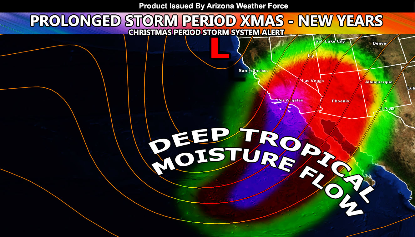
However, by Christmas Eve we will see the start of what will be a very active storm pattern in Arizona that will last from the 24th of December and could very well last with rain in the forecast for over a week through to New Years Day. This is a very prolonged period of rain chances. Since we are talking about the Christmas period, the focus will be on there. I do not see anything to stop storm chances on Christmas Eve through Christmas Day. It is a very active pattern and numbers this far out are very wild. One of these systems will have arctic air entrained into it an you can bet the Central/Northern Arizona Mountains will see heavy snowfall and high snow amounts so if you have houses/cabins up there you will have a 100% chance of a White Christmas.
The pattern is telling me it will start of with high snow-levels a day before Christmas and somewhere around the 25th we will see the levels drop considerably with the arctic air intrusion and the storms after it would be all resort level producers. Remember I told you on November 29th to make your plans at a mountain resort for Christmas if that is what you wanted to do for snow? Well you have your official answer to have a good time… but be safe.
All areas in Arizona should keep it to AZWF for updates as this is a prolonged stormy pattern.
There are indications of a shutdown in early January with storms missing to the northeast once again like what is happening now with the Santa Ana Conditions back in Southern California.
NOTE: This is the SCWF Website but it is being used for national updates until a suitable national website can be developed for you.
Your Facebook Page to join for this update is linked here – https://www.facebook.com/ArizonaWeatherForce
Reading for another state? Find your region I serve here – https://www.facebook.com/nwfweather/photos/a.643550279121473/1544547759021716